WHR
Rhyd Ddu Station
area page
V3.45 updated 19/7/03
New images on this page from 12/7/03.
Click here for start of new images
Click here for JC Sreeves latest construction map
Locations
This section begins at Ch.12600 with the Glan-yr-afon Viaduct. Off the viaduct, the line sweeps through reverse curves to resume a southerly course along the slopes of the main Nant-y-Betws. At Ch. 12800 there is a large exchange yard with the so-called Glanrafon Quarries built on a retaining wall. The Quarry incline points almost straight at Snowdon summit!
Following the contours, the railway takes a curve around Clogwyn-y-gwin farm and then curves sharply to the left around the Clogwyn rock buttress on a ledge on the increasingly steep hillside. There is a footpath on top of Clogwyn from Snowdon Ranger or Bron-y-fedw that runs via the Glanrafon Quarries and joins the trackbed around the corner.
Just around the curve is the site (Ch.13750) of a short siding for Rhosclogwyn Slate Quarries with the incline taking off to the left. This siding was abandoned by WHR days and a new siding built 300 metres towards Rhyd Ddu. A public footpath joins the line here and runs up to Rhyd Ddu on the trackbed. It will be diverted when construction starts on this section. A parallel footpath runs below the line to Rhyd Ddu.
The alignment now takes a sweeping curve through a side valley near Ffridd Isaf before turning sharply left around a rock buttress and left again into Rhyd Ddu station.
The original site of the station is now occupied by a GCC car park and a toilet block. The railway will deviate around this to the east requiring some rock excavation. A footpath crosses the alignment at the north end of the loop giving views over the station site for the first few hundred metres.
The deviation begins at Ch.14500 as a sharpening of the curve to the east then a curve to the south to provide a straight line for the loop platforms. The deviation skirts the south end of the car park and rejoins the alignment at Ch.15000. However, Phase 3 works continue to Ch. 15200 (roughly half way along the straight to Pitt's Head) to provide for a headshunt for a possible two sidings on the old alignment immediately south of the car park. One siding is for stock stabling and a shorter one for Phase 4 works trains which are expected to take off immediately Phase 3 is complete, assuming funding is in place. The initial plan is for one Phase 4 siding to allow works trains to assist in the extension to Beddgelert.
Gradients
The line is compensated to 1 in 117 through the Glan-yr-afon viaduct curves and then resumes the 1 in 90 'long drag' as far as Ffridd Isaf curve at approx Ch.14200. The gradient then slackens to 1 in 110 and finally to 1 in 275 on the approach to the station. The station itself is level. The trackbed south of the station rises at 1 in 1860 towards a minor summit with a final short climb of 1 in 86/200 around UB118 and a drop of 1 in 92 beyond it. These minor gradient fluctuations may be evened out by spare rockfill from the Rhyd Ddu deviation excavations.
Rhyd Ddu terminus
The station opened on 14/5/1881. It had two sidings on opposite sides of the line at the south end where the GCC car park now is. Work began in 1900 to extend the railway to Beddgelert but stopped through lack of funds by 1906. The result was a timber tramway on the alignment of the later WHR as far as Cwm Du (Ch. 17600) which was worked by Parry's using an ex-Glan-yr-afon Quarry loco. Timber was extracted from the Beddgelert Forest and taken on bolsters to Rhyd Ddu.
Parry's wood siding on the east side of the alignment was said to be quite busy during WW1. The siding on the west side of the alignment was used for coal deliveries.
DEFRA biosecurity agreement
I am grateful to the WHLR and Jan Woods for permitting me an official trackbed visit to this section from 29/8/01. As the section is controlled by DEFRA's biosecurity regime, I wore full protective clothing and used disinfectant sprays.
Although spraying continued for some months, DEFRA later agreed that since Wales had been clear for more than a month, the white protective clothing was no longer required. These were dispensed with from 22/10/01 saving the WHLR £400 a week.
Works vehicular access
The works are divided in two at LC62 because of farm borders during the F&M restrictions. This is from Glan-yr-afon to Clogwyn-y-gwin for the first section. Dumpers transfer slate waste between the two sites via the main road. The main site office is at Clogwyn-y-gwin farm.
The Ffridd Isaf section is accessed from Rhyd Ddu station LC65 and the Ffridd Isaf access track near UB113, where a site office has been established, close to the line.
Glan-yr-afon Viaduct to Rhyd Ddu station
This section has now been split off to reduce the size of this page.
Click here for Glan-yr-afon to Rhyd Ddu section
Rhyd-Ddu station approaches
The railway now swings around a tight curve above Rhyd Ddu village through a shallow cutting with the Afon Gwyrfai falling steeply to the right.
Tracklaying started from LC64 (Ch.14500) and worked north from the end of October 2001. Rail will be delivered to Rhyd Ddu from mid October, though alterations to the car park entrance will be required to allow access by articulated vehicles.
By 29/8/01, this area was noted scraped clean and ash ballast has been revealed on this section.
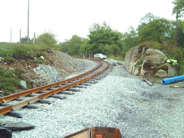
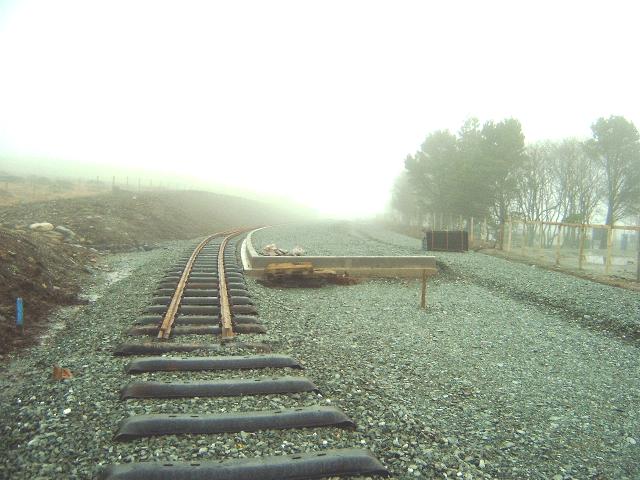
This northerly archive view shows the pristine trackbed, still with sleeper spacings evident, at Ch. 14400 at the end of the Ffridd Isaf curves. Little work is required on this section other than repairing drains and culverts, fencing, scraping the trackbed and ballasting. This whole section has been allocated to WHLR staff. Click on the image to enlarge. This image is copyright B.W.Hughes. Slide scan technology utilised is Olympus ES10 & iPhoto Plus4. Slide scanned at 200dpi.
This easterly archive view from Ch.14500 was taken from the public footpath on the railway on this section. Sleeper spacings are still evident. In the distance on the left, the Glanrafon Quarry waste tips are evident. Click on the image to enlarge. This image is copyright B.W.Hughes. Slide scan technology utilised is Olympus ES10 & iPhoto Plus4. Slide scanned at 200dpi.
This easterly view (15/9/01) taken from a similar viewpoint to the above view shows the route now fenced and the trackbed consolidated ready for tracklaying in October. Click on the image to enlarge. This image is copyright B.W.Hughes. Slide scan technology utilised is Olympus ES10 & iPhoto Plus4. Slide displayed at 96dpi.
This easterly view (22/10/01) from LC64 shows the completed ballasting at this point. Click on the image to enlarge. This image is copyright B.W.Hughes. Slide scan technology utilised is Olympus ES10 & iPhoto Plus4. Slide displayed at 96dpi.

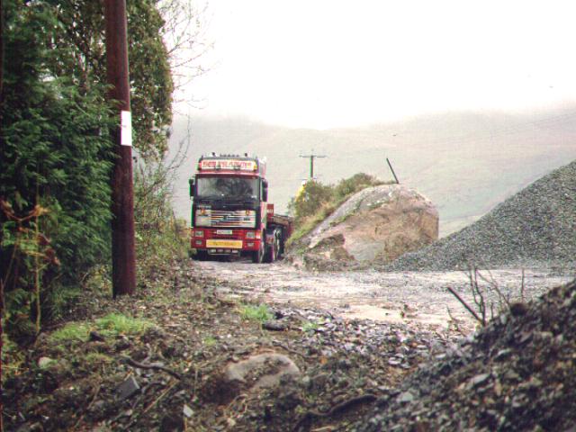
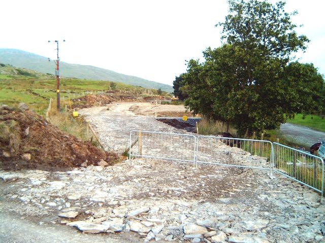
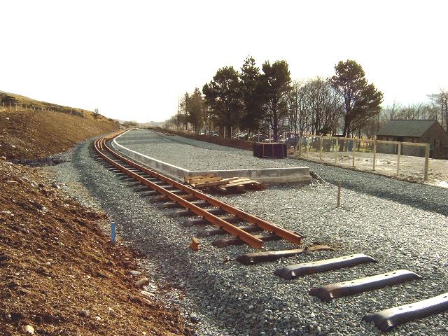
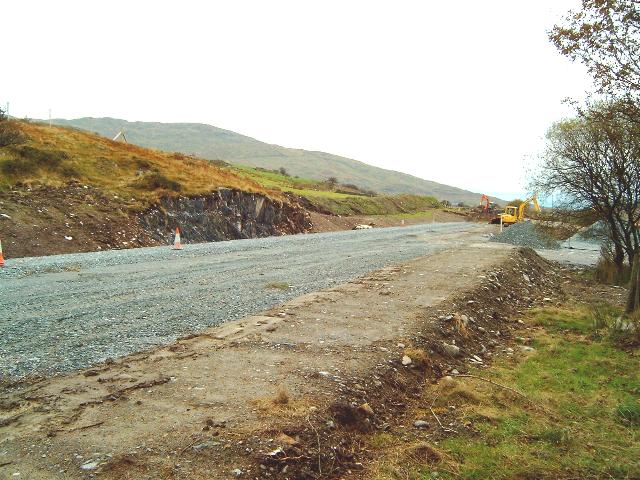
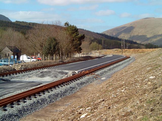
This southerly archive view at Ch.14500 shows the alignment curving sharply into Rhyd Ddu station. A gate gives access to a public footpath along the trackbed as far as the Rhosclogwyn incline but this will diverted when work starts on the railway after F&M restrictions are eased. Click on the image to enlarge. This image is copyright B.W.Hughes. Slide scan technology utilised is Olympus ES10 & iPhoto Plus4. Slide scanned at 200dpi.
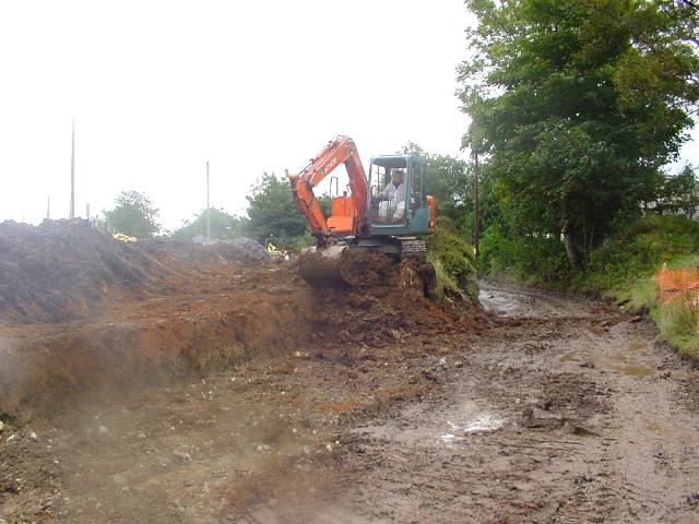
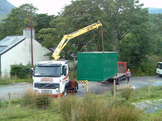
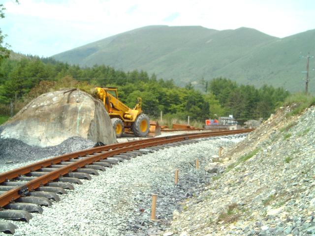
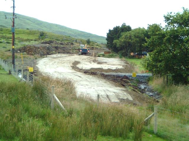
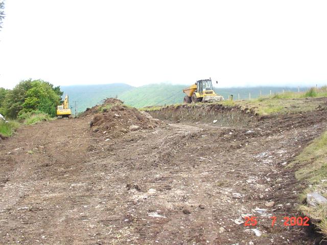
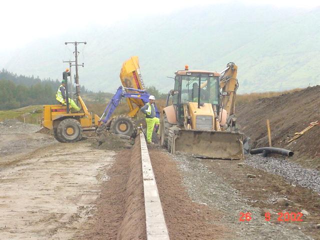
This southerly view (14/9/01) was taken at LC64 at Ch.14500. This is the point where the Station Deviation begins and track laying is due to commence from here to the north at the end of October. The new route deviates to the left (east). The excavators are seen removing boulder clay down to the level of the final new formation, while the original formation is visible to the right. Click on the image to enlarge. This image is courtesy WHLR (Jan Woods). Slide scan technology utilised is Olympus ES10 & iPhoto Plus4. Slide displayed at 96dpi.
This southerly view (16/9/01) from a similar viewpoint to the above view shows work nearing completion on the start of the Station Deviation at Rhyd Ddu. A large rock has been exposed between the old trackbed (right) and the new trackbed. Click on the image to enlarge. This image is copyright B.W.Hughes. Slide scan technology utilised is Olympus ES10 & iPhoto Plus4. Slide displayed at 96dpi.
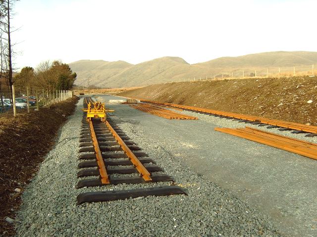
This northerly view (28/10/01) shows the first permanent track being laid east of LC64. There are four lengths of temporary track from the rail store near LC64 before the straight section to Ffridd Isaf curve. One length of permanent track was laid on 28/10 and six lengths on 29/10/01. Click on the image to enlarge. This image is copyright B.W.Hughes. Slide scan technology utilised is Olympus ES10 & iPhoto Plus4. Slide displayed at 96dpi.
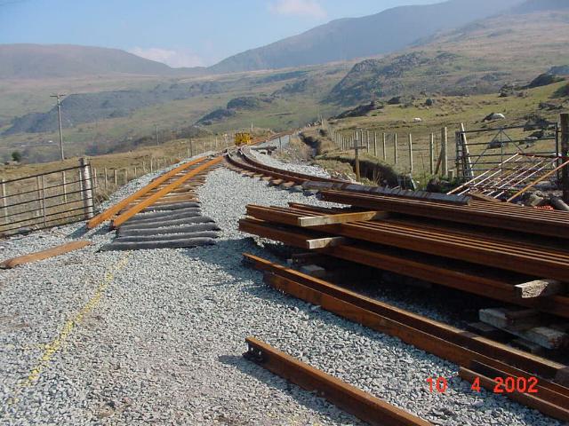
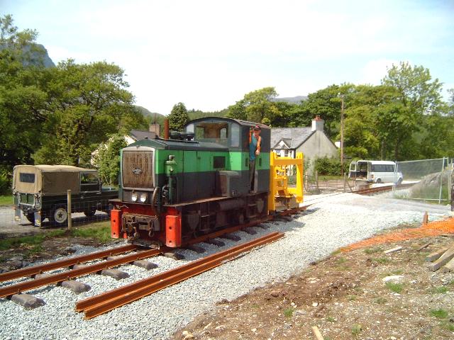
This southerly view (10/4/02) shows RRMs near LC64 (Ch.14500) at Rhyd Ddu. A space has been cleared straight on just beyond the level crossing for the loco shed. Click on the image to enlarge. Photo copyright WHLR courtesy Jan Woods. Image post processed by I-photo Plus4 and displayed at 96dpi.
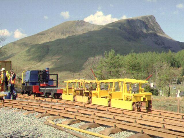
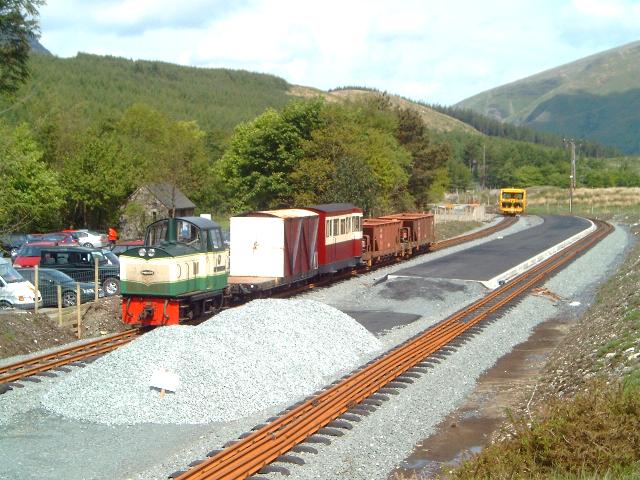
Just before Easter, a point was laid at Rhyd Ddu north for the loco siding. However, the point was misplaced and the siding did not provide safe clearance of the rail stack so it was relaid w/e 6-7/4/02. The works diesel loco Dolgarrog arrived on 3/5/02 by lorry from Dinas. After driver training on the morning of 4/5/02, the loco was in use the same afternoon.
Dolgarrog will assist in hauling the RRMs back up the hill as this is now a half mile push for the volunteers and detracts from progress. It will normally be used at the north (downhill) end to prevent runaways. Mike Hart's small braked match truck is also present and will normally run with the loco.
Also delivered with the loco were four additional RRMs. These will be used as two connected pairs to bring rails down to the railhead where they will be dropped in the two foot. When the loco and RRMs has left, the local pair of RRMs will be used to move the rail to the Head of Steel.
This northerly view (10/4/02) shows the repositioned point near LC64 (Ch.14500). The point had to be moved to allow the loco siding (left) to clear the rail stock pile. The yellow line on the ballast indicates the centre line of the loco siding. The temporary loco shed (container) will be sited immediately to the left of this view. Click on the image to enlarge. Photo copyright WHLR courtesy Jan Woods. Image post processed by I-photo Plus4 and displayed at 96dpi.
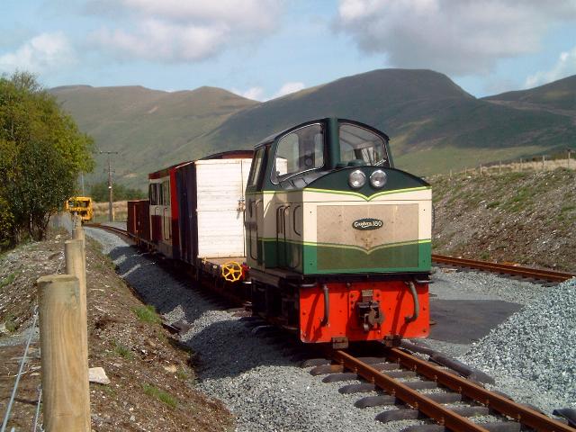
This northerly view (4/5/02) shows Dolgarrog departing Rhyd Ddu northbound with match truck with WHLR manager Roland Doyle in charge. Project Engineer Mike Schumann is being taken to the Head of Steel to inspect progress. Click on the image to enlarge. This image is copyright B.W.Hughes taken by a Sigma SA300SLR. Slide scanned at 200 dpi using Olympus ES10 and iPhoto Plus4 image correction technology and displayed at 96dpi.

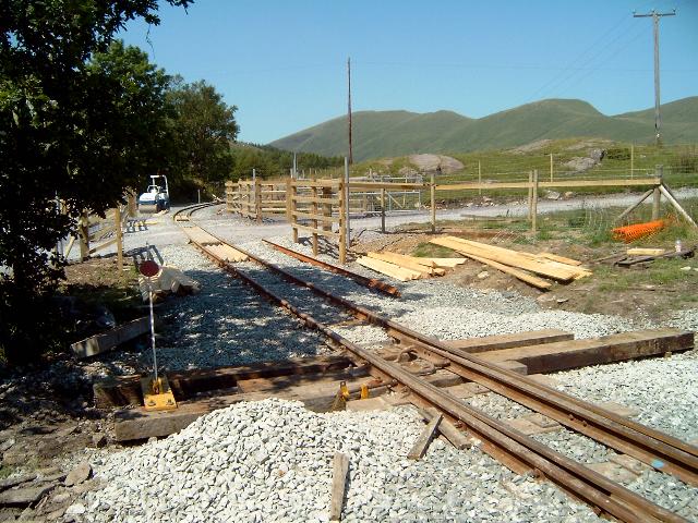
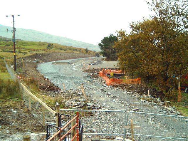
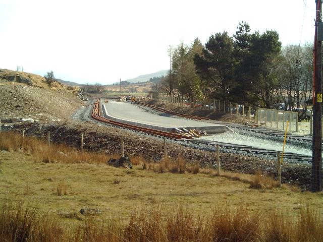
This northerly view (30/3/03) shows the north end of Rhyd Ddu North site with the point and siding removed on 22/3/03. The final alignment will follow the ballast to the extreme right. The summit of Snowdon is visible to the right. Click on the image to enlarge. This image is copyright B W Hughes taken on Samsung Digimax 230 digital camera. Image post processed using iPhoto Plus4 image correction technology and displayed at 96dpi.

This northerly view (28/5/03) shows the track now completed north from LC54, about to be joined up with existing track to Glan-yr-afon Viaduct. It is believed that pw trains first rolled through here on 2/6/03. Click on the image to enlarge. This image is copyright B W Hughes taken on Samsung Digimax 230 digital camera. Image post processed using iPhoto Plus4 image correction technology and displayed at 96dpi.
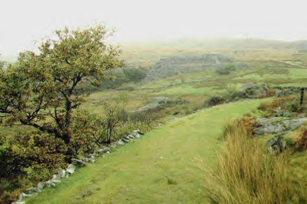
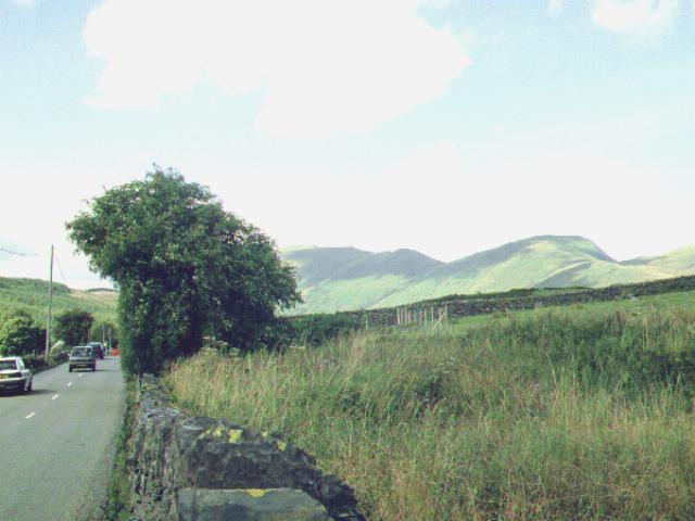
This southerly roadside view (28/4/01) shows the trackbed on a ledge just below the cliffs as the route winds around the final curves into Rhyd Ddu station (right). In the background Moel Hebog is covered in snow. Click on the image to enlarge. This image is copyright B.W.Hughes. Slide scan technology utilised is Olympus ES10 & iPhoto Plus4. Slide scanned at 200dpi.
This easterly roadside view (28/4/01) shows the view down the Nant-y-Betws Pass from the same location. Snowdon has a light covering of snow. The railway follows the line of walling below the rock buttresses on the far side of the valley. Click on the image to enlarge. This image is copyright B.W.Hughes. Slide scan technology utilised is Olympus ES10 & iPhoto Plus4. Slide scanned at 200dpi.
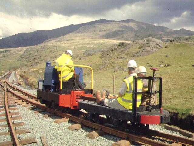
This westerly view (4/5/02) shows Dolgarrog with match truck and four RRMs which were delivered from Dinas the previous day. Click on the image to enlarge. This image is copyright B.W.Hughes taken by a Sigma SA300SLR. Slide scanned at 200 dpi using Olympus ES10 and iPhoto Plus4 image correction technology and displayed at 96dpi.
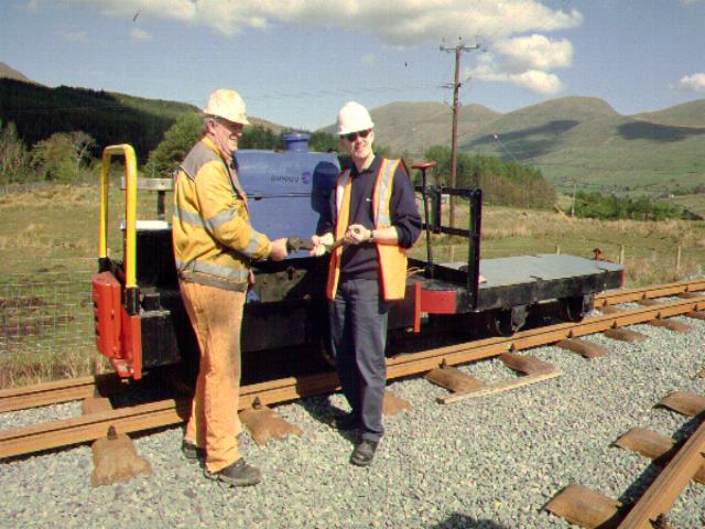
This northerly view (4/5/02) at Rhyd Ddu shows Dolgarrog's starting handle being handed over to Tracklaying Group Volunteer leader Dafydd Thomas by Innogy's Resource Manager John Baxendale. The starter crank is on the far side of the loco. Click on the image to enlarge. This image is copyright B.W.Hughes taken by a Sigma SA300SLR. Slide scanned at 200 dpi using Olympus ES10 and iPhoto Plus4 image correction technology and displayed at 96dpi.
This northerly view (4/5/02) shows Dolgarrog with match truck in the rail loading siding at Rhyd Ddu. Track has been laid into the 20 foot container that now serves as the loco shed. Click on the image to enlarge. This image is copyright B.W.Hughes taken by a Sigma SA300SLR. Slide scanned at 200 dpi using Olympus ES10 and iPhoto Plus4 image correction technology and displayed at 96dpi.

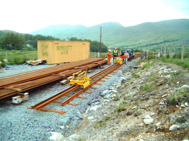
This southerly view (30/6/02) shows Dolgarrog loading rail from the rail store at Rhyd Ddu North. The braked truck is used to carry equipment to the railhead. From 30/6/02. All 26 remaining rails were being moved by RRM to Glan-yr-afon Yard to make way for a ballast dump to the right of the view. Click on this view to enlarge. This image is copyright B.W.Hughes. This image was taken using a Samsung Digimax 230 digital camera with post processing using iPhoto Plus4. Image displayed at 96dpi.
This northerly view (29/6/02) shows the rail store and loading siding and the soon to be moved rail stock pile. The loco shed in the background has seen another vandal attack by trespassers opposed to the project. Click on this view to enlarge. This image is copyright B.W.Hughes. This image was taken using a Samsung Digimax 230 digital camera with post processing using iPhoto Plus4. Image displayed at 96dpi.

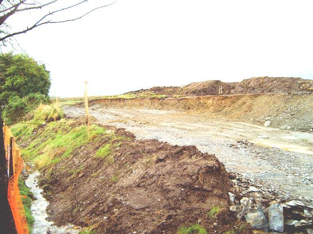
This westerly view (23/12/02) shows the reverse angle to that above. The end of the ballast laid by Jones Bros. during Autumn 2002 is visible. The temporary track in the former rail store is clearly at a lower level and will need to be lifted about 40cm to match the final levels. The large rock still needs to be trimmed or removed to provide adequate clearance for the modern rolling stock. To the right of the rock the original formation is still visible. Click on this view to enlarge. This image is copyright B.W.Hughes. This image was taken using a Samsung Digimax 230 digital camera with post processing using iPhoto Plus4. Image displayed at 96dpi.

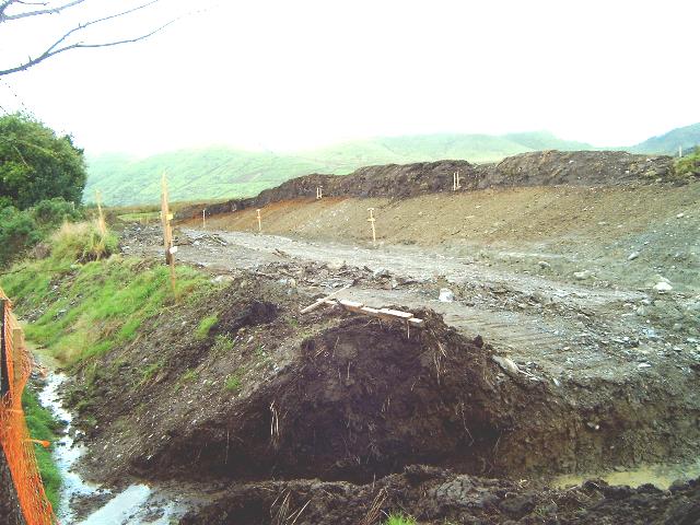
This southerly view (30/3/03) shows the north end of Rhyd Ddu station with rails removed from the former rail stack siding. Sleepers have been laid left of the rock on the new deviation. The trackbed requires a ballast bed to complete this section. The rock between the old and new alignments will have to be trimmed to provide adequate clearance. Click on the image to enlarge. This image is copyright B W Hughes taken on Samsung Digimax 230 digital camera. Image post processed using iPhoto Plus4 image correction technology and displayed at 96dpi.
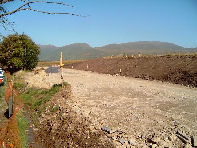
This southerly view (28/5/03) shows the track now complete past the large rock which will now obviously remain. Click on the image to enlarge. This image is copyright B W Hughes taken on Samsung Digimax 230 digital camera. Image post processed using iPhoto Plus4 image correction technology and displayed at 96dpi.
LC65 Snowdon Path access
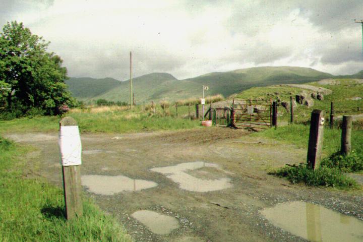
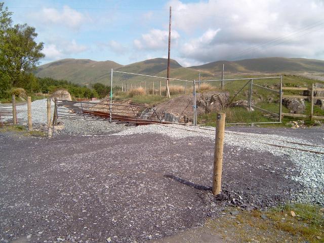
This northerly view (29/5/01) shows LC65, the Ffridd Isaf access, at the north end of Rhyd Ddu station. The original alignment enters the station to the left of the tree. The white notice states the permitted path on the trackbed is closed from 25/5/01 and work was expected to start in May on this section using WHLR direct labour. The new alignment through the station deviates to the right (east) skirting the large rock by the gate. The dirt track in the foreground is the site of the original north end loop points. Click on the image to enlarge. This image is copyright B.W.Hughes. Slide scan technology utilised is Olympus ES10 & iPhoto Plus4. Slide scanned at 200dpi.
This southerly view (29/5/01) was taken shortly after the car park and Snowdonia National Park footpaths were reopened. This view shows the former station area with LC65, the Ffridd Isaf access, in the foreground. The station deviation will take the track sharply to the left just past the large rock, into the area of flat marshy ground. At most, the southbound platform track will be about 25 metres off the original alignment. Click on the image to enlarge. This image is copyright B.W.Hughes. Slide scan technology utilised is Olympus ES10 & iPhoto Plus4. Slide scanned at 200dpi.
This northerly view (29/8/01) shows Bryan Humphries starting to clear the site immediately north of LC65 at the north end of Rhyd Ddu station. The grassed area to the right was also to be excavated to track level as this is where the alignment deviates to the east to avoid the GCC car park. Click on the image to enlarge. This image is copyright B.W.Hughes. Slide scan technology utilised is Olympus ES10 & iPhoto Plus4. Slide displayed at 96dpi.
This northerly view (26/10/01) from LC65 shows the final delivery of rail to Rhyd Ddu with the artic parked on the old formation. The Rhyd Ddu Deviation runs to the right of the rock, some of which will have to be removed. Click on the image to enlarge. This image is copyright B.W.Hughes. Slide scan technology utilised is Olympus ES10 & iPhoto Plus4. Slide displayed at 96dpi.
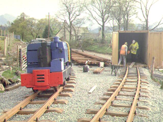
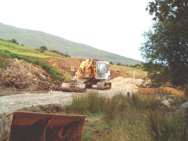
On 29/8/01 a start was made on excavating the trackbed to the right of the old formation north of LC65. The new alignment deviates to the east here and is already outside the original boundary at LC65. The main purpose of the excavation was to make a large storage area for imported quarry waste. On 31/8/01 lorries were bringing slate waste from the Cilgwyn quarries in Nantlle valley and piling it here ready to consolidate the trackbed towards Clogwyn-y-gwin.
This westerly view (6/8/02) shows the pw gang's container being moved from Rhyd Ddu north site. With tracklaying now finished on this section the container was moved to Cae Hywel to allow tracklaying to commence there from 10/8/02. The removal of the container allows Jones Bros. to access the alignment north of LC65 but they had not done so by 18/8/02. Click on the image to enlarge. This image is copyright B W Hughes, taken using Samsung Digimax230 digital camera. Image post processed using iPhoto Plus 4 and displayed at 96dpi.
This northerly view (30/10/02) at Rhyd Ddu shows the north end of the Deviation where it rejoins the original formation just north of LC65. The large rock visible has been marked with a green line for rock pecking to produce adequate clearance. The future formation clings to the right and has been built up with slate chips. Click on the image to enlarge. This image is copyright B W Hughes taken on Samsung Digimax 230 digital camera. Image post processed using iPhoto Plus4 image correction technology and displayed at 96dpi.
This northerly view (30/11/02) shows the trackbed complete and ballasted north of LC65. Click on the image to enlarge. This image is copyright B W Hughes taken on a Hitachi D8 digital camcorder VM-D865LE 230. Image post processed using iPhoto Plus4 image correction technology and displayed at 96dpi.
This northerly view (26/5/03) shows the level crossing completed by that date, though the track does not go around the corner yet. Click on the image to enlarge. This image is copyright B W Hughes taken on Samsung Digimax 230 digital camera. Image post processed using iPhoto Plus4 image correction technology and displayed at 96dpi.
This northerly view (29/5/03) shows the track now complete north of the level crossing. The formation has been shifted to the east slightly so as to miss the rock. Click on the image to enlarge. This image is copyright B W Hughes taken on Samsung Digimax 230 digital camera. Image post processed using iPhoto Plus4 image correction technology and displayed at 96dpi.
This northerly view (28/5/03) shows Upnor Castle shunting across LC65 with the ballast regulator. Click on the image to enlarge. This image is copyright B W Hughes taken on Samsung Digimax 230 digital camera. Image post processed using iPhoto Plus4 image correction technology and displayed at 96dpi.
This northerly view (13/7/03) shows the track now completed north from LC65, the footpath/cyclepath has a separate crossing to the roadway, which has been moved a little to the south. The point level is visible bottom left. Originally it had been intended to make this an automatic point but there was insufficient time to make a new mechanism in addition to the two fitted at Waunfawr recently. Click on the image to enlarge. This image is copyright B W Hughes taken on Samsung Digimax 230 digital camera. Image post processed using iPhoto Plus4 image correction technology and displayed at 96dpi.
This southerly view (16/8/02) from LC65 shows the Deviation has now extended to the level crossing. The alignment of the trackbed is now clear. The lighter area next to the tree is the rolled clay base for the future station building. Dumpers have been taking spare spoil up the Snowdon track for disposal/improvement of the track. No work has been done north of the l/c yet to join with the section cleared by the WHLR subcontractors. Click on the image to enlarge. This image is copyright B W Hughes, taken using Samsung Digimax230 digital camera. Image post processed using iPhoto Plus 4 and displayed at 96dpi.

This northerly view (28/9/02) at Rhyd Ddu north shows the gate and kissing gate have been moved east. The kissing gate has been relocated to the south side of the crossing. This now leaves the way open to extend the trackbed to link up with the works done by WHLR subcontractors north of LC65. Click on the image to enlarge. This image is copyright B W Hughes taken on Samsung Digimax 230 digital camera. Image post processed using iPhoto Plus4 image correction technology and displayed at 96dpi.
This southerly view (30/10/02) from LC65 at Rhyd Ddu shows the north end of the Deviation where the point will be placed for the run round loop. Initially trains will run into the left hand platform road, with the right hand road available for run round. This will leave the access from the station building (right) free most of the time. The point will be placed between the level crossing and the start of the ballast bed. Click on the image to enlarge. This image is copyright B W Hughes taken on Samsung Digimax 230 digital camera. Image post processed using iPhoto Plus4 image correction technology and displayed at 96dpi.
This southerly view (30/11/02) shows the completed ballast for the point just south of LC65. Jones Bros. has also placed piles of sleepers ready for the volunteers to lay track in the New Year. However, Rhyd Ddu tracklaying is likely to be a lower priority than completing the tracklaying from Waunfawr to Plas-y-nant to allow opening to Plas-y-nant for Easter 2003. The formation has not been completed across LC65. Click on the image to enlarge. This image is copyright B W Hughes taken on a Hitachi D8 digital camcorder VM-D865LE 230. Image post processed using iPhoto Plus4 image correction technology and displayed at 96dpi.
Ballasting across the level crossing was completed by 26/5/03 and one 18m length of track was laid north from the point through LC65 by that date. The work to form a new computer model of the alignment into the station has been taken 'in house' after the company producing the computer model found difficulties in this area with so many constraints. Trespassers kicked out some of the surveying posts and made it awkward for volunteers to position the run-round loop.

This southerly view (18/5/03) shows volunteers aligning the track into the north loop from LC65. Trespassers had kicked out some of the surveyor's 5m posts and made it difficult to get the run-round closure with the point accurate allowing for a straight out of the point for the future southbound arrival track. The left hand track will be the arrival track until the station becomes a through station. Click on the image to enlarge. This image is copyright B W Hughes taken on Samsung Digimax 230 digital camera. Image post processed using iPhoto Plus4 image correction technology and displayed at 96dpi.

This southerly view (26/5/03) shows the completed track with the point now linked to both the arrival and run-round tracks. This was needed so that the locos and trains could shunt into either platform using the short incomplete section across LC65 to Rhyd Ddu North as a headshunt. Click on the image to enlarge. This image is copyright B W Hughes taken on Samsung Digimax 230 digital camera. Image post processed using iPhoto Plus4 image correction technology and displayed at 96dpi.
This southerly view (29/5/03) shows the curvaceous track through the level crossing (LC65) from the site of the large rock featured above. Upnor Castle is visible on the ballast regulator. This image is copyright B W Hughes taken on Samsung Digimax 230 digital camera. Image post processed using iPhoto Plus4 image correction technology and displayed at 96dpi.

This northerly view (13/7/03) shows the track now completed north from LC54, about to be joined up with existing track to Glan-yr-afon Viaduct. It is believed that pw trains first rolled through here on 2/6/03. Click on the image to enlarge. This image is copyright B W Hughes taken on Samsung Digimax 230 digital camera. Image post processed using iPhoto Plus4 image correction technology and displayed at 96dpi.
Rhyd-Ddu station north
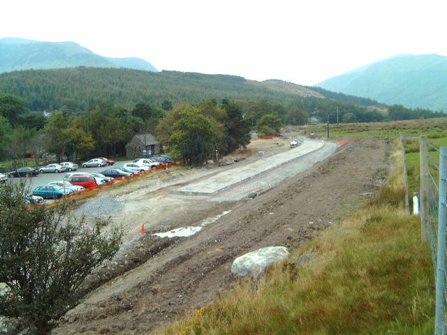
GCC built the Rhyd Ddu car park in the 1960s on the site of the former WHR station so the railway must be deviated around the car park to the east over a length of some 500 metres. This involves tightening the left hand curve from Ch.14500 to increase the distance to the old trackbed to a maximum of about 30 metres opposite the GCC toilet block.
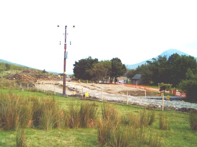
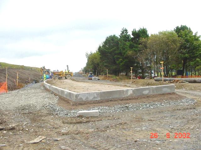
This southerly view from the Snowdon footpath at Rhyd Ddu (16/8/01) shows the future station site and the GCC toilet block. The new fences are now apparent. Work began here in July, excavating the alignment for the Station Deviation. The electricity pole and transformer will have to be moved as they on the site of the platform. This will supply the future station building as well as GCC toilets. Click on the image to enlarge. This image is copyright WHLR, courtesy Jan Woods using iPhoto Plus4 image correction technology and displayed at 96dpi.
The new Rhyd Ddu station will have an island platform with a station building separate from the island. The platform will be 6m wide at the north end to accommodate a 2m wide waiting shelter. The platform will taper to 4m wide south of this. The station building would be placed near the GCC toilet block at the north end of the car park. A footbridge is not required as access is on the level as at Dinas.
Very little rock excavation is required to achieve this new alignment now that the eastern coach stabling siding has been dropped. Initially the station will have left hand running so as to have the light engine run round movement being the only one crossing the passenger access. Although the loop will be constructed to the full 200m, only the northern half of the platform (alongside the car park) will be constructed. The platform will initially be just long enough for the existing 7 coach train.
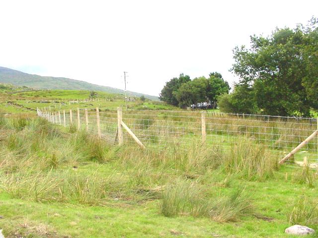
In early August 2001 work started on fencing the Station Deviation following the acquisition of the land. The route was pegged out and Achnashean completed fencing the Deviation by 16/8/01.
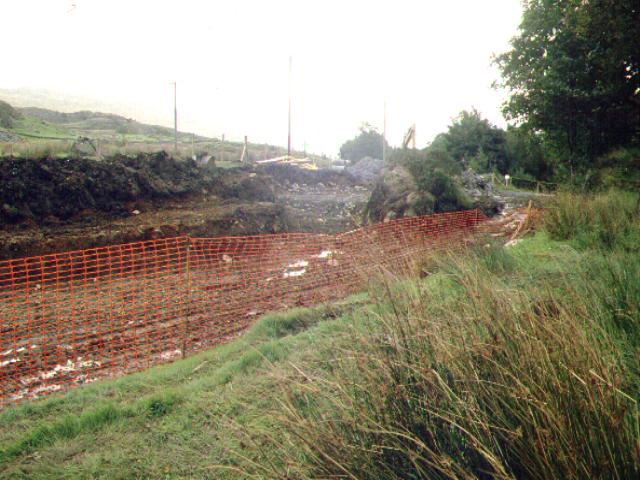
This southerly view (29/8/01) shows the area south of LC65. The new fences are visible enclosing the area of the Rhyd Ddu Station Deviation. The track swings to the east from a point just north of LC65 as the GCC car park now occupies the original WHR station site. The platform starts near the electricity pole which must be relocated. The Deviation reaches its maximum distance from the old formation with the bend in the fencing at the extreme left. From this point the tracks will pass to the left of the trees before converging with the old alignment just beyond the trees. Click on the image to enlarge. This image is copyright B.W.Hughes. Slide scan technology utilised is Olympus ES10 & iPhoto Plus4. Slide displayed at 96dpi.
This southerly view (16/8/01) shows the area south of LC65. The new fences are visible enclosing the area of the Rhyd Ddu Station Deviation. The run round track will follow the line of the fence before curving to the right around the electricity pole. Click on the image to enlarge. This image is copyright B.W.Hughes. Slide scan technology utilised is Olympus ES10 & iPhoto Plus4. Slide displayed at 96dpi.
The electricity pole and transformer were moved at the request of the WHLR by 29/6/02. As this is a deviation, the WHLR has to pay for new work. This clears the way for Jones Bros. to access the site and begin the Station Deviation in July. From the new pole, the ducted cable route goes around the east side of the car park to the south exit. Construction work began in May on this project. The transformer will provide a 230V supply for the new station building and existing GCC toilet block, which will also serve the station.

This northerly view (29/6/02) shows the newly repositioned electricity pole and transformer. A site road leads across the future formation to the pole. The cable is buried under the line of this site road, which is a little below the future formation level. Two diverging tracks roughly parallel with the left hand fence line will cross this site road and the platform will begin just beyond, where the platform track (and run round) swing to the right. Click on this view to enlarge. This image is copyright B.W.Hughes. This image was taken using a Samsung Digimax 230 digital camera with post processing using iPhoto Plus4. Image displayed at 96dpi.
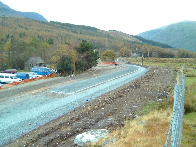
This southerly view (2/8/02) from LC65 shows the completed formation rolled level just north of the transformer pole. The formation is approximately 10 m wide allowing for the island platform and shelter. The platform will start just after the formation bends to the right, alongside the car park. Click on the image to enlarge. This image is copyright B W Hughes, taken using Samsung Digimax230 digital camera. Image post processed using iPhoto Plus 4 and displayed at 96dpi.
This southerly view (8/8/02) shows the rolled boulder clay embankment curving around from the station straight towards LC65. Click on the image to enlarge. This image is copyright B W Hughes, taken using Samsung Digimax230 digital camera. Image post processed using iPhoto Plus 4 and displayed at 96dpi.
This southerly view (16/8/02) down the axis of Rhyd Ddu station shows a year's progress from the same viewpoint as the image above. Surface peat has been stripped and stored in banks to the side of the formation. Boulder clay excavated on site has been tipped vibrated/rolled level to form the foundation for the new alignment. Quarry waste has been added to firm up the formation swinging in from the right. Click on the image to enlarge. This image is copyright B W Hughes, taken using Samsung Digimax230 digital camera. Image post processed using iPhoto Plus 4 and displayed at 96dpi.
This southerly view (30/10/02) at Rhyd Ddu shows the north end of the platform looking down the axis of the station. The future station building will be on the built up patch of yellow clay to the right, with access across the right hand track by l/c to the north end of the platform. Click on the image to enlarge. This image is copyright B W Hughes taken on Samsung Digimax 230 digital camera. Image post processed using iPhoto Plus4 image correction technology and displayed at 96dpi.
This northerly view (28/9/02) at Rhyd Ddu shows the end of the new platform. The station building will be on the yellow clay area to the right. Click on the image to enlarge. This image is copyright B W Hughes taken on Samsung Digimax 230 digital camera. Image post processed using iPhoto Plus4 image correction technology and displayed at 96dpi.
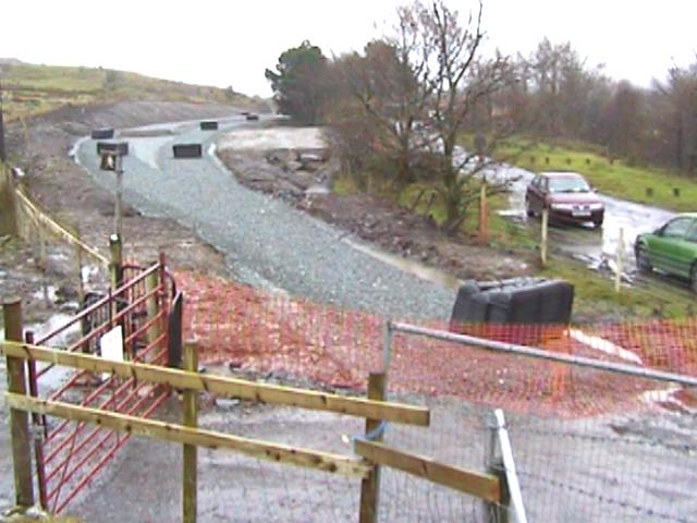
This southerly view (16/2/03) shows the recently completed tracklaying in the arrival line at Rhyd Ddu. Tracklaying to Rhyd Ddu north must await resolution of some computer alignment problems at this location. Click on the image to enlarge. This image is copyright B W Hughes taken on Samsung Digimax 230 digital camera. Image post processed using iPhoto Plus4 image correction technology and displayed at 96dpi.
This southerly view (30/3/03) shows the north end of Rhyd Ddu station with rails now laid in both platforms but awaiting the north end point. Tarmac has also been laid in a four metre wide strip on the platform to allow access to the east (left) arrival track. Click on the image to enlarge. This image is copyright B W Hughes taken on Samsung Digimax 230 digital camera. Image post processed using iPhoto Plus4 image correction technology and displayed at 96dpi.
Station Building
The original proposal for a wooden station building was rejected by the planning authority. The SNPA want an essentially stone building more in keeping with the local character. A revised application was submitted on 18/12/02. The building will be situated in the compound in the car park at the north end of the station.
This southerly view (23/12/02) shows the completion of fencing of the compound for the station building to the right just before the trees. A 2m wide gap in the fencing allows access to the platforms across the run round line. The building to the right is the GCC toilet block that serves the car park behind the trees. Click on this view to enlarge. This image is copyright B.W.Hughes. This image was taken using a Samsung Digimax 230 digital camera with post processing using iPhoto Plus4. Image displayed at 96dpi.
The original plan for the station building was to have a door to the south and a ramp access for disabled passengers. A 20 space linear car park will be created by diverting the roadway along the old formation to the west side of the old formation, north of the GCC toilet block.

This northerly view (29/5/01) shows the GCC toilet block built on the site of the original Rhyd Ddu station buildings. The dirt track occupies the site of the former loop. The proposed new station building will be to the right, off the island platform. The new platform will be further to the right of this accessed by a level crossing. Click on the image to enlarge. This image is copyright B.W.Hughes. Slide scan technology utilised is Olympus ES10 & iPhoto Plus4. Slide scanned at 200dpi.
Platforms
This southerly view (26/9/02) shows the start of construction of the platform at Rhyd Ddu. Like Waunfawr, the platform curves at the north end. Click on the image to enlarge. This image is copyright WHLR, courtesy Jan Woods. Image post processed using iPhoto Plus4 image correction technology and displayed at 96dpi.
This southerly view (26/1/03) at Rhyd Ddu shows the north end of the platform, now with track laid, where the track begins to curve towards the point. Both trackbeds are now fully ballasted. Further tracklaying will await final surveying of the position of the north loop point. Click on the image to enlarge. This image is copyright B W Hughes taken on Samsung Digimax 230 digital camera. Image post processed using iPhoto Plus4 image correction technology and displayed at 96dpi.
This northerly view (31/10/02) at Rhyd Ddu shows the north end of the Deviation where the platform ends. The point for the loop will be placed just beyond the ballast bed with LC65 beyond that again. Click on the image to enlarge. This image is copyright B W Hughes taken on Samsung Digimax 230 digital camera. Image post processed using iPhoto Plus4 image correction technology and displayed at 96dpi.
This southerly view (14/9/02) shows the site of the station building with the new trackbed beyond. The new building will now have to be local stone with a slate roof.. Click on the image to enlarge. This image is copyright B W Hughes, taken using Samsung Digimax230 digital camera. Image post processed using iPhoto Plus 4 and displayed at 96dpi.

This easterly view (5/7/03) shows the ramp to the platform from the future ticket office now complete. The DZ wagon moved to Rhyd Ddu is seen in the arrival line. some poles have gone up to delineate the fencing of the footpath platform access. Click on the image to enlarge. This image is copyright B W Hughes taken on Samsung Digimax 230 digital camera. Image post processed using iPhoto Plus4 image correction technology and displayed at 96dpi.
This northerly view (20/8/01) shows the fencing enclosing the Rhyd Ddu station Deviation as seen from the area of the GCC toilet block. At this point the tracks are at their maximum separation from the old alignment and curving back towards LC65, just north of which where they rejoin the existing formation. Click on the image to enlarge. This image is copyright B.W.Hughes. Slide scan technology utilised is Olympus ES10 & iPhoto Plus4. Slide displayed at 96dpi.
This northerly view (25/7/02) shows work alongside the car park carving out the new Station Deviation alignment. After a few weeks, Jones had cleared a plant road through the station at the new higher formation level and were proceeding to enlarge the width to the width of two tracks and a four metre wide platform. Click on this image to enlarge. This image is copyright WHLR, courtesy Jan Woods. Image post processed using iPhoto Plus4 and displayed at 96dpi.
This northerly view (18/8/02) shows the progress as seen from alongside the car park from a similar viewpoint to that above. The full width of the station is now clear as the slope has been excavated on the far side of the alignment. The formation is about 1.5m above the car park. Click on the image to enlarge. This image is copyright B W Hughes, taken using Samsung Digimax230 digital camera. Image post processed using iPhoto Plus 4 and displayed at 96dpi.
This northerly view (24/8/02) from the same viewpoint as above shows the completed excavation alongside the GCC car park. This station shelf will carry two tracks and a 6m wide island platform. The next steps will be to provide drainage. While Rhyd Ddu is a terminus, trains will pull into the far platform face in an untypical left-hand running manoeuvre so that only the run round movement crosses the passenger access l/c. Click on the image to enlarge. This image is copyright B W Hughes, taken using Samsung Digimax230 digital camera. Image post processed using iPhoto Plus 4 and displayed at 96dpi.
This northerly roadside view (14/9/02) shows work on the formation essentially complete. The far cutting side has been clad in excavated peat previously embanked. A platform will soon be created at this location for the 7 coach trains currently operated. Click on the image to enlarge. This image is copyright B W Hughes, taken using Samsung Digimax230 digital camera. Image post processed using iPhoto Plus 4 and displayed at 96dpi.
This northerly view (26/9/02) shows the completion of installation of platform edge kerb stones at Rhyd Ddu. The 88m long platform will be sufficient for existing lengths of train. The kerbing is being constructed for the east platform face as right-hand running will be the norm here until the route is extended to Beddgelert in Phase 4. Click on the image to enlarge. This image is copyright WHLR, courtesy Jan Woods. Image post processed using iPhoto Plus4 image correction technology and displayed at 96dpi.
This northerly view (28/9/02) at Rhyd Ddu shows the south end of the 88m long platform at Rhyd Ddu at Ch.14777 (approx.), part of the way along the car park. Click on the image to enlarge. This image is copyright B W Hughes taken on Samsung Digimax 230 digital camera. Image post processed using iPhoto Plus4 image correction technology and displayed at 96dpi.
This northerly view (30/11/02) shows the completed ballast along the westerly track (run-round loop) at Rhyd Ddu. Sleepers have been positioned on the ballast ready for the hand-over to WHLR volunteers in the New Year. Click on the image to enlarge. This image is copyright B W Hughes taken on a Hitachi D8 digital camcorder VM-D865LE 230. Image post processed using iPhoto Plus4 image correction technology and displayed at 96dpi.
This northerly view (16/2/03) at Rhyd Ddu shows track laid in the run-round loop at Rhyd Ddu alongside the platform three weeks previously. The track in the easterly arrival line visible to the right was laid a fortnight before. Click on the image to enlarge. This image is copyright B W Hughes taken on Samsung Digimax 230 digital camera. Image post processed using iPhoto Plus4 image correction technology and displayed at 96dpi.

This northerly view (26/5/03) shows the platform at Rhyd Ddu station with the run-round loop formed into a ramp to deliver rolling stock. This was achieved on 22/5/03. Click on the image to enlarge. This image is copyright B W Hughes taken on Samsung Digimax 230 digital camera. Image post processed using iPhoto Plus4 image correction technology and displayed at 96dpi.
This northerly view (26/5/03) shows a close-up of Conway Castle on the ballast train in the run-round track. The vehicle with the white door is the tool van placed immediately behind the loco. Click on the image to enlarge. This image is copyright B W Hughes taken on Samsung Digimax 230 digital camera. Image post processed using iPhoto Plus4 image correction technology and displayed at 96dpi.
This southerly view (29/5/01) shows the SNPA car park at Rhyd Ddu built on the south end of the former loop. The undisturbed original trackbed continues beyond the trees. The Rhyd Ddu station Deviation is still to the left but now closing with the original alignment. The viewpoint is the approximate alignment of the southbound track which will take the space between the fence on the left and the near edge of the car park. The WHR has standard 200 metre loops and so the platform will extend approximately 100m south of this point closing with the main road. Click on the image to enlarge. This image is copyright B.W.Hughes. Slide scan technology utilised is Olympus ES10 & iPhoto Plus4. Slide scanned at 200dpi.
This southerly view (20/8/01) from the GCC car park shows the area of the new station site enclosed by the new fencing (far left). The two tracks and a platform will be on embankment and cutting at slightly above the level as the car park. Click on the image to enlarge. This image is copyright B.W.Hughes. Slide scan technology utilised is Olympus ES10 & iPhoto Plus4. Slide displayed at 96dpi.

This southerly view (9/8/02) shows a year's progress from the same viewpoint as the image above from the south end of the car park. Peat has been extracted and embanked on the east side of the formation. Work started on this section in mid-August after rain had delayed progress. Click on the image to enlarge. This image is copyright B W Hughes, taken using Samsung Digimax230 digital camera. Image post processed using iPhoto Plus 4 and displayed at 96dpi.
This southerly view (16/8/02) shows a week's progress from the same viewpoint as above. The quarry waste is beginning to extend south from the car park area. Click on the image to enlarge. This image is copyright B W Hughes, taken using Samsung Digimax230 digital camera. Image post processed using iPhoto Plus 4 and displayed at 96dpi.

This southerly view (24/8/02) shows a further week's progress from the same viewpoint as above. Another 100m of formation south of the car park has been built up with clay excavated on site. Click on the image to enlarge. This image is copyright B W Hughes, taken using Samsung Digimax230 digital camera. Image post processed using iPhoto Plus 4 and displayed at 96dpi.

This southerly view (14/9/02) shows the same viewpoint as above 3 weeks on. The excavation is now complete and the formation has been established for some distance beyond the south end of the car park. Click on the image to enlarge. This image is copyright B W Hughes, taken using Samsung Digimax230 digital camera. Image post processed using iPhoto Plus 4 and displayed at 96dpi.
This southerly view (31/10/02) at Rhyd Ddu shows the south end of the Deviation where it is proposed to extend the platform when funds allow. Click on the image to enlarge. This image is copyright B W Hughes taken on Samsung Digimax 230 digital camera. Image post processed using iPhoto Plus4 image correction technology and displayed at 96dpi.
This southerly view (23/12/02) shows the completion of fencing at the south end of the station from a similar viewpoint to that above. The ballast for the run round loop does not join up with the headshunt on the arrival track visible in the distance. Click on this view to enlarge. This image is copyright B.W.Hughes. This image was taken using a Samsung Digimax 230 digital camera with post processing using iPhoto Plus4. Image displayed at 96dpi.
As at 30/5/03, the ballast for the run round loop had not been joined up with the south end headshunt. This was to allow access to dump ballast to be loaded in the arrival line.
This northerly view (26/9/02) shows the completed southern end of the platform edge kerbing at Rhyd Ddu, roughly alongside the car park. Yellow clay is being built up inside the platform before slate fines and tarmac are added. The loop is being built to the full 200m length but the platform is only 88m long (approx.) as an economy measure. Hillside drainage is visible to the right. Click on the image to enlarge. This image is copyright WHLR, courtesy Jan Woods. Image post processed using iPhoto Plus4 image correction technology and displayed at 96dpi.
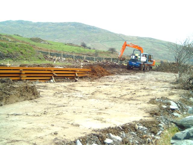
By Easter 2002, stone walls had been demolished at the south end of the Station Deviation and trial pits dug. These revealed that the amount of rock to be removed is much less than expected and much of the overburden can be reused. This will make the contract much cheaper. The contract for excavation was placed in May and work will started on 10/6/02.
By the end of July, excavations were extensive, with the new formation level cleared through the site and being widened to provide space for the island platform and loops. Spare spoil was being tipped and compacted both north and south on the line of the formation to bring the levels up to requirements.
This panoramic northerly view (2/8/02) from the mid point of the Deviation shows excavation nearing completion although no work was in progress on that day. Peat and spoil has been heaped up on the spare land to the right prior to use as cladding. The 10 m wide formation width alongside the car park is clearly visible. This image is copyright B W Hughes, taken using Samsung Digimax230 digital camera. Image post processed using iPhoto Plus 4 and displayed at 96dpi.
This northerly view (28/9/02) at Rhyd Ddu shows the newly constructed platform. Click on the image to enlarge. This image is copyright B W Hughes taken on Samsung Digimax 230 digital camera. Image post processed using iPhoto Plus4 image correction technology and displayed at 96dpi.
This northerly view (31/10/02) at Rhyd Ddu shows the north end of the Deviation where the shortened platform is now complete bar tarmac. The right hand (easterly) track has been ballasted for some 200m approx. The trackbed west of the platform has been left as a plant access road until the south end of the site is complete as some excavated spoil is being tipped on local dumps up the Snowdon track. Click on the image to enlarge. This image is copyright B W Hughes taken on Samsung Digimax 230 digital camera. Image post processed using iPhoto Plus4 image correction technology and displayed at 96dpi.
This northerly view (30/11/02) shows the completed ballast along the westerly track (run-round loop) at Rhyd Ddu. Sleepers have been positioned on the ballast ready for the hand-over to WHLR volunteers in the New Year. There are still some kerb stones to add. These will presumably go at the platform access crossing on the west side at the north end opposite the area for the station building. Click on the image to enlarge. This image is copyright B W Hughes taken on a Hitachi D8 digital camcorder VM-D865LE 230. Image post processed using iPhoto Plus4 image correction technology and displayed at 96dpi.
This northerly view (16/2/03) at Rhyd Ddu shows track laid along the platform arrival line almost complete three weeks earlier. Two 18m lengths were also laid in the run-round track to the left, next to the car park. These do not join up yet with the arrival track as neither point has been moved into position. By w/e 26/1/03, the run-round track had been extended by two additional lengths along the west side of the platform. Click on the image to enlarge. This image is copyright B W Hughes taken on Samsung Digimax 230 digital camera. Image post processed using iPhoto Plus4 image correction technology and displayed at 96dpi.
This northerly view (30/3/03) shows the platform at Rhyd Ddu station with rails now laid in the westerly run-round loop. A 4m wide tarmac top has been laid on the platform via the ramp at the south end. Click on the image to enlarge. This image is copyright B W Hughes taken on Samsung Digimax 230 digital camera. Image post processed using iPhoto Plus4 image correction technology and displayed at 96dpi.
This northerly view (26/5/03) shows the platform at Rhyd Ddu station with Conway Castle in view on the ballast train. The ballast dump is loaded into ballast wagons in the right hand arrival line. Click on the image to enlarge. This image is copyright B W Hughes taken on Samsung Digimax 230 digital camera. Image post processed using iPhoto Plus4 image correction technology and displayed at 96dpi.
This westerly view (5/7/03) shows the unloading of Barclay DM No.554 Taxi-2 which is on loan from the WHR(P) to work with the DZ wagon on fencing and stonemason duties from Rhyd Ddu north to Snowdon Ranger. In the background the tamper is being loaded for transport to Betws Garmon to tamp the section south from there. Click on the image to enlarge. This image is copyright B W Hughes taken on Samsung Digimax 230 digital camera. Image post processed using iPhoto Plus4 image correction technology and displayed at 96dpi.
Rhyd Ddu South
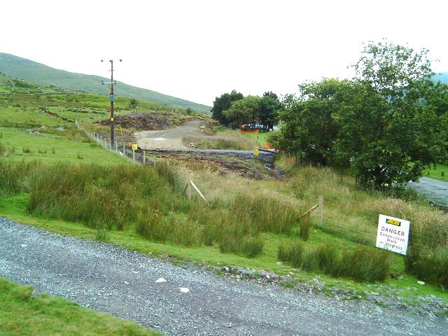
With work now well underway alongside the car park at Rhyd Ddu and generating queries from tourists, it is perhaps surprising that there are no signs to indicate this is a Millennium Project. Given the many visitors to Snowdon and the fact the station will be opened next Easter, perhaps the project information sign at OB1 should be moved here.
By 28/10/02 two high poles had been placed in removable concrete blocks facing south just south of the car park entrance. A similar pair facing north have been established at Plas-y-nant. However, signage has not been erected by 13/7/03 at either location.
This southerly view (2/8/02) shows the reverse angle from the above viewpoint. No work has been done on the southern half of the loop yet. Click on the image to enlarge. This image is copyright B W Hughes, taken using Samsung Digimax230 digital camera. Image post processed using iPhoto Plus 4 and displayed at 96dpi.
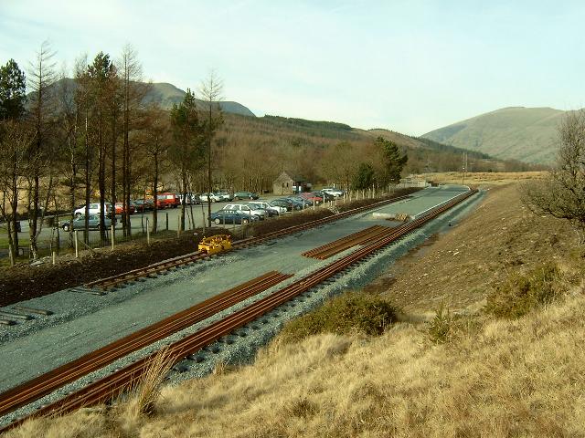
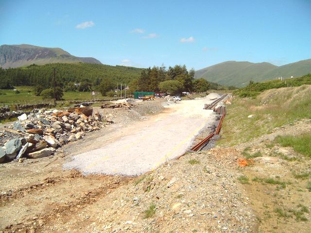
This southerly view (28/9/02) at Rhyd Ddu shows the rail store and limit of trackbed at Ch.14875. The point and headshunt are shown on plans to be situated some 125m further on at Ch.15000, close to where the Deviation rejoins the original alignment. Click on the image to enlarge. This image is copyright B W Hughes taken on Samsung Digimax 230 digital camera. Image post processed using iPhoto Plus4 image correction technology and displayed at 96dpi.
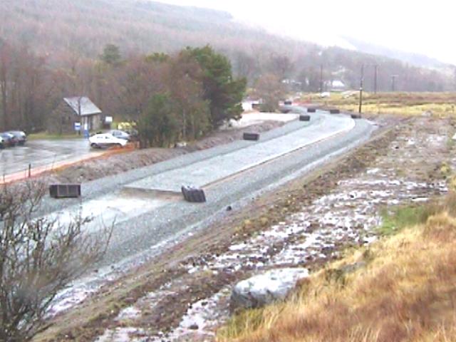
This southerly view (31/10/02) at Rhyd Ddu shows the south end of the Deviation where it rejoins the original formation. Ballast has been laid up to the rail stack on the easterly trackbed, which will be the future arrival line whilst the station is a terminus. Work was underway on this day landscaping clay dumps near the main road to make the station visible and tidy from the public side. Spoil was also being removed from the dumps stockpiled beyond the south end of the formation. Click on the image to enlarge. This image is copyright B W Hughes taken on Samsung Digimax 230 digital camera. Image post processed using iPhoto Plus4 image correction technology and displayed at 96dpi.
This southerly view (26/1/03) at Rhyd Ddu shows the south end of the Rhyd Ddu Deviation with track laid. Rails had been sorted into two piles over the weekend. The nearer bent rails were due to be transported to a rolling mill in Wolverhampton by the end of January. The position of the point for the run-round loop is next to the nearer pile of rails and the headshunt will be next to the further pile of rails. A section of the right hand (westerly) trackbed has not been ballasted until it runs nears the platform. This allows access for vehicles to tarmac the platform. Click on the image to enlarge. This image is copyright B W Hughes taken on Samsung Digimax 230 digital camera. Image post processed using iPhoto Plus4 image correction technology and displayed at 96dpi.
This southerly view (16/2/03) shows the south end of Rhyd Ddu station with rails removed to Wolverhampton for re-rolling. Click on the image to enlarge. This image is copyright B W Hughes taken on Samsung Digimax 230 digital camera. Image post processed using iPhoto Plus4 image correction technology and displayed at 96dpi.

This southerly view (13/7/03) shows the point now complete at the south end of Rhyd Ddu station. By 18/7/03 wooden sleepered track was being extended towards the run round loop. This track connects into another left hand point that gives access to an engineering siding at Rhyd Ddu. Click on the image to enlarge. This image is copyright B W Hughes taken on Samsung Digimax 230 digital camera. Image post processed using iPhoto Plus4 image correction technology and displayed at 96dpi.

This northerly view (13/7/03) shows the point for the run round track at the south end of Rhyd Ddu. The point for the pw siding is near the ballast pile at the end of the platform. Click on the image to enlarge. This image is copyright B W Hughes taken on Samsung Digimax 230 digital camera. Image post processed using iPhoto Plus4 image correction technology and displayed at 96dpi.
This northerly roadside view (20/8/01) shows the site of the south end of the new Rhyd Ddu platform and loop at Ch. 14900. The station deviates around the car park which was built on the original route just beyond the line of fir trees to the left. The new fencing to the right shows the edge of the substantial cutting that is required to fit in the two platform tracks and platform. The works siding for Phase 4 will run alongside the road just over the wall. Click on the image to enlarge. This image is copyright B.W.Hughes. Slide scan technology utilised is Olympus ES10 & iPhoto Plus4. Slide displayed at 96dpi.
This northerly roadside view (16/8/02) shows the start of work on the southern half of the loop with the car park behind the trees to the left. Peat has been embanked to both the east and west of the formation and quarry waste is being used to firm up the alignment. The patch of grass in the foreground is the original alignment and may be eventually used for a construction siding for Phase 4. Click on the image to enlarge. This image is copyright B W Hughes, taken using Samsung Digimax230 digital camera. Image post processed using iPhoto Plus 4 and displayed at 96dpi.
This northerly roadside view (24/8/02) shows a further week's progress from a similar viewpoint to that above. Clay excavated on site and been tipped and rolled to make a level shelf formation through the station. Click on the image to enlarge. This image is copyright B W Hughes, taken using Samsung Digimax230 digital camera. Image post processed using iPhoto Plus 4 and displayed at 96dpi.

This northerly roadside view (31/10/02) at Rhyd Ddu shows the south end of the Deviation where it rejoins the original formation. Work is underway landscaping former clay spoil dumps to tidy up the area. The rail stack is visible. Click on the image to enlarge. This image is copyright B W Hughes taken on Samsung Digimax 230 digital camera. Image post processed using iPhoto Plus4 image correction technology and displayed at 96dpi.
This northerly view (31/10/02) at Rhyd Ddu shows the south end of the Deviation where Jones Bros base is located. The large poles to the left of the ballast pile appear to be for a temporary sign advising of the Millennium Project. this will satisfy the many visitors who ask what all the works are for. A similar pair of poles has been erected at Plas-y-nant facing north. Click on the image to enlarge. This image is copyright B W Hughes taken on Samsung Digimax 230 digital camera. Image post processed using iPhoto Plus4 image correction technology and displayed at 96dpi.
This northerly roadside view (1/12/02) shows the rail stack at the south end of Rhyd Ddu station. This area is landscaped and clearly visible from the main road. Ballast is visible just to the right of the rails marking the site of the proposed Phase 3 headshunt. Signage has not yet been erected on the tall poles. Click on the image to enlarge. This image is copyright B W Hughes taken on a Hitachi D8 digital camcorder VM-D865LE 230. Image post processed using iPhoto Plus4 image correction technology and displayed at 96dpi.
This northerly view (13/7/03) shows the headshunt area at the south end of Rhyd Ddu station. The point has now been installed. There may be enough room here for a double headed Garratt as there is about 40m clear south of the point. Click on the image to enlarge. This image is copyright B W Hughes taken on Samsung Digimax 230 digital camera. Image post processed using iPhoto Plus4 image correction technology and displayed at 96dpi.
This southerly roadside view (24/8/02) shows the reverse angle from the same viewpoint as above. The sloping ground has been cleared of topsoil, which is piled to the left. The formation is being made up to the required level with rolled boulder clay. The alignment has now closed with the main road visible on the right. When Phase 4 is constructed towards Beddgelert a point may be put in here to allow access to a siding for construction trains alongside the road on the old formation. Click on the image to enlarge. This image is copyright B W Hughes, taken using Samsung Digimax230 digital camera. Image post processed using iPhoto Plus 4 and displayed at 96dpi.
This southerly roadside view (31/10/02) at Rhyd Ddu shows the south end of the Deviation where it rejoins the original formation by the main road. The rail stack is visible on the left and the formation ends between there and the excavator, which is clearing spoil dumps. Phase 4 may see a construction siding based on the packed clay area alongside the main road. Click on the image to enlarge. This image is copyright B W Hughes taken on Samsung Digimax 230 digital camera. Image post processed using iPhoto Plus4 image correction technology and displayed at 96dpi.
The new site entrance for rail deliveries (a 20 metre hole in roadside wall) was started on 15/10/01, 20metres south of southern entrance to Rhyd Ddu car park (see above image). This is to allow the 60 foot long articulated lorries carrying rail to pull off the road and then reverse back to Rhyd Ddu North for unloading.
This northerly roadside view (20/8/01) shows the extreme south end of Rhyd Ddu station. The end of the new fencing for the new station site is visible at Ch.15000. The new route will deviate around the car park to the east (right) but there is room for a Phase 4 construction siding to be added later on the old formation up to the car park. This would be built as a shunt back from the headshunt. Click on the image to enlarge. This image is copyright B.W.Hughes. Slide scan technology utilised is Olympus ES10 & iPhoto Plus4. Slide scanned at 200dpi.

This northerly roadside view (14/9/02) shows a year's progress since the above image. A bank of peat removed from the formation is visible by the fencing in the centre of this view. Click on the image to enlarge. This image is copyright B W Hughes, taken using Samsung Digimax230 digital camera. Image post processed using iPhoto Plus 4 and displayed at 96dpi.
Delivering rails
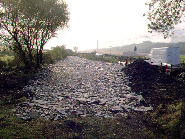
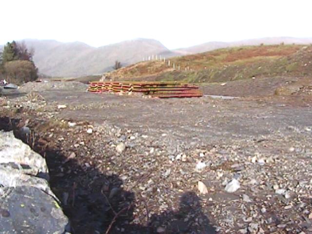
This southerly view (21/10/01) shows the clearance of the trackbed immediately south of Rhyd Ddu station. The mud and vegetation has been pushed further along the trackbed and hard core put down for articulated lorries to bring in the rail. This location will eventually have one siding for the future stabling of Phase 4 construction trains. Click on the image to enlarge. This image is copyright B.W.Hughes. Slide scan technology utilised is Olympus ES10 & iPhoto Plus4. Slide displayed at 96dpi.
This northerly view (26/10/01) shows the third and final delivery of rail to Rhyd Ddu. Lorries entered through the freshly made hole in the roadside wall. Due to the lorries bogging down, A JCB had to used to haul the lorry out by chain. Click on the image to enlarge. This image is copyright B.W.Hughes. Slide scan technology utilised is Olympus ES10 & iPhoto Plus4. Slide displayed at 96dpi.

This southerly view (26/10/01) shows the final lorry load of rails being towed through the trees (after bogging down) over geotextile and slate waste. The lorry is on the approximate position of the original NWNGR trackbed. Two deliveries of rail were made the previous day. The team then went on to lay three lengths of temporary siding by the rail store north of LC65. Click on the image to enlarge. This image is copyright B.W.Hughes. Slide scan technology utilised is Olympus ES10 & iPhoto Plus4. Slide displayed at 96dpi.
The platform will be the standard 200m long and the south end loop points situated at Ch.14990. A headshunt will extend to Ch.15200 almost halfway along the straight to Pitt's Head Halt. This would allow access to shunt back into a 60 m siding for Phase 4 works trains on the former alignment up to the south end of the car park. Eventually, there are plans for a second siding for stabling a passenger rake clear of the loop.
Second thoughts have suggested savings in the construction of the platforms as two edge platforms rather than an island platform. Initially one platform would be built on the car park side (for right hand running) and a second added later to the run round track when the line is extended to Beddgelert.
As only five points (4 lefts and one right) are being refurbished initially for Phase 3 (2 for Plasynant loop, 2 for Rhyd Ddu loop and 1 for Rhyd Ddu siding), there will be only one siding at Rhyd Ddu and none at Glan-yr-afon. This is not surprising as planned sidings at Tryfan Junction and Waunfawr have not been installed. The idea is to build a basic railway as economically as possible within the funding available and later volunteer schemes can add the frills.
Pitt's Head straight
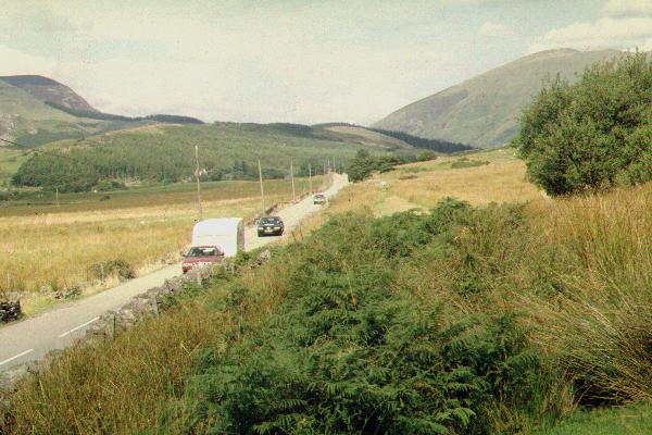
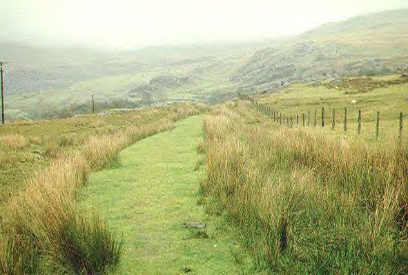
This northerly view (3/9/00) shows the busy A4085 and the
Pitt's Head straight as seen from the entrance to Pitt's Head Halt. Phase 3 of
the railway will extend almost as far as the tree in the distance, halfway along
this straight. This will provide a headshunt for a Phase 4 Works siding on the old alignment
south of the GCC car park. Click on the image to enlarge. This image is
copyright B.W.Hughes. Slide scan technology utilised is Olympus ES10 &
iPhoto Plus4. Slide scanned at 200dpi.
Click here to visit the Rhyd-Ddu to Beddgelert Forest page
Click here to return to Stop Press page
Site Development
If you have suggestions for development of this site, please contact me by
email at the address on the Stop Press page.
Comments
Please add comments in my Guestbook.
Page Version 3.45 Dated 19/7/03