WHR
Castell Cidwm - Glan-yr-afon
area page
V3.31 updated 9/7/03
New images on this page are from 6/7/03.
Click here for start of new images
Click here for JC Sreeves latest construction map
Locations
This section of line is largely
clear of vegetation and affords views of Snowdon to the left and Llyn Cwellyn to
the right.
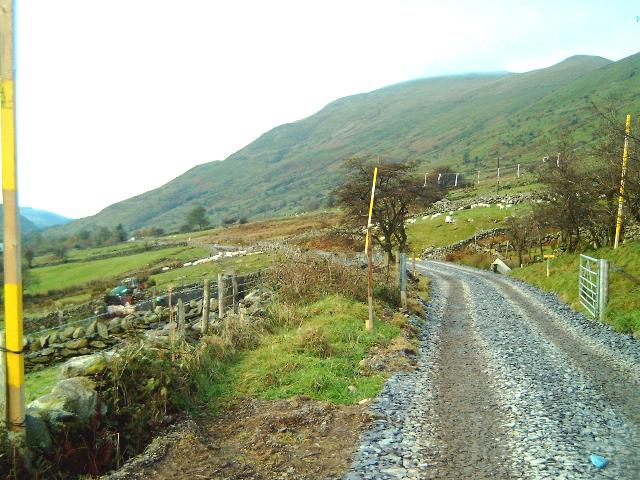
The section begins just south of Castell Cidwm road bridge OB71 at Ch. 10000. There are few visible remains of the formation through the fields as the fences have been grubbed out through to Caeau-gwynion farm access LC46. The route is visible as a rising ledge above and to the east of the A4085. The trackbed continues in a south easterly direction climbing along the valley side to Snowdon Ranger Halt.
Public Access to Snowdon Ranger Halt is from the A4085 via a steeply sloping path adjacent to the Snowdon Ranger Youth Hostel. A public footpath runs up the hillside from the north end of the Halt and it is intended to divert this straight down to the main road rather than at present, along the trackbed and down the access to the halt. There is a public car park opposite the Halt access.
The line continues to climb almost straight south east with stone walls and fences visible above and to the east of the A4085. There is a second public footpath crossing at Bron-y-fedw Isaf via UB87. A third public footpath crosses the route at Bron-y-fedw Uchaf via LC56. This footpath meets the one from the previous farm making a short circular walk above the railway possible.
At Ch. 12300, the alignment takes a reverse curve into the deeply incised valley of the Afon Treweunydd near Glan-yr-Afon. After a short cutting, the route crosses the high girder bridge known as the Glan-yr-afon Viaduct at Ch. 12630.
Snowdon Ranger Halt and loop
Snowdon Ranger Halt was opened on 1/6/1878 as a 1 mile extension from the short lived terminus at Quellyn. A temporary loop and siding extension was put in south of the Halt behind the Youth Hostel. There was a water tank on the hillside opposite the station building. The loop was cut off at the south end and became a siding when the line was opened throughout to Rhyd Ddu on 14/5/81. The original siding extension was removed by 1922.
Gradients
The route climbs steeply at 1 in 75 from OB71 at Castell Cidwm. This gradient will be increased as a result of the need to deepen the formation under the bridge by a metre to allow for the increased clearance required by the Garratt and Caernarfon Castle. After 200m, the gradient eases to 1 in 90 for about 2 km through Snowdon Ranger Halt.
The gradient increases to 1 in 75 again after Bron-y-fedw Isaf and finally eases on the approach to the Glan-yr-Afon Viaduct. The reverse curves approaching the viaduct are compensated to 1 in 117.
Castell Cidwm
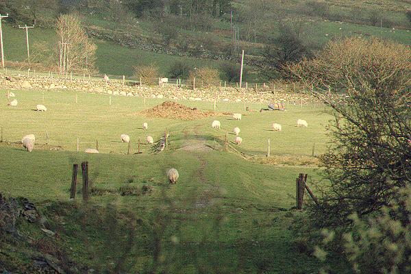
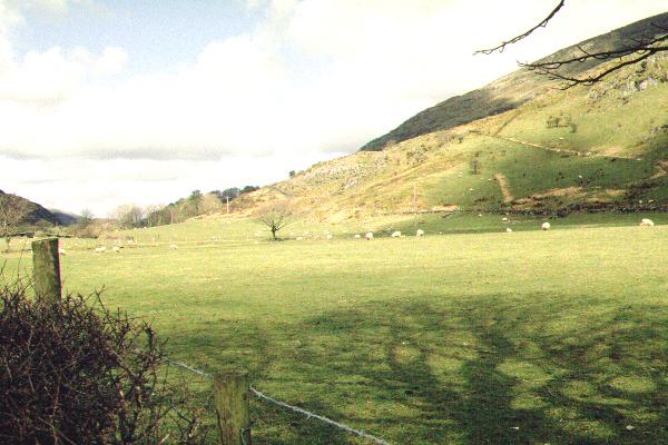
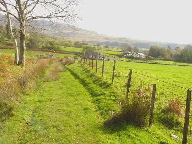
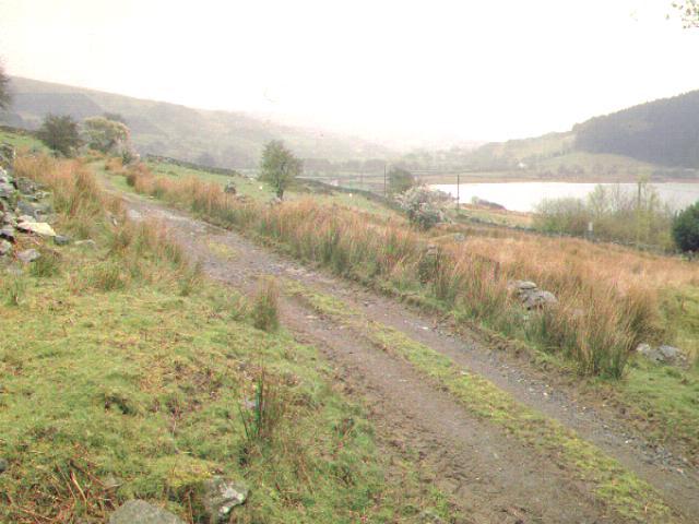
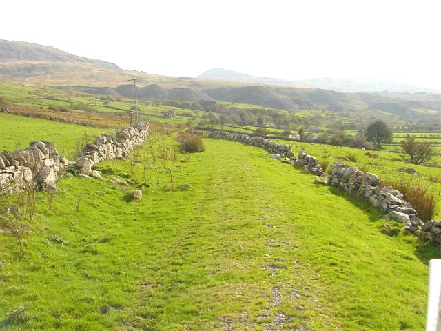
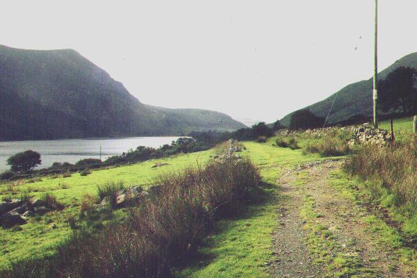
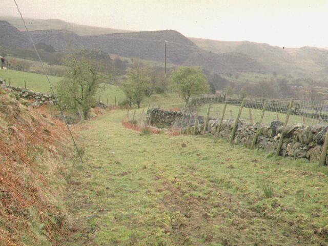
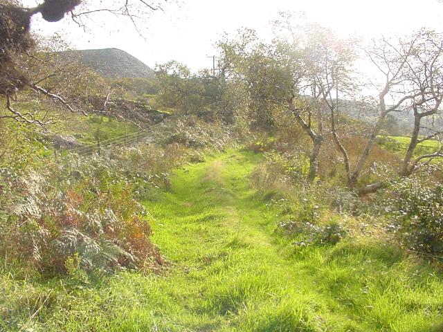
This southerly view (15/4/01) shows alignment of the railway from Castell Cidwm to Caeau-gwynion Farm. Fences have been removed in this area. The route swings to the right of the pile of manure and the gradient eases at this point from 1 in 75 to 1 in 90. Click on the image to enlarge. This image is copyright B.W.Hughes. Slide scan technology utilised is Olympus ES10 & iPhoto Plus4. Slide scanned at 200dpi.
This southerly view (15/11/01) shows the fencing completed at the site of the former temporary terminus (Quellyn) at Castell Cidwm. The 1 in 75 gradient towards the bridge has created a pool at this point. Click on the image to enlarge. This image is copyright WHLR, courtesy Jan Woods. Imaging technology utilised is iPhoto Plus4. Slide displayed at 96dpi.
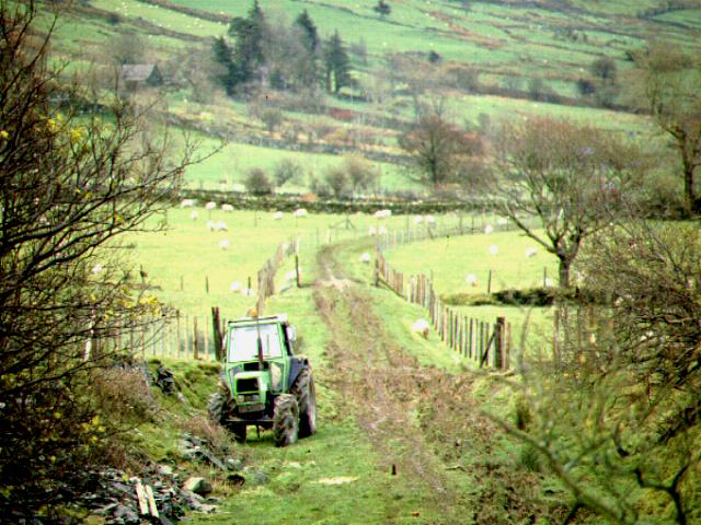
This telephoto southerly view from OB71 shows the trackbed now fenced. Refurbished WHR gates may be placed at the retained original steel gateposts just behind the tractor. Click on the image to enlarge. This image is copyright B.W.Hughes. Slide scan technology utilised is Olympus ES10 & iPhoto Plus4. Slide displayed at 96dpi.
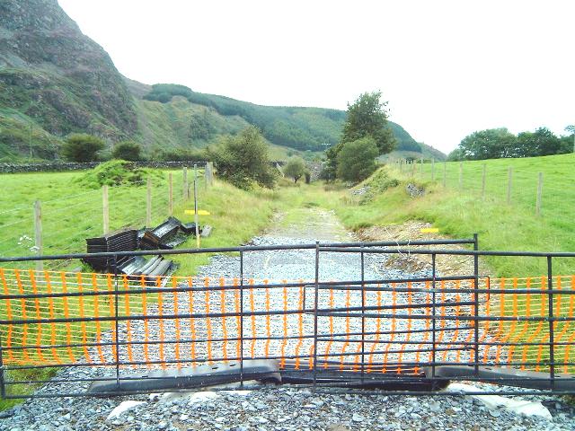
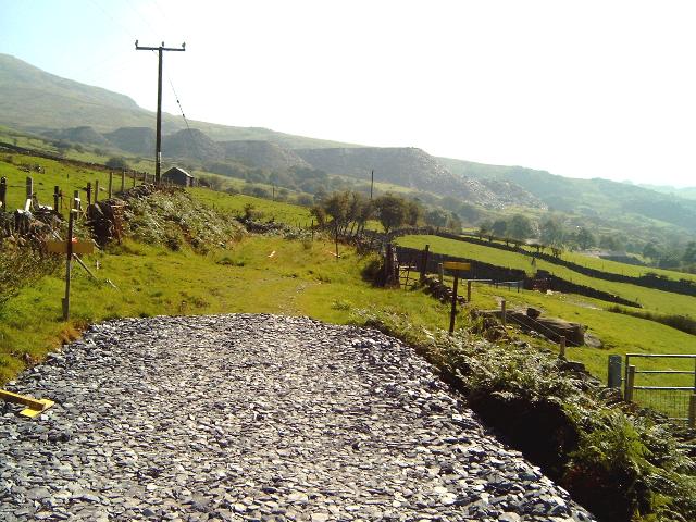
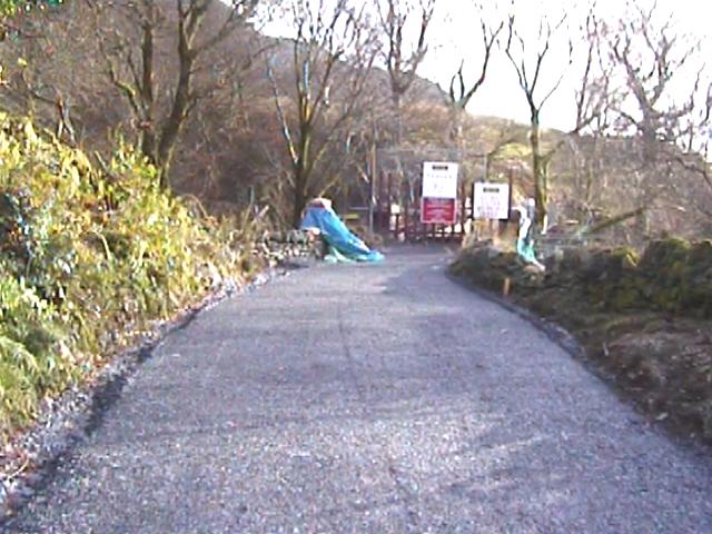
This southerly view (4/6/02) from OB71 shows the trackbed now covered with slate waste from Ch.10100 and fully fenced. Jones Bros. was due to start work on 10/6/02 from this point north. Click on the image to enlarge. This image is copyright B.W.Hughes. Slide taken using Sigma SA300 and scanned with Olympus ES10 with iPhoto Plus4. Slide displayed at 96dpi.
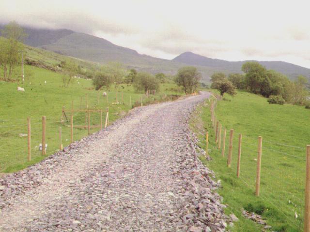
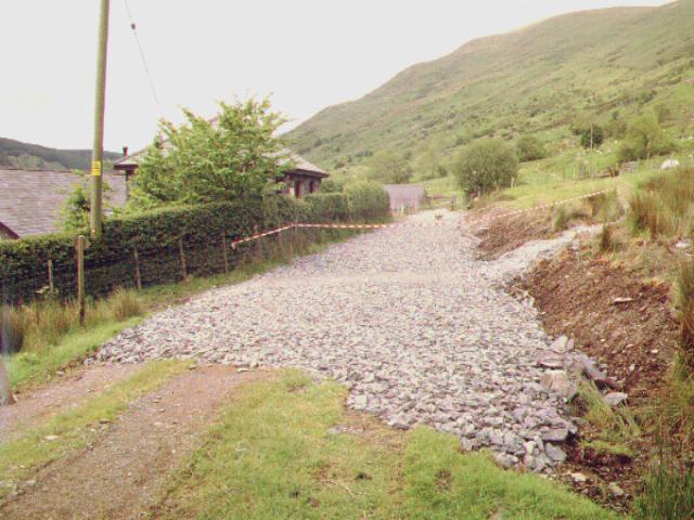
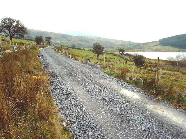
This southerly view (9/8/02) from OB71 shows the trackbed now ballasted. Initially, only the section to LC46 was ballasted. Click on the image to enlarge. This image is copyright B.W.Hughes. Image taken using Samsung Digimax 230 and post processed with iPhoto Plus4. Image displayed at 96dpi.
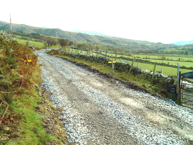
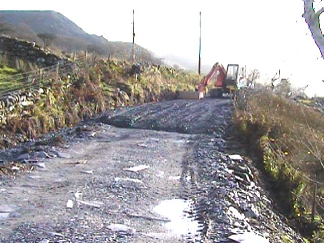
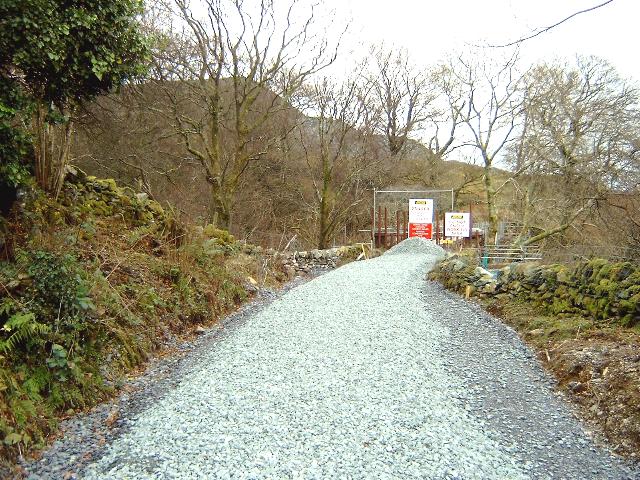
This southerly view (30/3/03) from OB71 shows Jones Bros. completing the drainage in the cutting south of OB71. the cutting is now cleared and the trackbed laid out ready for ballasting. Click on the image to enlarge. This image is copyright B.W.Hughes. Image taken using Samsung Digimax 230 and post processed with iPhoto Plus4. Image displayed at 96dpi.
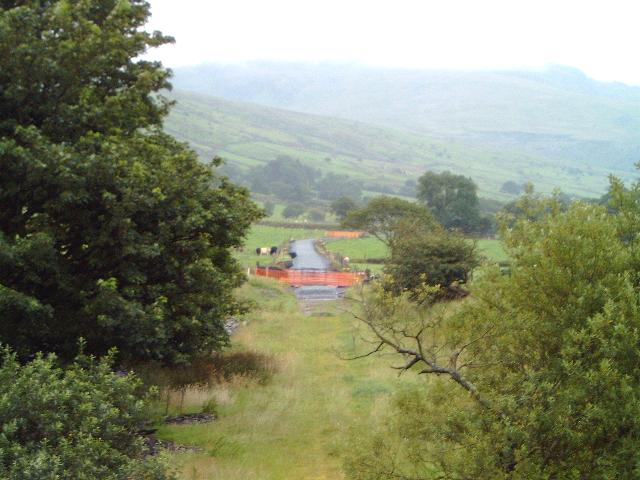
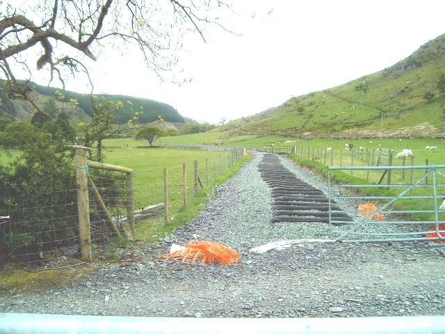
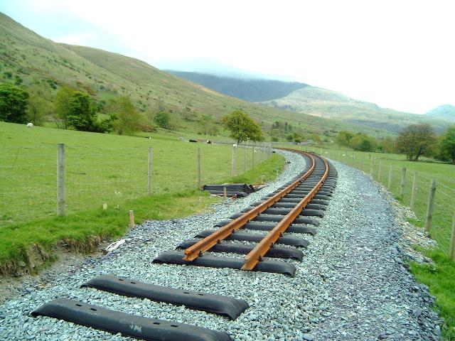
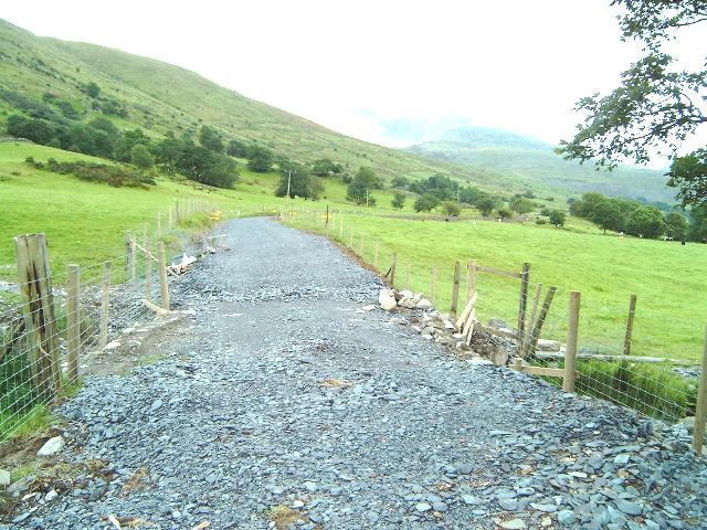
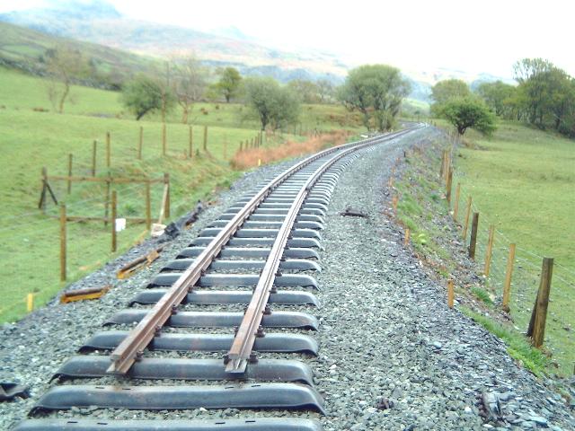
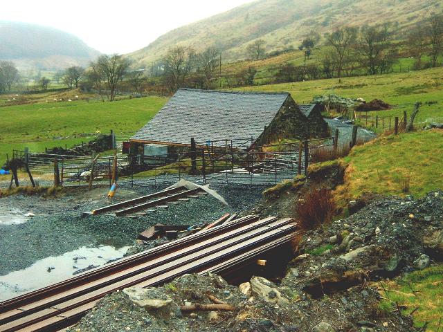
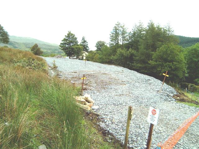
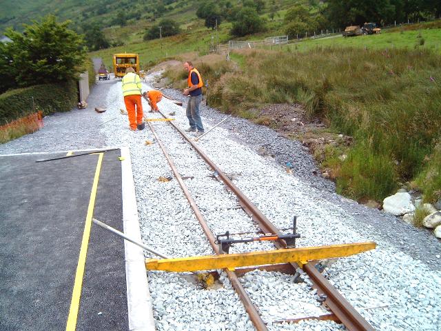
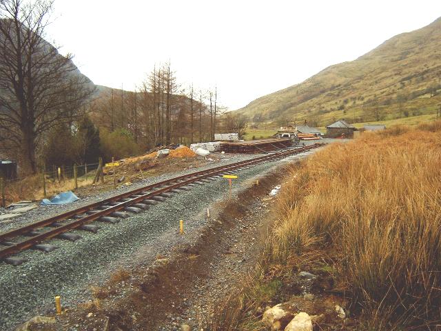
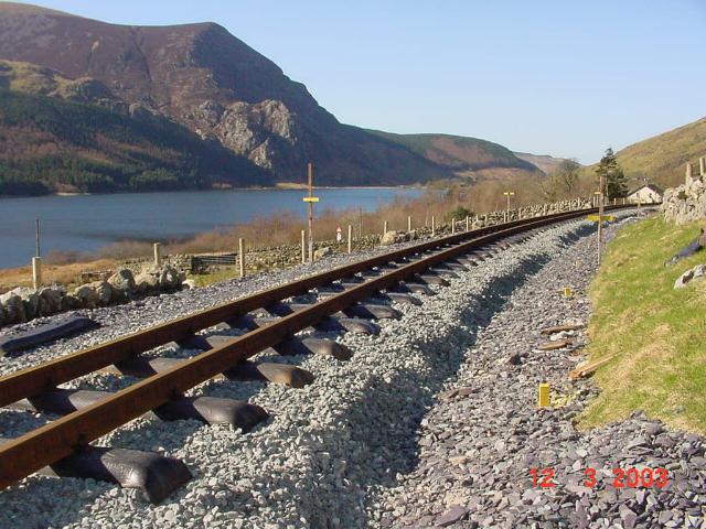
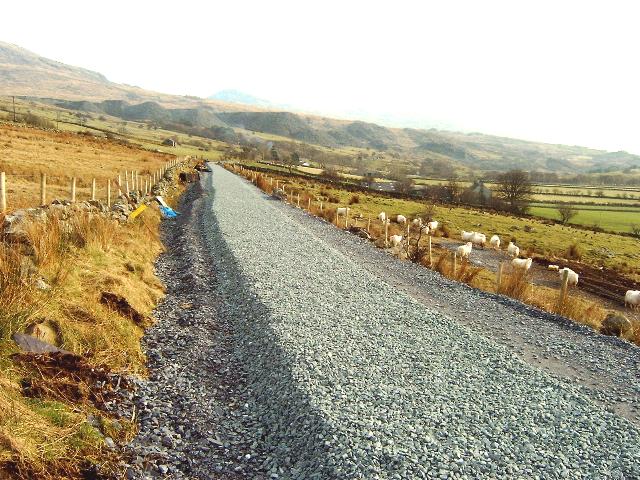
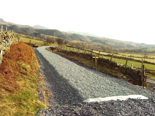
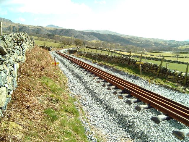
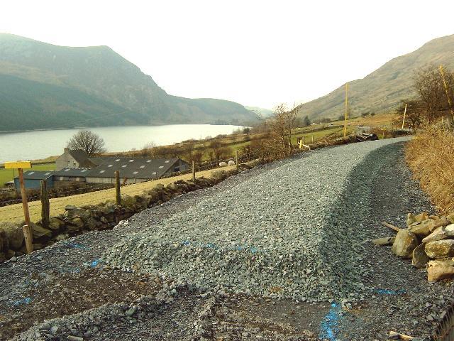
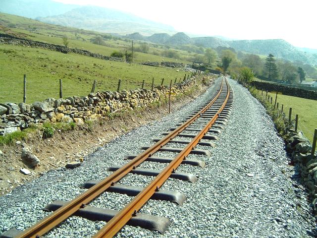
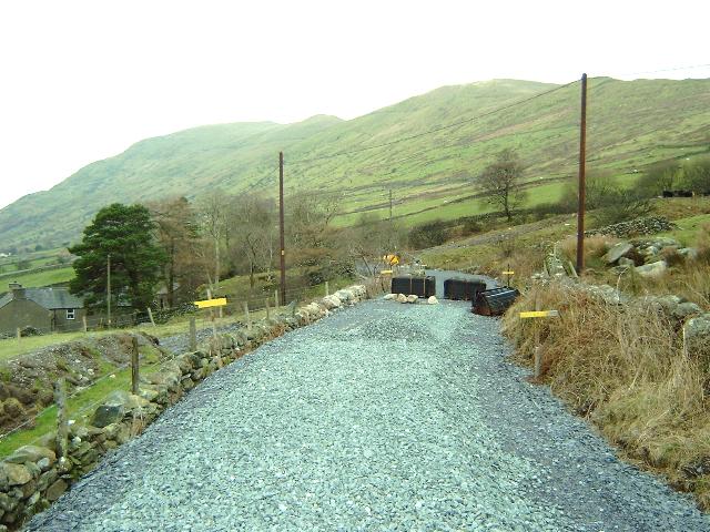
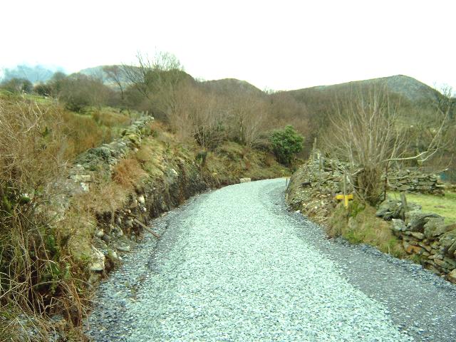
This southerly view (6/7/03) from OB71 shows the current end of ballasting and the Head of Steel. The white section of ballast has been north from Ch.10140. Click on the image to enlarge. This image is copyright B.W.Hughes. Image taken using Samsung Digimax 230 and post processed with iPhoto Plus4. Image displayed at 96dpi.

This southerly view (6/7/03) shows the northerly limit of track from Head of Steel from Snowdon Ranger near OB71. Click on the image to enlarge. This image is copyright B.W.Hughes. Image taken using Samsung Digimax 230 and post processed with iPhoto Plus4. Image displayed at 96dpi.
This northerly view (6/7/03) shows the Head of Steel from Snowdon Ranger and OB71 behind. This section of track in graded at 1 in 75. Click on the image to enlarge. This image is copyright B.W.Hughes. Image taken using Samsung Digimax 230 and post processed with iPhoto Plus4. Image displayed at 96dpi.
This northerly view (24/8/02) shows the recently completed ballasting that starts at Ch.10140 at the start of the WHLR subcontract. In the background is Castell Cidwm bridge OB71. Click on the image to enlarge. This image is copyright B.W.Hughes. Image taken using Samsung Digimax 230 and post processed with iPhoto Plus4. Image displayed at 96dpi.
This northerly view (6/7/03) from LC45 shows the track extended to the Head of Steel near OB71. Click on the image to enlarge. This image is copyright B.W.Hughes. Image taken using Samsung Digimax 230 and post processed with iPhoto Plus4. Image displayed at 96dpi.
This southerly view (24/8/02) from Ch.10150) shows the recently completed ballasting towards Caeau Gwynion Farm. Click on the image to enlarge. This image is copyright B.W.Hughes. Image taken using Samsung Digimax 230 and post processed with iPhoto Plus4. Image displayed at 96dpi.
This southerly view (6/7/03) from LC45 shows the track now completed back from Caeau Gwynion access LC46. Click on the image to enlarge. This image is copyright B.W.Hughes. Image taken using Samsung Digimax 230 and post processed with iPhoto Plus4. Image displayed at 96dpi.
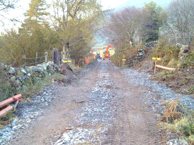
WHLR direct labour started work on construction of the 1.3km section of route from Ch.10100 at Castell Cidwm to Ch.11360 at Snowdon Ranger from 27/4/02. The first tasks have been to set up a construction base at Snowdon Ranger, clear the trackbed and fence the line fully. The alignment was then scraped clear of soil, which was placed on the embankment sides. Slate waste was added to firm up the foundation for the plant.
Culverts are having a cast reinforced concrete deck added on top of the existing slate decks. By 1/6/02, this had already been completed for UB77/8. Meanwhile UB72 and UB73 at Caeau Gwynion have been completely removed as the abutments were in a poor state. Side drainage is being installed by ditch digging on the upslope side of the alignment and intercepts some land drains in the pastures north of Snowdon Ranger. Work on UB73 started on 4/7/02.
Caeau-gwynion
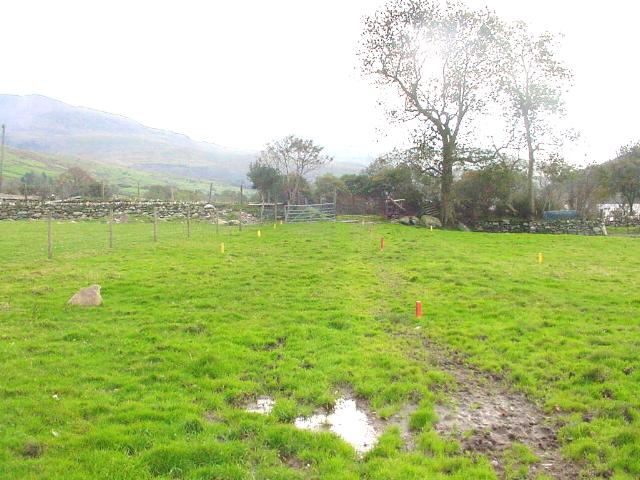
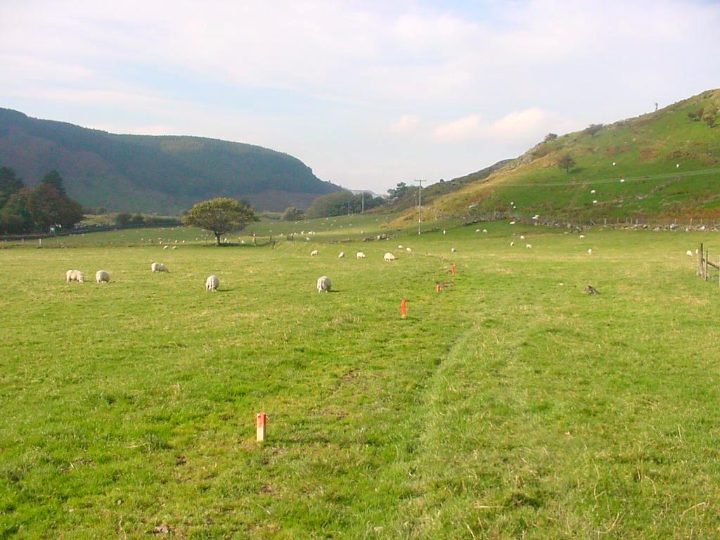
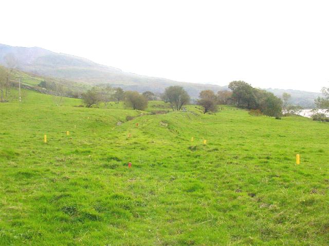
There will be an accommodation crossing in the field LC45 and the farm access will need a second level crossing LC46. There are five further accommodation crossings showing there is considerable use of the local valley bottom and hillsides for sheep raising.
This northerly view (16/4/01) was taken from the entrance to Caeau-gwynion Farm. From this angle there appears to be no trace of the railway across the field, though the cutting and A4085 road bridge are visible on the extreme left. Click on the image to enlarge. This image is copyright B.W.Hughes. Slide scan technology utilised is Olympus ES10 & iPhoto Plus4. Slide scanned at 200dpi.
This southerly archive view shows the start of pegging out operations in 2001 with LC46 (the Caeau Gwynion access) in view, marked by the wall and trees. All traces of the fencing had been grubbed out on this section. Click on the image to enlarge. This image is copyright WHLR, courtesy Jan woods. Slide scan technology utilised is Olympus ES10 & iPhoto Plus4. Slide displayed at 96dpi.

This southerly view (3-6-02) shows the same view as that above. The trackbed has been stabilised with slate waste and fully fenced This view is at Ch.10350 with LC46, the Caeau-gwynion farm access by the large tree in cloud shadow. At this point the railway is running through pastures alongside Llyn Cwellyn (right). Click on the image to enlarge. This image is copyright WHLR, courtesy Jan Woods with post processing by iPhoto Plus4. Image displayed at 96dpi.
This northerly view (11/10/01) shows the start of pegging out operations from LC46, the access road to Caeau Gwynion farm towards Castell Cidwm. Red pegs denote the centreline of the alignment. Once the fence lines are established, Achnashean can move in to fence of the route. This section from Castell Cidwm to the Glan-yr-afon viaduct will be completed by WHLR direct labour. Click on the image to enlarge. This image is copyright WHLR, courtesy Roland Doyle. Slide scan technology utilised is Olympus ES10 & iPhoto Plus4. Slide scanned at 200dpi.
This northerly view (3-6-02) shows the same view as that above. the trackbed has now been stabilised with slate waste and fully fenced. Click on the image to enlarge. This image is copyright WHLR, courtesy Jan Woods with post processing by iPhoto Plus4. Image displayed at 96dpi.

This northerly view (24/8/02) from near LC46 shows the current end of ballasting (Ch.10420). In the background, the orange fence tape marks the location of LC45. The trackbed through LC46 itself has been left until nearer the time for tracklaying this Autumn to minimise disruption to the farmer. Click on the image to enlarge. This image is copyright B.W.Hughes. Image taken using Samsung Digimax 230 and post processed with iPhoto Plus4. Image displayed at 96dpi.
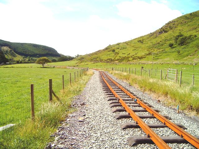
This northerly view (11/5/03) from LC46 shows the sleepers laid out on the ballasted trackbed. The trackbed through LC46 itself has been left until a date can be agreed to minimise disruption to the farmer. Click on the image to enlarge. This image is copyright B.W.Hughes. Image taken using Samsung Digimax 230 and post processed with iPhoto Plus4. Image displayed at 96dpi.
This northerly view (6/7/03) from LC46 shows the track now completed north from Caeau Gwynion farm access LC46. Click on the image to enlarge. This image is copyright B.W.Hughes. Image taken using Samsung Digimax 230 and post processed with iPhoto Plus4. Image displayed at 96dpi.
This southerly view (11/10/01) shows the start of pegging out operations from LC46, the access road to Caeau Gwynion farm. This section from Castell Cidwm to the Glan-yr-afon viaduct will be completed by WHLR direct labour. Click on the image to enlarge. This image is copyright WHLR, courtesy Roland Doyle. Slide scan technology utilised is Olympus ES10 & iPhoto Plus4. Slide scanned at 200dpi.
This southerly view (24/8/02) from the same viewpoint as above at LC46 shows the completed formation. Click on the image to enlarge. This image is copyright B.W.Hughes. Image taken using Samsung Digimax 230 and post processed with iPhoto Plus4. Image displayed at 96dpi.
This southerly view (11/5/03) from LC46 shows the current Head of Steel (Ch.10438). Tracklaying through LC46 to Castell Cidwm bridge has been left until a day's possession can be agreed to minimise disruption to the farmer. Click on the image to enlarge. This image is copyright B.W.Hughes. Image taken using Samsung Digimax 230 and post processed with iPhoto Plus4. Image displayed at 96dpi.
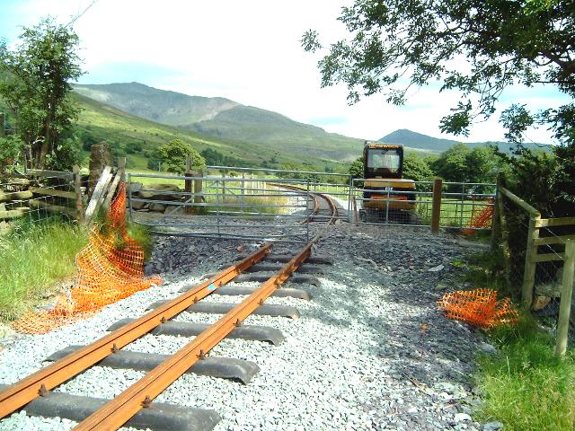
This southerly view (6/7/03) shows track completed across the Caeau Gwynion access, LC46. A small tracked excavator is present on railway land to complete the level crossing. Click on the image to enlarge. This image is copyright B.W.Hughes. Image taken using Samsung Digimax 230 and post processed with iPhoto Plus4. Image displayed at 96dpi.
Red pegs are used for track centreline, yellow pegs are used for fence lines. The setting out process is as follows:-
1. Topographical survey to approx 10 metres either side of centreline as
perceived on the ground.
2. MOSS alignment program run to fit the track into the topological survey
(includes adding exact chainages every 10 metres). MOSS is a standard package
originally developed for highway engineers and now adapted for railway
engineering.
3. MOSS centreline data produced as a series of coordinates for every 10 metres.
4. Survey team revisit site and set out centreline (not accurate at this stage,
only to within +or- 20mm).
5. Fence line drawn on to composite drawing (topological survey and MOSS
alignment). MOSS alignment drawn as centreline and two lines for rails. Fence
line derived from surviving artifacts still in position (gate posts, fence posts
etc) and 1916 OS map showing original land ownership.
6. Fence line pegged out by scaling off drawing (1:250) and locating artifacts
mentioned above. Scaling off drawing accurate to nearest 50mm, sufficient for
fence line.
The centreline gets surveyed again prior to tracklaying, this time to within +
or - 1mm.
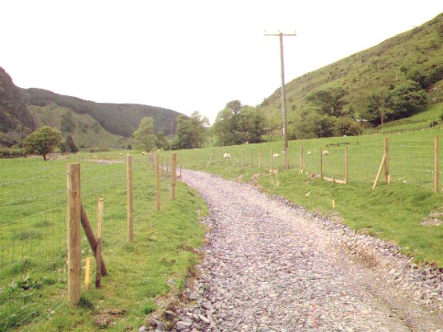
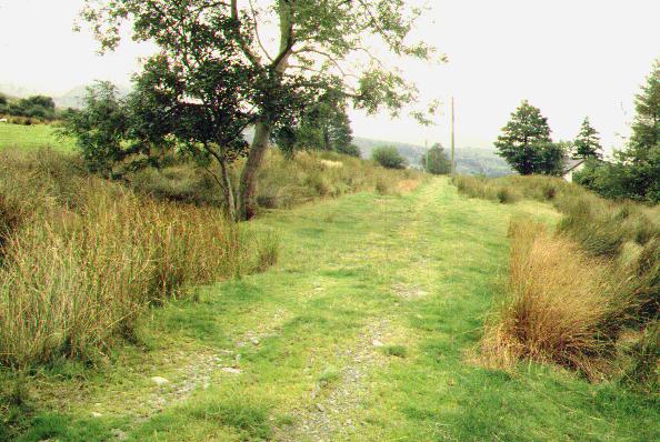
This southerly image (29/4/01) shows the unfenced route across the field from the Caeau-gwynion farm entrance. a light overnight dusting of snow lingers on the side of the Snowdon massif. Although deceptively level, the alignment is climbing at 1 in 90 onto a valley-side shelf. Click on the image to enlarge. This image is copyright B.W.Hughes. Slide scan technology utilised is Olympus ES10 & iPhoto Plus4. Slide scanned at 200dpi.

This northerly view (29/4/01) shows the unfenced route climbing across fields at Ch.10500 east of LC46. LC46 is the Caeau-gwynion farm crossing marked by the line of trees on the left. Click on the image to enlarge. This image is copyright B.W.Hughes. Slide scan technology utilised is Olympus ES10 & iPhoto Plus4. Slide scanned at 200dpi.
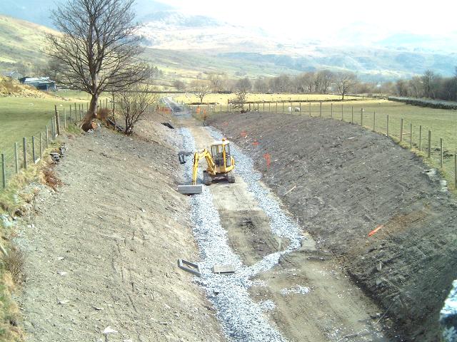
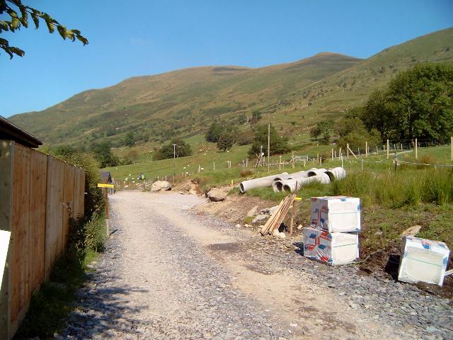
This northerly view (4/6/02) from UB73 shows the bridge removed at Ch.10550. The abutments need rebuilding and a new concrete pipe will be provided. Caeau Gwynion Farm is visible top right. Click on the image to enlarge. This image is copyright B.W.Hughes. Slide taken using Sigma SA300 and scanned with Olympus ES10 with iPhoto Plus4. Slide displayed at 96dpi.

This northerly view (11/5/03) from UB73 shows the completed track laid at this location. The headwalls appear to be at a slight angle to the track here and have been trimmed for clearance. Click on the image to enlarge. This image is copyright B.W.Hughes. Image taken using Samsung Digimax 230 and post processed with iPhoto Plus4. Image displayed at 96dpi.
This southerly view (24/8/02) from UB73 shows the completed formation although the trackbed needs raising and the culvert side walls built up. Click on the image to enlarge. This image is copyright B.W.Hughes. Image taken using Samsung Digimax 230 and post processed with iPhoto Plus4. Image displayed at 96dpi.
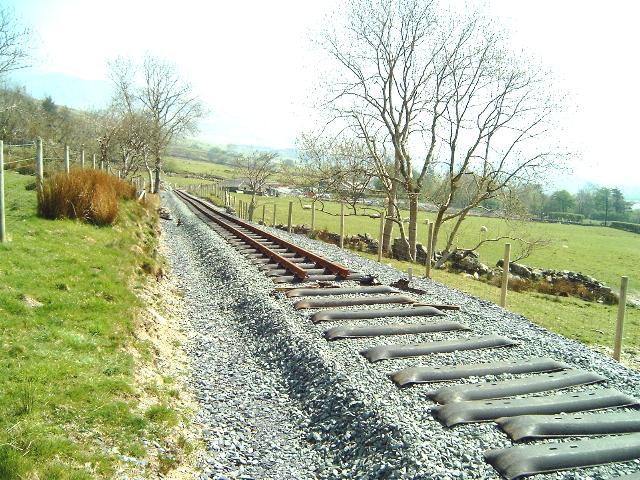
On 4/7/02 the reconstruction of UB73 at Ch.10550 was begun. The collapsed culvert is being replaced by a 1.2m diameter pipe in view of the occasionally heavy rainfall. The stream flow was diverted around the site using pumps. The culvert has been replaced by two 1.2m diameter pipes (in view) roughly 30 cm below formation level. Headwalls will be constructed later. Ballast was extended south to this point by 14/9/02.
A stream crossing above the railway was provided as a mitigation to the farmer who previously used the trackbed to access his fields. Two additional pipes were used for this purpose.

This northerly archive view (2001) shows the start of pegging out operations from LC47 (Ch.10690) towards LC46 (line of trees). This section from Castell Cidwm to Snowdon Ranger will shortly be under construction by WHLR direct labour. Click on the image to enlarge. This image is copyright WHLR, courtesy Jan woods. Slide scan technology utilised is Olympus ES10 & iPhoto Plus4. Slide displayed at 96dpi.
This northerly view (4/6/02) from LC47 shows the same view as that above with the trackbed now fully fenced and covered with slate waste. Click on the image to enlarge. This image is copyright B.W.Hughes. Slide taken using Sigma SA300 and scanned with Olympus ES10 with iPhoto Plus4. Slide displayed at 96dpi.

This northerly view (28/4/03) shows the Head of Steel on that day at Ch.10736 at LC47. Caeau Gwynion farm is to the right. Click on the image to enlarge. This image is copyright B.W.Hughes. Image taken using Samsung Digimax 230 and post processed with iPhoto Plus4. Image displayed at 96dpi.
This northerly view (11/5/03) from LC47 shows the completed track from the same viewpoint as above. Click on the image to enlarge. This image is copyright B.W.Hughes. Image taken using Samsung Digimax 230 and post processed with iPhoto Plus4. Image displayed at 96dpi.
This southerly archive view (2001) shows the start of pegging out operations from LC47 (Ch.10690) in 2001. The trackbed forms a shallow embankment rising at 1 in 90 towards Rhyd Ddu. Llyn Cwellyn is visible on the right. Click on the image to enlarge. This image is copyright WHLR, courtesy Jan woods. Slide scan technology utilised is Olympus ES10 & iPhoto Plus4. Slide displayed at 96dpi.
This southerly view (4/6/02) from LC47 shows the same viewpoint as that above with the trackbed now fully fenced and covered with slate waste. The alignment rises onto an embankment across UB74 with trees either side. Click on the image to enlarge. This image is copyright B.W.Hughes. Slide taken using Sigma SA300 and scanned with Olympus ES10 with iPhoto Plus4. Slide displayed at 96dpi.
This southerly view (28/4/03) shows the Head of Steel on that day at Ch.10736 at LC47. Click on the image to enlarge. This image is copyright B.W.Hughes. Image taken using Samsung Digimax 230 and post processed with iPhoto Plus4. Image displayed at 96dpi.
This southerly view (11/5/03) through LC47 shows the completed track in this area. Click on the image to enlarge. This image is copyright B.W.Hughes. Image taken using Samsung Digimax 230 and post processed with iPhoto Plus4. Image displayed at 96dpi.

This northerly view (4/6/02) from LC48 (Ch.10860) shows the trackbed now covered with slate waste and fully fenced. There has been no attention yet to the major culvert UB74 by the trees, which is crossed by an embankment. Click on the image to enlarge. This image is copyright B.W.Hughes. Slide taken using Sigma SA300 and scanned with Olympus ES10 with iPhoto Plus4. Slide displayed at 96dpi.
This northerly view (28/4/03) shows the trackbed from Ch.10800. Click on the image to enlarge. This image is copyright B.W.Hughes. Image taken using Samsung Digimax 230 and post processed with iPhoto Plus4. Image displayed at 96dpi.
This southerly view (4/6/02) from LC48 (Ch.10860) shows the trackbed now covered with slate waste and fully fenced. There is a very shallow rock cutting at this location. Galvanised poles set in concrete are used wherever the soil cover is insufficient to take wooden fence posts. The poles are supported by guy wires set into the cutting sides. Click on the image to enlarge. This image is copyright B.W.Hughes. Slide taken using Sigma SA300 and scanned with Olympus ES10 with iPhoto Plus4. Slide displayed at 96dpi.

This southerly view (28/4/03) shows the view of completed track from Ch.10800. Click on the image to enlarge. This image is copyright B.W.Hughes. Image taken using Samsung Digimax 230 and post processed with iPhoto Plus4. Image displayed at 96dpi.
This southerly archive view shows the view from LC49 (Ch.11060) in 2001. The white buildings to the right of the tree are Snowdon Ranger Youth Hostel. This section will shortly be under construction by WHLR direct labour. Click on the image to enlarge. This image is copyright WHLR, courtesy Jan woods. Slide scan technology utilised is Olympus ES10 & iPhoto Plus4. Slide displayed at 96dpi.
This southerly view (18/4/03) shows Dolgarrog shunting RRMs at the Head of Steel on that day near Ch.11000. Click on the image to enlarge. This image is copyright B.W.Hughes. Image taken using Samsung Digimax 230 and post processed with iPhoto Plus4. Image displayed at 96dpi.

This southerly view (4/6/02) from LC49 from the same viewpoint as above shows the trackbed now covered with slate waste and fully fenced. Llyn Cwellyn is visible to the right. Click on the image to enlarge. This image is copyright B.W.Hughes. Slide taken using Sigma SA300 and scanned with Olympus ES10 with iPhoto Plus4. Slide displayed at 96dpi.
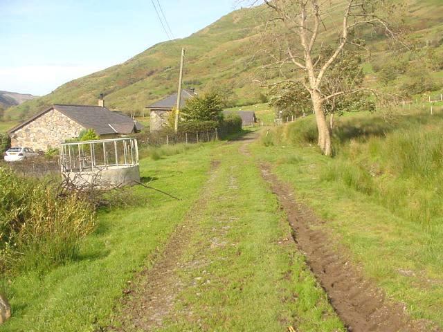
This southerly roadside view (29/4/01) shows the route (line of trees at bottom of slope) approaching Snowdon Ranger station, marked by the buildings on the right.. The unfenced route is seen here climbing at 1 in 90 through Ch. 11000. Snow dusts the upper slopes. Click on the image to enlarge. This image is copyright B.W.Hughes. Slide scan technology utilised is Olympus ES10 & iPhoto Plus4. Slide scanned at 200dpi.
This southerly archive view (2001) shows the trackbed from UB76 (Ch.11100 approx.). The buildings of Snowdon Ranger Halt are visible to the right. Click on the image to enlarge. This image is copyright WHLR, courtesy Jan woods. Slide scan technology utilised is Olympus ES10 & iPhoto Plus4. Slide displayed at 96dpi.
This southerly view (17/4/03) shows the Head of Steel on that day at Ch.11089 near LC49. Click on the image to enlarge. This image is copyright B.W.Hughes. Image taken using Samsung Digimax 230 and post processed with iPhoto Plus4. Image displayed at 96dpi.

This northerly view (17/4/03) shows the Head of Steel on that day at Ch.11089 near LC49 with Castell Cidwm rock buttress in the background. Click on the image to enlarge. This image is copyright B.W.Hughes. Image taken using Samsung Digimax 230 and post processed with iPhoto Plus4. Image displayed at 96dpi.

This southerly view (17/4/03) shows the northern approach to Snowdon Ranger Halt with track now laid north since the start of April. Click on the image to enlarge. This image is copyright B.W.Hughes. Image taken using Samsung Digimax 230 and post processed with iPhoto Plus4. Image displayed at 96dpi.
This northerly view (4/6/02) from Ch.11200 near Snowdon Ranger shows the trackbed now covered with slate waste and fully fenced. Drainage has been started on the uphill side of the line to intercept surface water draining down the hillside. The stump of a distant signal from NWNGR days was removed from the right hand side of the formation to allow the drainage ditch to be completed. This ditch intercepts several field drains. Click on the image to enlarge. This image is copyright B.W.Hughes. Slide taken using Sigma SA300 and scanned with Olympus ES10 with iPhoto Plus4. Slide displayed at 96dpi.

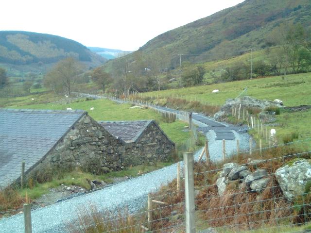
This southerly view (4/6/02) shows the completed UB77 with concrete deck and local stone parapets. The trackbed now covered with slate waste and fully fenced. Just beyond the gate at LC51 can be seen the Snowdon Ranger construction base below the line and to the right. Click on the image to enlarge. This image is copyright B.W.Hughes. Slide taken using Sigma SA300 and scanned with Olympus ES10 with iPhoto Plus4. Slide displayed at 96dpi.
This southerly view (17/4/03) from a similar viewpoint to that above shows the track now laid north from Snowdon Ranger across LC51. Click on the image to enlarge. This image is copyright B.W.Hughes. Image taken using Samsung Digimax 230 and post processed with iPhoto Plus4. Image displayed at 96dpi.

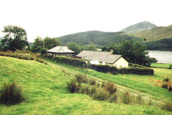
This northerly archive view is taken from the public footpath immediately north of Snowdon Ranger Halt. The footpath from LC51 runs up to Snowdon. The section of trackbed north from here was fenced in 2001 but the section south to Glan-yr-afon had still not been fenced in Spring 2002. Llyn Cwellyn is visible to the left. Click on the image to enlarge. This image is copyright B.W.Hughes. Slide scan technology utilised is Olympus ES10 & iPhoto Plus4. Slide displayed at 96dpi.

This northerly view (4/6/02) from the same viewpoint as above shows the trackbed now covered with slate waste and fully fenced. Click on the image to enlarge. This image is copyright B.W.Hughes. Slide taken using Sigma SA300 and scanned with Olympus ES10 with iPhoto Plus4. Slide displayed at 96dpi.
This northerly view (31/10/02) from the same viewpoint as that above shows the ballasted formation north from Snowdon Ranger has now had some sleepers laid on it. Click on the image to enlarge. This image is copyright B.W.Hughes. Image taken using Samsung Digimax 230 and post processed with iPhoto Plus4. Image displayed at 96dpi.
This northerly view (17/4/03) from the same viewpoint as that above shows the track now laid north from Snowdon Ranger since the start of April. Click on the image to enlarge. This image is copyright B.W.Hughes. Image taken using Samsung Digimax 230 and post processed with iPhoto Plus4. Image displayed at 96dpi.
Snowdon Ranger Halt
The station building remains but has been converted into a private dwelling. There is footpath crossing north of the station at LC51.
The WHR intends to have a halt here to serve the popular Youth Hostel and the Snowdon Path. However, the platform will need to be moved south from the footpath access as the existing station building and platform are now a private residence.
The site of the new location of Snowdon Ranger Halt was cleared by 19/8/02. The halt is to have an asphalt platform and waiting shelter in a style similar to original WHR shelters based loosely on the original Nantmor Halt shelter.
In mid August the WHLR subcontractors had built up and levelled the site of the halt and were advancing towards Glan-yr-afon. By 23/8/02, the trackbed had been consolidated to Ch. 11535 where culvert UB82 was having a reinforced concrete slab deck added. Some works remain to be finished on the Castell Cidwm to Snowdon Ranger section though, including LC46 and the formation over UB73.
Snowdon Ranger (WHRS magazine) has revealed details of the waiting shelter at the halt. It will be 2m x 6m approx. with a slate roof and windows to the front and in the end elevations, with a central access. The building will be erected on a blue brick plinth with a concrete floor that drains towards the platform.There will be a full length bench along the back wall of the shelter, though provision will be made for the southern third of the shelter to be partitioned off for a possible Token Room or Storeroom. The platform face of the building will have notice boards either end for timetables and information.
This northerly view (5/8/00) is taken from the public footpath at Snowdon Ranger Halt. The footpath turns right up the side of Snowdon at LC51 visible by the shed and will be diverted to continue down to the main road. Click on the image to enlarge. This image is copyright B.W.Hughes. Slide scan technology utilised is Olympus ES10 & iPhoto Plus4. Slide scanned at 200dpi.
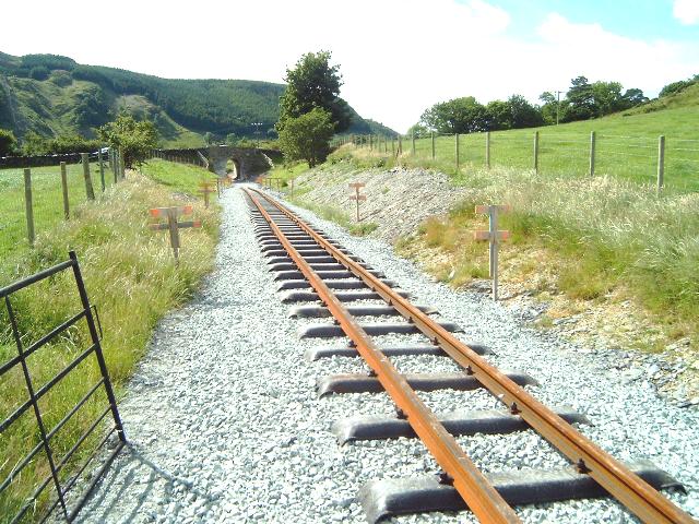
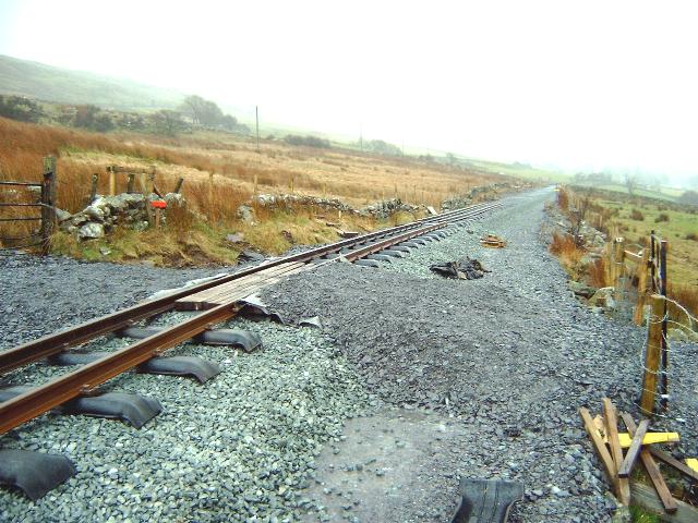
This northerly view (9/3/03) shows the track laid across the level crossing on 28/2/03. This was required to be done in a one day session to minimise disruption to farm access. A short isolated 10m length has been laid across the cross LC51. Click on the image to enlarge. This image is copyright B W Hughes taken on Samsung Digimax 230 digital camera. Image post processed using iPhoto Plus4 image correction technology and displayed at 96dpi.
This northerly view (9/3/03) shows LC51 at the north end of Snowdon Ranger Halt. the rail store for the section to Castell Cidwm is also visible. No temporary track is possible here as it would block access to rail store at the south end of the station. Rails will have to be manhandled onto the track to work north from this point. Click on the image to enlarge. This image is copyright B W Hughes taken on Samsung Digimax 230 digital camera. Image post processed using iPhoto Plus4 image correction technology and displayed at 96dpi.
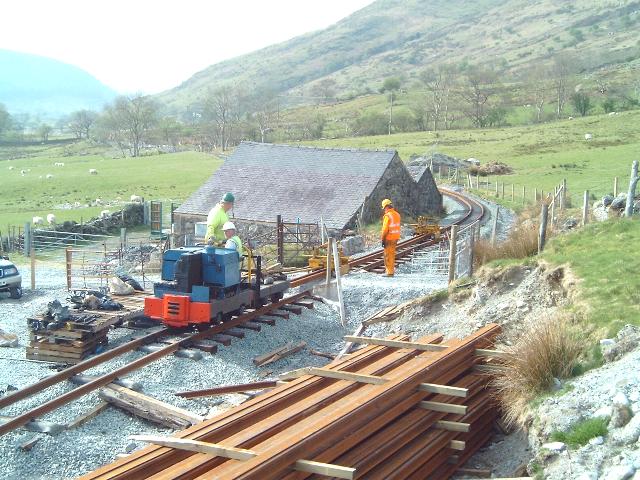
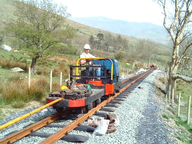
This northerly view (18/4/03) from the same viewpoint as that above shows Dolgarrog propelling rails north from Snowdon Ranger North rail stack. Click on the image to enlarge. This image is copyright B.W.Hughes. Image taken using Samsung Digimax 230 and post processed with iPhoto Plus4. Image displayed at 96dpi.
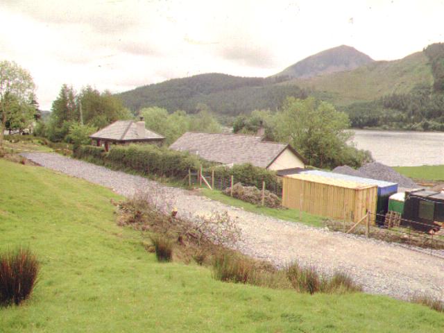
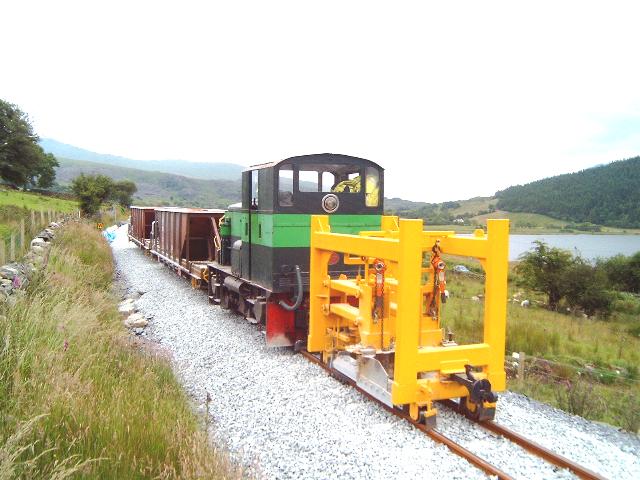
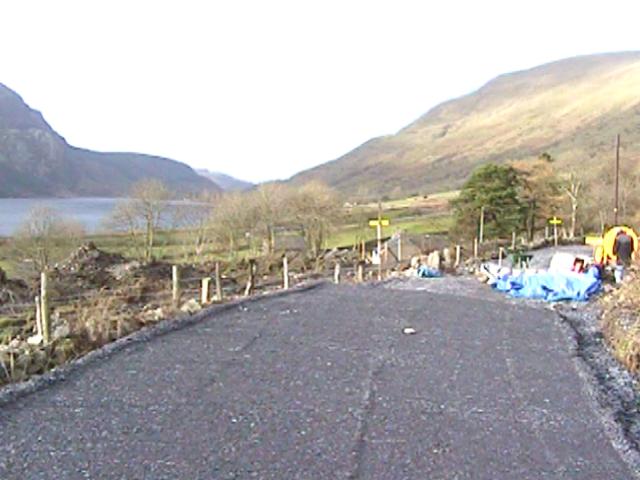
This westerly view (5/7/03) shows Upnor Castle standing on LC51 with the ballast train while it is loaded by the yellow shovel loader in the background. This was its final act before leading for Betws Garmon. The section north of LC51 has not been tamped or lined yet. Click on the image to enlarge. Click on the image to enlarge. This image is copyright B W Hughes taken on Samsung Digimax 230 digital camera. Image post processed using iPhoto Plus4 image correction technology and displayed at 96dpi.
This northerly view (5/7/03) shows Upnor Castle standing on LC51 with the ballast train. The dust cloud was produced the loading of ballast by the yellow shovel loader in the background. Beyond LC51 is the yellow tamper. Click on the image to enlarge. Click on the image to enlarge. This image is copyright B W Hughes taken on Samsung Digimax 230 digital camera. Image post processed using iPhoto Plus4 image correction technology and displayed at 96dpi.
This southerly view (5/8/00) was taken from the footpath that climbs up Snowdon from LC51 looking back towards Snowdon Ranger Halt. The original station building is still present and is the small grey building alongside the line to the left. The white building is a later addition lower down the slope. Both are private residences. Click on the image to enlarge. This image is copyright B.W.Hughes. Slide scan technology utilised is Olympus ES10 & iPhoto Plus4. Slide scanned at 200dpi.
This southerly view (4/6/02) from the same viewpoint shows the trackbed now covered with slate waste as far as Ch.11360 (left). The footpath across the station has now been diverted along the bank to the left, crossing the line to the left of the old station building. It is now a permissive path that will, from Easter 2003, provide access to the new station platform. Click on the image to enlarge. This image is copyright B.W.Hughes. Slide taken using Sigma SA300 and scanned with Olympus ES10 with iPhoto Plus4. Slide displayed at 96dpi.
This southerly view (17/4/03) from the same viewpoint as that above shows the loco shed moved to opposite the old station building and now facing north. Temporary track has now been laid north to join with the length previously laid across LC51. These temporary rails are displaced to the left (east) to allow space for vehicles to access the Halt platform north of the loco shed and complete it. Click on the image to enlarge. This image is copyright B.W.Hughes. Image taken using Samsung Digimax 230 and post processed with iPhoto Plus4. Image displayed at 96dpi.

This southerly view (22/6/03) shows the completed track from a similar viewpoint to that above. The footpath will be diverted from the station access to LC51 passing along the side of the track adjacent to the old station building. Click on the image to enlarge. Click on the image to enlarge. This image is copyright B W Hughes taken on Samsung Digimax 230 digital camera. Image post processed using iPhoto Plus4 image correction technology and displayed at 96dpi.
This southerly view (30/6/02) from the same viewpoint shows the former station building now with a noise dampening fence. The red marked object to the left of the formation is the foot square stump of the former NWNGR home signal. The centreline for the new railway is marked with yellow. The signal stump is foul of the new alignment and must be removed. Click on the image to enlarge. This image is copyright B.W.Hughes. Image taken using Samsung Digimax 230 and post processed with iPhoto Plus4. Image displayed at 96dpi.
This northerly view (4/6/02) shows the trackbed now covered with slate waste from Ch.11360. The new permissive path is visible crossing the formation at this point and diverted up the bank to the right. Click on the image to enlarge. This image is copyright B.W.Hughes. Slide taken using Sigma SA300 and scanned with Olympus ES10 with iPhoto Plus4. Slide displayed at 96dpi.
This northerly view (14/9/02) from the current footpath crossing of the station shows slabs for cladding drainage ditches. Recently the formation has been widened to the east close to LC50. Concrete culvert pipes are also stored here. Click on the image to enlarge. This image is copyright B.W.Hughes. Image taken using Samsung Digimax 230 and post processed with iPhoto Plus4. Image displayed at 96dpi.
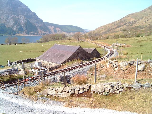
This southerly view (5/8/00) shows the trackbed south from the public footpath on Snowdon Ranger station access. The original loop and later siding occupied the marshy area to the right. This will be the probable location of the new platform when the halt is reopened. Snowdon Ranger Halt will be an early priority for the WHLR, possibly to be opened at the same time as the Rhyd Ddu opening next Spring as the adjacent Youth Hostel may become a considerable source of business. Click on the image to enlarge. This image is copyright B.W.Hughes. Slide scan technology utilised is Olympus ES10 & iPhoto Plus4. Slide scanned at 200dpi.
This southerly view (18/8/02) from the same viewpoint as above shows the cleared site of the new halt. Land levels will need to be built up Click on the image to enlarge. This image is copyright B.W.Hughes. Image taken using Samsung Digimax 230 and post processed with iPhoto Plus4. Image displayed at 96dpi.
This southerly view (24/8/02) from the same viewpoint as above shows the completed formation and built up site for the platform and halt (right) immediately south of the current footpath access (orange tape fence). Click on the image to enlarge. This image is copyright B.W.Hughes. Image taken using Samsung Digimax 230 and post processed with iPhoto Plus4. Image displayed at 96dpi.
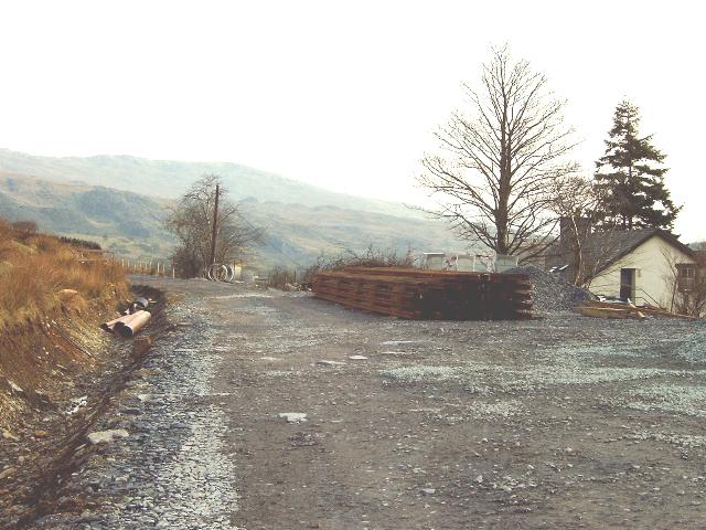
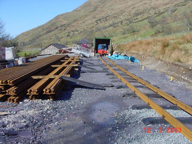
This southerly view (16/2/03) from the same viewpoint as above shows the newly delivered rails on the site of the Halt building ready for tracklaying. It was hoped ballast would reach this point by 21/2/03 following good weather in February. This would then allow tracklaying south from w/e 23/2/03. Click on the image to enlarge. This image is copyright B.W.Hughes. Image taken using Samsung Digimax 230 and post processed with iPhoto Plus4. Image displayed at 96dpi.
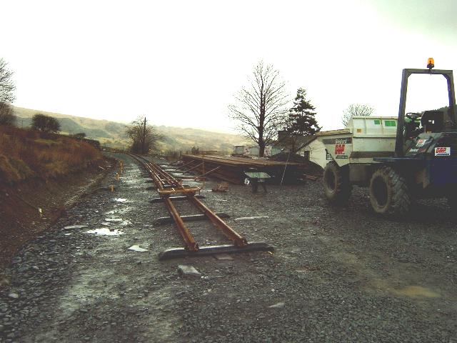
This southerly view (16/2/03) from the same viewpoint as above shows the newly laid temporary track on the site of the Halt. Click on the image to enlarge. This image is copyright B.W.Hughes. Image taken using Samsung Digimax 230 and post processed with iPhoto Plus4. Image displayed at 96dpi.

This southerly view (16/2/03) shows the piles of rail stored at Snowdon Ranger on the site of the platform and halt. These rails may be used on 22/2/03 to lay track south towards Glan-yr-afon if the ballast bed is finished in time. Click on the image to enlarge. This image is copyright B.W.Hughes. Image taken using Samsung Digimax 230 and post processed with iPhoto Plus4. Image displayed at 96dpi.

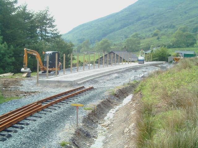
This southerly view (26/5/03) shows the start of work on the platform at Snowdon Ranger Halt. The gap in the fencing is for the concrete base for the future waiting shelter. The platform is 3m wide as far as the shelter and narrows to 2.5m south of that. Click on the image to enlarge. Click on the image to enlarge. This image is copyright B W Hughes taken on Samsung Digimax 230 digital camera. Image post processed using iPhoto Plus4 image correction technology and displayed at 96dpi.
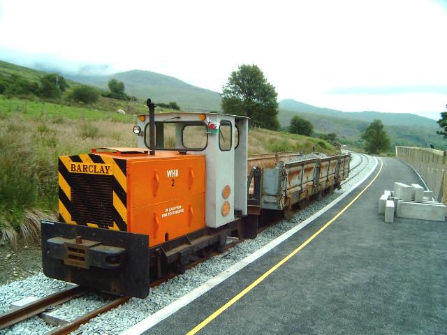
This southerly view (5/7/03) shows the WHR(P) Barclay shunter standing in the completed platform at Snowdon Ranger Halt. The loco was on loan to speed completion of this isolated section and is hauling DZ1423. It will be used to ferry contractors equipment for the stonemason and level crossing works. The halt has been completed with a tarmac platform and yellow safety stripe (High speed trains pass this platform!). Wooden sleepers have been used in the platform. Click on the image to enlarge. This image is copyright B W Hughes taken on Samsung Digimax 230 digital camera. Image post processed using iPhoto Plus4 image correction technology and displayed at 96dpi.
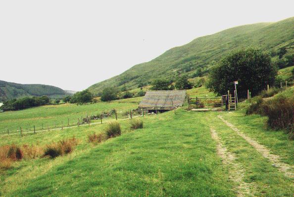
This northerly archive view (2001) shows the view shows the former station building (the smaller building behind the electricity supply pole) at Snowdon Ranger Halt. A worksite will shortly be constructed here and the section north from here to Castell Cidwm will soon be under construction by WHLR direct labour. Click on the image to enlarge. This image is copyright WHLR, courtesy Jan woods. Slide scan technology utilised is Olympus ES10 & iPhoto Plus4. Slide displayed at 96dpi.
This northerly view (12/3/03) from a similar viewpoint to that above, shows the arrangement of the rail loading point and Dolgarrog's loco shed. The blue loco is just visible at the door of the shed. Click on the image to enlarge. This image is copyright WHLR taken on a digital camera courtesy Jan Woods. Image post processed using iPhoto Plus4 image correction technology and displayed at 96dpi.
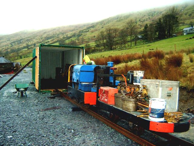
This northerly view (9/3/03) from a similar viewpoint to that above, shows Dolgarrog's loco shed with the blue loco and its braked match truck carrying tracklaying materials. Click on the image to enlarge. This image is copyright B W Hughes taken on Samsung Digimax 230 digital camera. Image post processed using iPhoto Plus4 image correction technology and displayed at 96dpi.
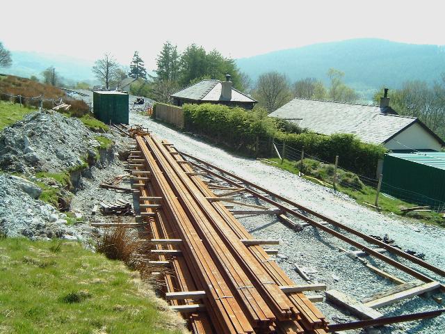
This northerly view (17/4/03) from a similar viewpoint to that above, shows Dolgarrog's loco shed moved further north to serve the tracklaying campaign north from Snowdon Ranger. It has also been moved to the east side of the alignment to allow access for vehicles building the platform, which will follow the left side of the track. The track in the foreground is temporary track that was used to load rail for the push south to Glan-yr-Afon Viaduct. Click on the image to enlarge. This image is copyright B W Hughes taken on Samsung Digimax 230 digital camera. Image post processed using iPhoto Plus4 image correction technology and displayed at 96dpi.
This northerly view (5/7/03) from a similar viewpoint to that above shows the process of tamping in the completed platform at Snowdon Ranger Halt. Click on the image to enlarge. Click on the image to enlarge. This image is copyright B W Hughes taken on Samsung Digimax 230 digital camera. Image post processed using iPhoto Plus4 image correction technology and displayed at 96dpi.
Pot jacks are used to jack the track up to the requires level, sighted by eye. These are placed at every 4th sleeper. When adjacent to platforms, a gauge bar (visible above) is used to set the required gap and height. A level (visible above) is used to make sure the track is level with a bubble on a mark. This is capable of being tilted to obtain the correct super-elevation on curves.
The tamper then comes through and works through the jacked area. The machine has proved fairly reliable failing with broken belts etc. twice a week or so. The pots are worked from the back to the front of the tamper as progress is being made with continuous checks for cross-level. Two or three passes may be required especially where the formation is weak on one side.
Finally, the ballast train drops the lining ballast and the regulator tidies it up and forms neat shoulders.
This northerly archive view is taken from the south end of Snowdon Ranger station. A siding at a lower level can be seen to the left. The new platform may occupy the 100m long strip to the left where the former platform was. A piece of light rail has been uncovered here in recent times and can be seen lying on the ground. Click on the image to enlarge. This image is copyright B.W.Hughes. Slide scan technology utilised is Olympus ES10 & iPhoto Plus4. Slide displayed at 96dpi.
This northerly view (30/6/02) from the same viewpoint as above shows the diversion of the electrical supply (in a trench) to the former station building . The new platform and station building will be between the trench and the trackbed. The new station building will also receive a power supply. The former electric cable is foul of the railway alignment between the pole by the former station building and the viewpoint. Click on the image to enlarge. This image is copyright B.W.Hughes. Image taken using Samsung Digimax 230 and post processed with iPhoto Plus4. Image displayed at 96dpi.
This northerly view (24/8/02) from a similar viewpoint to that above shows the completed formation and built up area (left) for the relocated halt at Snowdon Ranger. Click on the image to enlarge. This image is copyright B.W.Hughes. Image taken using Samsung Digimax 230 and post processed with iPhoto Plus4. Image displayed at 96dpi.
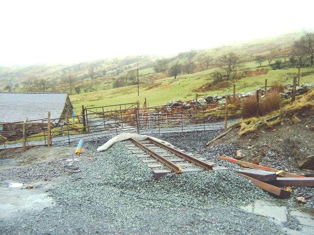
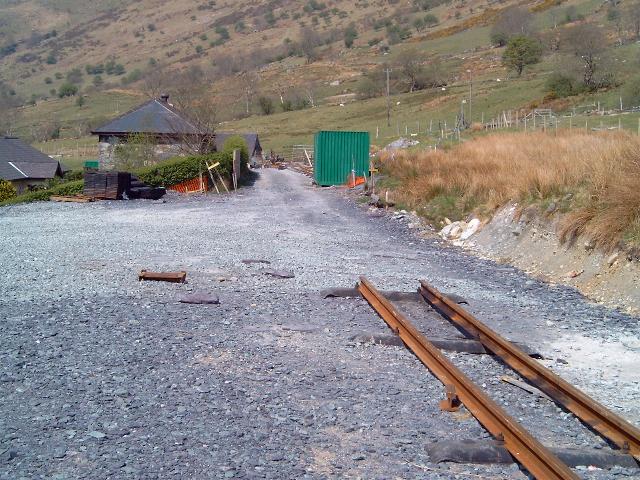
This northerly view (23/2/03) from the same viewpoint as above shows the newly delivered rails on the site of the future Snowdon Ranger Halt building ready for tracklaying. Nine permanent lengths of track were laid south of this point (to the left) over the course of the weekend. Click on the image to enlarge. This image is copyright B.W.Hughes. Image taken using Samsung Digimax 230 and post processed with iPhoto Plus4. Image displayed at 96dpi.
This southerly view (29/5/03) shows the completion of the platform at Snowdon Ranger. The temporary track leading to the loco shed has been removed. Click on the image to enlarge. Click on the image to enlarge. This image is copyright B W Hughes taken on Samsung Digimax 230 digital camera. Image post processed using iPhoto Plus4 image correction technology and displayed at 96dpi.
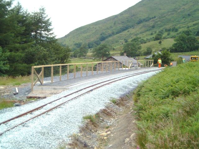
This northerly view (5/7/03) shows the finished platform at Snowdon Ranger. The near end fence of the platform was removed as it was foul of the tamper loading gauge. As the last act of the pw train on this section, the track was tamped and lined on 5/7/03. Click on the image to enlarge. Click on the image to enlarge. This image is copyright B W Hughes taken on Samsung Digimax 230 digital camera. Image post processed using iPhoto Plus4 image correction technology and displayed at 96dpi.
This southerly view (16/2/03) from the south end of Snowdon Ranger Halt shows the formation marked out with the centre line prior to ballasting. Click on the image to enlarge. This image is copyright B.W.Hughes. Image taken using Samsung Digimax 230 and post processed with iPhoto Plus4. Image displayed at 96dpi.
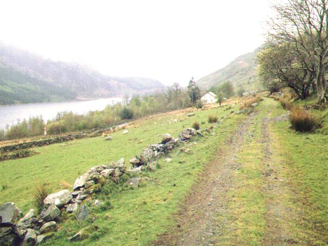
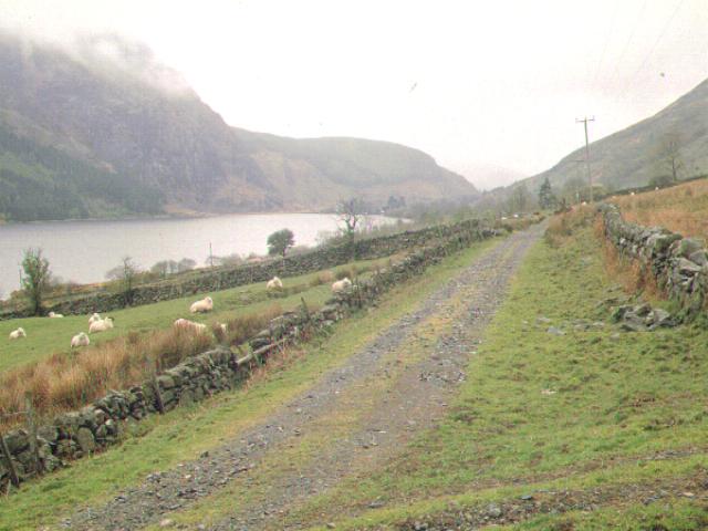
This southerly archive view is taken from the south end of Snowdon Ranger Halt. The route from here to Rhyd Ddu forms a ledge on the hillside above the main road and Llyn Cwellyn. Stone walls on this section have been largely demolished by 60 years of sheep. Click on the image to enlarge. This image is copyright B.W.Hughes. Slide scan technology utilised is Olympus ES10 & iPhoto Plus4. Slide displayed at 96dpi.
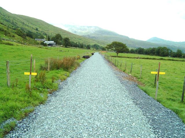
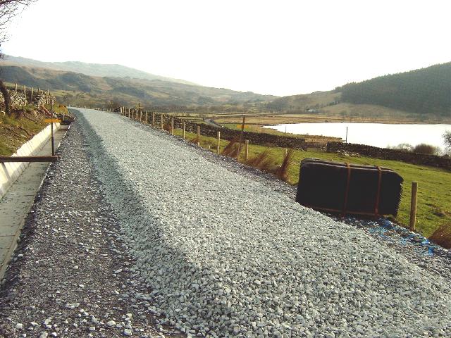
This southerly view (31/12/02) from the same position as the above image shows the end of the rolled slate fines section south of Snowdon Ranger. The trackbed is still in use by agricultural vehicles until the ballast is laid. In December, ballast was laid back from Glan-yr-afon viaduct towards Bron-y-fedw Uchaf farm. When it reaches Snowdon Ranger by the Spring, it will be possible to lay track southwards from this location. Click on the image to enlarge. This image is copyright B.W.Hughes. Image taken using Samsung Digimax 230 and post processed with iPhoto Plus4. Image displayed at 96dpi.

This southerly view (23/2/03) from the same viewpoint as above shows the newly laid track heading for LC52 with Llyn Cwellyn in view to the right. Click on the image to enlarge. This image is copyright B.W.Hughes. Image taken using Samsung Digimax 230 and post processed with iPhoto Plus4. Image displayed at 96dpi.
This southerly view (5/7/03) from a similar viewpoint to that above shows Upnor Castle standing with Daffodil and the ballast train prior to reloading. Click on the image to enlarge. Click on the image to enlarge. This image is copyright B W Hughes taken on Samsung Digimax 230 digital camera. Image post processed using iPhoto Plus4 image correction technology and displayed at 96dpi.
LC52 (Ch.11580)
This northerly archive view shows the trackbed south of LC52 at Ch.11700 in 2001. Sleeper spacings are still evident on this section. Snowdon Ranger Youth Hostel is visible on the right. Click on the image to enlarge. This image is copyright WHLR, courtesy Jan woods. Slide scan technology utilised is Olympus ES10 & iPhoto Plus4. Slide displayed at 96dpi.

This northerly view (24/8/02) from UB82 (Ch.11535) shows the completed formation just north of LC52. A new reinforced concrete deck slab is being cast over the existing culvert lintel. This was the limit of formation work towards Glan-yr-afon during August. Click on the image to enlarge. This image is copyright B.W.Hughes. Image taken using Samsung Digimax 230 and post processed with iPhoto Plus4. Image displayed at 96dpi.
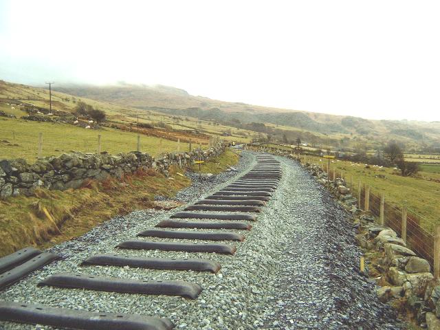
This northerly view (16/2/03) from the same viewpoint as above shows the completed formation with centre line marked out prior to ballasting. Piles of sleepers have been laid at the side of the formation ready for tracklaying. Click on the image to enlarge. This image is copyright B.W.Hughes. Image taken using Samsung Digimax 230 and post processed with iPhoto Plus4. Image displayed at 96dpi.

This northerly view (30/6/02) from LC52 (Ch.11580) shows the stump of the former distant signal at the far corner of the gate. This stump will most likely be left in place. This section of line was recently fenced. Click on the image to enlarge. This image is copyright B.W.Hughes. Image taken using Samsung Digimax 230 and post processed with iPhoto Plus4. Image displayed at 96dpi.

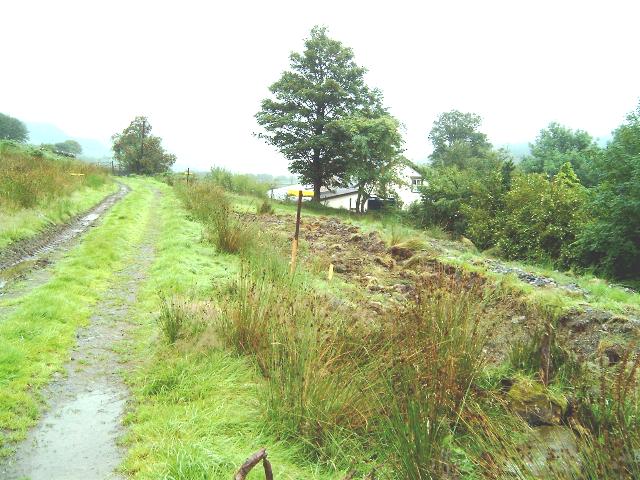
This northerly view (14/9/02) from LC52 shows the completed ditch along the uphill side of the formation. This interceptor ditch is one of the deepest seen on the project so far. The trackbed has been hardened with slate waste to allow vehicular access prior to completion of the drainage works, addition of slate fines and grading. Click on the image to enlarge. This image is copyright B.W.Hughes. Image taken using Samsung Digimax 230 and post processed with iPhoto Plus4. Image displayed at 96dpi.
This northerly view (30/10/02) from the same viewpoint as that above shows the newly installed sidelong ditch with protective slabs. This ditch was full to the brim in one of the recent October rainstorms. Click on the image to enlarge. This image is copyright B.W.Hughes. Image taken using Samsung Digimax 230 and post processed with iPhoto Plus4. Image displayed at 96dpi.
This northerly view (19/2/03) from just south of LC52 shows the use of laser grading equipment to obtain the correct depth of ballast bed across LC52 just south of Snowdon Ranger Halt. The ballast bed ranges from a normal 25cm to 40cm deep. Click on the image to enlarge. This image is copyright WHLR. Image taken using a digital camera and post processed with iPhoto Plus4. Image displayed at 96dpi.

This northerly view (23/2/03) from the same viewpoint as above shows the Head of Steel at LC52. Glass fibre matting was laid over the ballast and quarry waste laid above to provide level access for farm traffic using the crossing. Click on the image to enlarge. This image is copyright B.W.Hughes. Image taken using Samsung Digimax 230 and post processed with iPhoto Plus4. Image displayed at 96dpi.
This northerly view (16/2/03) from south of LC52 shows the ballasted formation approaching LC52 south of Snowdon Ranger Halt. The excavator marks the end of the ballast bed on this date. Click on the image to enlarge. This image is copyright B.W.Hughes. Image taken using Samsung Digimax 230 and post processed with iPhoto Plus4. Image displayed at 96dpi.
This southerly archive view is taken from south of LC52 (Ch.11650 approx.) south of Snowdon Ranger Halt. The Glanrafon Quarry tips are visible in the distance. The local stone walls along this section have been extensively reduced to piles of rubble by over 60 years lack of attention since the closure (not to mention the attention of enthusiastic sheep!). Click on the to enlarge. This image is copyright WHLR, courtesy Jan Woods. Slide scan technology utilised is Olympus ES10 & iPhoto Plus4. Slide displayed at 96dpi.
This southerly view (16/2/03) from just south of LC52 (Ch.11610) shows the ballasted formation running above Llyn Cwellyn. Track may be laid on this section on 22/2/03. Click on the image to enlarge. This image is copyright B.W.Hughes. Image taken using Samsung Digimax 230 and post processed with iPhoto Plus4. Image displayed at 96dpi.
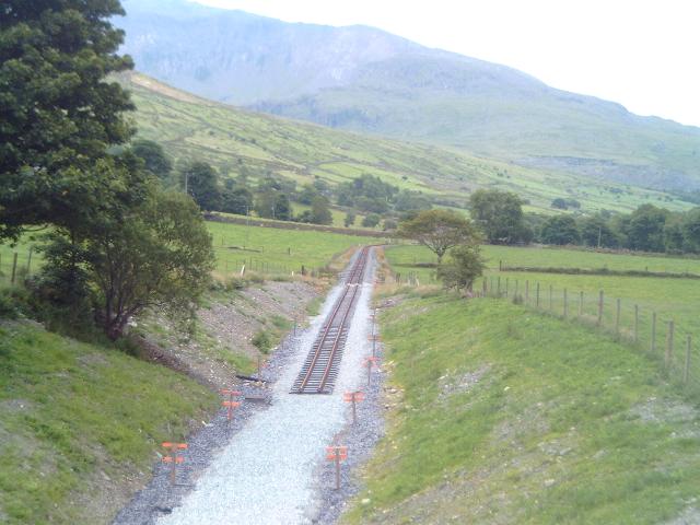
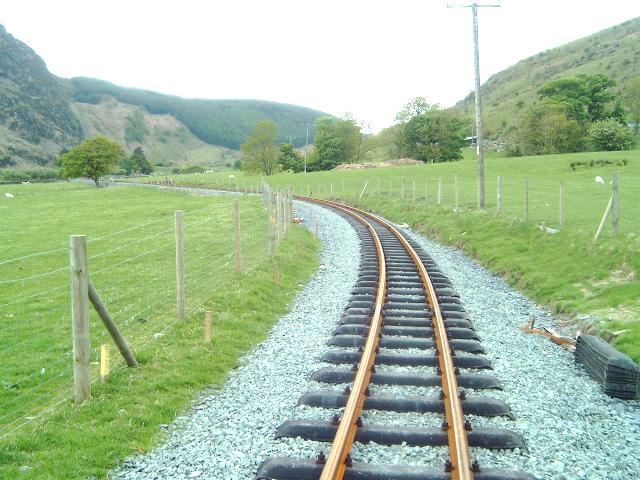
This southerly view (23/2/03) from the same viewpoint as above shows the Head of Steel just south of LC52. Sleepers have been laid as far as LC53 by volunteers from the SVR. Click on the image to enlarge. This image is copyright B.W.Hughes. Image taken using Samsung Digimax 230 and post processed with iPhoto Plus4. Image displayed at 96dpi.
This northerly archive view is taken from the trackbed south of LC52 (Ch.11600 approx.) with the white building, Snowdon Ranger YHA in view in the distance. Llyn Cwellyn is visible to the left. Click on the image to enlarge. This image is copyright B.W.Hughes. Slide scan technology utilised is Olympus ES10 & iPhoto Plus4. Slide displayed at 96dpi.
This northerly view (12/3/03) from a similar viewpoint to that above shows the completed track south of LC52. Llyn Cwellyn and the Castell Cidwm rock buttress are visible on the left. Click on the image to enlarge. This image is copyright B W Hughes taken on Samsung Digimax 230 digital camera. Image post processed using iPhoto Plus4 image correction technology and displayed at 96dpi.
This southerly view (30/6/02) from south of LC52 (Ch.11700) shows the recently completed fencing.. In the background, on the stone ledge below the spoil heaps, is Glan-yr-afon Yard where orange suited figures are visible completing the track into the yard. Click on the image to enlarge. This image is copyright B.W.Hughes. Image taken using Samsung Digimax 230 and post processed with iPhoto Plus4. Image displayed at 96dpi.
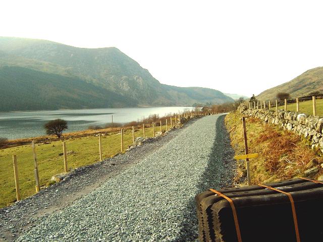
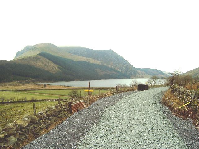
This southerly view (16/2/03) from the same viewpoint as above shows the ballasted formation running above Llyn Cwellyn. The ballast is laid unwashed and thus covered in white dust. The colour change visible in the distance is due to rain washing which removes the dust and renders the ballast it nominal grey colour. Glanrafon Quarry tips are visible in the distance just past the site of Glan-yr-afon viaduct. Click on the image to enlarge. This image is copyright B.W.Hughes. Image taken using Samsung Digimax 230 and post processed with iPhoto Plus4. Image displayed at 96dpi.
This southerly view (23/2/03) from the same viewpoint as above shows the sleepers laid towards LC53 by volunteers from the SVR. Tracklaying work on this section may be done by WHLR staff during the mid-week. Click on the image to enlarge. This image is copyright B.W.Hughes. Image taken using Samsung Digimax 230 and post processed with iPhoto Plus4. Image displayed at 96dpi.
Bron-y-fedw Isaf
A footpath crosses that line here and provides a short circular walk above the railway coming down and across the trackbed a few hundred metres further along the line.
This northerly archive view was taken south of LC53 at Bron-y-fedw Isaf. The route will offer excellent views of Llyn Cwellyn and Castell Cidwm rock buttress. Click on the image to enlarge. This image is copyright B.W.Hughes. Slide scan technology utilised is Olympus ES10 & iPhoto Plus4. Slide scanned at 200dpi.
This northerly archive view at LC53 (Ch.11760) shows Llyn Cwellyn in the background. This section of trackbed is in use as a farm track. Click on the image to enlarge. This image is copyright B.W.Hughes. Slide scan technology utilised is Olympus ES10 & iPhoto Plus4. Slide displayed at 96dpi.

This northerly view (14/9/02) shows the progress made since the views above from Ch.11960. This section will offer beautiful views of Llyn Cwellyn and Castell Cidwm rock buttress that will attract significant traffic from coach tour operators. Click on the image to enlarge. This image is copyright B.W.Hughes. Image taken using Samsung Digimax 230 and post processed with iPhoto Plus4. Image displayed at 96dpi.
This northerly view (16/2/03) from a similar viewpoint to that above shows the ballasted formation running above Llyn Cwellyn. Piles of sleepers have been deposited alongside the formation in preparation for tracklaying on this section from 22/2/03. Click on the image to enlarge. This image is copyright B.W.Hughes. Image taken using Samsung Digimax 230 and post processed with iPhoto Plus4. Image displayed at 96dpi.
This northerly view (9/3/03) shows the Head of Steel at LC53. Click on the image to enlarge. This image is copyright B W Hughes taken on Samsung Digimax 230 digital camera. Image post processed using iPhoto Plus4 image correction technology and displayed at 96dpi.
This southerly view (16/2/03) shows the view in the opposite direction with ballasted formation running above Llyn Cwellyn. Although this section is straight, it is a little surprising to find the ballast alignment less so! This image is copyright B.W.Hughes. Image taken using Samsung Digimax 230 and post processed with iPhoto Plus4. Image displayed at 96dpi.
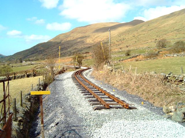
This southerly view (9/3/03) shows the Head of Steel crossing LC53 at the end of a very wet weekend's tracklaying. Click on the image to enlarge. This image is copyright B W Hughes taken on Samsung Digimax 230 digital camera. Image post processed using iPhoto Plus4 image correction technology and displayed at 96dpi.
This southerly view (30/3/03) shows track now completed south from LC53 with both Bron-y-fedw farms in view. The kink in the alignment half way along the straight does not appear strictly necessary. Click on the image to enlarge. This image is copyright B W Hughes taken on Samsung Digimax 230 digital camera. Image post processed using iPhoto Plus4 image correction technology and displayed at 96dpi.

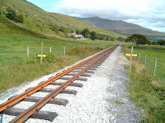
This northerly view (16/2/03) from LC54 shows the ballasted formation running above Llyn Cwellyn. Click on the image to enlarge. This image is copyright B.W.Hughes. Image taken using Samsung Digimax 230 and post processed with iPhoto Plus4. Image displayed at 96dpi.
This northerly view (30/3/03) shows track now completed north from LC54 with Llyn Cwellyn in view. Click on the image to enlarge. This image is copyright B W Hughes taken on Samsung Digimax 230 digital camera. Image post processed using iPhoto Plus4 image correction technology and displayed at 96dpi.
This southerly archive view from LC54 (Ch.11960) shows the Glan-yr-afon slate tips in the background. UB 87 carries the footpath under the line here. The trackbed is not used as a farm track on this section. Click on the image to enlarge. This image is copyright B.W.Hughes. Slide scan technology utilised is Olympus ES10 & iPhoto Plus4. Slide displayed at 96dpi.
This southerly view (14/9/02) from Ch.11960 shows the end of the trackbed works so far at LC54. Click on the image to enlarge. This image is copyright B.W.Hughes. Image taken using Samsung Digimax 230 and post processed with iPhoto Plus4. Image displayed at 96dpi.
This southerly view (30/10/02) from the same viewpoint as that above shows the cleared and firmed up formation at this point. During the Winter, additional sidelong drains on the uphill side (left) will be installed and a final rolled slate fines layer will be laid. Click on the image to enlarge. This image is copyright B.W.Hughes. Image taken using Samsung Digimax 230 and post processed with iPhoto Plus4. Image displayed at 96dpi.
This southerly view (16/2/03) from the same viewpoint as above shows the ballasted formation running above Bron-y-fedw Isaf farm. In the foreground glass fibre matting has been laid across the ballast at LC54 with quarry waste above to level the crossing for farm vehicles. Click on the image to enlarge. This image is copyright B.W.Hughes. Image taken using Samsung Digimax 230 and post processed with iPhoto Plus4. Image displayed at 96dpi.
This southerly view (30/3/03) shows track now completed south from LC54 with lots of rails laid in the two foot ready for onward transport. Click on the image to enlarge. This image is copyright B W Hughes taken on Samsung Digimax 230 digital camera. Image post processed using iPhoto Plus4 image correction technology and displayed at 96dpi.
This northerly view (30/10/02) shows the bend at Ch.12000 from the reverse angle. The trackbed has been cleared and hardened with small slate waste for a plant road. This image is copyright B.W.Hughes. Image taken using Samsung Digimax 230 and post processed with iPhoto Plus4. Image displayed at 96dpi.
This northerly archive view near LC55 (Ch.12140) shows Bron-y-fedw Isaf farm. This section of trackbed is not used as a farm track. Click on the image to enlarge. This image is copyright B.W.Hughes. Slide scan technology utilised is Olympus ES10 & iPhoto Plus4. Slide displayed at 96dpi.
This northerly archive view (2001) shows the trackbed from LC55 (Ch.12140). The alignment curves into a small side valley and crosses a stream and public footpath at UB86. Llyn Cwellyn is visible on the right. Click on the image to enlarge. This image is copyright WHLR, courtesy Jan woods. Slide scan technology utilised is Olympus ES10 & iPhoto Plus4. Slide displayed at 96dpi.
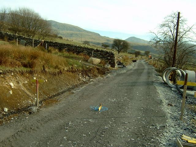
A gap has been left in the ballast between LC55 and LC56. This is due to the need to rebuild UB90 for a local farmer, widening it to 2.5m from a 1m sheep creep. This will allow access by quad bike at all times rather than use the more restricted adjacent level crossing. He is turn has allowed waste to be deposited on his land and slate waste to be utilised from a local tip. Later, WHLR subcontractors will access the trackbed at LC56 and lay the ballast bed back to LC55.
This northerly view (16/2/03) from the same viewpoint as above shows the ballasted formation running above Llyn Cwellyn from its restart at LC55 (Ch.12140). The gap in the ballast between here and LC56 is due to the need to rebuild UB90 for a local farmer. Track may be laid on this section on 22/2/03. Click on the image to enlarge. This image is copyright B.W.Hughes. Image taken using Samsung Digimax 230 and post processed with iPhoto Plus4. Image displayed at 96dpi.
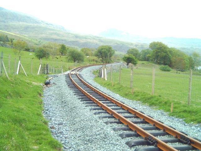
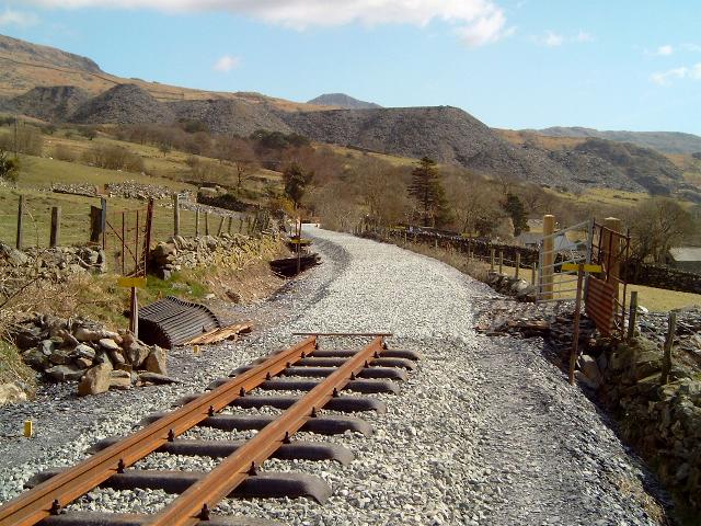
This northerly view (30/3/03) shows track now completed from LC55 with the curve around Bron-y-fedw Isaf farm in view. Ballast retaining walls are still being built up on the bridges north of here. Click on the image to enlarge. This image is copyright B W Hughes taken on Samsung Digimax 230 digital camera. Image post processed using iPhoto Plus4 image correction technology and displayed at 96dpi.
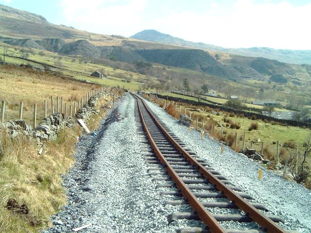
This northerly view (17/4/03) from a similar viewpoint to that above, shows the completed track and the fine view of Llyn Cwellyn from this point. Click on the image to enlarge. This image is copyright B W Hughes taken on Samsung Digimax 230 digital camera. Image post processed using iPhoto Plus4 image correction technology and displayed at 96dpi.
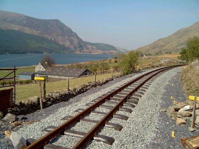
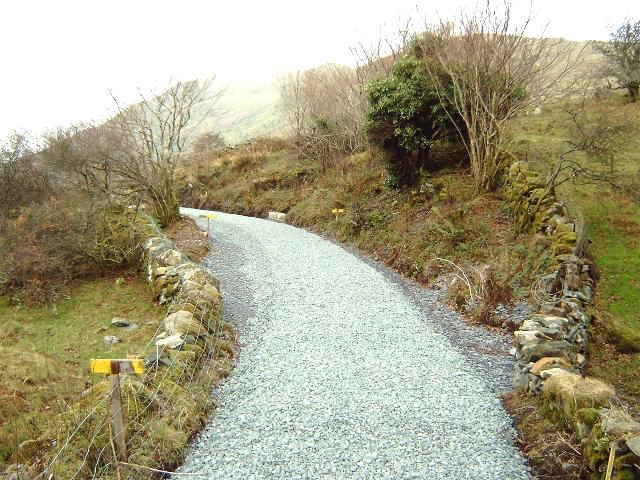
This southerly view (30/3/03) shows the Head of Steel and the ballast now completed south from LC55 past Bron-y-fedw farm and UB90. The ballast was completed on this day and there is now a continuous bed from LC55 to the Glan-yr-afon Viaduct. Tracklaying will proceed to the viaduct during April. Click on the image to enlarge. This image is copyright B W Hughes taken on Samsung Digimax 230 digital camera. Image post processed using iPhoto Plus4 image correction technology and displayed at 96dpi.
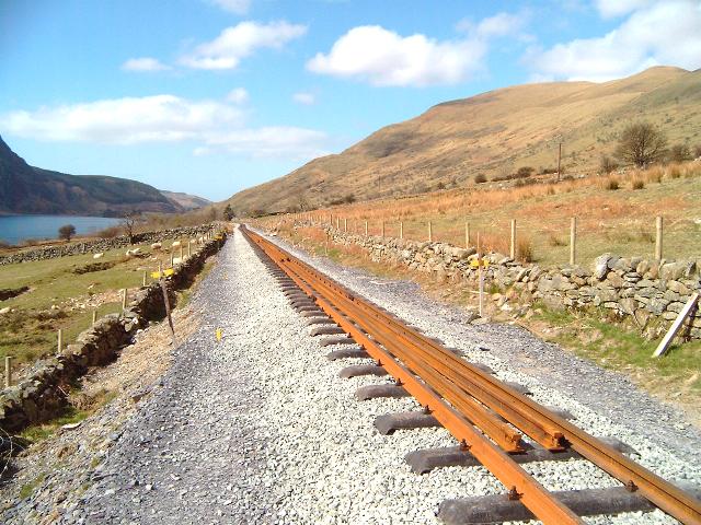
This southerly view (17/4/03) from a similar viewpoint to that above, shows the completed track with Bron-y-fedw Uchaf farm and Glan-yr-afon slate tips in the distance. Click on the image to enlarge. This image is copyright B W Hughes taken on Samsung Digimax 230 digital camera. Image post processed using iPhoto Plus4 image correction technology and displayed at 96dpi.
Bron-y-fedw Uchaf
A footpath crosses the line at this location. There are fine views over Llyn Cwellyn and towards the summit of the Nant-y-Betws Pass. UB90 is being rebuilt as a 2.5m wide underbridge rather than a sheep creep. This will permit the farm owner to use his quad bike through here rather than use the adjacent level crossing LC56.
This southerly view (16/2/03) at UB90 shows the ballasted formation south of LC56 just beyond the bridge rebuilding. The south abutment is being strengthened but the nearer north abutment is being reconstructed in reinforced concrete with local stone cladding. Click on the image to enlarge. This image is copyright B.W.Hughes. Image taken using Samsung Digimax 230 and post processed with iPhoto Plus4. Image displayed at 96dpi.
This northerly view (17/4/03) from a similar viewpoint to that above, shows the completed track over UB90. Click on the image to enlarge. This image is copyright B W Hughes taken on Samsung Digimax 230 digital camera. Image post processed using iPhoto Plus4 image correction technology and displayed at 96dpi.
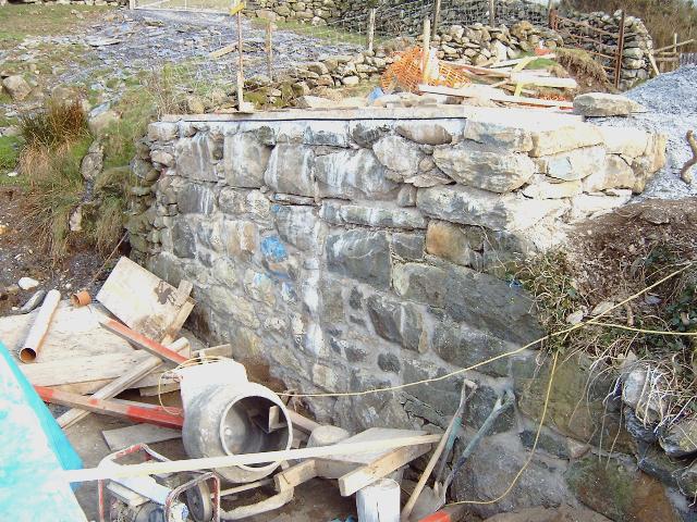
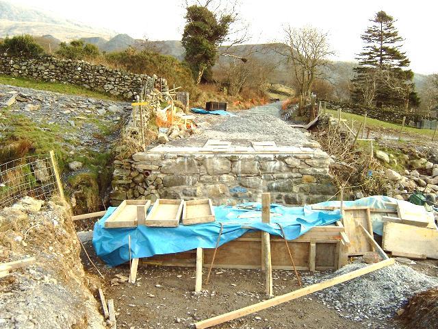
This easterly view (16/2/03) shows the south abutment of UB90. The abutment has been repointed and may have some concrete backfill to strengthen it. A new bridge deck is due to be cast in March following completion of the north abutment. Click on the image to enlarge. This image is copyright B.W.Hughes. Image taken using Samsung Digimax 230 and post processed with iPhoto Plus4. Image displayed at 96dpi.
This northerly view (12/3/03) shows the completion of work on the rebar web for the deck of UB90. It was hoped to cast the concrete for the deck a few days later. Click on the image to enlarge. This image is copyright B W Hughes taken on Samsung Digimax 230 digital camera. Image post processed using iPhoto Plus4 image correction technology and displayed at 96dpi.

This northerly view (30/3/03) shows ballast now completed over UB90 at Bron-y-fedw Uchaf. Click on the image to enlarge. This image is copyright B W Hughes taken on Samsung Digimax 230 digital camera. Image post processed using iPhoto Plus4 image correction technology and displayed at 96dpi.
This northerly view (17/4/03) from a similar viewpoint to that above, shows the completed track over UB90 and LC56. This level crossing will see little use as UB90 has been made wide enough for a quad bike. Passengers will be treated to a fine view of Llyn Cwellyn from this point. Click on the image to enlarge. This image is copyright B W Hughes taken on Samsung Digimax 230 digital camera. Image post processed using iPhoto Plus4 image correction technology and displayed at 96dpi.
This northerly archive view (2001) shows the section north of UB92 (Ch.12470) above Bron-y-fedw Uchaf farm. The farm is below and to the left. In the distance are the gates of LC56. Click on the image to enlarge. This image is copyright WHLR, courtesy Jan woods. Slide scan technology utilised is Olympus ES10 & iPhoto Plus4. Slide displayed at 96dpi.
This northerly view (30/10/02) from a similar vantage point to that above (Ch.12400 approx.) shows the firmed up formation alongside Bron-y-fedw Uchaf farm (left). Click on the image to enlarge. This image is copyright B.W.Hughes. Image taken using Samsung Digimax 230 and post processed with iPhoto Plus4. Image displayed at 96dpi.

This northerly view (17/4/03) from a similar viewpoint to that above, shows the completed track at UB91. Click on the image to enlarge. This image is copyright B W Hughes taken on Samsung Digimax 230 digital camera. Image post processed using iPhoto Plus4 image correction technology and displayed at 96dpi.
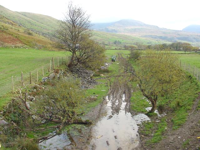
This southerly archive view (2001) shows the trackbed from UB92 (Ch.12400 approx.) with Glan-yr-afon Viaduct just 200m around the bend. The trackbed is overgrown on this section and no fencing or tree clearance had been done by Spring 2002. Click on the image to enlarge. This image is copyright WHLR, courtesy Jan woods. Slide scan technology utilised is Olympus ES10 & iPhoto Plus4. Slide displayed at 96dpi.
This southerly view (1/12/02) shows the same viewpoint as that above a year on. The trackbed has had French drains added on the uphill side (left). With the formation stabilised, slate fines have been tipped. These will be carefully rolled to provide the necessary camber for super-elevation on curves or to assist drainage on straights. Click on the image to enlarge. This image is copyright B W Hughes taken on a Hitachi D8 digital camcorder VM-D865LE 230. Image post processed using iPhoto Plus4 image correction technology and displayed at 96dpi.
This southerly view (1/12/02) shows the completion of sidewalls on UB93 at Ch.12460. Visible just beyond is the end of the rolled slate fines section that extends to Glan-yr-afon viaduct. Slate fines have been rolled with a camber on these sharp bends to provide super-elevation and aid drainage. Click on the image to enlarge. This image is copyright B W Hughes taken on a Hitachi D8 digital camcorder VM-D865LE 230. Image post processed using iPhoto Plus4 image correction technology and displayed at 96dpi.
This southerly view (31/12/02) shows the same viewpoint as the above image. The end of the ballasted section south from here to the viaduct is visible. Sleeper packs have been spaced out along the trackbed. Yellow lines sprayed on the rolled trackbed indicate where the ballast layer should be placed. Click on the image to enlarge. This image is copyright B.W.Hughes. Image taken using Samsung Digimax 230 and post processed with iPhoto Plus4. Image displayed at 96dpi.
This northerly view (31/12/02) shows the end of the ballasted section south from Glan-yr-afon viaduct at Bron-y-fedw Uchaf. Sleeper packs have been spaced out along the trackbed. Click on the image to enlarge. This image is copyright B.W.Hughes. Image taken using Samsung Digimax 230 and post processed with iPhoto Plus4. Image displayed at 96dpi.
This northerly view (1/12/02) shows the recently completed trackbed at Bron-y-fedw Uchaf with Llyn Cwellyn in the background. The drainage has been completed on the uphill side (right) and the trackbed stabilised. The ballast retaining walls of UB93 are visible under construction at Ch.12480. Slate fines have been rolled with a camber on these sharp bends to provide super-elevation and aid drainage. Click on the image to enlarge. This image is copyright B W Hughes taken on a Hitachi D8 digital camcorder VM-D865LE 230. Image post processed using iPhoto Plus4 image correction technology and displayed at 96dpi.
This northerly view (31/12/02) shows the same viewpoint as the above image. This section was ballasted south from Glan-yr-afon viaduct in December. Sleeper packs have been spaced out along the trackbed. Click on the image to enlarge. This image is copyright B.W.Hughes. Image taken using Samsung Digimax 230 and post processed with iPhoto Plus4. Image displayed at 96dpi.

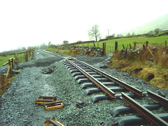
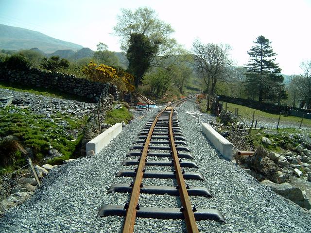
This northerly view (17/4/03) from a similar viewpoint to that above, shows the completed track at UB93. To obtain a smooth curve laid out to the 5m surveyors pegs in view on the right, the track has to overhang the prepared ballast bed. This will be remedied when the ballast train arrives at this point. Click on the image to enlarge. This image is copyright B W Hughes taken on Samsung Digimax 230 digital camera. Image post processed using iPhoto Plus4 image correction technology and displayed at 96dpi.
This southerly view (17/4/03) from a similar viewpoint to that above, shows the completed track overhanging the ballast bed slightly to the right. Glan-yr-afon slate tips are visible in the distance showing how close the viaduct is to this point. This image is copyright B W Hughes taken on Samsung Digimax 230 digital camera. Image post processed using iPhoto Plus4 image correction technology and displayed at 96dpi.
This southerly view (31/12/02) shows the reverse view of that above. The recently ballasted section curves south towards Glan-yr-afon viaduct. This section will not be disturbed again until tracklaying advances south from Snowdon Ranger. Click on the image to enlarge. This image is copyright B.W.Hughes. Image taken using Samsung Digimax 230 and post processed with iPhoto Plus4. Image displayed at 96dpi.

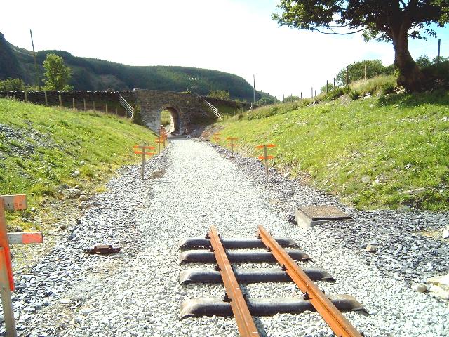
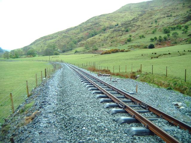
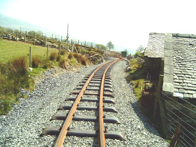
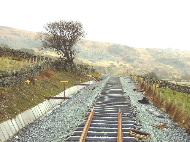
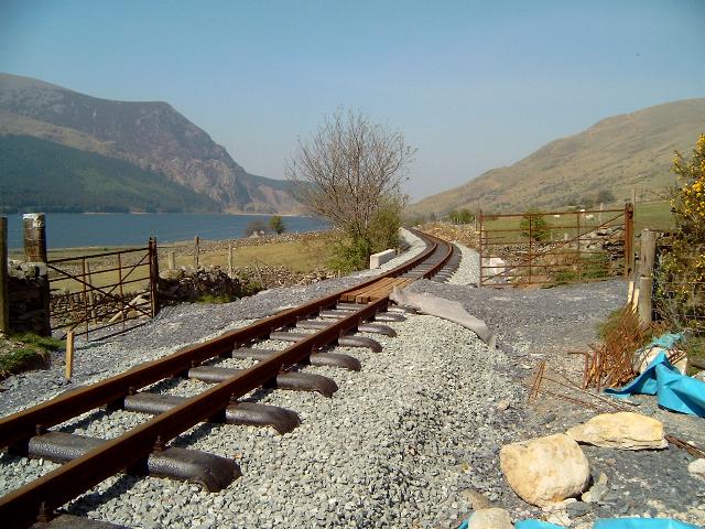
This northerly view (17/4/03) shows the Head of Steel on the approaches to Glan-yr-afon Viaduct. There are fine view of Llyn Cwellyn from this point. The track has been left 3 panels short of the viaduct to allow for adjustment of levels. Click on the image to enlarge. This image is copyright B W Hughes taken on Samsung Digimax 230 digital camera. Image post processed using iPhoto Plus4 image correction technology and displayed at 96dpi.
This northerly view (1/12/02) shows the recently completed section of rolled trackbed immediately north of Glan-yr-afon Viaduct. There are tight reverse curves both sides of the viaduct to reduce the span. Click on the image to enlarge. This image is copyright B W Hughes taken on a Hitachi D8 digital camcorder VM-D865LE 230. Image post processed using iPhoto Plus4 image correction technology and displayed at 96dpi.
This northerly view (31/12/02) from the same viewpoint as above shows the view from Glan-yr-afon viaduct (north end) showing the end of the ballasted section that now extends north from Glan-yr-afon viaduct to Bron-y-fedw Uchaf. Sleeper packs have been spaced out along the trackbed. Click on the image to enlarge. This image is copyright B.W.Hughes. Image taken using Samsung Digimax 230 and post processed with iPhoto Plus4. Image displayed at 96dpi.
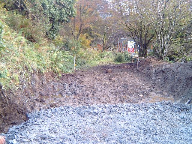
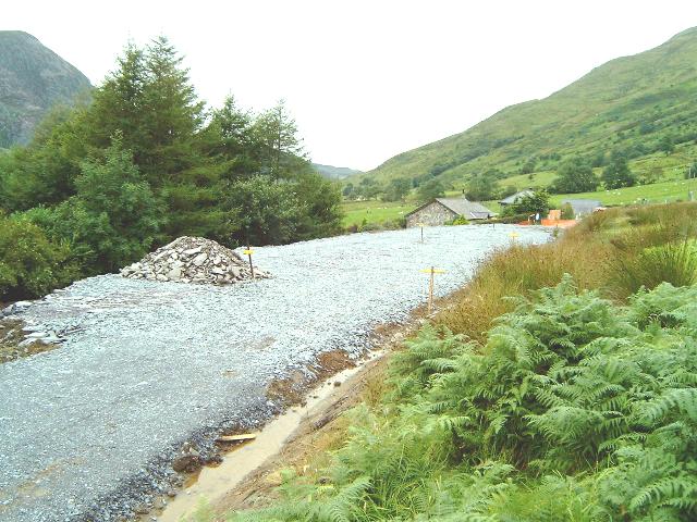
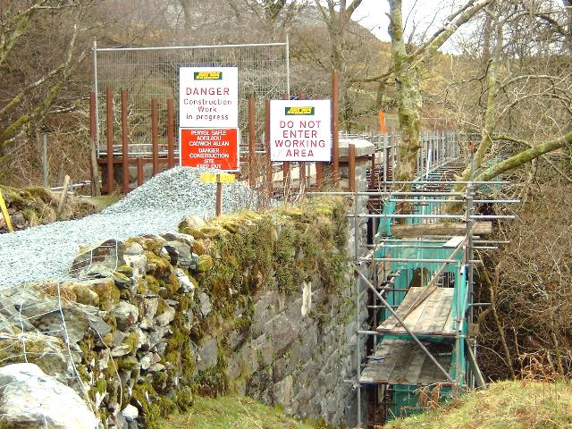
This southerly view (30/10/02) from Ch.12550 approx. shows the end of the cleared section south from Snowdon Ranger. The warning signs and fencing protect the Glan-yr-afon Viaduct immediately beyond. The commencement of work to this point means that work is now in progress on the full length of the WHR except for the short stretch immediately north of Castell Cidwm bridge, which is awaiting the serving of a Court Order on a local farmer by the County Sheriff. Once the ground is scraped clean of grass and mud, the next step is to firm up the formation for use as a plant road by adding small slate waste. Click on the image to enlarge. This image is copyright B.W.Hughes. Image taken using Samsung Digimax 230 and post processed with iPhoto Plus4. Image displayed at 96dpi.
This southerly view (1/12/02) shows a similar view to that above. The drainage has been completed and the trackbed stabilised. Slate fines have been rolled with a camber on these sharp bends approaching the viaduct to provide super-elevation and aid drainage. Click on the image to enlarge. This image is copyright B W Hughes taken on a Hitachi D8 digital camcorder VM-D865LE 230. Image post processed using iPhoto Plus4 image correction technology and displayed at 96dpi.
This southerly view (31/12/02) from the same viewpoint as the above image shows the end of the ballasted section south from Bron-y-fedw Uchaf to Glan-yr-afon viaduct. Sleeper packs have been spaced out along the trackbed. All work on the viaduct, which remains fenced off, is accessed from Glan-yr-afon yard. Click on the image to enlarge. This image is copyright B.W.Hughes. Image taken using Samsung Digimax 230 and post processed with iPhoto Plus4. Image displayed at 96dpi.

This southerly view (17/4/03) from a similar viewpoint to that above, shows the Head of Steel at Ch.12552, just 3 lengths short of the viaduct. Rails left in the 'two foot' will close this gap in May. Click on the image to enlarge. This image is copyright B W Hughes taken on Samsung Digimax 230 digital camera. Image post processed using iPhoto Plus4 image correction technology and displayed at 96dpi.
Glan-yr-afon viaduct

This easterly archive view (1/10/41) shows the Glan-yr-afon viaduct with the demolition train on it. The massive wrought iron panels can be seen. The bridge was once known variously as Dingle bridge and Bont Ddu. Photographer J.F.Bolton. Photo copyright WHR(P), courtesy David Allan.

This southerly archive view shows the Glan-yr-afon Viaduct. Two heavy riveted girders carry cross beams upon which the way-beams are laid. The wooden side beams constrain derailment damage. The viaduct is dangerous to cross being slippery and high above the Afon Treweunydd. It was fenced off with a heavy duty security grid at the north end by the WHLR when it took possession of the land in 1999. However, by August 2000 unknown persons had cut a hole through the grid with an oxy-acetylene equipment. Click on the image to enlarge. This image is copyright B.W.Hughes. Slide scan technology utilised is Olympus ES10 & iPhoto Plus4. Slide scanned at 200dpi.
This southerly view (31/12/02) shows the end of the ballasted section south from Glan-yr-afon viaduct. The abutment of the viaduct has been repointed and tie bars inserted with plates on the end to spread the load. No work was evident on the cross beams on this date. Click on the image to enlarge. This image is copyright B.W.Hughes. Image taken using Samsung Digimax 230 and post processed with iPhoto Plus4. Image displayed at 96dpi.
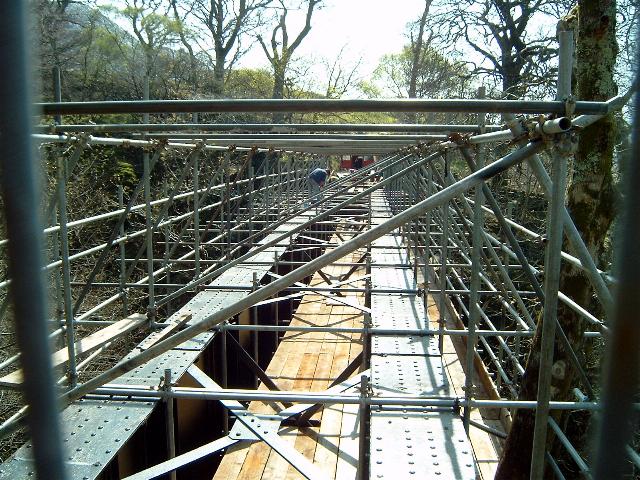
This southerly view (17/4/03) shows work in progress on the top of the main beams preparing them for addition of crossbeams to support waybeams, sleepers and track. Click on the image to enlarge. This image is copyright B W Hughes taken on Samsung Digimax 230 digital camera. Image post processed using iPhoto Plus4 image correction technology and displayed at 96dpi.
Click here to visit the Glan-yr-Afon to Rhyd Ddu page
Click here to return to Stop Press page
Site Development
If you have suggestions for development of this site, please contact me by email at the address on the Stop Press page.
Comments
Please add comments in my Guestbook.
Page Version 3.31 dated 9/7/03