WHR
Plasynant - Castell Cidwm
area page
V3.22 updated 20/7/03
New images on this page are from 13/7/03.
Click here for start of new images
Click here for JC Sreeves latest construction map
Locations
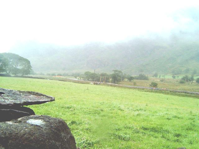
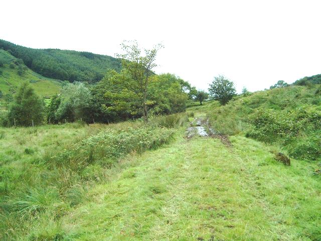
This 1 km section begins just south of the Plas-y-nant bowstring bridge UB 64 at Ch. 9100 and runs to just south of Castell Cidwm bridge at Ch.10000 where the WHLR Snowdon Ranger contract begins. There are no visible remains of Plas-y-nant Halt at Ch. 9100 approx. Access to Plasynant halt is from the A4085 opposite the entrance to Plasynant House Lodge by a short footpath beside the Afon Gwyrfai. A lay-by for car parking is available on the northbound side of the main road. The most southerly of the three bowstring bridges is visible to the right.
There are no signs of the remains of the 17 yards long halt that appears to have been a gravel platform on the east side of the line. The line runs straight south east until it meets the Afon Gwyrfai again at Ch. 9500.
There are no public footpaths but the line is overlooked by the footpath from Pont Cerrig-y-rhyd which climbs straight up the Tros-y-gol mountainside opposite the halt.
At Ch. 9500, there is a widening of the formation for a 40 yard siding and the remains of a tramway are seen descending from Plasynant and Brynmanllyn slate quarries. It is not certain a tramway was ever completed, crossing the road at Ty'n-y-werglodd, but traces of a formation are shown between the main road and the siding, following the north side of the hill spur. The quarries closed by 1885 and so the siding and tramway, if constructed, were only in action for 8 years from the opening of the NWNGR.
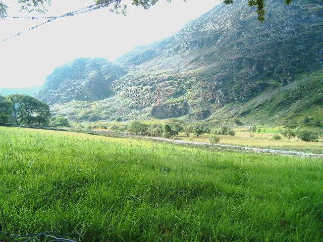
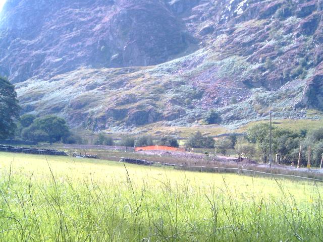
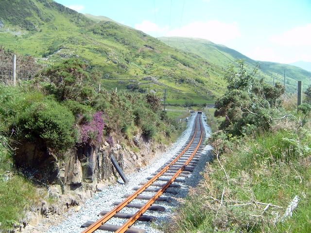
From Ch. 9500, the line follows gentle curves on the east bank of the Afon Gwyrfai before turning sharply into a vertical sided rock cutting at Ch. 9700. The route emerges from the cutting to run due across pasture land to pass under the A4085 at Castell Cidwm Hotel. The Hotel is named after the imposing rock buttress on the west side of the valley.
The track curves south-east under the bridge (OB71) located at Ch. 10000. The bridge is a standard NWNGR arch. The formation widens for 100 metres immediately east of the bridge. This was the site of a run round loop at the temporary terminus named Quellyn which was opened to goods 21/5/1877 and to passengers 15/8/1877. However, works continued towards Rhyd Ddu, and the line to Snowdon Ranger was opened for all traffic within one year on 1/6/1878. There is no evidence of a halt here subsequent to the opening of the railway's extension to Rhyd Ddu in 1878.
Station and loop
Plasynant halt will take the form of two platforms (up to 200 m long) on the either side of the line as at Dinas rather than an island platform. Taking advantage of the recent sale of the Plasynant Estate, the WHLR has bought sufficient land to widen the single track formation to double track over a length of 300 metres from Ch. 9200 to Ch. 9500, giving ample space to pass two trains. This location was to be the first to receive rock from the Rhyd Ddu station deviation but material had to be imported.
The position of this strategic loop will be useful in breaking up the long 9 km (6 mile) climb between Waunfawr loop and Rhyd Ddu loop, especially if locos experience operational difficulties on the long 1 in 40 climb and tight horseshoe curves up the Nant Colwyn Pass through Beddgelert Forest.
Gradients
The formation is level through Plasynant Halt and loop. It then climbs at 1 in 200 alongside the Afon Gwyrfai before running level through the cutting and pasture approaches to Castell Cidwm. This former terminus sees the start of the main climb to Rhyd Ddu, with a gradient of 1 in 75 commencing shortly after the road bridge. This gradient will be increased as the road bridge will require underpinning and the formation, deepening by about a metre to accommodate the Garratt loading gauge.
Gwyrfai Bridge
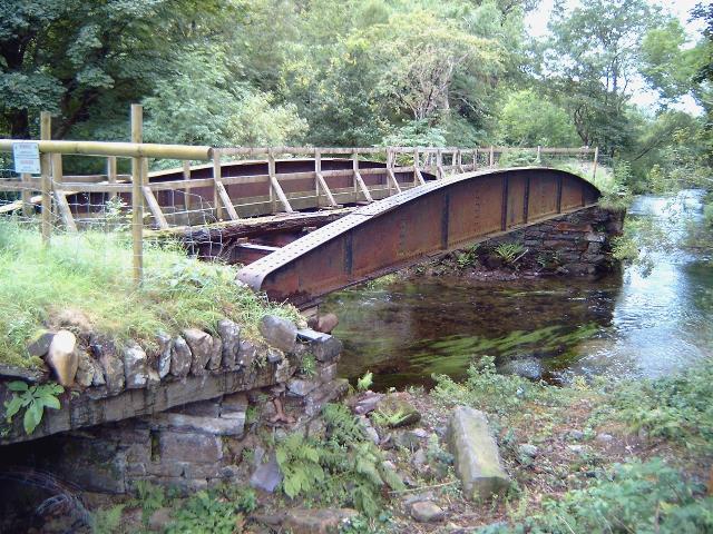
After crossing the final Gwyrfai Bridge (UB64) and its two overflow channels, the alignment enters the site of Plas-y-nant Halt.
Full details about the refurbishment of this bridge are given on the previous page.
This northerly view (2/8/02) from the public access to Plas-y-nant Halt shows the bridge and one of the two overflow channels (left). The bridge will be repaired and strengthened. The piers will also receive some work. Click on the image to enlarge. This image is copyright B W Hughes. Image taken on Samsung Digimax230 digital camera using iPhoto Plus4 image correction technology. Image displayed at 96dpi.

This northerly view (11/5/03) shows the ballasting of the trackbed onto the bridge. Temporary track has been laid on the bridge so that Harold could be delivered to the section north of here. Click on the image to enlarge. This image is copyright B W Hughes. Image taken on Samsung Digimax230 digital camera using iPhoto Plus4 image correction technology. Image displayed at 96dpi.
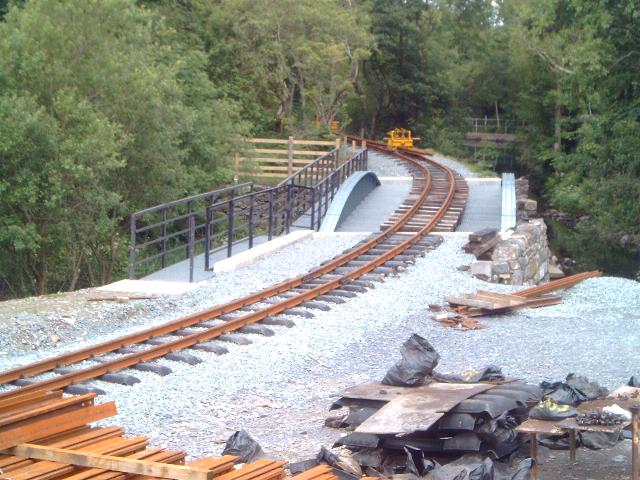
This northerly view (28/6/03) from a similar viewpoint shows the track now laid linked over Plas-y-nant bridge using temporary materials. Click on the image to enlarge. This image is copyright B W Hughes. Image taken on Samsung Digimax230 digital camera using iPhoto Plus4 image correction technology. Image displayed at 96dpi.
Plasynant Halt
Shortly after decision was announced to rebuild the WHR, a local resident tipped loads of rubbish on the route at Plasynant. Services have already been diverted in this area.

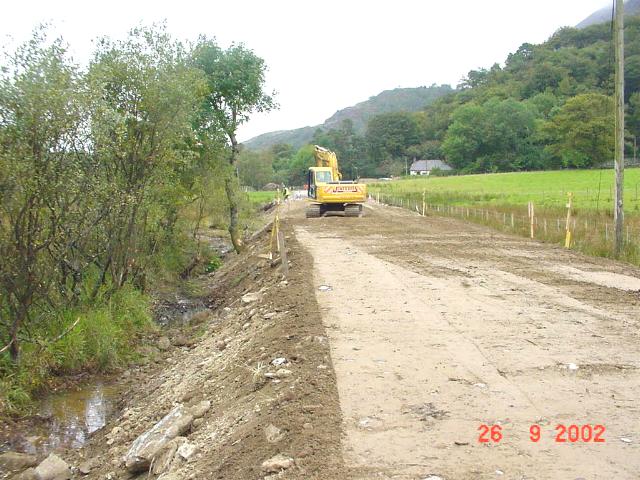
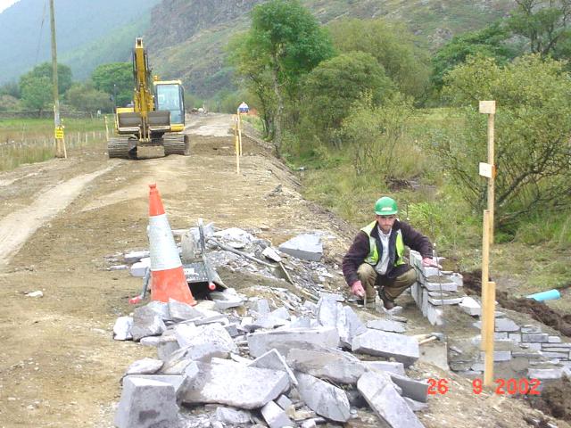
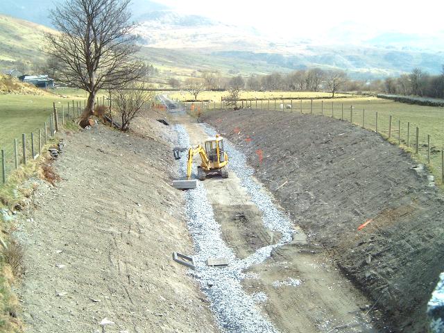
This southerly view (28/10/00) shows workmen diverting services on behalf of local residents at Plasynant Halt. The mound of building rubble behind the digger was deliberately dumped by a local resident a few years ago on hearing the rebuilding of the WHR was going ahead. Click on the image to enlarge. This image is copyright B.W.Hughes. Slide scan technology utilised is Olympus ES10 & iPhoto Plus4. Slide scanned at 200dpi.
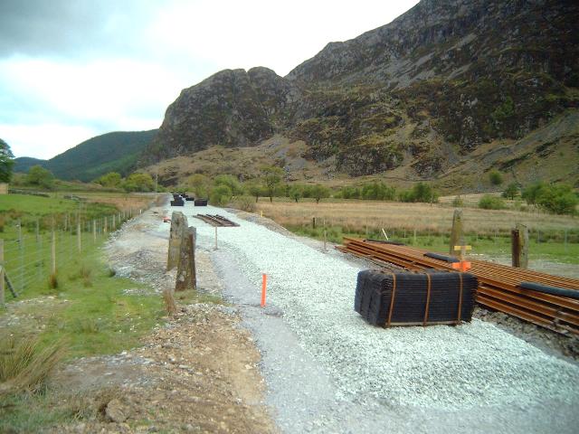
This southerly view (30/10/02) from the same angle as that above shows the large rail stack at Plas-y-nant. Click on the image to enlarge. This image is copyright B W Hughes. Image taken on Samsung Digimax230 digital camera using iPhoto Plus4 image correction technology. Image displayed at 96dpi.
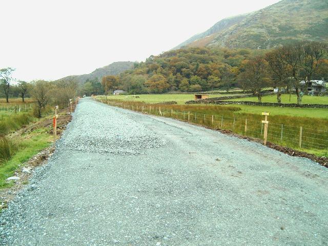
This northerly view (11/5/03) from near the same viewpoint as above shows the completed trackbed at this point. Click on the image to enlarge. This image is copyright B W Hughes. Image taken on Samsung Digimax230 digital camera using iPhoto Plus4 image correction technology. Image displayed at 96dpi.
Ballasting was completed at Plas-y-nant by 18/5/03 and Jones Bros. was off site. A subsidiary rail stack had been established nearer the loop on the west side of the alignment.
This southerly view (18/5/03) from the same viewpoint shows the fully ballasted track at this location with piles of rails ready for tracklaying. The private footpath that crosses the bridge is visible to the right. Click on the image to enlarge. This image is copyright B W Hughes. Image taken on Samsung Digimax230 digital camera using iPhoto Plus4 image correction technology. Image displayed at 96dpi.
This southerly view (28/6/03) from a similar viewpoint shows the track now laid north from Plas-y-nant. The temporary lengths over the bridge will be replaced in coming weeks. Click on the image to enlarge. This image is copyright B W Hughes. Image taken on Samsung Digimax230 digital camera using iPhoto Plus4 image correction technology. Image displayed at 96dpi.

This westerly roadside view (29/4/01) shows the site of Plasynant loop just above the electric fence. The steel posts of LC41 are visible but this l/c will be removed by agreement with local landowners. The railway took advantage of the sale of the Plasynant Estate a few years ago and purchased enough land either side to make a long loop here and two edge platforms. Click on the image to enlarge. This image is copyright B.W.Hughes. Slide scan technology utilised is Olympus ES10 & iPhoto Plus4. Slide scanned at 200dpi.
This westerly roadside view (18/8/02) from the same angle as that above shows widening work proceeding on the north end of the loop at Plas-y-nant. Click on the image to enlarge. This image is copyright B W Hughes. Image taken on Samsung Digimax230 digital camera using iPhoto Plus4 image correction technology. Image displayed at 96dpi.
This southerly roadside view (29/4/01) shows the trackbed heading south with the buttress of Castle Cidwm on the left. The 200 metre long Plasynant passing loop will extend almost the full length of this view. Click on the image to enlarge. This image is copyright B.W.Hughes. Slide scan technology utilised is Olympus ES10 & iPhoto Plus4. Slide scanned at 200dpi.
This westerly roadside view (18/8/02) from the same angle as the above image shows widening work proceeding towards the south end of the loop at Plas-y-nant as far as LC42. Click on the image to enlarge. This image is copyright B W Hughes. Image taken on Samsung Digimax230 digital camera using iPhoto Plus4 image correction technology. Image displayed at 96dpi.
This westerly roadside view (26/8/02) from the same angle as the above image shows that widening work has passed LC42 and reached the south end of the loop, although the formation is not yet wide enough for two tracks and associated platforms. Click on the image to enlarge. This image is copyright B W Hughes. Image taken on Samsung Digimax230 digital camera using iPhoto Plus4 image correction technology. Image displayed at 96dpi.
This westerly roadside view (18/8/02) from the same angle as the above image shows a close up of the widening work beyond LC42, marked by orange tape fence (centre). Click on the image to enlarge. This image is copyright B W Hughes. Image taken on Samsung Digimax230 digital camera using iPhoto Plus4 image correction technology. Image displayed at 96dpi.
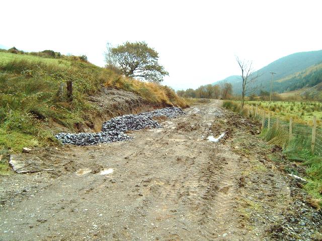
Work started in early August but progress was restricted due to the development of a hole in the roadside verge. This was due to a collapsed culvert that had undermined the road. Jones Bros. provided a new concrete access south of the hole by 9/8/02 and work resumed. GCC was excavating the road to fill the large cavity and repair the culvert by 12/8/02 with 3 way traffic lights being required. By 26/8/02, GCC had provided new pipes and was building an inspection chamber. Work was finished in early September and the lights removed, providing easier access for Jones Bros. and anticipated rail deliveries in October.
This westerly view (15/4/01) from the main road towards the Afon Gwyrfai shows the route of the WHR on an embankment on the near side of the river. There is a line of bushes just beyond the railway. Plas-y-nant loop is to the right. Click on the image to enlarge. This image is copyright B.W.Hughes. Slide scan technology utilised is Olympus ES10 & iPhoto Plus4. Slide scanned at 200dpi.
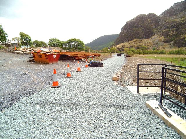
Plas-y-nant Halt is being constructed as two 2m wide side platforms as at Dinas but only 60m long. The loops themselves will have two automatic points set for right hand running as at Dinas. With the points set at Ch.9200 and Ch.9500, the loop is well over 200m clear (half the length of a Eurostar!) and will provide passing space for any anticipated future growth in the length of WHR trains.
The north end of the platforms will be situated over 100m south of the road entrance. Footpaths will run either side of the line to provide pedestrian access from the main road UB64. These will also provide a good vantage point for photography.
Initially, it was proposed that the loop would not be commissioned for the Easter 2003 opening to Rhyd Ddu. Instead it was to operate as a siding. The 6 mile section from Waunfawr to Rhyd Ddu was to be operated as a single section, allowing three trains on the whole route at once. Waunfawr points will be automated as at Dinas. This will require a new signalling system as two tokens will be issued at Dinas for the same direction, one for Rhyd Ddu and one for Waunfawr.
However, with the delays in the Jones Bros. contract, the opening to Plas-y-nant at Easter now seems likely with a run round loop. A Summer Holiday opening to Rhyd Ddu is now proposed. The contractor was laying ballast at the south end of the loop by 23/12/02 from the area of the temporary headshunt at Ch.9500 approx. back towards LC42. Two separate ballasted trackbeds are visible from Plas-y-nant. As of 23/12/02, the ballast did not extend far to the south but by 12/1/03 was visible emerging from Ty'n-y-werglodd cutting at Ch.9800 as seen from OB71.
Once the loop is ballasted and the bridgeworks at Plas-y-nant complete, the site will be handed over to the WHLR for tracklaying, hopefully in February. Continuing trackbed preparation and ballasting towards OB71 can be accessed from that end.
LC41
Although this l/c has been abandoned, the point for the north end of the loop will be situated close to this location. The stone gateposts on the east side have been removed.

This southerly view (26/9/02) shows the trackbed at LC41 near the north of the Plas-y-nant loop. The trackbed has been widened with rock excavated from elsewhere to complete the loop south of this point. Click on the image to enlarge. This image is copyright WHLR, courtesy Jan Woods with post processing by iPhoto Plus4. Image displayed at 96dpi.
This northerly view (11/5/03) shows the position of the end of ballast on that day at LC41. The point seen here on the formation south of LC41 was subsequently positioned in its final location north of LC41. Click on the image to enlarge. This image is copyright B W Hughes. Image taken on Samsung Digimax230 digital camera using iPhoto Plus4 image correction technology. Image displayed at 96dpi.
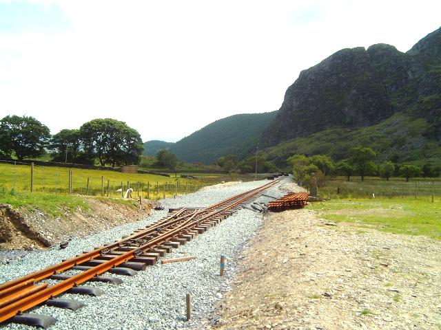
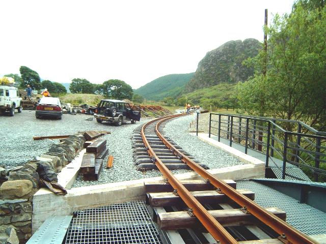
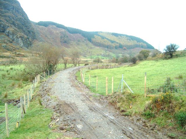
This southerly view (15/6/03) from a similar viewpoint shows the track now laid south from Plas-y-nant. The position of the loop point is considerably to the north of the TWO map and has required the removal of the stone gateposts of the abandoned LC41 on the east side of the line. The track through the loop will be the last section to be completed. Click on the image to enlarge. This image is copyright B W Hughes. Image taken on Samsung Digimax230 digital camera using iPhoto Plus4 image correction technology. Image displayed at 96dpi.

This southerly view (6/7/03) shows the main line (right) and the short siding at Plas-y-nant. The switchback nature of the trackbed here will feature for a few years as the underlying peat compresses under the load of the wider formation. Click on the image to enlarge. This image is copyright B W Hughes taken on Samsung Digimax 230 digital camera. Image post processed using iPhoto Plus4 image correction technology and displayed at 96dpi.

This northerly view (2/8/02) from the closed LC41 (Ch.9140) shows the original NWNGR stone gateposts and their 1922 steel rail replacements. Some work has been done clearing the pile of rubbish blocking the line but further access by vehicles was prohibited when a roadside cavity opened up. The new fencing can be seen very wide of the original formation on both sides. This extra land has been taken for the loop and new side platforms and their respective footpath accesses. Click on the image to enlarge. This image is copyright B W Hughes. Image taken on Samsung Digimax230 digital camera using iPhoto Plus4 image correction technology. Image displayed at 96dpi.

This northerly view (11/5/03) shows the position of the northern loop point just south of the former l/c seen in the previous image. It was later moved north of LC41. Click on the image to enlarge. This image is copyright B W Hughes. Image taken on Samsung Digimax230 digital camera using iPhoto Plus4 image correction technology. Image displayed at 96dpi.

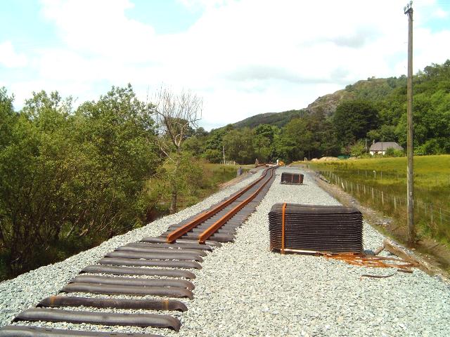
This northerly view (18/5/03) shows the view back towards Plas-y-nant bridge from the same level crossing. This section is now fully ballasted and sleepers have been laid out ready on the trackbed. A subsidiary rail stack has been established at the in this area. Click on the image to enlarge. This image is copyright B W Hughes. Image taken on Samsung Digimax230 digital camera using iPhoto Plus4 image correction technology. Image displayed at 96dpi.
This northerly view (15/6/03) from a similar viewpoint shows the point in its final position considerably to the north of the TWO map location. Click on the image to enlarge. This image is copyright B W Hughes. Image taken on Samsung Digimax230 digital camera using iPhoto Plus4 image correction technology. Image displayed at 96dpi.

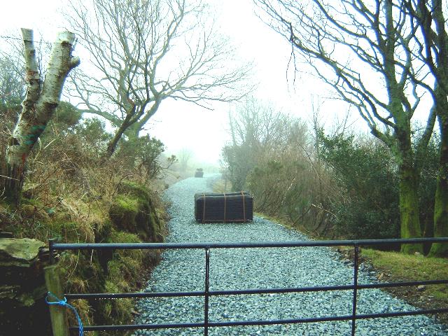
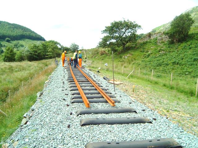
This northerly view (13/7/03) shows the volunteers using RRMs moving new rail north to replace bent rail at Salem. Click on the image to enlarge. This image is copyright B W Hughes taken on Samsung Digimax 230 digital camera. Image post processed using iPhoto Plus4 image correction technology and displayed at 96dpi.
This northerly 2001 view shows the trackbed at Ch.9300 near the centre of the Plas-y-nant loop. The trackbed will be widened with rock excavated from elsewhere to complete the loop. Click on the image to enlarge. This image is copyright WHLR, courtesy Jan Woods with post processing by iPhoto Plus4. Image displayed at 96dpi.
This northerly view (26/9/02) shows the trackbed around Ch.9300 near the centre of the Plas-y-nant loop. The trackbed has been widened with rock and clay excavated from elsewhere to complete the loop. Click on the image to enlarge. This image is copyright WHLR, courtesy Jan Woods with post processing by iPhoto Plus4. Image displayed at 96dpi.
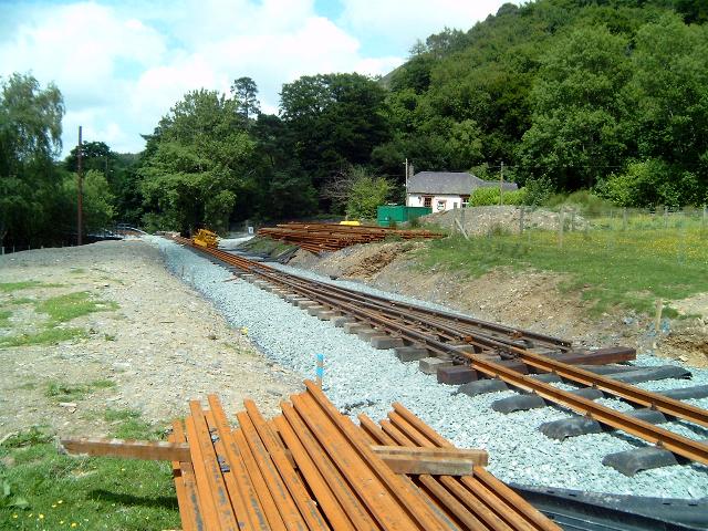
This northerly view (6/7/03) from a similar viewpoint to that above shows the trackbed ballasted and a siding laid (right) as well as the main line (left). Click on the image to enlarge. This image is copyright B W Hughes taken on Samsung Digimax 230 digital camera. Image post processed using iPhoto Plus4 image correction technology and displayed at 96dpi.
Work was halted in late Autumn 2002 when subsidence was discovered. A buried peat layer, several metres down was deforming under the weight of the rockfill above. This was allowed to deform over winter and the resulting subsidence of up to 1m in the middle of the loop topped up with stone removed from the Cae Hywel compound and Cae Wernlasddu clearance. This embankment will continue to move slowly over a period of up to 2 years. Work then restarted in earnest after Easter 2003 to complete the formation to the correct level and ballast this section with double track width ballast.
This southerly view (28/4/03) shows the double track ballasting near the middle of the loop. Two adjacent piles of sleepers indicate the position of the double track. Click on the image to enlarge. This image is copyright B W Hughes. Image taken on Samsung Digimax230 digital camera using iPhoto Plus4 image correction technology. Image displayed at 96dpi.

This southerly 2001 view shows the trackbed at Ch.9300 near the centre of the Plas-y-nant loop. The trackbed will be widened with rock excavated from elsewhere to complete the loop, which will finish at Ch.9500 on the left hand curve in the distance. Castell Cidwm rock buttress is visible in the background. Click on the image to enlarge. This image is copyright WHLR, courtesy Jan Woods with post processing by iPhoto Plus4. Image displayed at 96dpi.

This southerly view (25/6/02) shows the trackbed at Ch.9400 towards the south end of the Plas-y-nant loop, which will finish on the left hand corner at Ch. 9500 visible in the distance. The trackbed will be widened with rock excavated from elsewhere to complete the loop. clearance work was due to start within days at this location. Castell Cidwm rock buttress is visible in the background. Click on the image to enlarge. This image is copyright WHLR, courtesy Jan Woods with post processing by iPhoto Plus4. Image displayed at 96dpi.
This southerly view (26/9/02) shows the trackbed at Ch.9300 near the centre of the Plas-y-nant loop. The trackbed has been widened with rock and clay excavated from elsewhere to complete the loop. Click on the image to enlarge. This image is copyright WHLR, courtesy Jan Woods with post processing by iPhoto Plus4. Image displayed at 96dpi.
This southerly view (26/9/02) shows the construction of the headwall of UB66 at Ch.9350 near the centre of the Plas-y-nant loop. Sawn slate ends are being used for all these structures to be in keeping with local rock construction. The excavator is seen widening the southern end of the loop near LC42. The trackbed can be glimpsed beyond in its firmed up but still to widened state. Click on the image to enlarge. This image is copyright WHLR, courtesy Jan Woods with post processing by iPhoto Plus4. Image displayed at 96dpi.
This northerly view (30/10/02) shows some 60m of ballasting completed on the western (southbound) track at Plas-y-nant loop. The remaining part of the trackbed will be used as a plant road until this section is completed. Click on the image to enlarge. This image is copyright B W Hughes. Image taken on Samsung Digimax230 digital camera using iPhoto Plus4 image correction technology. Image displayed at 96dpi.
This northerly view (15/6/03) from a similar viewpoint shows the track now laid south from Plas-y-nant. The kink in the track is due to the volunteers getting ahead of the surveying. The piles of sleepers indicate the site of the future loop track. This will be the last item to be completed. Click on the image to enlarge. This image is copyright B W Hughes. Image taken on Samsung Digimax230 digital camera using iPhoto Plus4 image correction technology. Image displayed at 96dpi.
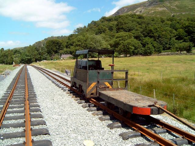
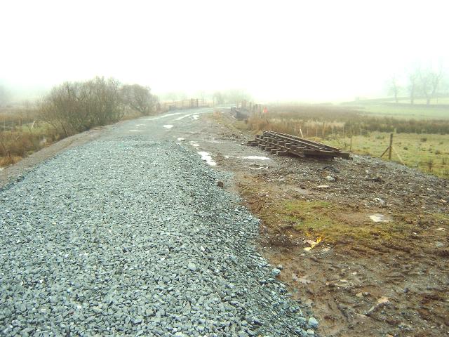
This northerly view (13/7/03) shows the shunter Harold with flat battery at Plas-y-nant siding, now laid to full length. Click on the image to enlarge. This image is copyright B W Hughes taken on Samsung Digimax 230 digital camera. Image post processed using iPhoto Plus4 image correction technology and displayed at 96dpi.
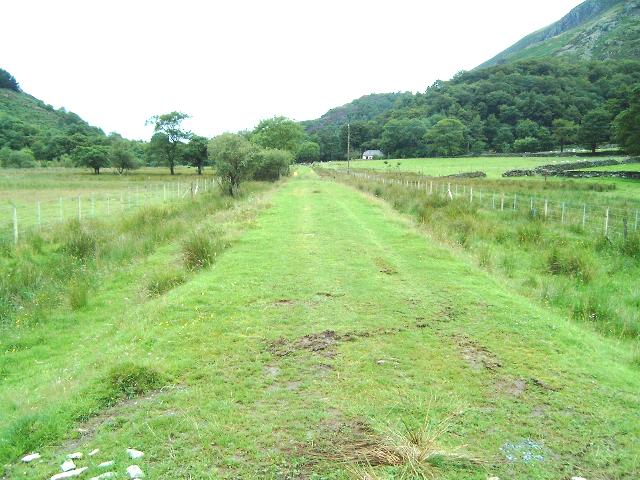
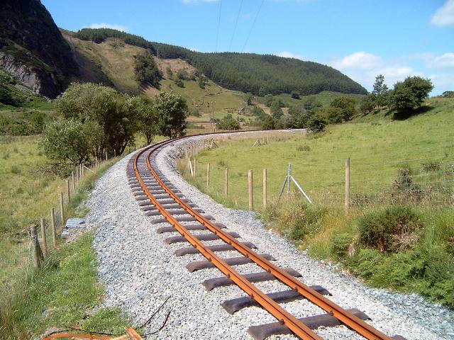
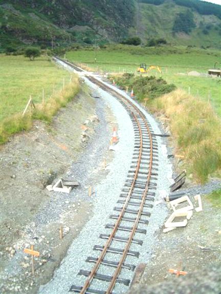
This northerly view (2/8/02) with the reverse angle from that above shows the site of Plas-y-nant Halt. The newly installed side fencing reveals the width required by the new loop and platforms. The loop will begin at Ch.9200 and extend around the curve in the distance to Ch.9500, some 300m long. The platforms will only be constructed for the first 60m from Ch.9220-9280 approx. Click on the image to enlarge. This image is copyright B W Hughes. Image taken on Samsung Digimax230 digital camera using iPhoto Plus4 image correction technology. Image displayed at 96dpi.

This northerly view (28/4/03) from LC42 shows the double track ballasting near the middle of the loop. Click on the image to enlarge. This image is copyright B W Hughes. Image taken on Samsung Digimax230 digital camera using iPhoto Plus4 image correction technology. Image displayed at 96dpi.
This northerly view (6/7/03) shows the tracklaying completed at LC42 with the siding in the distance (right). Click on the image to enlarge. This image is copyright B W Hughes taken on Samsung Digimax 230 digital camera. Image post processed using iPhoto Plus4 image correction technology and displayed at 96dpi.
This southerly view (2/8/02) LC42 at Ch.9350 shows the southern end of the loop which will curve a little way around the corner. The Afon Gwyrfai is to the right at the corner. Click on the image to enlarge. This image is copyright B W Hughes. Image taken on Samsung Digimax230 digital camera using iPhoto Plus4 image correction technology. Image displayed at 96dpi.

This southerly view (6/7/03) from a similar viewpoint to that above shows the track laid south from LC42. For the time being, the easterly loop track will not be laid. Click on the image to enlarge. This image is copyright B W Hughes taken on Samsung Digimax 230 digital camera. Image post processed using iPhoto Plus4 image correction technology and displayed at 96dpi.
This northerly view (2/8/02) from Ch.9500 shows the position of the southern loop point. This location was the supposed junction with the Ty'n-y-Weirglodd Quarry branch to the right. However, there is little evidence that the branch was ever completed although Boyd shows a siding here (perhaps anticipating traffic). Click on the image to enlarge. This image is copyright B W Hughes. Image taken on Samsung Digimax230 digital camera using iPhoto Plus4 image correction technology. Image displayed at 96dpi.
This northerly view (26/1/03) from Ch.9500 shows the position of the southern loop point, which is visible stored on the right. This was placed in position at Xmas. Click on the image to enlarge. This image is copyright B W Hughes. Image taken on Samsung Digimax230 digital camera using iPhoto Plus4 image correction technology. Image displayed at 96dpi.

This northerly view (30/10/02) shows the southern end of Plas-y-nant loop from Ch.9500 approx. The trackbed did not appear wide enough for the southern loop point at this time. Progress on the trackbed was very limited south of this point. Click on the image to enlarge. This image is copyright B W Hughes. Image taken on Samsung Digimax230 digital camera using iPhoto Plus4 image correction technology. Image displayed at 96dpi.

This northerly view (6/7/03) shows plain track laid at the southern end of the Plas-y-nant loop with the future point pushed to one side by the tree. Click on the image to enlarge. This image is copyright B W Hughes taken on Samsung Digimax 230 digital camera. Image post processed using iPhoto Plus4 image correction technology and displayed at 96dpi.

This close-up view (14/4/02) of the Plas-y-nant loop area shows the route left to right just above the trees. When the Plas-y-nant estate was sold in the 1990s, the FR took advantage and bought a strip of land alongside the railway to construct the 200 m long loop and associated side platforms at this location. Click on the image to enlarge. This image is copyright B.W.Hughes. Slide scan technology utilised is Olympus ES10 & iPhoto Plus4. Slide scanned at 200dpi.
This easterly view (9/8/02) from the Tros-y-gol public footpath shows the widening of the northern half of the loop at Plas-y-nant. Click on the image to enlarge. This image is copyright B.W.Hughes. Image taken on Samsung Digimax 230 digital camera using iPhoto Plus4 image correction technology and displayed at 96dpi.
This easterly close-up view (9/8/02) from the Tros-y-gol public footpath shows the widening of the northern half of the loop at Plas-y-nant. Click on the image to enlarge. This image is copyright B.W.Hughes. Image taken on Samsung Digimax 230 digital camera using iPhoto Plus4 image correction technology and displayed at 96dpi.
Riverside section

This southerly view (30/10/02) from Ch.9500 shows the trackbed cleared with the Afon Gwyrfai to the right. Other than basic clearance and consolidation, little work on the trackbed had been done south of this point at this time. Click on the image to enlarge. This image is copyright B W Hughes. Image taken on Samsung Digimax230 digital camera using iPhoto Plus4 image correction technology. Image displayed at 96dpi.
This southerly view (26/1/03) from Ch.9500 shows the same viewpoint as that above. The trackbed is now ballasted and sleeper packs have been laid out over this section to Ty'n-y-weirglodd cutting. The section north for 100m remains to be fenced even at this late stage. Click on the image to enlarge. This image is copyright B W Hughes. Image taken on Samsung Digimax230 digital camera using iPhoto Plus4 image correction technology. Image displayed at 96dpi.
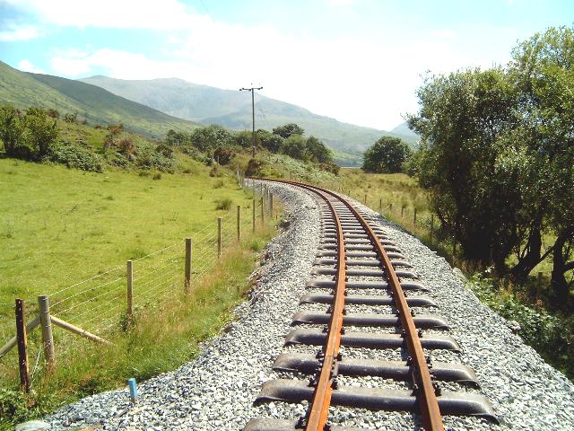
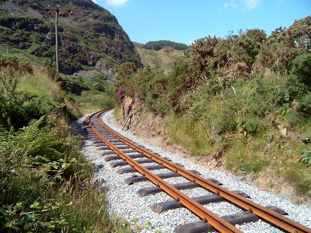
This southerly view (6/7/03) shows the track laid from a similar viewpoint to the above image. The sinuous curves are along the Afon Gwyrfai river bank. Click on the image to enlarge. This image is copyright B W Hughes taken on Samsung Digimax 230 digital camera. Image post processed using iPhoto Plus4 image correction technology and displayed at 96dpi.
This northerly view (25/6/02) shows the riverside section around Ch.9600 beyond the north end of the Plas-y-nant loop. At this point the railway is running along the banks of the Afon Gwyrfai (left). Click on the image to enlarge. This image is copyright WHLR, courtesy Jan Woods with post processing by iPhoto Plus4. Image displayed at 96dpi.
This northerly 2001 view shows the left hand curve in the overgrown trackbed at Ch.9600. At this point the railway is running along the banks of the Afon Gwyrfai (left). Click on the image to enlarge. This image is copyright WHLR, courtesy Jan Woods with post processing by iPhoto Plus4. Image displayed at 96dpi.
This northerly view (12/7/03) shows the track now laid from a similar viewpoint to that above. Click on the image to enlarge. This image is copyright B W Hughes taken on Samsung Digimax 230 digital camera. Image post processed using iPhoto Plus4 image correction technology and displayed at 96dpi.
This northerly view (2/8/02) from Ch.9650 shows the position of the proposed LC43 accommodation crossing where the boggy patch is. The Afon Gwyrfai approaches from the left and runs alongside the alignment from where the trees start. Click on the image to enlarge. This image is copyright B W Hughes. Image taken on Samsung Digimax230 digital camera using iPhoto Plus4 image correction technology. Image displayed at 96dpi.
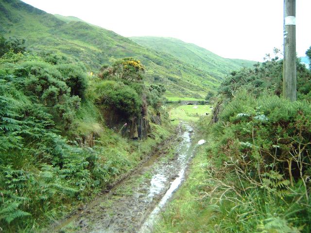
This southerly view (30/10/02) shows a very damp spot at LC43 (Ch.9600). Jones Bros. had just begun to consolidate the track at this point on this date, including some drainage works covered by slate waste (left). Click on the image to enlarge. This image is copyright B W Hughes. Image taken on Samsung Digimax230 digital camera using iPhoto Plus4 image correction technology. Image displayed at 96dpi.
This southerly view (30/10/02) shows fencing works still underway at Ch.9650. The Afon Gwyrfai has now swung away to the right. Click on the image to enlarge. This image is copyright B W Hughes. Image taken on Samsung Digimax230 digital camera using iPhoto Plus4 image correction technology. Image displayed at 96dpi.
This southerly view (26/1/03) from a similar viewpoint to that above shows the completed ballasted trackbed. Packs of sleepers have been laid out ready for tracklaying around Easter. Click on the image to enlarge. This image is copyright B W Hughes. Image taken on Samsung Digimax230 digital camera using iPhoto Plus4 image correction technology. Image displayed at 96dpi.
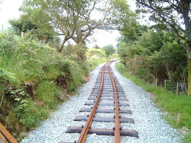
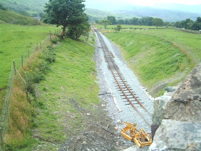
This southerly view (6/7/03) shows the Head of Steel some 30 lengths south of the Plas-y-nant point from a similar viewpoint to the image above. Click on the image to enlarge. This image is copyright B W Hughes taken on Samsung Digimax 230 digital camera. Image post processed using iPhoto Plus4 image correction technology and displayed at 96dpi.
This southerly view (12/7/03) shows the track now laid from a similar viewpoint to that above. Click on the image to enlarge. This image is copyright B W Hughes taken on Samsung Digimax 230 digital camera. Image post processed using iPhoto Plus4 image correction technology and displayed at 96dpi.
This northerly view (6/7/03) shows the Head of Steel at Ch.9694. Click on the image to enlarge. This image is copyright B W Hughes taken on Samsung Digimax 230 digital camera. Image post processed using iPhoto Plus4 image correction technology and displayed at 96dpi.
This southerly view (30/10/02) shows fencing works complete at Ch.9700. At this time only basic clearance of the trackbed had been completed. Click on the image to enlarge. This image is copyright B W Hughes. Image taken on Samsung Digimax230 digital camera using iPhoto Plus4 image correction technology. Image displayed at 96dpi.
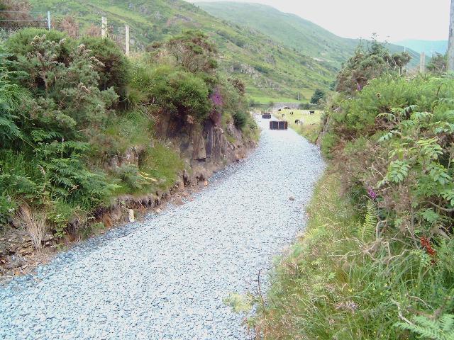
This southerly view (30/10/02) shows fencing works complete at Ty'n-y-weirglodd cutting. At this time only basic clearance of the trackbed had been completed. Click on the image to enlarge. This image is copyright B W Hughes. Image taken on Samsung Digimax230 digital camera using iPhoto Plus4 image correction technology. Image displayed at 96dpi.
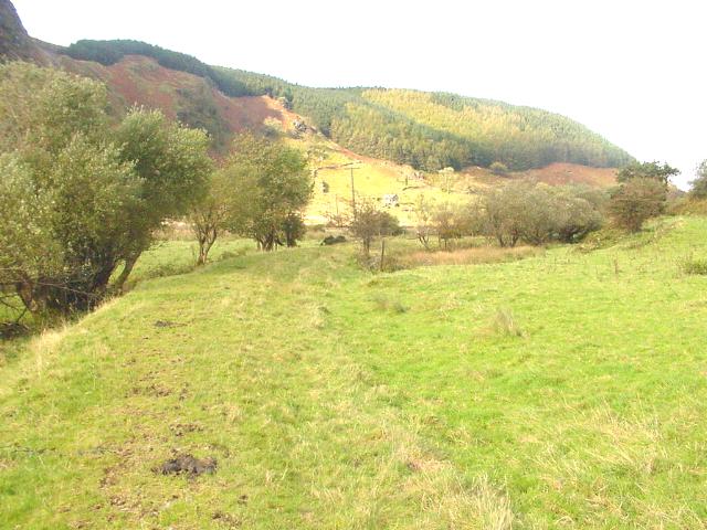
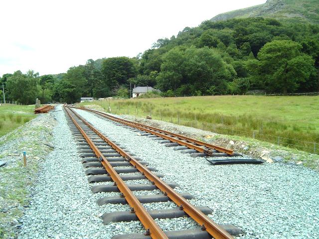
This northerly 2001 view from the north end of the Ty'n-y-Weirglodd rock cutting shows the track curving along the banks of the Afon Gwyrfai at Ch.9800. The south end of Plas-y-nant loop is just 300m away at Ch.9500. The section south of Plas-y-nant loop features wide pastures with the Afon Gwyrfai in close proximity. Click on the image to enlarge. This image is copyright WHLR, courtesy Jan Woods with post processing using iPhoto Plus4. Image displayed at 96dpi.
This northerly view (30/10/02) shows the scene from the same viewpoint as that above a year on. At this time only basic clearance of the trackbed had been completed. Click on the image to enlarge. This image is copyright B W Hughes. Image taken on Samsung Digimax230 digital camera using iPhoto Plus4 image correction technology. Image displayed at 96dpi.
This northerly view (26/1/03) from a similar viewpoint to that above shows the completion of ballasting on this section from Ch.9500 to Ch.9800. Packs of sleepers have been placed for the tracklayers at Easter. Click on the image to enlarge. This image is copyright B W Hughes. Image taken on Samsung Digimax230 digital camera using iPhoto Plus4 image correction technology. Image displayed at 96dpi.
This northerly view (12/7/03) shows the track now laid from a similar viewpoint to that above. Click on the image to enlarge. This image is copyright B W Hughes taken on Samsung Digimax 230 digital camera. Image post processed using iPhoto Plus4 image correction technology and displayed at 96dpi.
Rock Cutting section
A deep rock cutting takes the railway through a spur onto the Castell Cidwm straight.

This southerly view (2/8/02) from Ch.9750 shows the start of the curve into Ty'n-y-Weirglodd cutting with Snowdon behind (left of the electricity supply post). Click on the image to enlarge. This image is copyright B W Hughes. Image taken on Samsung Digimax230 digital camera using iPhoto Plus4 image correction technology. Image displayed at 96dpi.
This southerly view (12/7/03) shows the track now laid from a similar viewpoint to that above. Click on the image to enlarge. This image is copyright B W Hughes taken on Samsung Digimax 230 digital camera. Image post processed using iPhoto Plus4 image correction technology and displayed at 96dpi.
This easterly view (2/8/02) from Ch.9800 shows the short Ty'n-y-Weirglodd rock cutting with OB71 at Castell Cidwm visible beyond. Click on the image to enlarge. This image is copyright B W Hughes. Image taken on Samsung Digimax230 digital camera using iPhoto Plus4 image correction technology. Image displayed at 96dpi.
This easterly view (6/7/03) shows the track now ballasted in Ty'n-y-weirglodd cutting. This image is now instant history as track has now been laid through this cutting. Click on the image to enlarge. This image is copyright B W Hughes taken on Samsung Digimax 230 digital camera. Image post processed using iPhoto Plus4 image correction technology and displayed at 96dpi.
This easterly view (12/7/03) shows the track now laid from a similar viewpoint to that above. Click on the image to enlarge. This image is copyright B W Hughes taken on Samsung Digimax 230 digital camera. Image post processed using iPhoto Plus4 image correction technology and displayed at 96dpi.
This easterly view (26/1/03) from the same viewpoint as that above shows the end of the ballast bed at Ch.9818 at Ty'n-y-weirglodd cutting where the wooden plank crosses the line. The alignment is marked out with construction levels beyond this point. Click on the image to enlarge. This image is copyright B W Hughes. Image taken on Samsung Digimax230 digital camera using iPhoto Plus4 image correction technology. Image displayed at 96dpi.
This westerly view (30/10/02) shows east end of the Ty'n-y-weirglodd cutting. At this time only basic clearance of the trackbed had been completed. Click on the image to enlarge. This image is copyright B W Hughes. Image taken on Samsung Digimax230 digital camera using iPhoto Plus4 image correction technology. Image displayed at 96dpi.
This westerly view (26/1/03) from Ch.9800 shows the position of the end of the ballast bed at Ch.9818 in Ty'n-y-weirglodd cutting. Click on the image to enlarge. This image is copyright B W Hughes. Image taken on Samsung Digimax230 digital camera using iPhoto Plus4 image correction technology. Image displayed at 96dpi.
This westerly view (12/7/03) shows the track now laid from a similar viewpoint to that above. Click on the image to enlarge. This image is copyright B W Hughes taken on Samsung Digimax 230 digital camera. Image post processed using iPhoto Plus4 image correction technology and displayed at 96dpi.

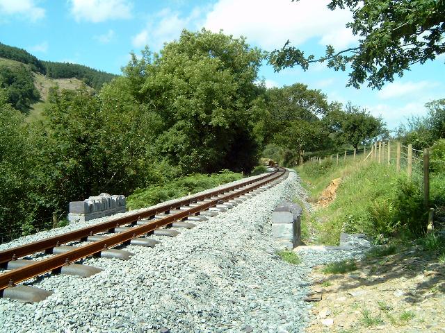
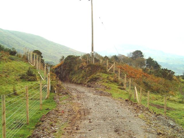
This northerly view (12/7/03) shows the straight section laid between Ty'n-y-weirglodd Cutting and LC44 with Castell Cidwm bridge, OB71, in the background. Click on the image to enlarge. This image is copyright B W Hughes taken on Samsung Digimax 230 digital camera. Image post processed using iPhoto Plus4 image correction technology and displayed at 96dpi.
This westerly view (16/4/01) from the main road bridge OB71 at Castell Cidwm shows the vertical sided rock cutting as the railway cuts through a spur and heads east for the former NWNGR terminus at Quellyn. Click on the image to enlarge. This image is copyright B.W.Hughes. Slide scan technology utilised is Olympus ES10 & iPhoto Plus4. Slide scanned at 200dpi.

This westerly view (3/6/02) shows the trackbed now fenced at Ty'n-y-Weirglodd cutting from LC44 at Ch.9920. This narrow vertical sided rock cutting is reminiscent of Tyler's Cutting on the FR. Click on the image to enlarge. This image is copyright WHLR, courtesy Jan Woods with post processing by iPhoto Plus4. Image displayed at 96dpi.
This westerly view (26/1/03), from Castell Cidwm bridge, shows the trackbed levelled and with rolled slate fines between Ch.9800 and Ch.9900. Click on the image to enlarge. This image is copyright B W Hughes. Image taken on Samsung Digimax230 digital camera using iPhoto Plus4 image correction technology. Image displayed at 96dpi.
LC44
This westerly view (6/7/03) from LC44 shows the trackbed ballasted immediately west of the level crossing. Click on the image to enlarge. This image is copyright B W Hughes taken on Samsung Digimax 230 digital camera. Image post processed using iPhoto Plus4 image correction technology and displayed at 96dpi.
This easterly 2001 view from UB70 at Ch.9850 shows straight approaching Castell Cidwm A4085 road bridge (OB71). The track curves into the bridge in a rising cutting. Passengers will also get there first views on Snowdon around here (extreme right). Click on the image to enlarge. This image is copyright WHLR, courtesy Jan Woods with post processing using iPhoto Plus4. Image displayed at 96dpi.

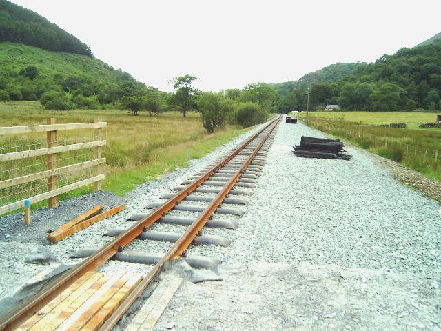
This easterly view (12/7/03) shows the Head of Steel at LC44. The final splice took place just west of the level crossing, about 30m further on. Plant material is seen parked on the access to LC44. Click on the image to enlarge. This image is copyright B W Hughes taken on Samsung Digimax 230 digital camera. Image post processed using iPhoto Plus4 image correction technology and displayed at 96dpi.
This westerly view (12/7/03) shows the Head of Steel from LC44. The final splice took place just west of the level crossing in the foreground. Click on the image to enlarge. This image is copyright B W Hughes taken on Samsung Digimax 230 digital camera. Image post processed using iPhoto Plus4 image correction technology and displayed at 96dpi.
This northerly view (17/7/03) shows the pw team cutting the final splice just west of LC44 to complete the track between Waunfawr and Rhyd Ddu for the first time since 1941. Click on the image to enlarge. This image is copyright Clive Briscoe taken on a digital camera. Image post processed using iPhoto Plus4 image correction technology and displayed at 96dpi.
This westerly view (17/7/03) shows the final length of track being clipped down just west of LC44. In the background, Harold awaits duty. Click on the image to enlarge. This image is copyright WHLR courtesy Jan Woods taken on a digital camera. Image post processed using iPhoto Plus4 image correction technology and displayed at 96dpi.
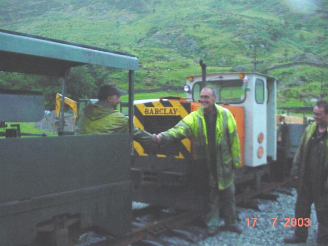
This easterly view (17/7/03) shows the drivers of WHR(P) shunter Taxi-2 and FR Harold shaking hands at the historic joining just west of LC44. Unfortunately, after several days of hot sunshine the skies opened on the proceedings but spirits were undaunted! Click on the image to enlarge. This image is copyright WHLR courtesy Jan Woods taken on a digital camera. Image post processed using iPhoto Plus4 image correction technology and displayed at 96dpi.
This easterly view (6/7/03) shows the trackbed remains to be made up east of LC44 to allow access for the bridgeworks. This work was scheduled to be completed as soon as Celtest ( van visible working on a Sunday) had completed the drilling of holes for chairs under the bridge. This image is copyright B W Hughes taken on Samsung Digimax 230 digital camera. Image post processed using iPhoto Plus4 image correction technology and displayed at 96dpi.
This westerly view (15/4/01) also from OB71 shows the route curving in a boggy cutting under OB71, the Castell Cidwm road bridge. Beyond the accommodation crossing LC44, the route is on a shallow embankment over UB70 and then disappears into the deep rock cutting mentioned above. Click on the image to enlarge. This image is copyright B.W.Hughes. Slide scan technology utilised is Olympus ES10 & iPhoto Plus4. Slide scanned at 200dpi.
This westerly view (24/11/01) shows the route from OB71 pegged out with yellow fence line pegs and red centreline pegs. Some fencing has already taken place at the rock cutting in the distance. The tractor ruts reveal that Achnashean's vehicles have already traversed the trackbed at this point. Once fenced in, contractors will be able to start constructing this section early in the New Year. Click on the image to enlarge. This image is copyright B.W.Hughes. Slide scan technology utilised is Olympus ES10 & iPhoto Plus4. Slide displayed at 96dpi.

This westerly view (9/8/02) shows Achnashean are finally getting the fencing done on this section, the last indeed to be fenced. Click on the image to enlarge. This image is copyright B.W.Hughes. Image taken on Samsung Digimax 230 digital camera using iPhoto Plus4 image correction technology and displayed at 96dpi.
Fencing had been completed along the south side of the line by 26/8/02 but remained incomplete on the north side as late as 31/10/02 awaiting the resolution of a land dispute, settled in early November.
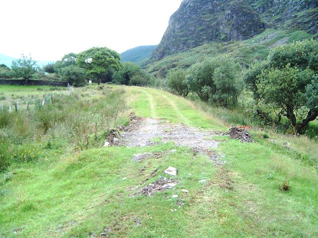
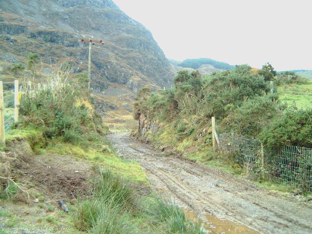
This westerly view (31/10/02) shows the Jones Bros. worksite at Ch.10000 for the underpinning of the Castell Cidwm bridge. Work was initially impeded by lack of access. At this time only basic clearance of the trackbed had been completed. A week later the County Sheriff had ensured that access to the trackbed was granted as deemed under the WHR TWO. Click on the image to enlarge. This image is copyright B W Hughes. Image taken on Samsung Digimax230 digital camera using iPhoto Plus4 image correction technology. Image displayed at 96dpi.
OB71 requires a small amount of work to provide additional clearance for the modern loading gauge. This has exacerbated problems at the bridge site, which has accumulated water for a number of years. The cutting to the north is being excavated and there will be some excavation under the bridge itself. While scraping mud from the trackbed and attempting to dig a deep drainage ditch on the north side, the contractors found an extensive glacially smoothed rock base. This required some rethinking and a hydraulic rock pecker was brought in to shatter the rock and provide a drainage channel.
This westerly view (1/12/02) shows the contractor had hit rock while increasing the trackbed depth for improved clearance under OB71. The rock can also be seen to be blocking the drainage ditch to the right. Click on the image to enlarge. This image is copyright B W Hughes. Image captured from a Hitachi D8 camcorder using iPhoto Plus4 image correction technology. Image displayed at 96dpi.
This westerly view (23/12/02) shows that Jones Bros. have succeeded in excavating the trackbed through the rock base. A small amount of work is necessary to excavate the drainage ditch (right) but the wide diameter French drain has been laid both sides of the obstruction and covered with slate chips. Click on the image to enlarge. This image is copyright B W Hughes. Image taken on Samsung Digimax230 digital camera using iPhoto Plus4 image correction technology. Image displayed at 96dpi.
This westerly view (30/3/03) from the same viewpoint shows the trackbed now fully cleared and drainage installed. Ballasting is complete in the distance to LC44 but has been left on the bridge approach to allow access for the reinforcement of the abutments exposed by the deepening of the formation. The ballasting was still required on 30/5/03. Click on the image to enlarge. This image is copyright B W Hughes. Image taken on Samsung Digimax230 digital camera using iPhoto Plus4 image correction technology. Image displayed at 96dpi.
This westerly view (12/7/03) shows the completed track west of OB71 as joined two days previously. The final splice took place just west of the level crossing visible in the distance. To allow the track to be straight under the bridge in view of the clearance problem, the alignment sweeps more to the right than expected and the concrete inspection cess that collected water from the spring in the field to the right will have to be repositioned. Click on the image to enlarge. This image is copyright Chris Price taken on a Fuji digital camera. Image post processed using iPhoto Plus4 image correction technology and displayed at 96dpi.
Castell Cidwm bridge (OB71)
GCC repointed and waterproofed the bridge in the Autumn of 2000 along with the Pitt's Head road bridge.

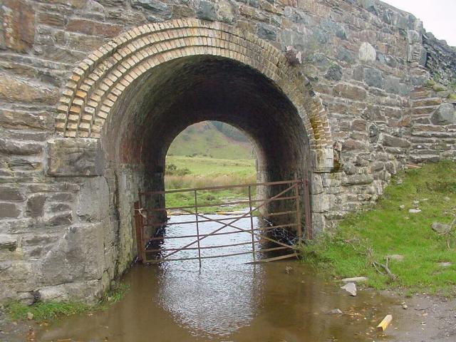
This southerly view (8/10/00) shows OB71, the A4085 road bridge at Ch.10000. During September and October 2000, GCC repointed the bridge as this was easier to do before the railway works began. They also repointed Pitt's Head road bridge in August/September. Click on the image to enlarge. This image is copyright B.W.Hughes. Slide scan technology utilised is Olympus ES10 & iPhoto Plus4. Slide scanned at 200dpi.
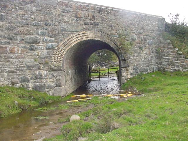
This easterly 2001 view shows the west face of OB71, the A4085 bridge at Castell Cidwm. some flooding has occurred here as the formation drains towards the viewpoint. Click on the image to enlarge. This image is copyright WHLR, courtesy Jan Woods and post processed with iPhoto Plus4. Image displayed at 96dpi.
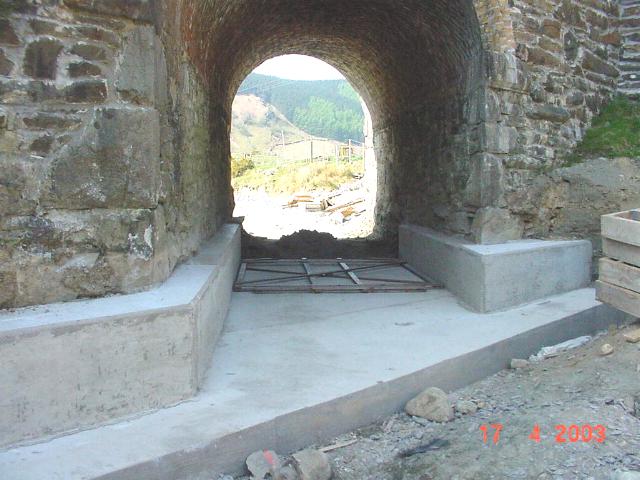
This easterly view (17/4/03) shows the concrete haunches and base slab built to reinforce the abutments after the foundations of OB71 were exposed by the excavation of the trackbed to obtain greater clearance for the new rolling stock. The clearance through this bridge has been found wanting using the gauge frame seen under the bridge. Click on the image to enlarge. This image is copyright WHLR courtesy Jan Woods taken on a digital camera. Image post processed using iPhoto Plus4 image correction technology and displayed at 96dpi.
The bridge was completed by Jones Bros. but unfortunately has been found to have insufficient vertical clearance. A similar problem occurred at Rhostryfan Road bridge during Phase 2. The solution here has been to fix the track directly to the concrete floor. The new concrete haunches built to brace the abutments have been trimmed back to allow for the kinematic profile of the rolling stock. Special base plates have been constructed to bolt directly to the concrete floor.
At first the base plates were held in alignment by rails and the bolts secured with epoxy cement in the pre-drilled holes. Next the base plates were lowered to give a minimum gap of 20cm over the uneven concrete floor. Finally this gap was grouted to provide even support to the base plates. This work was completed by 16/7/03. A long term solution maybe to rebuild the bridge.

This easterly view (6/7/03) shows the Celtest concrete trimming work reaching a conclusion on OB71. Click on the image to enlarge. This image is copyright B W Hughes taken on Samsung Digimax 230 digital camera. Image post processed using iPhoto Plus4 image correction technology and displayed at 96dpi.
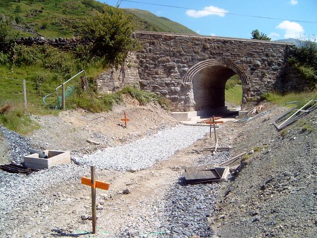
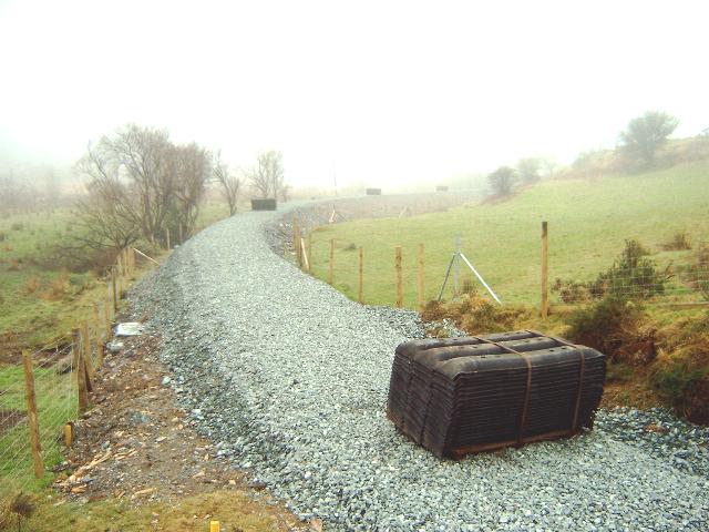
This southerly view (12/7/03) shows the formation ballasted on the approach to OB71. This has always been a wet location and the opportunity has been taken to place geotextile under the ballast to prevent mud pumping up into the formation.. Click on the image to enlarge. This image is copyright B W Hughes taken on Samsung Digimax 230 digital camera. Image post processed using iPhoto Plus4 image correction technology and displayed at 96dpi.

This southerly view (12/7/03) shows the rails ready for laying the following day. Sets of three holes have been drilled at 70cm intervals to secure the specially designed steel base plates complete with Pandrol clips. Click on the image to enlarge. This image is copyright B W Hughes taken on Samsung Digimax 230 digital camera. Image post processed using iPhoto Plus4 image correction technology and displayed at 96dpi.
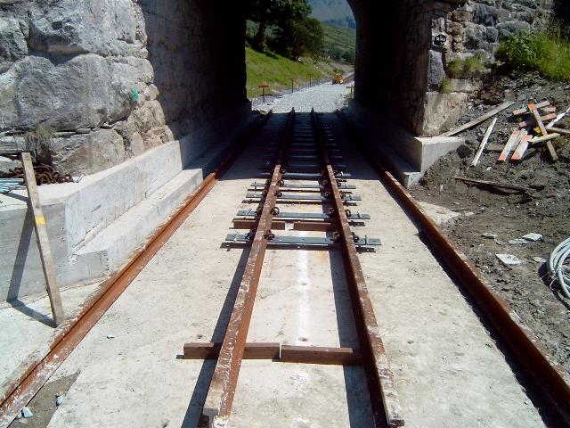
This easterly view (13/7/03) shows the rails being used to hold the clips in the correct alignment while the epoxy cement sets around the securing bolts. Click on the image to enlarge. This image is copyright B W Hughes taken on Samsung Digimax 230 digital camera. Image post processed using iPhoto Plus4 image correction technology and displayed at 96dpi.
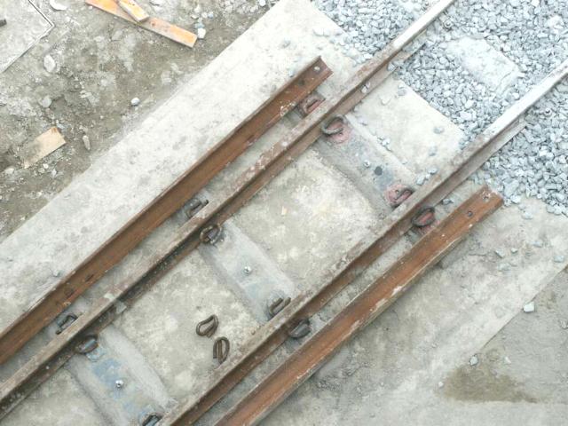
This vertical view (16/7/03) shows the base plates now grouted to the concrete under OB71. Click on the image to enlarge. This image is copyright Ben Fisher taken on a digital camera. Image post processed using iPhoto Plus4 image correction technology and displayed at 96dpi.

This easterly 2001 view shows the wide cutting at the former temporary Quellyn Terminus. There was a run-round loop here in NWNGR days. Click on the image to enlarge. This image is copyright WHLR, courtesy Jan Woods with post processing using iPhoto Plus4. Image displayed at 96dpi.
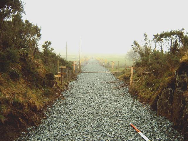
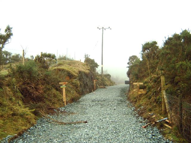
By 23/12/02, no work had been done on the short 140m section south of OB71 to the boundary with the WHLR contract at Ch.10140. This section requires no more than basic trackbed construction.
This southerly view (26/1/03) from Castell Cidwm bridge shows the trackbed marked out south of the bridge with yellow posts. A water main crosses the track immediately south of the bridge. Progress in expected here in February. Click on the image to enlarge. This image is copyright B W Hughes. Image taken on Samsung Digimax230 digital camera using iPhoto Plus4 image correction technology. Image displayed at 96dpi.
This southerly view (30/3/03) from the same viewpoint shows the trackbed now fully cleared and drainage installed. Ballasting had still not been completed by 30/5/03 and was awaiting the successful resolution of the gauging problem through the bridge. Click on the image to enlarge. This image is copyright B W Hughes. Image taken on Samsung Digimax230 digital camera using iPhoto Plus4 image correction technology. Image displayed at 96dpi.
This easterly view (12/7/03) shows the completed track south from the bridge. Click on the image to enlarge. This image is copyright Chris Price taken on a Fuji digital camera. Image post processed using iPhoto Plus4 image correction technology and displayed at 96dpi.
This westerly 2001 view shows the east face of OB71. There will be a slight amount of deepening through the bridge. The route curves to the left the other side of the bridge in a marshy cutting. Click on the image to enlarge. This image is copyright WHLR, courtesy Jan Woods with post processing using iPhoto Plus4. Image displayed at 96dpi.
By 30/5/03, Jones Bros. had still not resolved the kinematic profile issue at this bridge. The gauge frame that determines the rolling profile of the stock (allowing for swaying) was still on site. This is Jones Bros. last job before they complete their contract. As a consequence, the trackbed is not yet ballasted for the 140m southeast of the bridge, nor the formation completed west of the bridge to the correct levels for some 100m to LC44.
This westerly view (17/4/03) shows the east face of OB71. The concrete base has been cast and the haunch supports for the abutments have also been completed. These structures effectively brace the abutments as their foundations have been excavated to provide depth for the increased loading gauge. Click on the image to enlarge. This image is copyright WHLR, courtesy Jan Woods with post processing using iPhoto Plus4. Image displayed at 96dpi.
Clearance through this bridge has proved unsatisfactory as the kinematic loading gauge seen in the bridge, fouls in terms of height. The temporary solution has been to do away with wooden sleepers and bolt the track direct to the new concrete foundation with base-plates that are already in stock at Dinas.

This westerly view (6/7/03) shows the concrete haunch supports cut back to improve clearances through OB71. Click on the image to enlarge. This image is copyright B W Hughes taken on Samsung Digimax 230 digital camera. Image post processed using iPhoto Plus4 image correction technology and displayed at 96dpi.
Click here to visit the Castell Cidwm - Glan yr Afon page
Click here to return to Stop Press page
Site Development
If you have suggestions for development of this site, please contact me by
email at the address on the Stop Press page.
Comments
Please add any comments you may have in my Guestbook.
Page Version 3.22 Dated 20/7/03.