WHR
Waunfawr-Betws Garmon
area page
V3.13 updated 8/2/03
New images on this page updated 26/1/03.
Click here for start of new images
Click here for latest news of progress
Click here for JC Sreeves latest construction map
Locations
The A4085 runs along the west side the line from Waunfawr station to Betws Garmon at Ch 6860. The next section begins at Ch. 7000 at the river bridge immediately south of the station. The formation is alongside the road from Ch. 6200 to Ch. 6720 at LC28. There are no other public locations. However, customers of the Snowdonia Park Hotel/campsite may view the line from its premises, which includes a large car park alongside the route. The station car park is just south of the pub car park. An access track runs through the caravan site and crosses the headshunt by a level crossing.
The headshunt stop block was at Ch.5877 approximately (estimated). After a short section in woods, the railway runs alongside the road from Ch. 6200 to Ch. 6700. The road bends to the west and the railway continues behind Gwyrfai Terrace. The Hafod-y-wern (Victoria) Quarry branch crosses the road at the Betws Garmon station entrance. The station is visible from the road and the A4085 bridge over the Afon Gwyrfai but scrub obstructs the view.
After a short rise at 1 in 120, the line rises gently at 1 in 600 from Waunfawr towards Betws Garmon station, which is level.
First Train on the new Line
This northerly view from March 2001 shows Upnor Castle propelling wagons south of the Waunfawr Headshunt onto the new line. The WHR Brakevan is attached to the rear of the train. Click on the image to enlarge. This image is copyright WHLR courtesy of Jan woods.
After laying some ballast over the first 200 metres, the decision was taken to await the arrival of a tamper rather than dig the track into an unsatisfactory alignment. No more works trains are expected on this section until the tamper is back in action.
The WHLR Ltd. has set up a small tamping team. During the week ending 17/11/02 they have been placing 'top up' ballast along section from Waunfawr to Betws Garmon and preparing the new tamper. Volunteers have also done some manual horizontal track alignment in preparation.
Apparently, the tamper has been tested to 4" of tilt without toppling over. However, the packing gangs were requested to pack the track up where one of the rails was more than an inch lower than the other rail. If both rails dipped by the same amount, the track does not require attention.
The first tamping pass is to lock track horizontally and get some ballast up under sleepers to hold the track in place. After that the track will be lifted and canted during a second pass to tamp and pack the track in its final position.
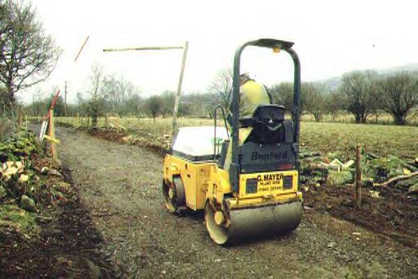
The tamper was finally noted at work by 26/11/02 and initial impressions were very favourable.
Most of the trackbed to Betws Garmon appeared lined and tamped by 1/12/02.
This easterly view (30/11/02) shows the tamper parked with the ballast train and Upnor Castle south of the stop blocks at Waunfawr. It appeared that most of the track had been tamped between Betws Garmon and Waunfawr. Click on the image to enlarge. This image is copyright B W Hughes taken on a Hitachi D8 digital camcorder VM-D865LE 230. Image post processed using iPhoto Plus4 image correction technology and displayed at 96dpi.
Waunfawr-Betws Garmon clearance starts
A Resident Engineer has been appointed who will run the outside contracts and the direct labour civils projects. Marker posts have been planted every 10 metres from Waunfawr to Betws Garmon.
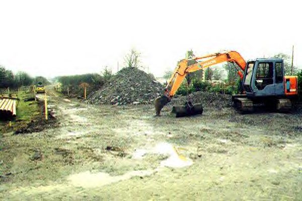
Work started in mid-November on the section from Waunfawr to Betws Garmon. Temporary fencing has been erected and a tracked excavator has scraped off the trackbed earth. The ten-week schedule sees tracklaying to Betws Garmon as early as February, given good weather! This will allow Betws Garmon to be established as the pw base for Phase 3, clear of the existing running line. Rail is in stock for this length. Points kits are being prepared at Dinas for Betws Garmon yard and Plasynant loop. The Chattendon mess coach and associated tool van has been rebuilt for the Phase 3 works train, which may stable at Betws Garmon.
The 300 metres from Tan-y-ffordd (Ch. 6700) to Betws Garmon (Ch. 7000) was cleared and levelled and hard core put down in November. The EAG extended the cleared section south from Waunfawr from Ch. 6020 to 6100 over the weekend 25/26 November.
Waunfawr
From Waunfawr, the railway runs in a gentle easterly curve until it meets the A4085. A shallow cutting is visible from LC22 at Waunfawr station, until the railway disappears into woodland. The new WHR Dudley Park Granite Quarry Branch (inspected 13/10/26) left the line in the area of LC22 following the angled boundary of the Snowdonia Park caravan site up to main road where it crossed via an ungated crossing. Here wagons were run under a loading chute. It is not reported if WHR locos used this short 100 m branch.
This southerly view (15/7/00) shows the way ahead from the Waunfawr headshunt. Work will start here soon to extend the line to Rhyd Ddu for opening at Easter 2002. Click on the image to enlarge. This image is copyright B.W.Hughes. Slide scan technology utilised is Olympus ES10 & iPhoto Plus4. Slide scanned at 200dpi.

This northerly view (16/12/00) shows the Mountaineer reversing from Waunfawr headshunt to the run round loop. Tracklaying started here on 3/3/01 to extend the line to Betws Garmon to establish a pw depot there with a shed for Upnor Castle. A yellow marker in the trackbed indicates a surveyor's peg. Click on the image to enlarge. This image is copyright B.W.Hughes. Slide scan technology utilised is Olympus ES10 & iPhoto Plus4. Slide scanned at 200dpi.
Phase 3 tracklaying begins
Work reached Waunfawr headshunt by Xmas. WHLR laid off staff after Xmas, reducing the track workforce to five awaiting the completion of the trackbed ready for tracklaying in the Spring. Work proceeded from LC27 towards Waunfawr headshunt. New culverts were installed and the trackbed rolled flat with slate waste. Sleepers were placed on the trackbed on 20/2/01 and tracklaying commenced on 3/3/01.
This southerly view (23/12/00) shows the difference at the headshunt just a week after the previous shot. Once drainage and fencing is complete the track will be laid to Betws Garmon station in the Spring to establish the major construction base there for Phase 3. Click on the image to enlarge. This image is copyright B.W.Hughes. Slide scan technology utilised is Olympus ES10 & iPhoto Plus4. Slide scanned at 200dpi.

This southerly view (18/2/01) shows the trackbed south from LC23 at Waunfawr headshunt. Two months of progress have produced a well-drained rolled slate base. Click on the image to enlarge. This image is copyright B.W.Hughes. Slide scan technology utilised is Olympus ES10 & iPhoto Plus4. Slide scanned at 200dpi.

This northerly view (19/2/01) shows WHLR trackwork staff at the Waunfawr headshunt with Mountaineer running round on the first train of the day. RRMs have been delivered to the site to transport rail from Waunfawr yard to the headshunt. As no siding is available at Waunfawr yet, the new rails were laid between the rails of the run-round loop and were probably transported there by train from Dinas. Click on the image to enlarge. This image is copyright B.W.Hughes. Slide scan technology utilised is Olympus ES10 & iPhoto Plus4. Slide scanned at 200dpi.

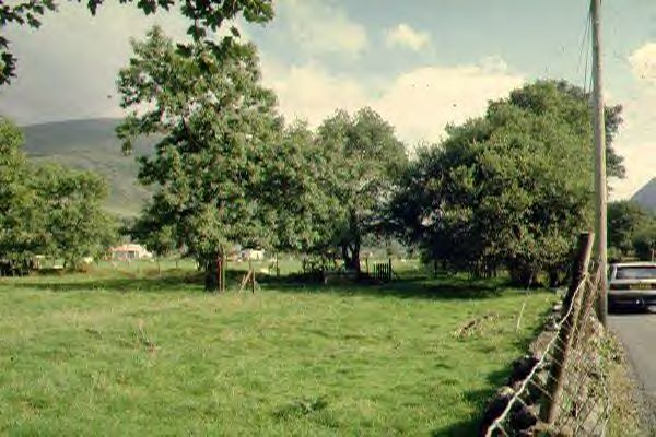
This northerly roadside view (15/9/01) shows Upnor Castle stabled on the new formation just south of the Waunfawr headshunt. This type of wooden topped fencing is for fields where animals might graze (horses in this case). The loco is not allowed along the extension to Betws Garmon until the section is ballasted and tamped. Click on the image to enlarge. This image is copyright B.W.Hughes. Slide scan technology utilised is Olympus ES10 & iPhoto Plus4. Slide scanned at 200dpi.
This southerly view (4/3/01) was taken by the volunteer track gang from LC23 as they completed their weekend of work. Six lengths were laid on wooden sleepers south from Waunfawr headshunt to UB45. Click on the image to enlarge. This image is copyright Stan Owen.
This southerly view (16/12/00) shows basic clearance done by volunteers just south of Waunfawr headshunt at Ch. 5950. Mechanised progress is advancing through the wood towards Waunfawr. The main road is to the right. Click on the image to enlarge. This image is copyright B.W.Hughes. Slide scan technology utilised is Olympus ES10 & iPhoto Plus4. Slide scanned at 200dpi.
This southerly view (18/2/01) shows the same view with the completed trackbed over UB45. The main road follows the line of trees to the right. The trackbed has been rolled level. Click on the image to enlarge. This image is copyright B.W.Hughes. Slide scan technology utilised is Olympus ES10 & iPhoto Plus4. Slide scanned at 200dpi.

This northerly view (16/12/00) shows the view from Ch. 6000 back towards Waunfawr. Click on the image to enlarge. This image is copyright B.W.Hughes. Slide scan technology utilised is Olympus ES10 & iPhoto Plus4. Slide scanned at 200dpi.
This northerly view (18/2/01) shows the completed UB46 with trackbed rolled over it. On this date the trackbed was complete as far as Ch. 6300 where major works were required on culvert UB47. Click on the image to enlarge. This image is copyright B.W.Hughes. Slide scan technology utilised is Olympus ES10 & iPhoto Plus4. Slide scanned at 200dpi.

This northerly view (20/2/01) shows the completed trackbed at UB45. The pile of wooden sleepers had just been placed at the headshunt and the track position had been marked on the trackbed with yellow paint. In the distance, two RRMs were placed by the headshunt ready for tracklaying to commence 2 weeks later. Click on the image to enlarge. This image is copyright B.W.Hughes. Slide scan technology utilised is Olympus ES10 & iPhoto Plus4. Slide scanned at 200dpi.
This southerly view (16/12/00) shows the limit of mechanised work on this date at Ch. 6000 approx. Slotted trackside drains are being inserted at an early stage to prevent the track becoming the mudbath that Phase 2 became. Click on the image to enlarge. This image is copyright B.W.Hughes. Slide scan technology utilised is Olympus ES10 & iPhoto Plus4. Slide scanned at 200dpi.
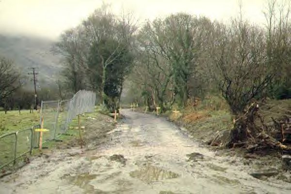
This easterly view (7/4/01) shows the head of steel at LC24 at Ch. 6137 as taken from the main road. F&M restrictions require a disinfected straw mat to protect the entrance to the worksite. The ballast bed also ends just beyond here. Click on the image to enlarge. This image is copyright B.W.Hughes. Slide scan technology utilised is Olympus ES10 & iPhoto Plus4. Slide scanned at 200dpi.
This southerly view (16/12/00) shows the finished trackbed curving to the right with the road over the fence to the right. This location is LC24 at Ch.6150 approx. Click on the image to enlarge. This image is copyright B.W.Hughes. Slide scan technology utilised is Olympus ES10 & iPhoto Plus4. Slide scanned at 200dpi.
This southerly view (28/4/01) shows the newly laid track south of LC24 with the permanent fencing being built up around this level crossing. A rail store has been built just south of this location. Click on the image to enlarge. This image is copyright B.W.Hughes. Slide scan technology utilised is Olympus ES10 & iPhoto Plus4. Slide scanned at 200dpi.
Roadside section
After LC24, an accommodation crossing, the railway curves south to run parallel with the road, just over the fence on a shallow embankment. Immediately north of LC27, a former mineral branch trails sharply in towards Betws Garmon. This served two quarries on the east side of the Afon Gwyrfai, Treflan and Gareg Fawr Slate quarry.
The formation is wide here as the mineral branch ran parallel with two points forming a run round for the quarry branch using the main line in NWNGR days. A rationalised simple junction and trap point sufficed from 1922 until the quarries shut in 1928. From LC28 at Ch. 6700, the railway curves a little to the south and disappears behind Gwyrfai Terrace, as the road turns sharply to the south. The isolated 11 house terrace is built in the same type of brick as the NWNGR station buildings.
This northerly view (16/12/00) at Ch. 6300 approx. shows the railway alongside the road just north of LC25. This section is well drained despite being in a cutting. Click on the image to enlarge. This image is copyright B.W.Hughes. Slide scan technology utilised is Olympus ES10 & iPhoto Plus4. Slide scanned at 200dpi.
This northerly view (16/12/00) shows the view from LC26 at Ch. 6440. The roadside work is attracting a lot of interest from passing traffic. Two large trees hem in the trackbed north of LC25. Click on the image to enlarge. This image is copyright B.W.Hughes. Slide scan technology utilised is Olympus ES10 & iPhoto Plus4. Slide scanned at 200dpi.
This southerly view (16/12/00) shows a gap in the works just north of LC25 for the culvert UB47 to be completed. There is also evidence of a wood recycler being used (right foreground) rather than accumulate debris in off-line storage areas as on Phase 2. The coloured poles protect an overhead power line. Click on the image to enlarge. This image is copyright B.W.Hughes. Slide scan technology utilised is Olympus ES10 & iPhoto Plus4. Slide scanned at 200dpi.
This northerly view (18/2/01) shows the incomplete trackbed at UB48. As well as the two culverts, two large trees had grown in the 64 years since closure which were foul of the loading gauge. The stumps are visible in the distance at the right. The stumps undermined the trackbed when they were removed and a large hole required backfilling as a result. Click on the image to enlarge. This image is copyright B.W.Hughes. Slide scan technology utilised is Olympus ES10 & iPhoto Plus4. Slide scanned at 200dpi.

This northerly view (19/2/01) shows the removal of a difficult tree stump north of LC25. Click on the image to enlarge. This image is copyright B.W.Hughes. Slide scan technology utilised is Olympus ES10 & iPhoto Plus4. Slide scanned at 200dpi.
This view (20/2/01) shows the same location a day later with Brian Humphries rolling the infilled trackbed where the tree stump had been removed leaving a large hole. Click on the image to enlarge. This image is copyright B.W.Hughes. Slide scan technology utilised is Olympus ES10 & iPhoto Plus4. Slide scanned at 200dpi.

This northerly view (7/4/01) shows the completed culvert for UB48 at LC25 taken from the main road. This culvert was the subject of protracted negotiations with GCC as the levels of the highway drain had to be agreed. The completion of this culvert opens the way to laying ballast and track to Betws Garmon. Click on the image to enlarge. This image is copyright B.W.Hughes. Slide scan technology utilised is Olympus ES10 & iPhoto Plus4. Slide scanned at 200dpi.
The Easter tracklaying campaign saw 246 metres of track laid from Ch.6137 to Ch. 6383 from LC24 to LC25. There had been a problem at LC25 with subsidence and the trackbed had to be excavated to remove peat. Once backfilled with quarry waste a firm foundation was available to lay ballast through this location and roll it level.
The length of the ballast bed was the limiting factor in the end and it was only possible to lay a couple of lengths on the final day.
This northerly view (15/4/01) shows the head of steel as taken from the main road. Sleepers were laid at LC25 ready for the final day's tracklaying over the Easter Weekend. This area had suffered subsidence due to the presence of peat under the formation and had been stabilised only days before. Click on the image to enlarge. This image is copyright B.W.Hughes. Slide scan technology utilised is Olympus ES10 & iPhoto Plus4. Slide scanned at 200dpi.
The track levels through LC25 left something to be desired as the LC would have been too high for the adjacent road with risk of grounding for vehicles. The solution was to take the railway down a short 1 in 60 grade and back up a 1 in 60 grade, dropping the l/c by some 30 cm at this point.
This northerly view (16/4/01) was taken 24 hours later from the main road. Tracklaying has advanced over LC25 to within 7 metres of the end of the ballast bed. Click on the image to enlarge. This image is copyright B.W.Hughes. Slide scan technology utilised is Olympus ES10 & iPhoto Plus4. Slide scanned at 200dpi.
This southerly view (3/9/00) shows the trackbed on a shallow embankment south of LC26 at Ch. 6400 approx. Click on the image to enlarge. The railway runs alongside the road for about 400 metres. This image is copyright B.W.Hughes. Slide scan technology utilised is Olympus ES10 & iPhoto Plus4. Slide scanned at 200dpi.
This southerly view (18/2/01) shows the trackbed south from LC26. The rolled slate waste begins again south of this location where major work was due on two tree stumps and culverts UB47 and UB48. The trackbed slopes towards the road to channel run-off to the trackside drain installed on that side. Click on the image to enlarge. This image is copyright B.W.Hughes. Slide scan technology utilised is Olympus ES10 & iPhoto Plus4. Slide scanned at 200dpi.
This southerly view (16/4/01) shows the head of steel at the end of the Easter Track Bash as seen from the main road. Click on the image to enlarge. From this point Betws Garmon station is only 40 rail lengths away. This image is copyright B.W.Hughes. Slide scan technology utilised is Olympus ES10 & iPhoto Plus4. Slide scanned at 200dpi.
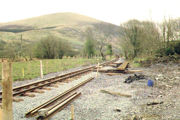
This northerly roadside view (28/4/01) shows sleepers laid out along the trackbed just north of LC27. Packs of sleepers are placed by tracked vehicles and then volunteers carry them to the extending Head of Steel. Click on the image to enlarge. This image is copyright B.W.Hughes. Slide scan technology utilised is Olympus ES10 & iPhoto Plus4. Slide scanned at 200dpi.
This easterly view (16/12/00) shows the trackbed of the Treflan Quarry branch. The narrow trackbed passed between the line of trees and over the causeway across the floodplain. A tight curve of only 48 feet radius towards Betws Garmon connected into the NWNGR. This image is copyright B.W.Hughes. Slide scan technology utilised is Olympus ES10 & iPhoto Plus4. Slide scanned at 200dpi.
This southerly view (3/9/00) shows the trackbed at LC27 at Ch. 6550 approx. The original steel rail gateposts can be seen under the trees delineating the east side of the formation. At this point a branch line trailed in from the east serving two quarries on the far side of the river. Click on the image to enlarge. This image is copyright B.W.Hughes. Slide scan technology utilised is Olympus ES10 & iPhoto Plus4. Slide scanned at 200dpi.
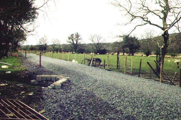
This northerly roadside view (28/4/01) shows the completed ballasted trackbed at LC27. The renewed UB49 is also visible. the ballast bed is clearly over 30 cm thick. The rolled slate waste sub base slopes to the left to aid drainage to the cess which runs along this side. Click on the image to enlarge. This image is copyright B.W.Hughes. Slide scan technology utilised is Olympus ES10 & iPhoto Plus4. Slide scanned at 200dpi.
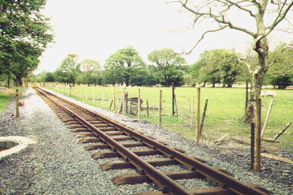
This northerly view (19/5/01) shows the completed track north from LC27. The former Treflan Quarry siding turns sharp right past the tree through the steel posts. Click on the image to enlarge. This image is copyright B.W.Hughes. Slide scanned at 200 dpi using Olympus ES10 and iPhoto Plus4 image correction technology.
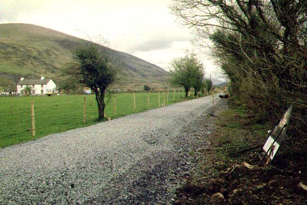
This southerly roadside view (28/4/01) shows the completed ballasted trackbed south from LC27. Tan-y-ffordd farm is in the background. Click on the image to enlarge. This image is copyright B.W.Hughes. Slide scan technology utilised is Olympus ES10 & iPhoto Plus4. Slide scanned at 200dpi.
This southerly view (19/5/01) from LC27 shows the completed track at LC27 and the head of steel approaching Tan-y-ffordd l/c. All the l/cs on this section have had their fencing completed. Click on the image to enlarge. This image is copyright B.W.Hughes. Slide scanned at 200 dpi using Olympus ES10 and iPhoto Plus4 image correction technology.
This northerly view (16/12/00) shows trackbed north from LC28 at Ch. 6700. This is the southern end of the roadside section. Click on the image to enlarge. This image is copyright B.W.Hughes. Slide scan technology utilised is Olympus ES10 & iPhoto Plus4. Slide scanned at 200dpi.
This northerly view (28/4/01) shows the trackbed being graded with ballast just north of LC28. A ballast bed 30 cm deep about 1.5 m wide is being laid on the rolled slate bed. Click on the image to enlarge. This image is copyright B.W.Hughes. Slide scan technology utilised is Olympus ES10 & iPhoto Plus4. Slide scanned at 200dpi.

This northerly view (19/5/01) shows the trackbed completed from LC28. Quarry waste has been laid over the ballast on geotextile until the l/c is completed in the next few weeks. Click on the image to enlarge. This image is copyright B.W.Hughes. Slide scanned at 200 dpi using Olympus ES10 and iPhoto Plus4 image correction technology.
This southerly view (16/12/00) shows the trackbed south from LC28 with Gwyrfai Terrace to the right and Betws Garmon station visible ahead. Slotted French drains remain to be installed here to stabilise the trackbed. Quarry waste is stored to the right. This image is copyright B.W.Hughes. Slide scan technology utilised is Olympus ES10 & iPhoto Plus4. Slide scanned at 200dpi.
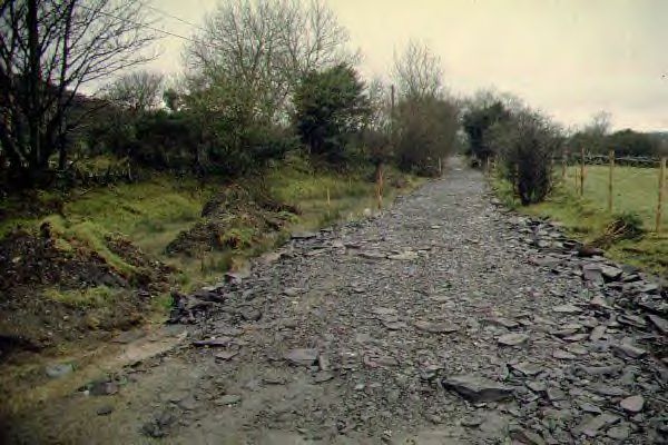
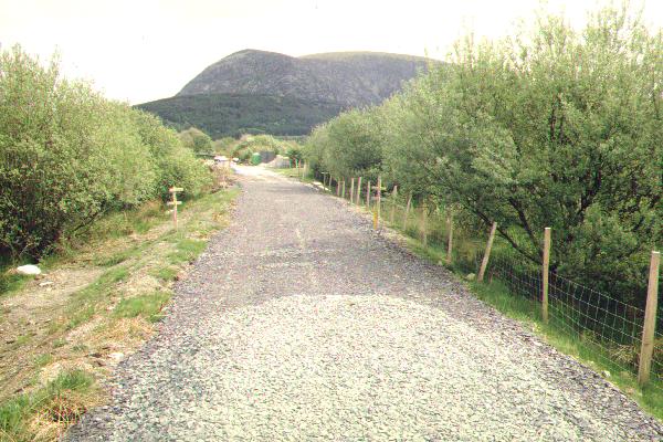
This southerly view (18/2/01) shows the trackbed from LC28 towards Betws Garmon station. This is the delivery point for slate waste used as trackbed base material. Click on the image to enlarge. This image is copyright B.W.Hughes. Slide scan technology utilised is Olympus ES10 & iPhoto Plus4. Slide scanned at 200dpi.
This southerly view (19/5/01) from LC28 at Tan-y-ffordd shows the trackbed curving into Betws Garmon station. This is an identical angle to the view above. The former ballast pile to the right has been landscaped. Click on the image to enlarge. This image is copyright B.W.Hughes. Slide scanned at 200 dpi using Olympus ES10 and iPhoto Plus4 image correction technology.
The trackbed south from LC27 to Betws Garmon station was ballasted by 7/4/01.
Betws Garmon station
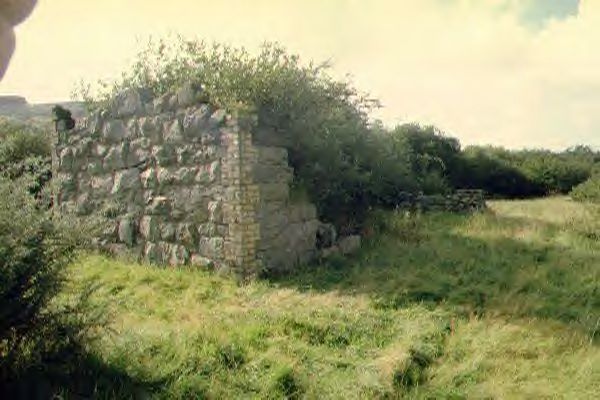
The station access road leaves the main road where the main road bends sharply east, crossing the former Hafod y Wern (Victoria) slate quarry branch. Sewage diversion works a few years ago have made this area very boggy. The station has been overgrown with gorse since then. It is largely demolished with only two walls standing and no roof. The railway ran along the east side of the building onto the Afon Gwyrfai bridge, though a sharply curved mineral loop ran around the west side of the building. This was lifted by the time the WHR took over from the NWNGR.
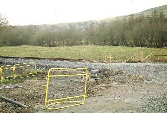
This southerly view (16/12/00) shows the view from LC29 at Ch. 6860 approx. The tramway junction deviates to the right and the station building is behind the Portacabin. A pw yard will be constructed here. Click on the image to enlarge. This image is copyright B.W.Hughes. Slide scan technology utilised is Olympus ES10 & iPhoto Plus4. Slide scanned at 200dpi.
This northerly view (19/5/01) shows the trackbed from LC29. Plant is stored in Cedric Lodge's field to the right. Click on the image to enlarge. This image is copyright B.W.Hughes. Slide scan technology utilised is Olympus ES10 & iPhoto Plus4. Slide scanned at 200dpi.
This southerly view (19/5/01) shows the limit of ballasting at Ch. 6810 near LC29. Yellow ground marks show the dumpers the guidelines for the trackbed and where to lay the ballast. Ballast is currently being dropped at this point working from Betws Garmon station. Click on the image to enlarge. This image is copyright B.W.Hughes. Slide scan technology utilised is Olympus ES10 & iPhoto Plus4. Slide scanned at 200dpi.

This southerly view (24/6/01) shows the limit of ballasting at Ch. 6830 near LC29. Yellow ground marks show the dumpers the guidelines for the trackbed and where to lay the ballast. Ballast is currently being dropped at this point working from Betws Garmon station. Click on the image to enlarge. This image is copyright B.W.Hughes. Slide scan technology utilised is Olympus ES10 & iPhoto Plus4. Slide scanned at 200dpi.
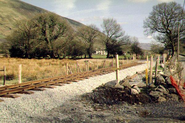
This northerly archive view shows the remains of Betws Garmon station surrounded by gorse and the trackbed running north towards Waunfawr. The station is on an embankment about 2 metres above the flood plain. The access track to the main road is to the left. Click on the image to enlarge. This image is copyright B.W.Hughes. Slide scan technology utilised is Olympus ES10 & iPhoto Plus4. Slide scanned at 200dpi.

This southerly view (16/12/00) shows the remains of the Betws Garmon station buildings. The front wall has largely gone. The trackbed has been scraped clear of gorse and topsoil and quarry waste is being applied in the foreground. Click on the image to enlarge. This image is copyright B.W.Hughes. Slide scan technology utilised is Olympus ES10 & iPhoto Plus4. Slide scanned at 200dpi.
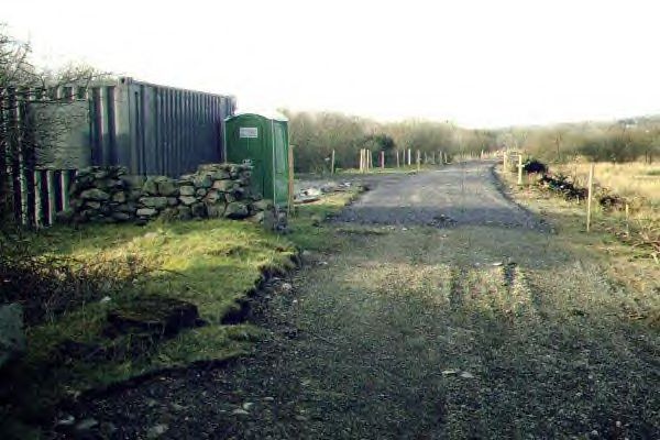
This southerly view (19/5/01) shows the site of the proposed construction siding or loop at Betws Garmon station. The main line is to the left of the station buildings (behind the container). Click on the image to enlarge. This image is copyright B.W.Hughes. Slide scan technology utilised is Olympus ES10 & iPhoto Plus4. Slide scanned at 200dpi.
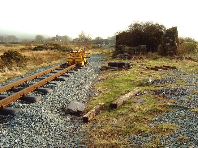
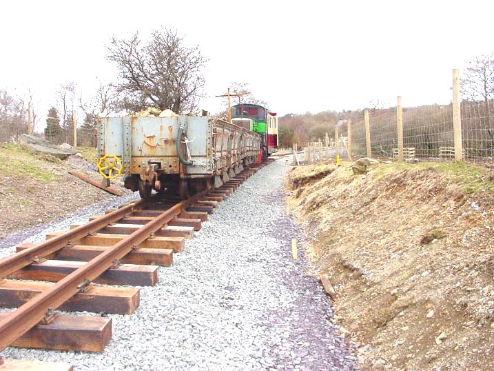
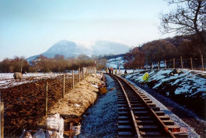
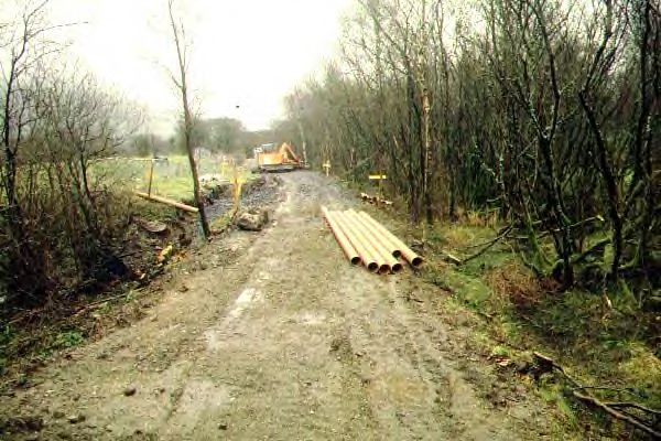
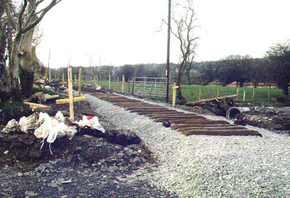
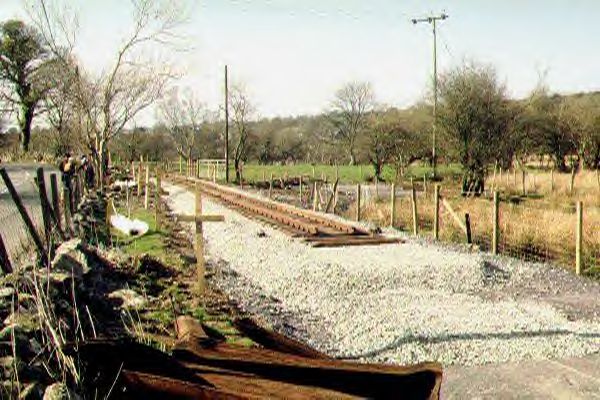
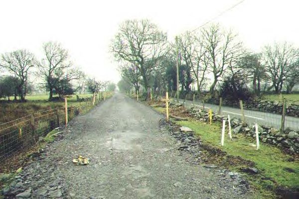
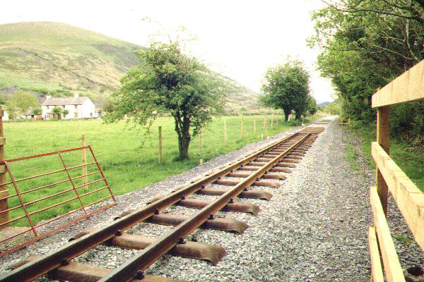
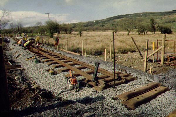
This southerly view (26/1/03) of Betws Garmon shows the current Head of Steel at Ch.6919 with RRMs shackled to the track. Click on the image to enlarge. This image is copyright B W Hughes. Image taken on Samsung Digimax230 digital camera using iPhoto Plus4 image correction technology. Image displayed at 96dpi.
This northerly view (18/2/01) shows Betws Garmon station building and the rolled slate waste trackbed towards LC27. Click on the image to enlarge. This image is copyright B.W.Hughes. Slide scan technology utilised is Olympus ES10 & iPhoto Plus4. Slide scanned at 200dpi.
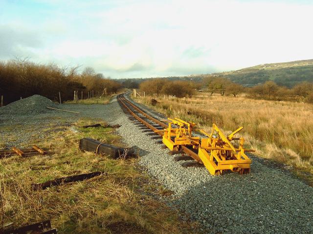
This northerly view (26/1/03) shows the Head of Steel adjacent to the former station building with RRMs shackled to the trackbed. Click on the image to enlarge. This image is copyright B W Hughes. Image taken on Samsung Digimax230 digital camera using iPhoto Plus4 image correction technology. Image displayed at 96dpi.

This southerly archive view shows the way ahead from the Betws Garmon with the bowstring bridge before its demolition in November. Work will start here in January to move the Caernarfon water main off the trackbed to follow the road visible on the right. Click on the image to enlarge. This image is copyright B.W.Hughes. Slide scan technology utilised is Olympus ES10 & iPhoto Plus4. Slide scanned at 200dpi.
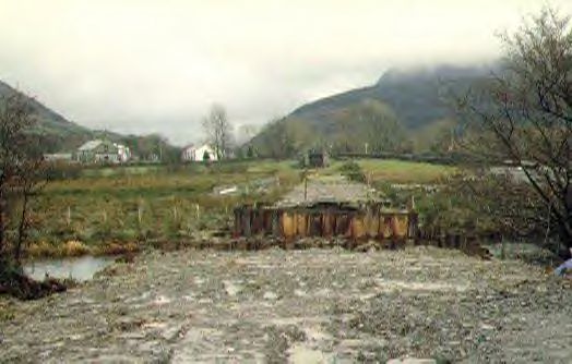
This same southerly view (16/12/00) shows the remains of UB51 following its removal in November. Piling protects both abutments to allow work to continue through the fish spawning season. Click on the image to enlarge. This image is copyright B.W.Hughes. Slide scan technology utilised is Olympus ES10 & iPhoto Plus4. Slide scanned at 200dpi.
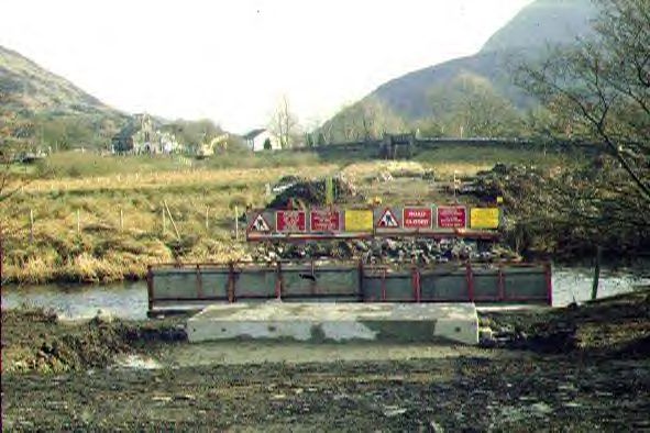
This southerly view (18/2/01) shows the completed foundations for the new Afon Gwyrfai bridge UB51. Click on the image to enlarge. This image is copyright B.W.Hughes. Slide scan technology utilised is Olympus ES10 & iPhoto Plus4. Slide scanned at 200dpi.
It is hoped to establish a major construction base at Betws Garmon station in the Summer, though later plans indicate that Plasynant could be the preferred location given the blockade on works through Bryn Gloch campsite until the Autumn and the need to replace two more river bridges.
A run round loop could be constructed around the Betws Garmon station building as was in use in the NWNGR days (lifted by 1922). This will allow the construction loco Upnor Castle to run round its train and propel the rake up the bank to Rhyd Ddu. The temporary shed removed from Wernlasddu will be based here. Unless another siding is provided (3 points required) the shed will have to be adapted to make doors at each end so it can operate as a through siding.
At the very least a siding will be required to stable pw trains clear of the main line. No mention has been made of using the Victoria Quarry branch, which appears to be an entirely independent embankment unlike that shown in Boyd.
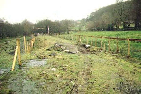
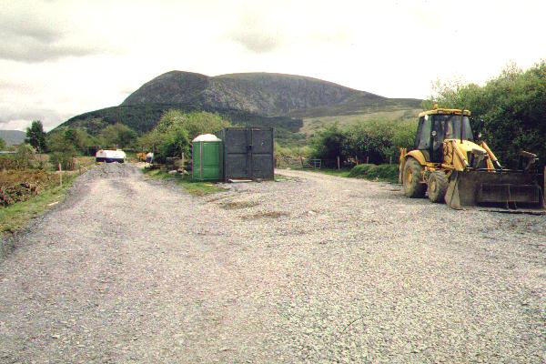
Work started at Betws Garmon station in the first week of October. The access road has been cleared of gorse, though it remains very muddy. Some quarry waste may be brought in to remedy this situation, as with the Phase 2 works. A local contractor, Triact of Colwyn Bay, was present with a grab lorry improving fencing and clearance during the last week of October.
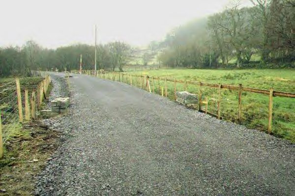
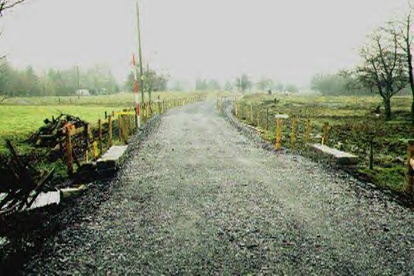
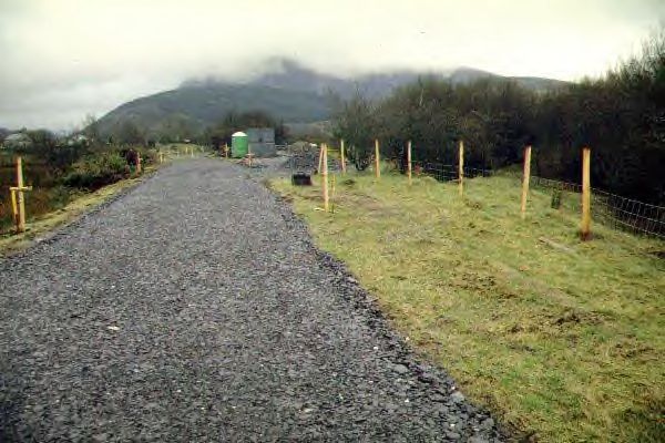
It is intended that the 1.1 km section from Waunfawr to Betws Garmon will be built by direct labour and local contractors. Fencing will precede construction work. The WHLR can only do basic clearance until it has detailed planning permission from GCC. Brush clearance must proceed before the Spring bird nesting season blockade.
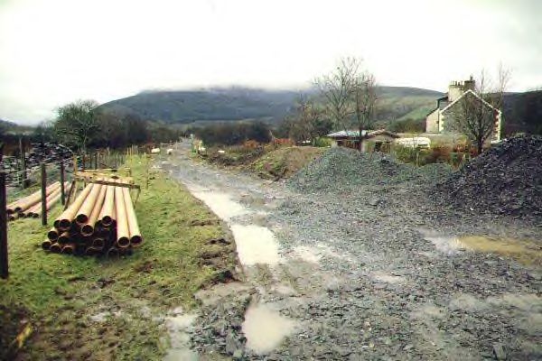
Hyder (Welsh Water) is moving the Caernarfon water supply pipeline from the trackbed to a new route following the main road (start 15/2/01). Advance works for this have taken place.
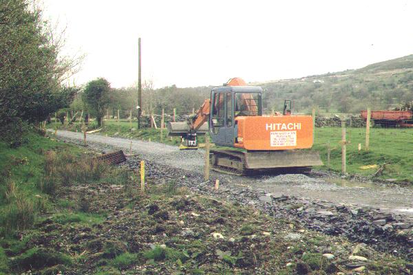
On 28/10/00, there was no sign of any access to the trackbed having been made between Waunfawr and Betws Garmon station. However, on 16/12/00, clearance had been completed along the whole section and slate waste was built up over most of the formation from Betws Garmon working north. Work had reached Ch. 6000 where local contractors were replacing UB46.
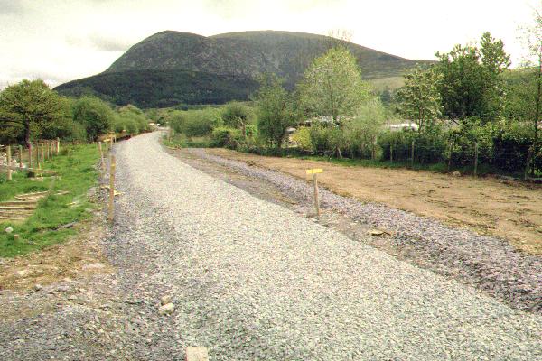
By 23/12/00, work had reached the headshunt, leaving the whole section cleared and accessible by 360 degree excavators. Trackside drains have been installed and then the trackbed levelled and ballasted. The trackbed has been made firm with slate waste with a rolled slate fines top.
On 20/2/01 wooden sleepers were placed along the trackbed and ballasting has since worked back from the headshunt to LC24 during March. Tracklaying commenced on 3/3/01 working south from the headshunt with rails moved from Waunfawr by RRMs.
The trackbed has been inclined towards the west side along the roadside section to encourage drainage towards the lineside drain installed there.
Track is being laid through the Spring to a possible pw depot to be installed at Betws Garmon (see above) ready for the big push south enabled by the completion of works on the Aberglaslyn Pass and the diversion of the water main between Bryn Gloch and Betws Garmon station.
By 15/1/01 the culvert UB44 at the headshunt had been completed and track was laid over it in March. The second culvert (of 4) has also been finished. Triact was back on site on 15/1/01 working on the new bridge abutments, adjacent flood relief arches and the formation in the area.
Clearance of the final tree stumps fouling the loading gauge was completed on 20/2/01 at UB47. Works on two culverts at UB47 and UB48 took place during March, delayed by the need to consult with GCC over levels as they connected with road drains.
Most of the trackside drainage is now completed and slate waste will make up the trackbed to the right level. A 30 cm ballast bed is being laid using supplies from the Cyrnant ballast mountain with the track continuing to follow from Waunfawr to Betws Garmon through the Spring. Final ballasting will be by pw train, followed by tamping by the now repaired Yorkshire Engines (ex-Gullick & Dobson) tamper.
By 7/4/01, tracklaying had reached Ch. 6137 at LC24, and the ballast extended a little south of here. Further ballasting had occurred for over 200 m northwards from Betws Garmon station reaching LC28. There was a major tracklaying effort over the Easter weekend bringing the track onto the roadside section at LC25.
At the end of the Easter tracklaying campaign, the Head of Steel was at Ch. 6383 at 1700 on 16/4/01 with just seven metres of ballast free ahead of the rails!
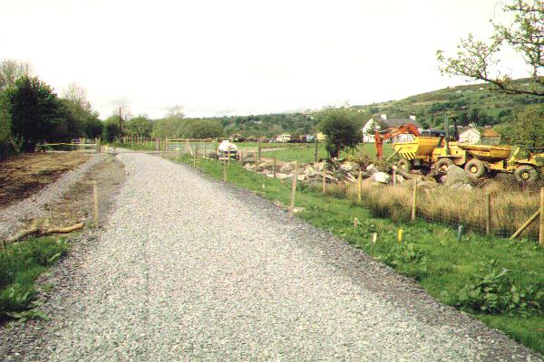
By 24/6/01, WHR tracklaying had reached Betws Garmon station at Ch. 6830. There was no further track laying in July or August as attention focussed on the rebuilding of 5 sets of points for the extension to Rhyd Ddu.
Track Scenes!

This easterly roadside view (28/4/01) shows the new rail mounted bolt tightener at work at LC25. This machine has speeded up tracklaying considerably as the track gang need only make sure the bolts are located correctly and hand tight before moving on. The tightener has a torque limiter to make sure a standard tightness is achieved. Sleepers are ticked off with chalk on completion of all 4 bolts. Click on the image to enlarge. This image is copyright B.W.Hughes. Slide scan technology utilised is Olympus ES10 & iPhoto Plus4. Slide scanned at 200dpi.
This northerly view (28/4/01) is a roadside view at LC26. The rails are being cut short as rail joints are not allowed on a l/c as the bolts would be inaccessible for later tightening. The North Wales track gang is seen locating bolts in position. The rail saw is visible cutting off the excess rail. Click on the image to enlarge. This image is copyright B.W.Hughes. Slide scan technology utilised is Olympus ES10 & iPhoto Plus4. Slide scanned at 200dpi.
Click here to visit the Betws Garmon-Cae Hywel page
Click here to return to Stop Press page
Site Development
If you have suggestions for development of this site, please contact me by email
at the address on the Stop Press page.
Comments
Please add comments in my Guestbook.
Page Version 3.13 Dated 8/2/03