WHR
Rhyd Ddu to Pont Cae'r Gors
V4.3 updated 29/6/06
Images updated from 25/6/06
Click here for Laurence Armstrong's latest WHR North map
Click here for Steve Harris' Phase 4 gradient profiles
Click here for Steve Harris' Phase 4 TWA maps
Click here for Chainages and OS Map References
Locations
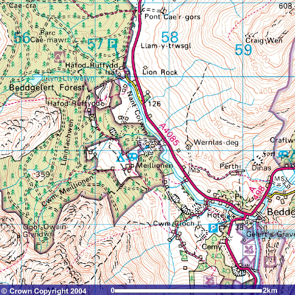
The above OS map shows the route through the Beddgelert Forest. Click on the image to enlarge. Image produced from the Ordnance Survey Get-a-map service. Image reproduced with kind permission of Ordnance Survey and Ordnance Survey of Northern Ireland.
Click here to use the free OS Get-a-map service
The railway alignment runs south-east along the east side of the A4085 on an embankment from Rhyd Ddu station to Pitt's Head Halt. The halt is named after the large rock on the west side of the railway by the road bridge OB123 which is said the resemble the 19th Century Prime Minister's head as viewed from the north.
A track and gate lead to the site of the halt at LC68 (Ch. 15650) near Cerrig Cyllau. The railway now runs into a cutting before curving under the bridge to cross to the west side of the A4085. The cutting has become flooded and is heavily overgrown. A public footpath joins the road from Ffridd Uchaf farm making a circular walk from Rhyd Ddu possible.
The alignment now runs due south through the summit bog. A wet cutting passes under a former cattle overbridge (OB124) and then reaches the summit of the WHR (197m or 646 ft.) at Ch.16180. This cutting can be seen from the parallel A4085. The trackbed runs downhill now on a shallow embankment to Pont Cae'r-Gors where it meets the public access to Beddgelert Forest car park and a forestry track at LC70 (Ch.16560). The cutting at LC20 has been filled in and resumes immediately south of the level crossing.
From this point the railway begins its steep descent of the Nant Colwyn Pass to Beddgelert. For a while the railway keeps close on the west side of the forestry track, the Afon Colwyn and the A4085. Already the railway is effectively high on an embankment above the road as the road and river drop steeply in just 2 miles to Beddgelert. The railway doubles this distance, through use of S curves and a loop into a side valley, to keep the gradient down to a manageable 1 in 40.
The alignment now curves west into the side valley of the Afon Cwm-Du, which it crosses in a horseshoe curve at UB131 (Ch.17570). There permissive paths on this section in Beddgelert Forest.
Forest Enterprise (ex Forestry Commission) has produced a map available free to residents of the campsite at Beddgelert Forest. It covers a number of way-marked paths, some of which appear to be on the WHR trackbed. These are permitted paths.
Click here for map of Walks in Beddgelert Forest.
There is a car park (from Pont Cae'r-Gors follow way-marks 51, 52, 54 and 56) and numerous walks, though the car park toilet has been demolished. One of the way-marked walks (way-marks 53, 57, 80 and 81) is nominated along the trackbed to Hafod Ruffydd.
All trees were felled on this section to Hafod Ruffydd Halt in 1998 and excellent views will be had for several years until the new planting obscures the view again (sadly before trains run in 2009).
After Cwm-Du bridge the railway resumes its southerly course and crosses a Forestry Track at LC71 (Ch.17940) which was the site of Hafod Ruffydd Halt. The alignment now runs on an embankment across pasture below Hafod Ruffydd Ganol farm where a public bridleway crosses at LC72 (Ch.18140). Shortly after the farm the route re-enters the Beddgelert Forest in an area of mature trees followed by new planting.
There is a deeply flooded cutting starting at Ch. 18550 caused by a Forestry track crossing the route at Ch. 18650. At Ch. 18600, the railway begins the first of its two famously tight S curves to loose height as it approaches the Afon Meillionen and its adjacent forestry track. The railway turns from south to north over the 300m from Ch. 18600 to Ch.18900, moving from cutting to a high embankment.
The route now moves into pasture land, passing Weirglodd-isaf cottage before encountering the second part of the S curve at Ch.19100. Over the next 300m, the railway curves through cutting from north to south and onto a shallow embankment alongside the Afon Colwyn.
The alignment re-enters Beddgelert Forest running south at Ch.19600 and crosses the Afon Meillionen via UB150 at Ch.19760. A new Forestry crossing is required here at Ch.19760. The railway now crosses the Beddgelert Forest Campsite in a shallow cutting, passing under a footbridge OB171 (Ch.19940).
There was no halt here in the previous history of the WHR but as this large and popular Forest Campsite has developed from the 1950s, it is likely to be a large source of traffic and income for the WHR from tourists travelling to Porthmadog or Caernarfon. The Beddgelert Forest Halt will be located on a straight length of trackbed at Ch.20000, the end of this section of the website.
Gradients
The railway climbs ands falls with rapidly changing grades, mostly shallow, from Rhyd Ddu to the site of Pitt's Head Halt. All the heights are within two metres and this switchback section could be made even with ballast or fill from the Rhyd Ddu stockpile.
From the A4085 road bridge the gradient steepens to 1 in 76 then finally to 1 in 46 on the climb to the short level summit section around Ch.16200. The route then drops at 1 in 104 towards Pont Cae'r-Gors.
The descent proper begins at Pont Cae'r-Gors where the gradient steepens to 1 in 40, the ruling grade for the line. The gradient is eased to 1 in 46 through the Cwm-Du curve before resuming the 1 in 40 to Hafod Ruffydd. Here there is a short easing to 1 in 46 before another 1 in 40 section. The S curve is eased to 1 in 48 and 1 in 44 with a short 1 in 40 section in the middle. Beddgelert Forest Halt is graded at 1 in 44 but the route changes to 1 in 40 again south of the halt.
Rhyd Ddu
The Phase 4 work at Rhyd Ddu includes,
1) providing a grass block car park on the old formation north of the toilets
2) a water tank either end feeding each platform
3) widening of the platform and relaying the easterly track
4) placing a new waiting shelter on the north end of the platform
5) extending the platform to the south to make it 200m long
6) providing a stock stabling siding on the west side at the south end
7) providing a short pw siding east of this and a headshunt
8) providing 3 additional station name boards
9) provision of a bus bay at the south end of the station
During early 2006, James Cyf. was providing the base for the station building on the platform with all incoming supplies, electricity, water etc. The electricity supply has already been wired into the box constructed by Phasey in the car park and heritage style lamp posts are being fitted along platform length. An order has been placed with a specialist timber building contractor for the station building. The WHRCL would like to thank David Gunn (who also spends much his time on carriage building at Boston Lodge) for managing that contract for WHRC Ltd.
The contractors will deliver the station building in pre-made sections and erect it on site. A roofing contractor will finish the slating of the roof. This will be followed by volunteers who will fit the guttering and complete the final painting etc. The building combines a shelter and a small room for operations, with a double 'barn' type door so it can also function as a small booking office when required. The shell of the building should be up around Easter with final finishing and commissioning in May.
The priority for the volunteer tracklayers over next few weeks is the completion of the platform tracks (chasing the platform construction southwards) and, as soon as the land is available, installing Rhyd Ddu yard sidings. These consist of two sidings and a headshunt. The yard point has been positioned at the very south end of Phase 3, just short of the Ch.15000 marker, so that there is room for a lockable stop block between it and the loop point. During Phase 4 construction the stop block will separate the operating railway from the construction railway. This will allow the two yard sidings to be normally available for construction trains while passenger train engines can run round, without either operation interfering with the other.
The yard sidings will be installed as soon as ground works in that area are completed by James Cyf. The water tower cleverly straddles the long carriage siding, which is designed to hold a train of approximately 10 carriages in length, once Phase 4 is open. This will give some extra flexibility e.g. stabling special trains, Gala workings, etc. during the day. The other shorter siding is intended ultimately to become a general purpose midway stabling point for engineers' trains etc.
The siding points will be controlled by a lever frame with facing point lock and on commissioning of Phase 4 it will be locked with a key on the token. The Dinas 'shunt token' system will installed with 'home' shunt signals to enable trains to run round and shunt to the sidings without needing to have the associated single line staff. The shunt limit will be about half way along the Pitt's Head straight, allowing a full train to be shunted into the yard.
In February 2006 Roland Doyle's volunteer gang had largely installed the Automatic Trailable Point Mechanism that they had built in preparation at Boston Lodge. Work to complete the Rhyd Ddu south installation will continue over next few weeks, as well as reversing the action of the previously installed north loop point ATP unit to normal RH running.
Rhyd Ddu Station Works
It was hoped contracts for the station trackbed alterations continuing to Pont Cae'r Gors would be let in late May 2005. They were in fact let in June and July, with a 16 week deadline, later extended to the end of February 2006. Track in the station area was laid in the Autumn and Winter 2005/6 closed season and the south end point moved to its new position further south. The other point, giving access to the siding, will be moved further south still and reversed in direction to start the two new sidings. A headshunt will be provided for Rhyd Ddu's two sidings. The new station was reopened in 8/4/06 and it is intended that trackwork can then advance south independently of the passenger line, which will be separated from the construction railway by a track block. The two new sidings at the south end will be used by construction trains in the interim.
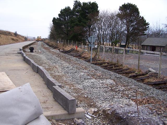
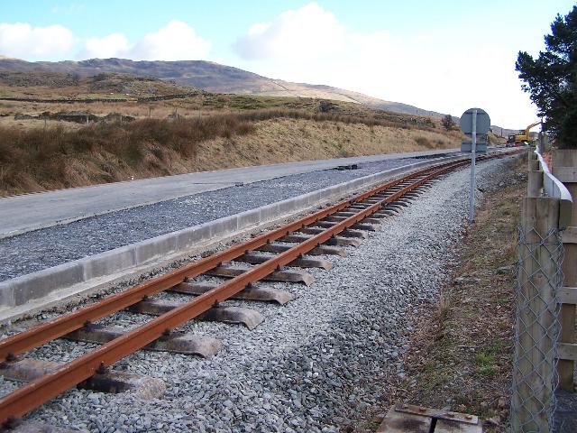
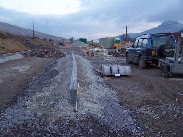
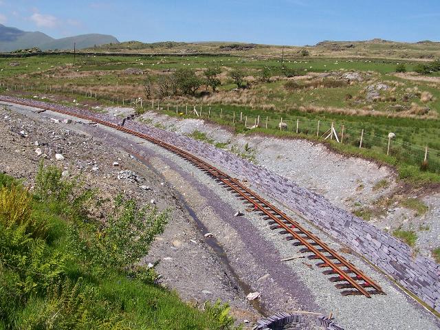
These southerly views (5/2/06 and 20/2/06) show the former run round loop removed as it was laid in bent South African rail (to be reused in Rhyd Ddu Yard). The second view shows the southbound (westerly) track being relaid and the kerbing (seen stored ready in the previous image)) laid up to it. Click on the image to enlarge. This image is copyright B.W.Hughes and was taken on a Kodak DX6490 digital camera. Image post processed using iPhoto Plus4 and displayed at 96dpi.
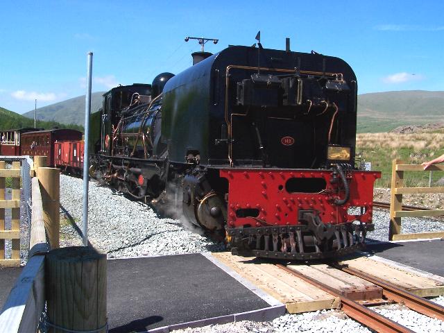
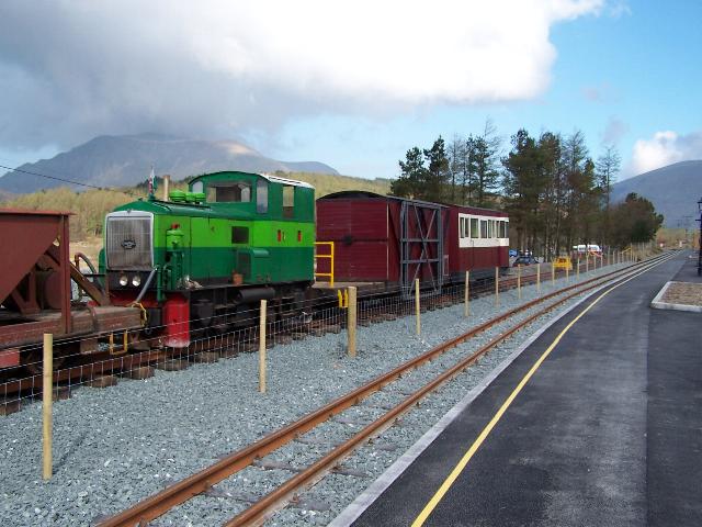
These northerly views (5/2/06 and 2/6/06) show Rhyd Ddu north. The first view shows the platform with a cut out ready for the foundations and services to be laid in place for the station building. Although James Cyf. is doing that part of the job, the wooden building itself was erected by another contractor. The second view shows the arrival of No.143 with operations switched to right hand running the day before. The level crossing platform access has recently been finished with tarmac. Click on the images to enlarge. These images are copyright B.W.Hughes and were taken on a Kodak DX6490 digital camera. Image post processed using iPhoto Plus4 and displayed at 96dpi.
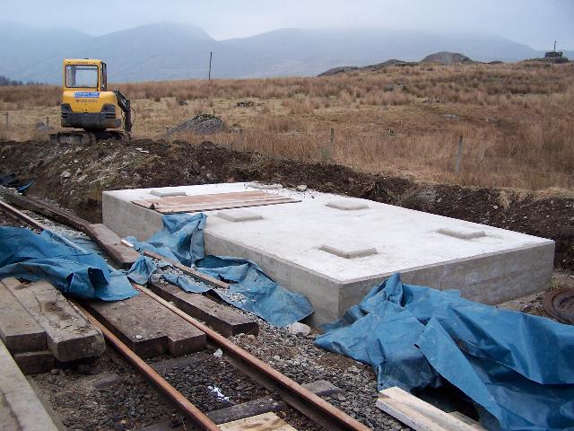

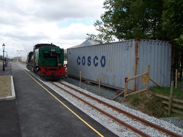
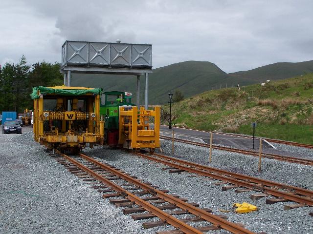
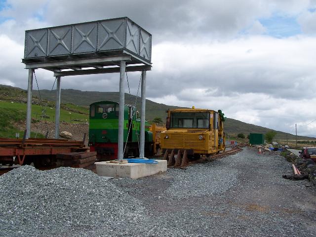
These northerly views (5/2/06 and 21/4/06) show the new water tower at Rhyd Ddu north. The first shows the base, with pads for six legs. This tower, which provides for the needs of northbound trains after their hard slog through the Beddgelert Forest 1 in 40 section, will only have a 1 inch supply! With 90 minutes between northbound trains let us hope the tank refills fast enough! The second shows Castell Caernarfon passing the water tower on a northbound service. Click on the image to enlarge. This image is copyright B.W.Hughes and was taken on a Kodak DX6490 digital camera. Image post processed using iPhoto Plus4 and displayed at 96dpi.

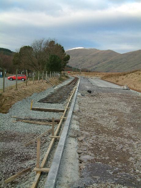
This northerly view (20/2/06) shows the newly laid track with the new western platform face. Click on the image to enlarge. This image is copyright B.W.Hughes and was taken on a Kodak DX6490 digital camera. Image post processed using iPhoto Plus4 and displayed at 96dpi.

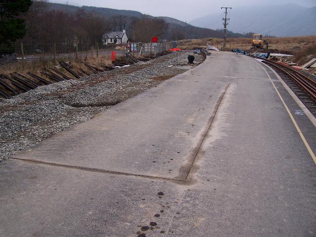
This southerly view (20/2/06) shows the new western platform face. Water and electric cable runs are being laid in the platform sub base. Click on the image to enlarge. This image is copyright B.W.Hughes and was taken on a Kodak DX6490 digital camera. Image post processed using iPhoto Plus4 and displayed at 96dpi.
This view (26/2/06) shows the SA rails being laid alongside the new western (southbound) platform face due to be surfaced with tarmac in March. Click on the image to enlarge. This image is copyright Tim Evans and was taken on a digital camera. Image post processed using iPhoto Plus4 and displayed at 96dpi.
Car park works
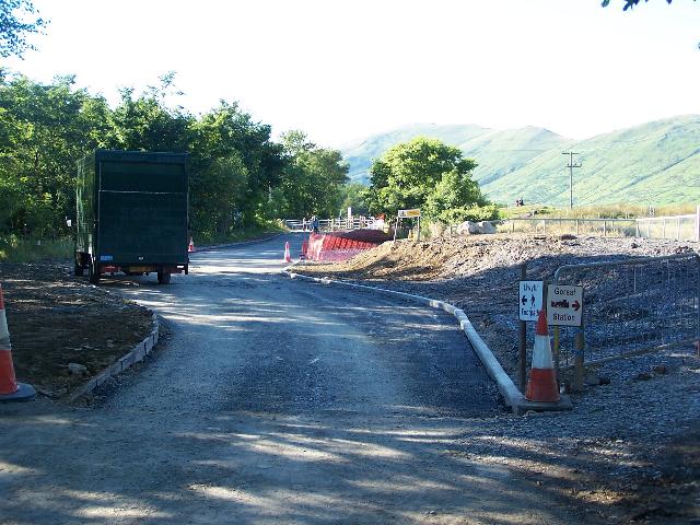
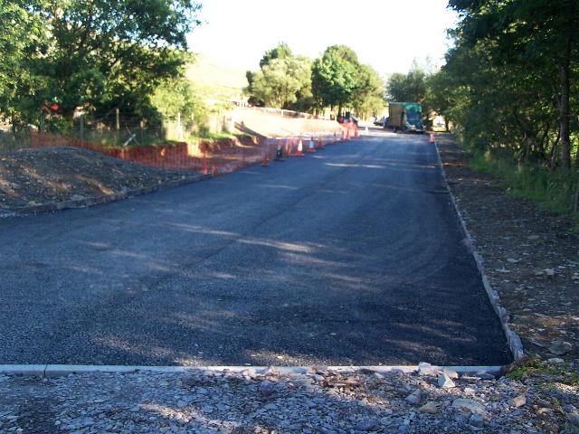
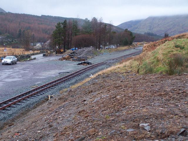
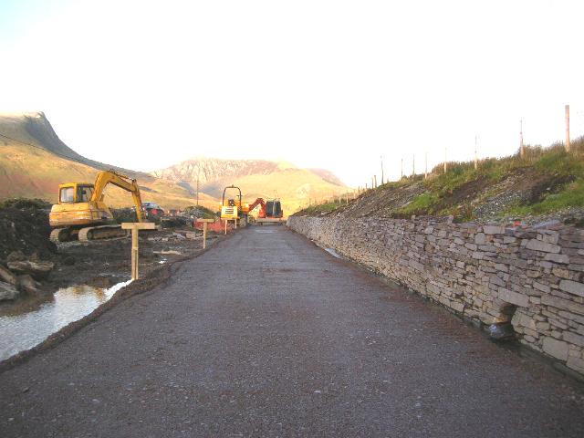
This northerly view (16/7/05) from Rhyd Ddu car park shows the new car park road constructed on the west side of the original alignment. Car park spaces will be on the east side, next to the railway. The new banking on the right provides space for a disabled access ramp. Click on the image to enlarge. This image is copyright B.W.Hughes and was taken on a Kodak DX6490 digital camera. Image post processed using iPhoto Plus4. Image displayed at 96dpi.
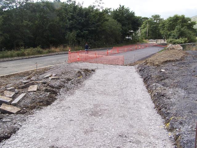
These northerly views (5/8/05, 10/8/05 and 1/10/05) from Rhyd Ddu platform access show construction of the zigzag disabled access slope and the car park bays. The second view shows the slate kerbing and a pile of steel mesh reinforcement in the car park bays, which were brought into use the following day without a tarmac surface. The third view shows the completed Grasscrete and tarmaced path. Click on the images to enlarge. These images are copyright B.W.Hughes and were taken on a Kodak DX6490 digital camera. Images post processed using iPhoto Plus4. Images displayed at 96dpi.
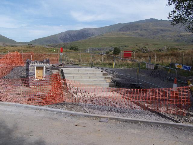
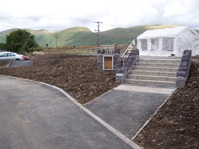
These easterly views (16/7/05 and 17/9/05) from Rhyd Ddu car park show the new station access steps and electricity cabinet. The new steps have local stone sidewalls to match the cabinet and a hand rail on the south side. The nearby ramp has also been surfaced and the former ramp to the right of the view covered in soil. Click on the images to enlarge. These images are copyright B.W.Hughes and were taken on a Kodak DX6490 digital camera. Images post processed using iPhoto Plus4 and displayed at 96dpi.
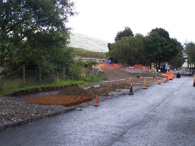

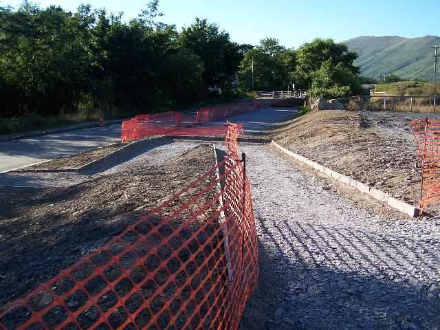
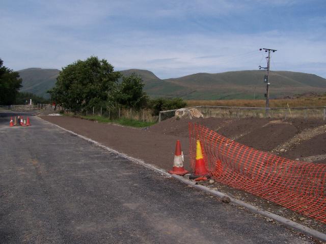
These southerly views (1/8/05, 25/8/05 and 17/9/05) from the Ffridd Isaf level crossing at Rhyd Ddu show the new car park access completed on west side of the original alignment at the north end of the station and preparations for the re-inforced concrete pour for the 'Grasscrete' surface. Car parking will be on the east side, adjacent to the railway. The final view shows the growing Grasscrete with cars parked during Super Power. Click on the image to enlarge. This image is copyright B.W.Hughes and was taken on a Kodak DX6490 digital camera. Image post processed using iPhoto Plus4. Image displayed at 96dpi.
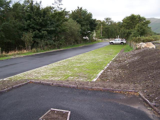
This northerly view (3/8/05) shows the completed Rhyd Ddu car park 'Grasscrete' on the east side of the original alignment at the north end of the station. Powdered peat has been spread over the Grasscrete and needs to be brushed into the X shaped holes. More peat has been spread on the side of the future site retained for a potential station building in the future. Click on the image to enlarge. This image is copyright B.W.Hughes and was taken on a Kodak DX6490 digital camera. Image post processed using iPhoto Plus4. Image displayed at 96dpi.
Work on the new bus/coach bay proceeded in fits and starts. After making the new access gaps in the wall in late July, Phasey was making the area behind the wall level on 3/9/05, when Saturday working seemed to have started. The work was complete and the bus bay apparently in use by 17/9/05.
These southerly views (3/8/05 and 17/9/05) from the main road south of Rhyd Ddu station show the new 'temporary' bus bay has been formed by two openings through the stone wall with kerbstones to delineate the edge of the tarmac. In the later view the bus bay appears to be in use. Click on the images to enlarge. These images are copyright B.W.Hughes and were taken on a Kodak DX6490 digital camera. Images post processed using iPhoto Plus4 and displayed at 96dpi.
Rhyd Ddu south
During early November, the track at the south end of the station was lifted in preparation for the platform extension and the new siding arrangements.
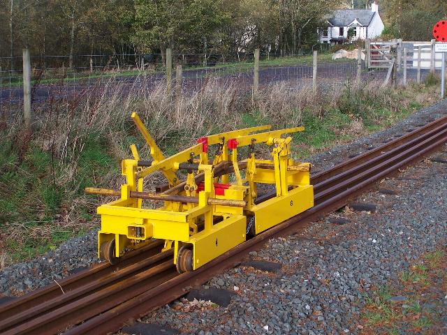
This northerly view (12/11/05) shows the newly refurbished RRMs in use at Rhyd Ddu. The RRMs have been used to lay the rails in the 'two foot' of the run round loop. Click on the image to enlarge. This image is copyright B.W.Hughes and was taken on a Kodak DX6490 digital camera. Image post processed using iPhoto Plus4. Image displayed at 96dpi.


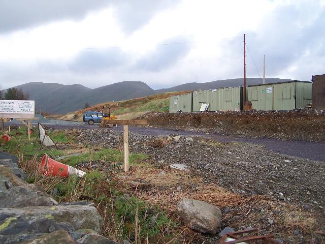
These southerly views (16/7/05, 24/10/05, 12/11/05 and 5/2/06) from Rhyd Ddu station headshunt show Phasey's Portacabin established east of the alignment on the south side of the station and, secondly, the siding removed as the Funkey runs round. The headshunt and never ballasted crossover were removed on 5/11/05. The third image shows the siding, crossover and headshunt removed. The fourth image shows the extension of the platform edge kerbing to the south on the northbound platform. Click on the images to enlarge. These images are copyright B.W.Hughes and were taken on a Kodak DX6490 digital camera. Image post processed using iPhoto Plus4 and displayed at 96dpi.
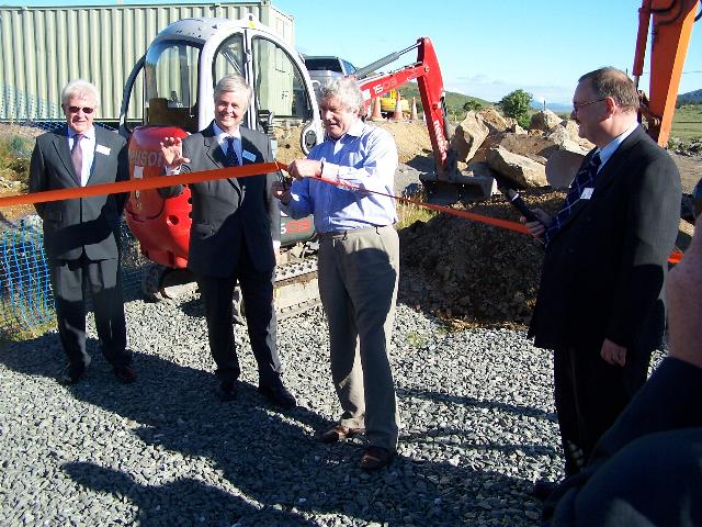
This southerly view (1/8/05) from Rhyd Ddu station headshunt shows the First Minister of the Welsh Assembly Rhodri Morgan cutting the tape to inaugurate work on Phase 4. Click on the image to enlarge. This image is copyright B.W.Hughes and was taken on a Kodak DX6490 digital camera. Image post processed using iPhoto Plus4. Image displayed at 96dpi.
From this point south chainages have been painted in white on the roadside to facilitate the walling, which was nearing completion on 12/11/05.

These southerly views (12/11/05 and 30/12/05) show the recently removed crossover, headshunt and siding. The point was moved to the south and reversed so that it forms a lead into Rhyd Ddu Yard. The yard will consist of two sidings and a headshunt. The second view shows the 5m gap at the end of the platform. All Phasey's offices are now at the roadside and the WHR track gang's green Portacabin has also appeared further south. It would seem that the platform will have a curve to the left at this point unlike the TWO plans. Click on the images to enlarge. These images are copyright B.W.Hughes and were taken on a Kodak DX6490 digital camera. Images post processed using iPhoto Plus4 and displayed at 96dpi.

This northerly view (12/11/05) shows the recently removed siding and crossover track. The crossover and siding were never ballasted, being temporary features. Click on the image to enlarge. This image is copyright B.W.Hughes and was taken on a Kodak DX6490 digital camera. Image post processed using iPhoto Plus4. Image displayed at 96dpi.

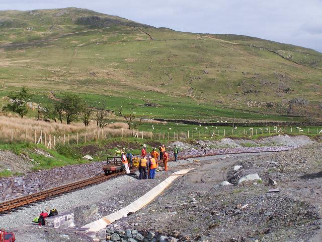
These southerly views (20/2/06 and 22/2/06) show the newly excavated space for the stabling siding and the rapid progress made two days later in filling the space with slate waste sub base. The western platform face had also been extended to the south. Click on the images to enlarge. These images are copyright B.W.Hughes and were taken on a Kodak DX6490 digital camera. Images post processed using iPhoto Plus4 and displayed at 96dpi.

This northerly views (31/3/05 and 8/1/06) at Ch.14950 show the trackbed needed levelling in this area. The right hand track is being extended to the south to lie alongside what will become the extended northbound arrival platform. The point has been moved further south. The siding to the left has been taken up to make room for the extended platform and the point removed to the viewpoint and reversed so that it leads into two sidings to the left as a train approaches from the south. Click on the images to enlarge. These images are copyright B.W.Hughes and were taken on a Kodak DX6490 digital camera. Images post processed using iPhoto Plus4 and displayed at 96dpi.

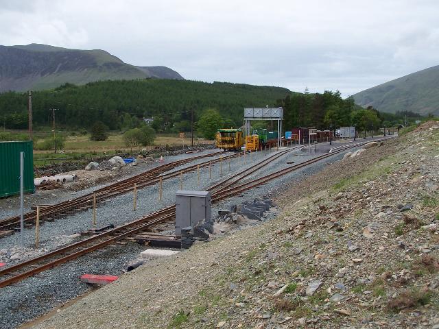
These northerly views (30/12/05, 22/2/06 and 16/4/06) show the southern extension of the platform and the completion with two face, three flower beds, a waiting shelter, water towers and platform seats and lighting. Click on the images to enlarge. These images are copyright B.W.Hughes and were taken on a Kodak DX6490 digital camera. Images post processed using iPhoto Plus4 and displayed at 96dpi.
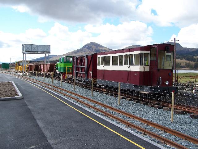
This southerly view (30/5/06) shows No.138 running north through the westerly platform face past the new temporary tamper shed. Operations switched to right hand running a few days later. By 3/6/06, the shed had acquired a solar panel facing south. Click on the image to enlarge. This image is copyright B.W.Hughes and was taken on a Kodak DX6490 digital camera. Image post processed using iPhoto Plus4 and displayed at 96dpi.
This northerly view (22/10/05) at Rhyd Ddu south taken from the temporary bus bay shows the alterations in the trackbed alignment to include Rhyd Ddu sidings. The siding has been removed and the headshunt and crossover was removed on 5/11/05. Click on the image to enlarge. This image is copyright Chris Price and was taken on a Fuji Finepix F601Z digital camera. Image post processed using iPhoto Plus4 and displayed at 96dpi.
This southerly view (20/2/06) shows the newly laid western (southbound) platform face with a slight curve. Also in view are the two bases for the water tower. The stock stabling siding will run under the tower in line with the car and trailer. Site access kindly granted by WHRCL. Click on the image to enlarge. This image is copyright B.W.Hughes and was taken on a Kodak DX6490 digital camera. Image post processed using iPhoto Plus4 and displayed at 96dpi.
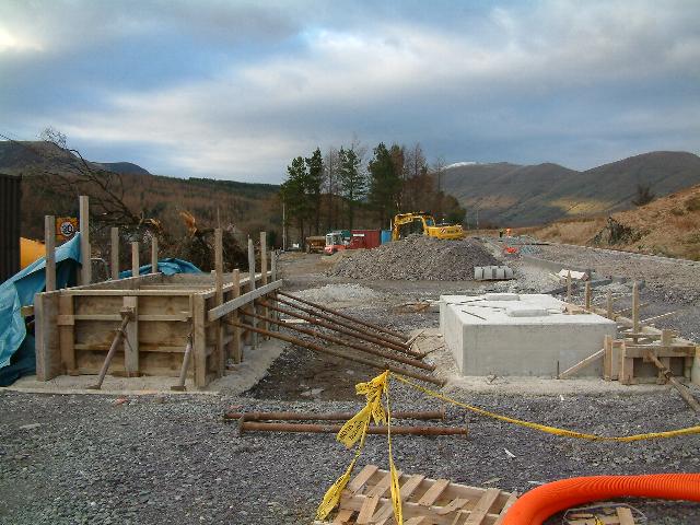
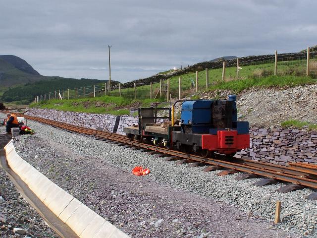
These views (26/2/06 and 28/5/06) show Rhyd Ddu Yard. The twin bases for the water tower at the southern end of the station in the first northerly image. The base comes in two concrete sections as the stock stabling siding goes between the two. The southbound platform track will be laid immediately to the right. The second southerly image shows the sidings complete with Upnor Castle and the rail bolster in one siding and the tamper in the short siding. Click on the image to enlarge. This image is copyright Tim Evans and was taken on a digital camera. Image post processed using iPhoto Plus4 and displayed at 96dpi.
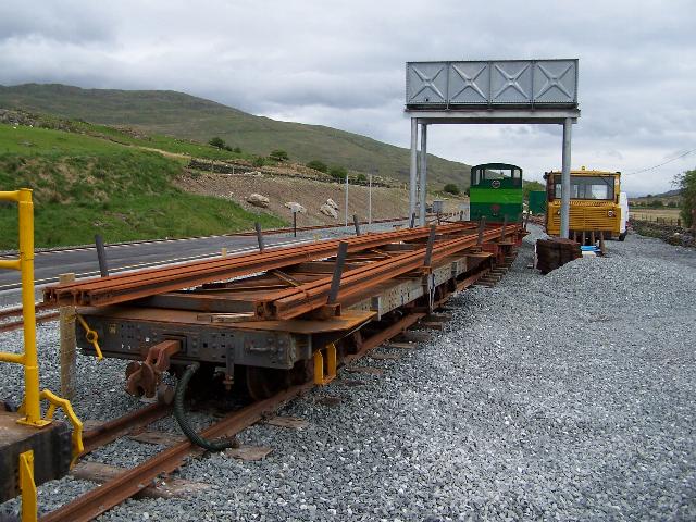
These southerly and northerly views (21/4/06) from Rhyd Ddu platform show Upnor Castle having shunted the pw train right along the stabling siding. This was the first loco under the water tower. Click on the images to enlarge. These images are copyright B.W.Hughes and were taken on a Kodak DX6490 digital camera. Images post processed using iPhoto Plus4 and displayed at 96dpi.
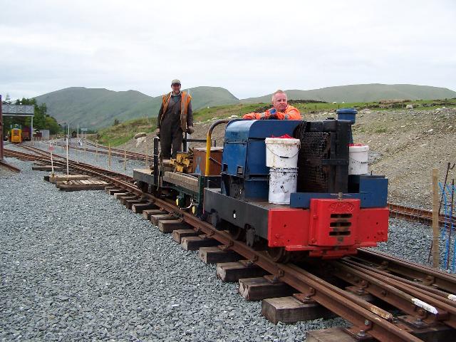
These views (28/5/06) show the sidings in Rhyd Ddu Yard with Upnor Castle and the tamper. Click on the images to enlarge. These images are copyright B.W.Hughes and were taken on a Kodak DX6490 digital camera. Images post processed using iPhoto Plus4 and displayed at 96dpi.

This southerly roadside view (12/11/05) at Ch.14800 approx. shows the newly excavated trackbed now completed through Rhyd Ddu South. Sub-base has been laid right up to the wall for the future site of the PW siding. Click on the image to enlarge. This image is copyright B.W.Hughes and was taken on a Kodak DX6490 digital camera. Image post processed using iPhoto Plus4. Image displayed at 96dpi.

These views (26/2/06 and 28/5/06) shows the track at Rhyd Ddu south. The first view shows the southern loop point with ATP fitted. In the distance is the yard point with the short temporary siding relaid for RRM storage. The second view shows some second stage ballasting and tamping has been done since the tamper was repaired. Click on the images to enlarge. first image is copyright Tim Evans and was taken on a digital camera. Second image is copyright B.W.Hughes and was taken on a Kodak DX6490 digital camera. Images post processed using iPhoto Plus4 and displayed at 96dpi.
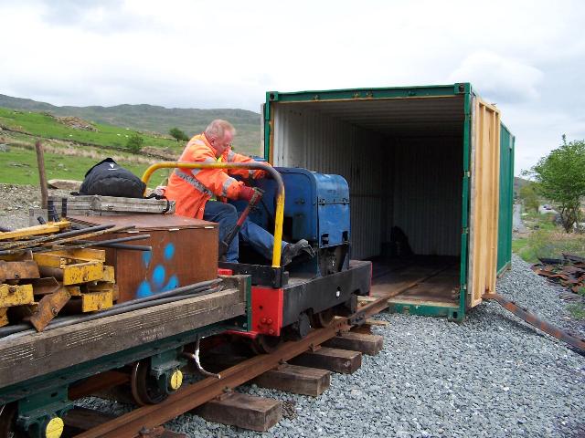
These views (28/5/06) show Dolgarrog's shed and the loco being shunted inside its shed. Click on the images to enlarge. These images are copyright B.W.Hughes and were taken on a Kodak DX6490 digital camera. Images post processed using iPhoto Plus4 and displayed at 96dpi.
This northerly roadside view (12/11/05) at Ch.14900 approx. shows the newly excavated trackbed at Rhyd Ddu South. Click on the image to enlarge. This image is copyright B.W.Hughes and was taken on a Kodak DX6490 digital camera. Image post processed using iPhoto Plus4. Image displayed at 96dpi.
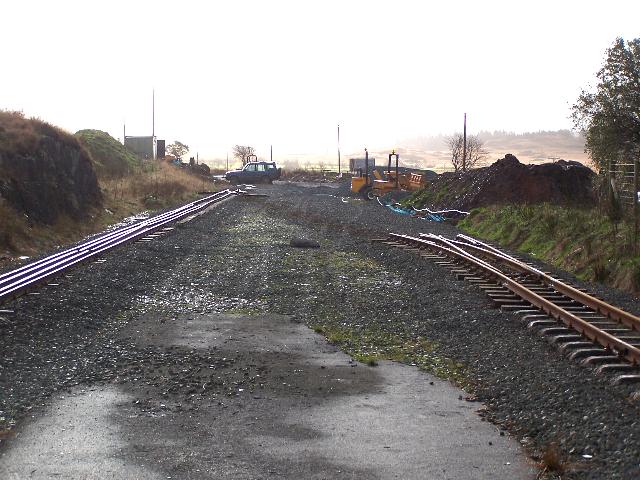
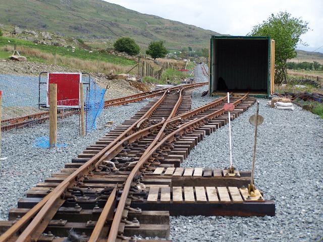
These northerly views (11/12/05 and 28/5/06) at Ch.15000 show Rhyd Ddu Yard. The first shows the two points and rail stacks and the track laid between them the previous day. The second shows the final layout of the yard. Click on the images to enlarge. These images are copyright B.W.Hughes and were taken on a Kodak DX6490 digital camera. Images post processed using iPhoto Plus4 and displayed at 96dpi.
Pitt's Head straight
Immediately south of Rhyd Ddu is the long undulating straight to Pitt's Head.
These southerly views (31/3/05 and 30/12/05) at Ch.14950 show the south end of Rhyd Ddu at Ch.15000. The first view shows trees cut down. At this point the new station alignment rejoins the line and level of the original formation. The second view shows landscaping finished, track laid and the yard point installed. Click on the images to enlarge. These images are copyright B.W.Hughes and were taken on a Kodak DX6490 digital camera. Images post processed using iPhoto Plus4 and displayed at 96dpi.
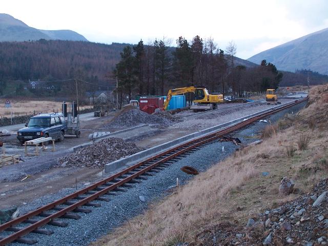
These northerly roadside views (16/7/05, 28/10/05 and 30/12/05) at Ch.15030 approx. show Phasey's Portacabin and plant established east of the alignment at the south end of the station. The 1m rise in the trackbed for Rhyd Ddu's new station is being worked out south of the station. The second view shows the start of ballasting using an asphalt paver just north of UB117. The third view shows track being laid with the new sleepers. Click on the images to enlarge. These images are copyright B.W.Hughes and were taken on a Kodak DX6490 digital camera. Images post processed using iPhoto Plus4 and displayed at 96dpi.


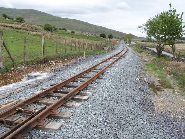
These northerly roadside views (16/7/05 17/9/05 and 31/12/05) from Ch.15080 approx. show the end of the current fill works and the strengthened trackbed two months on. The third view shows track being laid using the new Polish rail and Indian sleepers. Click on the images to enlarge. Theses images are copyright B.W.Hughes and were taken on a Kodak DX6490 digital camera. Images post processed using iPhoto Plus4 and displayed at 96dpi.
This northerly view (20/11/05) at Ch.15080 approx. shows the finished wall and ballasted trackbed. Click on the images to enlarge. These images are copyright B.W.Hughes and were taken on a Kodak DX6490 digital camera. Images post processed using iPhoto Plus4 and displayed at 96dpi.
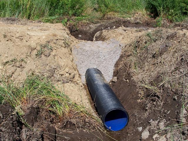

These easterly roadside views (16/7/05 and 17/9/05) from Ch.15030 approx. show the first culvert installed south of Rhyd Ddu. The plastic tubing in concrete is in common to trunk road construction standards. The later view shows the completed culvert with local stone headwalls and the trackbed reinforced with local stone rubble. Click on the image to enlarge. This image is copyright B.W.Hughes and was taken on a Kodak DX6490 digital camera. Image post processed using iPhoto Plus4. Image displayed at 96dpi.
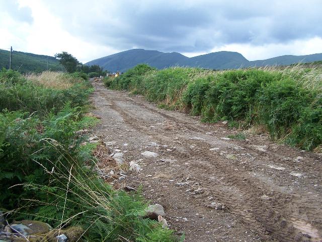


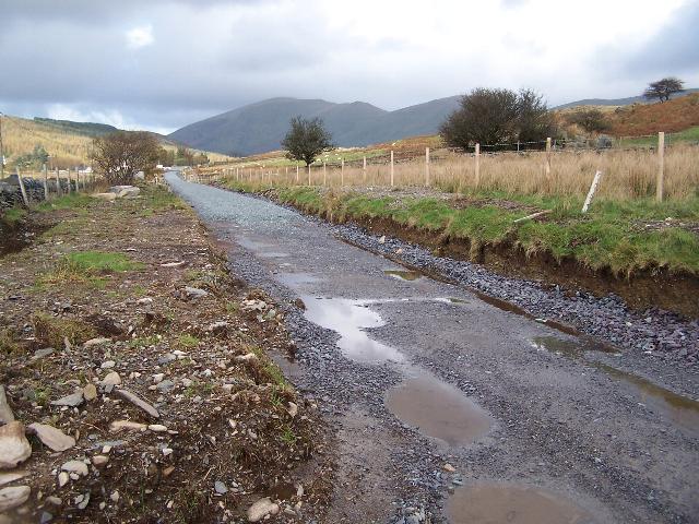
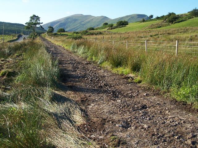
These northerly roadside views (16/7/05, 5/8/05, 25/8/05 and 3/9/05) from LC65 at Ch.15100 approx. show the trackbed scraped down to ballast and then in use an a haul road to the long straight south to Pitt's Head. The final image shows the sidelong ditch on the right hand (east) side and French drains (slotted plastic pipes) being inserted where water will drain from the mountainside. The drains are then covered in slate chips. Click on the images to enlarge. These images are copyright B.W.Hughes and were taken on a Kodak DX6490 digital camera. Images post processed using iPhoto Plus4. Images displayed at 96dpi.
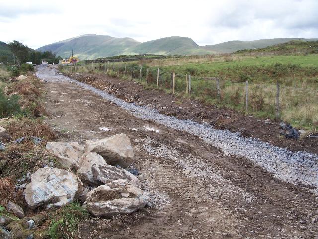
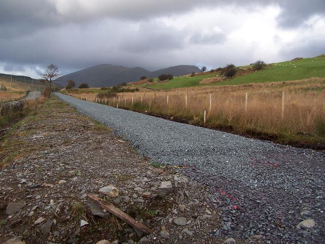
This northerly roadside view (17/9/05) from LC65 at Ch.15100 approx. shows the trackbed with sidelong drainage now complete and covered with slate chips. Phasey has started using slate waste to strengthen the trackbed and is seen approaching from the north. Click on the image to enlarge. This image is copyright B.W.Hughes and was taken on a Kodak DX6490 digital camera. Image post processed using iPhoto Plus4 and displayed at 96dpi.
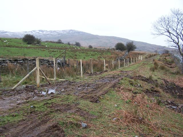
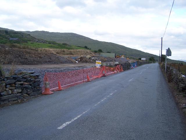
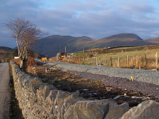
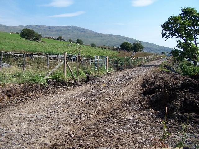
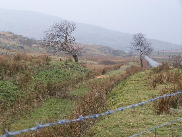
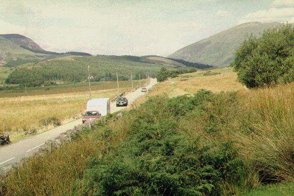
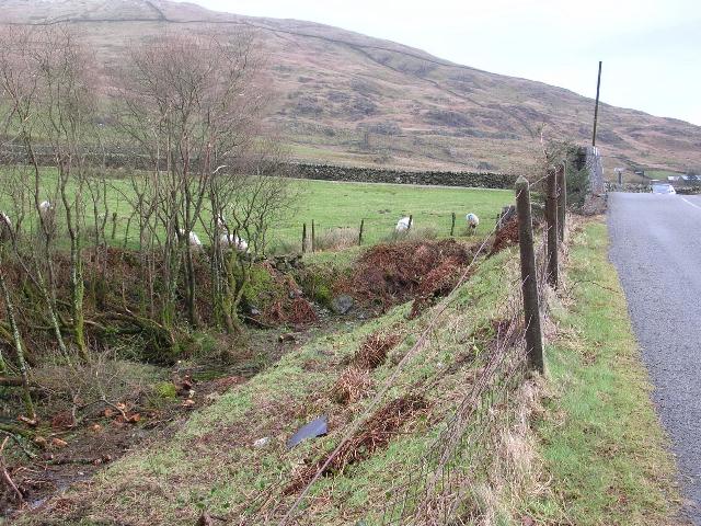
This southerly roadside view (31/3/05) from LC65 at Ch.15100 approx. show the new fencing south from Rhyd Ddu after basic clearance had finished. At this point the fencing on the east side is very close to the trackbed to allow the construction of a track between two fields for the neighbouring farm within former railway boundaries. Such mitigating measures have been common along all parts of the route. Click on the image to enlarge. This image is copyright B.W.Hughes and was taken on a Kodak DX6490 digital camera. Image post processed using iPhoto Plus4. Image displayed at 96dpi.
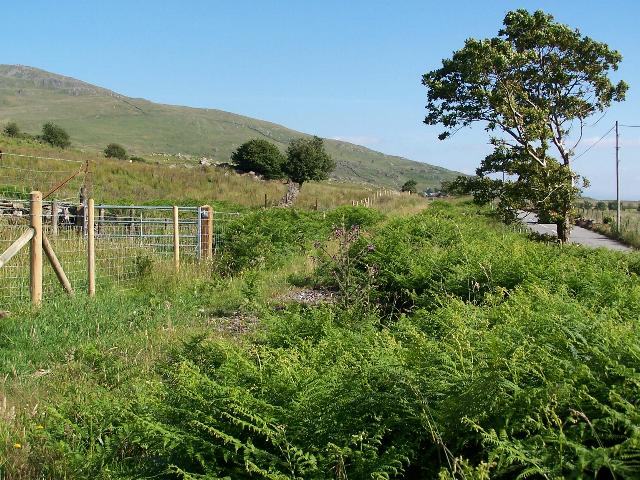
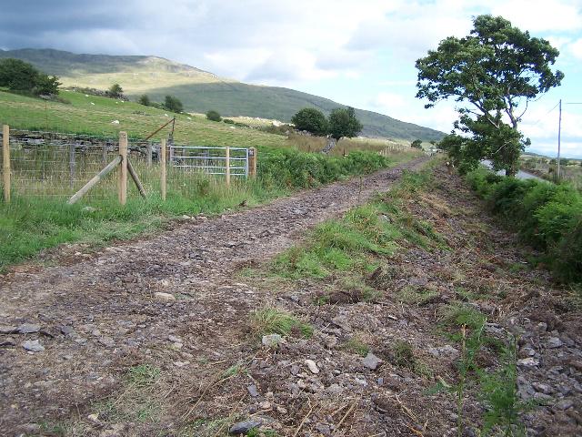
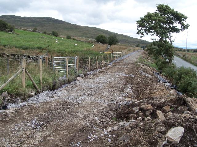
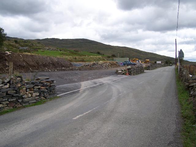
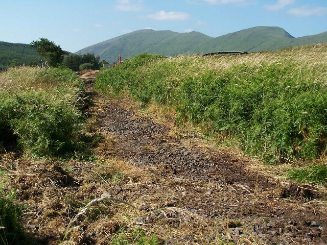
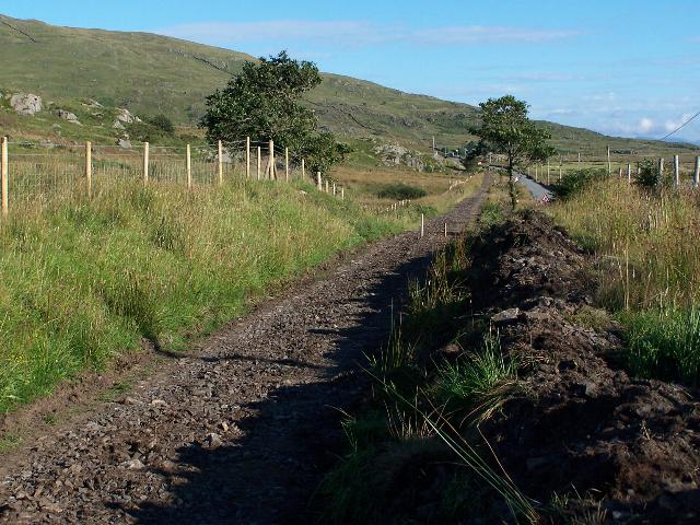
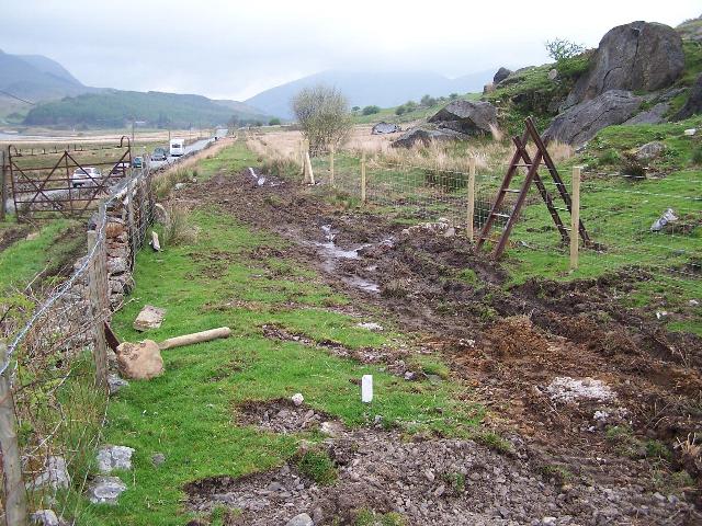
These southerly roadside views (16/7/05, 5/8/05, 3/9/05 and 17/9/05) from LC65 at Ch.15100 approx. show ballast peeping through the formation. There was no work visible south of this location on the earlier date though by the second date the trackbed was in use as a haul road to the long straight towards Pitt's Head. The third image shows sidelong ditches cut on the left (east) side to intercept water run-off from the mountainside and the fourth, the drainage complete and buried in slate chips. Click on the images to enlarge. These images are copyright B.W.Hughes and were taken on a Kodak DX6490 digital camera. Images post processed using iPhoto Plus4. Images displayed at 96dpi.

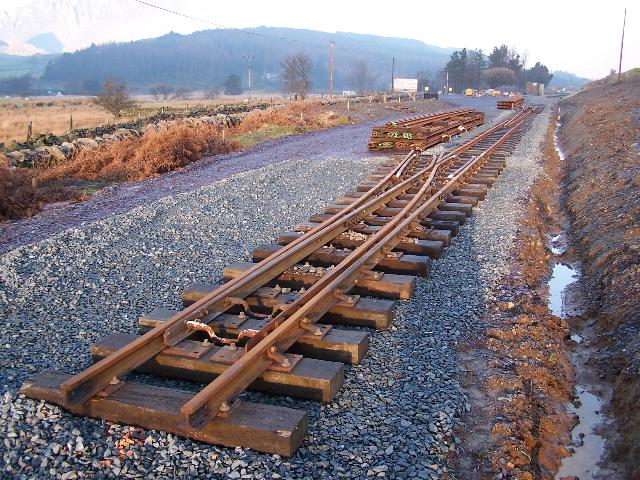
This view (8/1/06) at Ch.15140, south of Rhyd Ddu, shows tracklaying volunteer (and FR. Co. Chairman!) Michael Whitehouse assisting as volunteers fix down the eighth panel on Phase 4 at the end of the weekend. Click on the image to enlarge. This image is copyright B.W.Hughes and was taken on a Kodak DX6490 digital camera. Image post processed using iPhoto Plus4 and displayed at 96dpi.
This view (8/1/06) at Ch.15140, south of Rhyd Ddu, shows volunteers fixing down the eighth panel on Phase 4 at the end of the weekend. Click on the image to enlarge. This image is copyright B.W.Hughes and was taken on a Kodak DX6490 digital camera. Image post processed using iPhoto Plus4 and displayed at 96dpi.

This northerly roadside view (19/5/01) shows the trackbed north LC66 at Ch.15260 approx. Click on the image to enlarge. This image is copyright B.W.Hughes. Slide scan technology utilised is Olympus ES10 & iPhoto Plus4. Slide scanned at 200dpi.


These northerly roadside views (31/3/05, 10/8/05 12/11/05, 8/1/06 and 5/2/06) at LC66 show the clearance in this area and the trackbed scraped down to ballast. Some surveyor's posts have been erected on the centreline in the second view and it is clear there is a considerable rising gradient from Rhyd Ddu towards LC66. In the third view, ballast has been laid using a paver to within 10m of the crossing. In the fourth view, new steel sleepers have been stockpiled next to the level crossing, which has been made up with temporary timbers. The fifth view shows track laid through this location with gauge widened sleepers, mistakenly delivered to this site laid aside. Click on the images to enlarge. These images are copyright B.W.Hughes and were taken on a Kodak DX6490 digital camera. Images post processed using iPhoto Plus4. Images displayed at 96dpi.

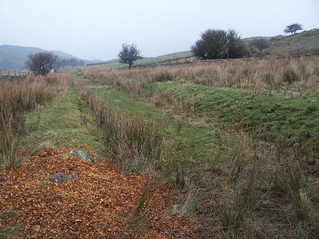
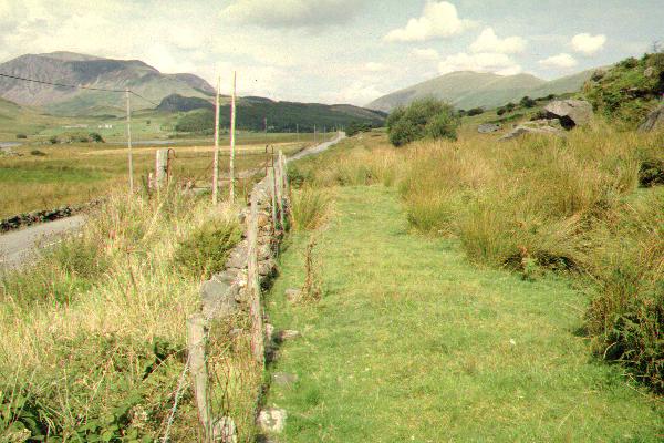
This southerly view (19/5/01) shows the trackbed at LC66, part way along the Pitt's Head straight. This section needs little work to re-instate other than clearance, fencing and drainage. Click on the image to enlarge. This image is copyright B.W.Hughes. Slide scan technology utilised is Olympus ES10 & iPhoto Plus4. Slide scanned at 200dpi.
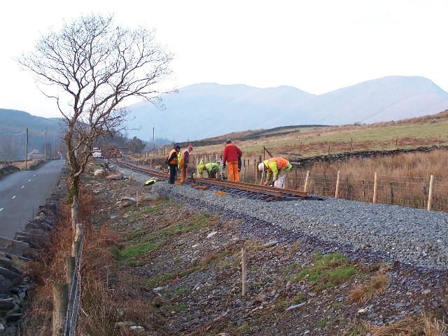
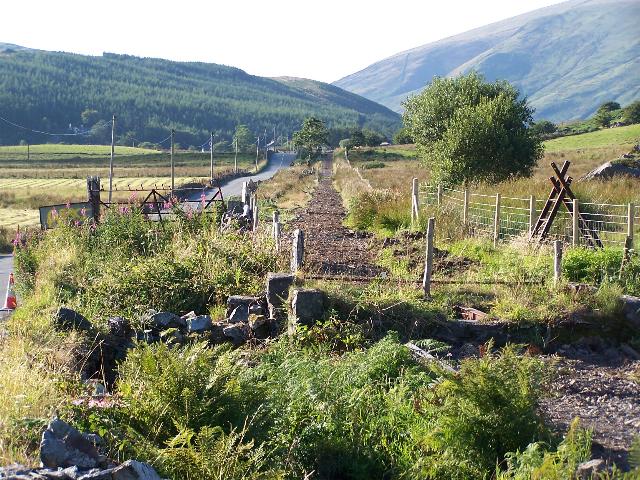
These southerly views (31/3/05, 10/8/05, 12/11/05, 8/1/06 and 5/2/06) at LC66 show the clearance and scraping down to ballast of the trackbed in this area. It is possible that the undulations in the trackbed on this long straight will be evened out using spare fill from Rhyd Ddu Phase 3 works as there is a clear dip between LC66 and Pitt's Head in the second view. Some surveyor's posts have been erected on the centreline. The third view shows the paver has laid a ballast bed south from a point about 10m south of the level crossing. In the fourth view, the ballast is complete and temporary timbers have been used to allow farm vehicles to cross the formation. The fifth view shows track laid through the crossing. The spare sleepers are extra wide ones for curves brought up by mistake. In the distance, the tracklayers are visible in action. Click on the images to enlarge. These images are copyright B.W.Hughes and were taken on a Kodak DX6490 digital camera. Images post processed using iPhoto Plus4. Images displayed at 96dpi.

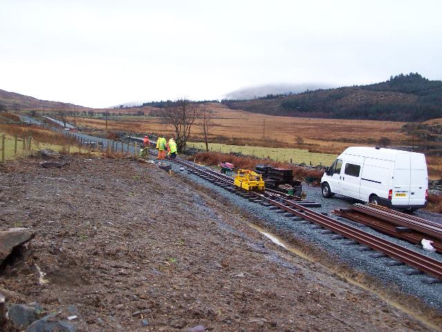
This northerly view (5/2/06) at Ch.15400, south of Rhyd Ddu, shows volunteers packing up after laying four panels that weekend. Click on the image to enlarge. This image is copyright B.W.Hughes and was taken on a Kodak DX6490 digital camera. Image post processed using iPhoto Plus4 and displayed at 96dpi.
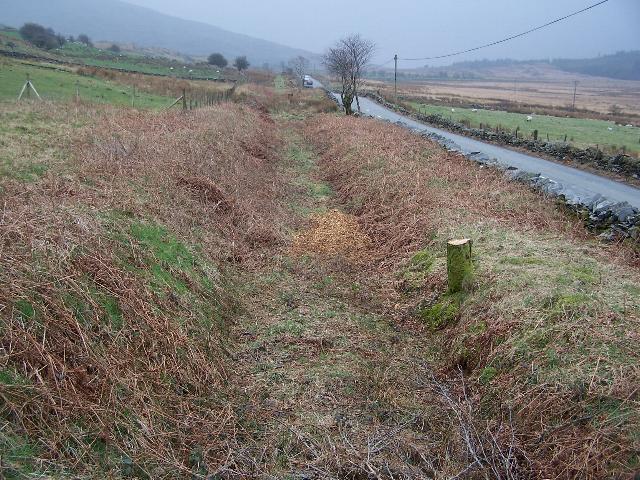
This northerly view (26/12/04) shows the trackbed north of LC67 at Ch.15470. There has been some discussion of the provision of a cycleway on this narrow road between the railway and the road as part of the Three Valleys Initiative. Click on the image to enlarge. This image is copyright B.W.Hughes and was taken on a Concord 3340z digital camera. Image post processed using iPhoto Plus4. Image displayed at 96dpi.
These northerly roadside views (31/3/05, 6/8/05 and 12/11/05) at LC67 show the trackbed as it had lain undisturbed since the 1940s, then scraped down to ballast. The third view shows the ballast bed laid by a paver to within metres of the level crossing. Click on the image to enlarge. This image is copyright B.W.Hughes and was taken on a Kodak DX6490 digital camera. Image post processed using iPhoto Plus4. Image displayed at 96dpi.
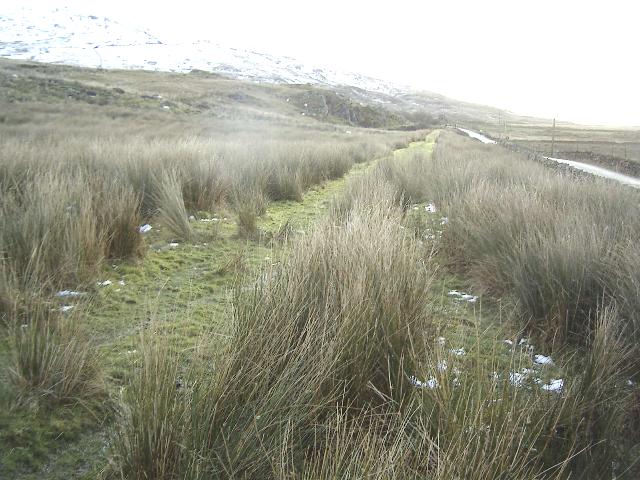
This northerly view (26/12/04) shows the trackbed south of LC67. There has been some discussion of the provision of a cycleway on this narrow road between the railway and the road as part of the Three Valleys Initiative. The mountains peaks are often covered with snow in winter. Click on the image to enlarge. This image is copyright B.W.Hughes and was taken on a Concord 3340z digital camera. Image post processed using iPhoto Plus4. Image displayed at 96dpi.
These southerly roadside views (31/3/05, 6/8/05, 12/11/05 and 11/12/05) at LC67 show the trackbed as it was, then scraped down to ballast in this area. The third view shows the ballast bed laid by a paver within metres of the level crossing. The fourth view shows the ballast completed and slate waste ramps and temporary wood built up for vehicular access across the level crossing. Click on the images to enlarge. These images are copyright B.W.Hughes and were taken on a Kodak DX6490 digital camera. Images post processed using iPhoto Plus4. Images displayed at 96dpi.
Pitt's Head Halt
The railway reaches its summit of 197.8m above sea level just south of Pitt's Head halt in a cutting between the A4085 bridge and Pont Cae'r-Gors. The pass between the Nant y Betws valley and the Nant Colwyn valley is perhaps disappointingly flat and quite wide at 500 metres but the lip into the Nant Colwyn is quite spectacular from Pont Cae'r-Gors.
This northerly view (3/9/00) shows the embankment running north to the right of the A4085 from Pitt's Head Halt towards Rhyd Ddu. Phase 4 begins by the tree in the distance half way along this long straight. The straight is subject to a number of rapid changes in gradient both up and down. Click on the image to enlarge. This image is copyright B.W.Hughes. Slide scan technology utilised is Olympus ES10 & iPhoto Plus4. Slide scanned at 200dpi.
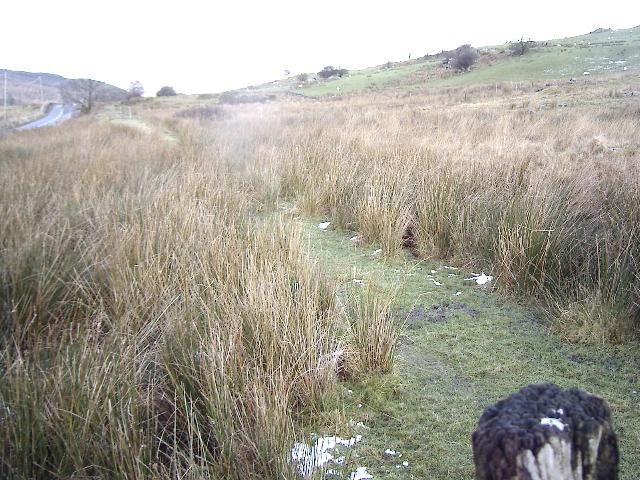
There is currently no intention to rebuild this halt as it is situated just 1 km from Rhyd Ddu station. There is no evidence left of the halt which was probably just a short gravel platform accessed through the gate at LC68.
This northerly roadside view (2/9/00) shows the site of Pitt's Head Halt (Ch.15650) and its access at LC68. Sleeper impressions are still evident in the grass. Cerrig Cyllau is to the right. The railway has already begun its reverse curve under OB123, the main road bridge at this point. Click on the image to enlarge. This image is copyright B.W.Hughes. Slide scan technology utilised is Olympus ES10 & iPhoto Plus4. Slide scanned at 200dpi. Image displayed at 96dpi.
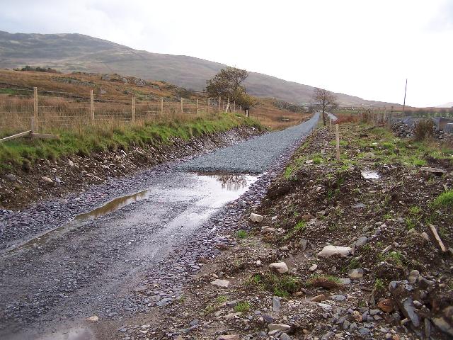
These northerly roadside views (1/5/05, 6/8/05 and 12/11/05) show the site of Pitt's Head Halt (Ch.15650) and its access at LC68. In the earlier view, clearance and fencing has been completed. In the second view, the trackbed has been scraped down to ballast for the full length to the long straight towards Rhyd Ddu. In the third view the paver has laid a ballast bed to a Ch.15650 approx. Click on the images to enlarge. These images are copyright B.W.Hughes and were taken on a Kodak DX6490 digital camera. Images post processed using iPhoto Plus4. Images displayed at 96dpi.
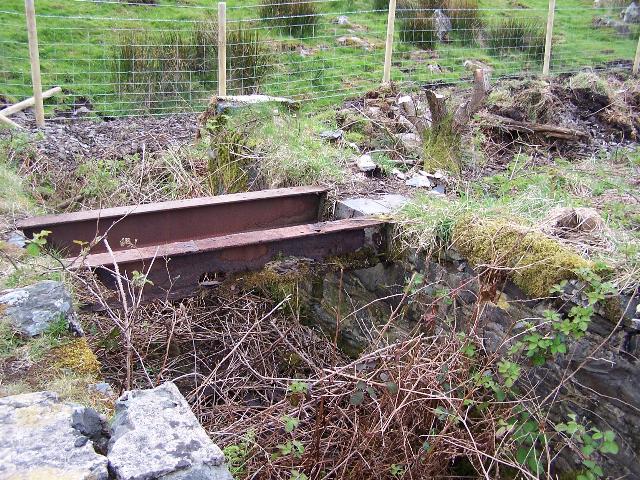

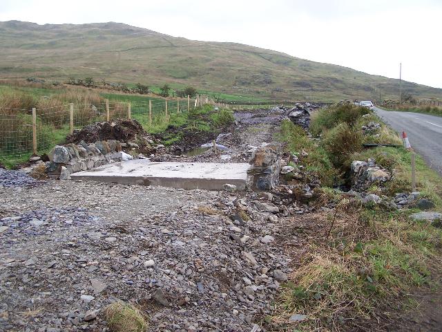
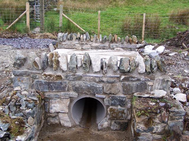
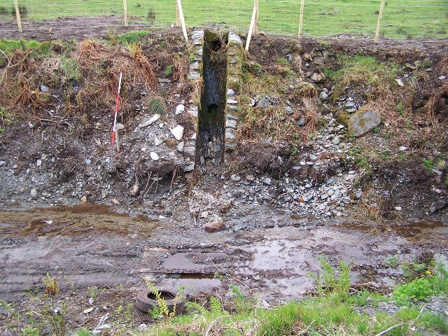
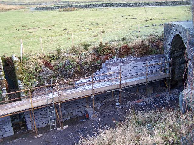
These easterly roadside views (1/5/05, 17/9/05 and two from 1/10/05) show the badly rusted girders of the underbridge immediately south of the site of Pitt's Head Halt and their replacement with a concrete pipe with local stone headwalls. The final two views show the concrete deck and the completed ballast retaining walls. Click on the images to enlarge. These images are copyright B.W.Hughes and were taken on a Kodak DX6490 digital camera. Images post processed using iPhoto Plus4 and displayed at 96dpi.

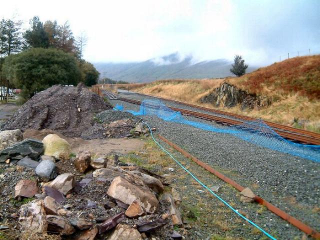
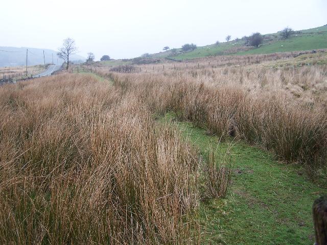
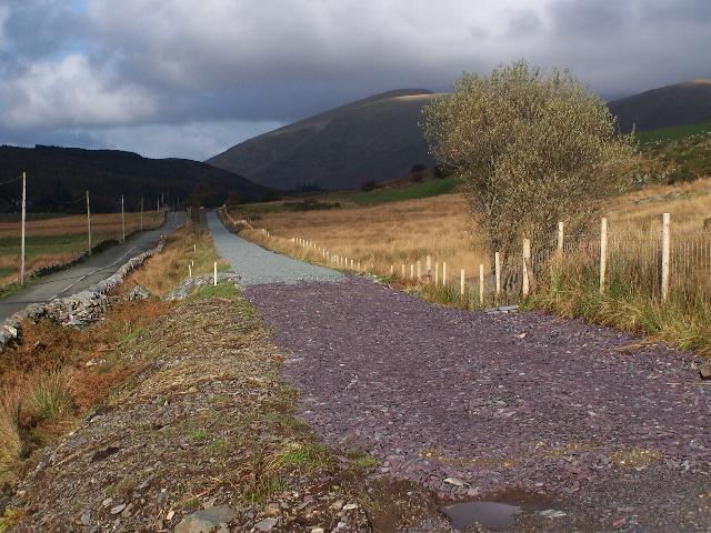
These southerly views (1/5/05 and 12/11/05) show the cleared trackbed south from the site of Pitt's Head Halt. The ballast bed is clearly evident curving left into Pitt's Head Cutting. A major sidelong ditch will be needed on the left hand side to catch water flowing down the slopes of Snowdon. The trackbed swings first to the left and then to the right under the road bridge. The second view shows the trackbed has been hardened and is nearing completion. Click on the images to enlarge. These images are copyright B.W.Hughes and were taken on a Kodak DX6490 digital camera. Images post processed using iPhoto Plus4 and displayed at 96dpi.
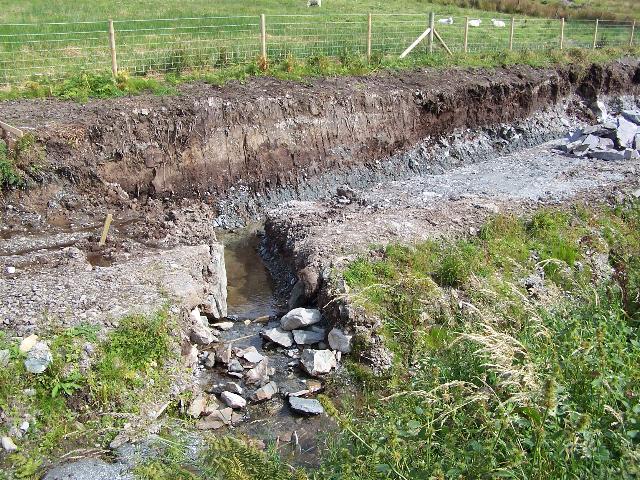
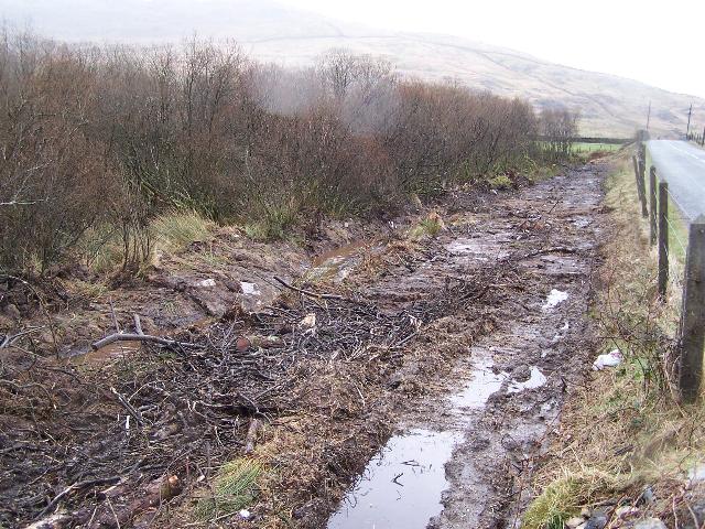
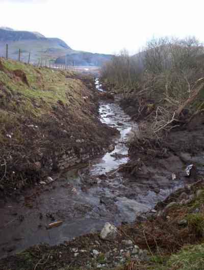
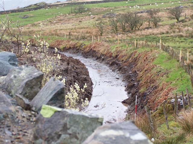
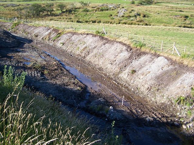
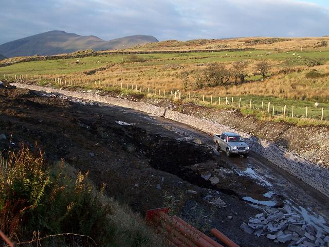
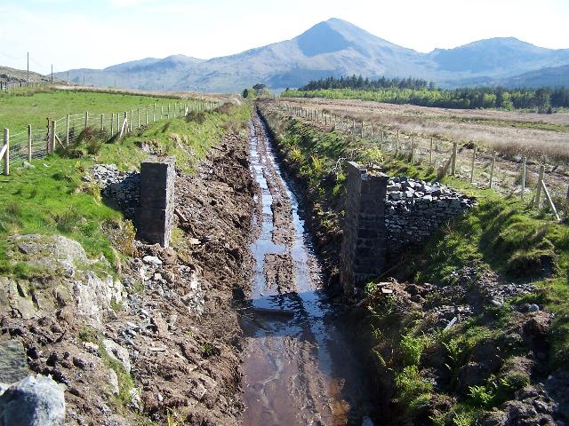
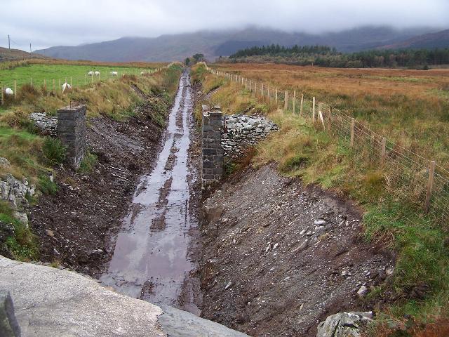
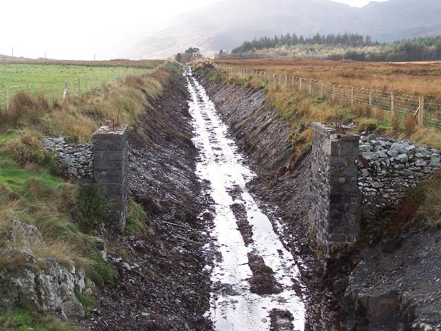
These southerly roadside views (19/5/01, 19/3/05, 17/4/05 and 3/8/05) of the north end of Pitt's Head Cutting show the boggy flooded cutting as the trackbed swings first to left to the trees and then to the right through the bushes under the bridge. In the second view, the trees have been cleared and a drain cut. In the third view, the trackbed has been excavated down to the ballast bed on the far left of the site. The excavated peat is being filed against the roadside embankment. In the last view, the cutting side to the east has been scraped and the trackbed hardened. Click on the images to enlarge. These images are copyright B.W.Hughes. Slide scan technology utilised is Olympus ES10Slide scanned at 200dpi. The later views were captured on a Kodak DX6490 digital camera. Images post processed using iPhoto Plus4 and displayed at 6 dpi.

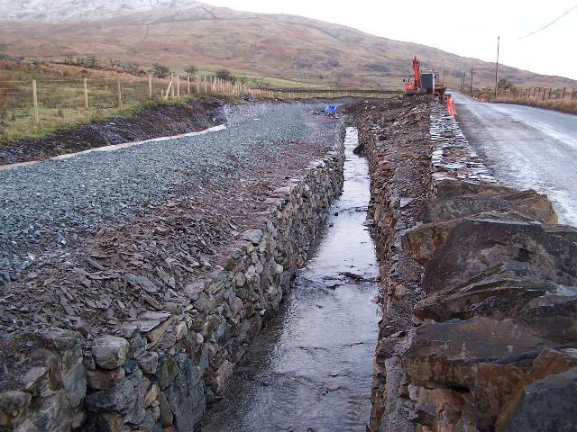
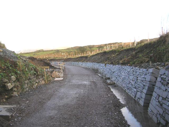
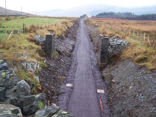
These easterly roadside views (3/9/05, 1/10/05, 12/11/05, 5/2/06 and 21/2/06) show the new cross drain cut at the north end of Pitt's Head Cutting. The trench on the east side of the line is for the slate retaining wall and a drainage ditch. The second view shows the wall, constructed of sawn slate ends, nearing completion except for a gap left for a drainage pipe. The third view shows the retaining wall completed except for where a field drain crosses the railway. The fourth view shows the ballast and drainage completed. The fifth view shows the roadside wall being rebuilt. Click on the images to enlarge. These images are copyright B.W.Hughes and were taken on a Kodak DX6490 digital camera. Images post processed using iPhoto Plus4 and displayed at 96dpi.


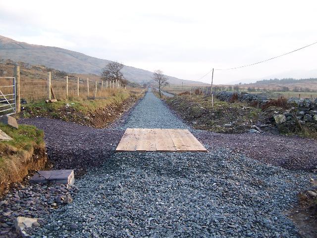
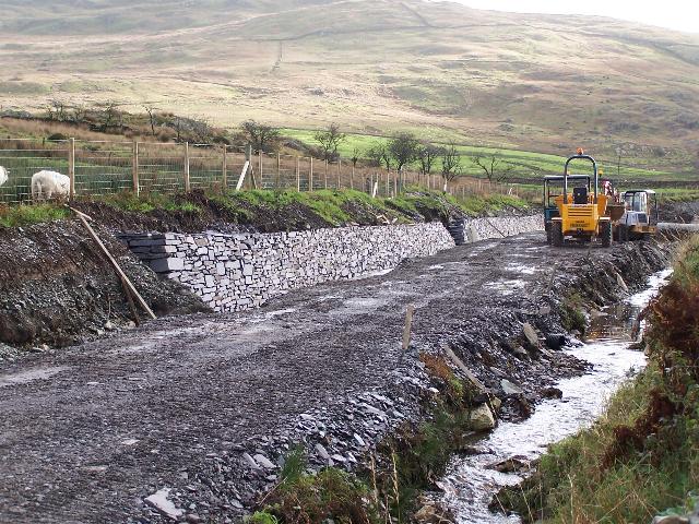
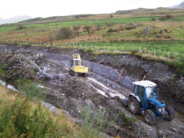
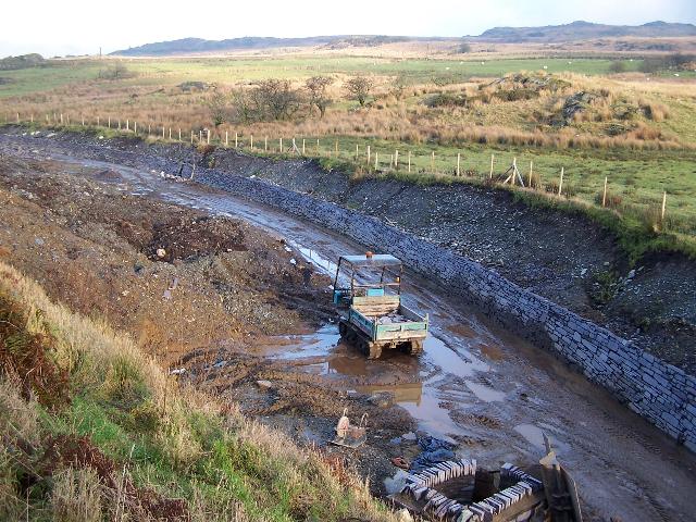
These northerly roadside views (1/8/05, 19/8/05, 23/12/05, 8/1/06, 5/2/06 and 28/5/06) at the north end of Pitt's Head Cutting show the trackbed and an adjacent area nearer the road scraped clean and a laydown area, for the delivery of materials and the construction of a retaining wall on the east side of the cutting finished in local sawn slate slabs. The third view shows the retaining wall completed along the east side and a slabbed ditch installed north of that. A deep drainage ditch has been excavated on the west side over 1m below the trackbed that will hopefully keep the cutting dry in future. The fourth view shows the trackbed has been rolled level with sub base and will receive ballast early in the new year. Track may be laid here as early as February. Slate slab coping stones are visible to cap the retaining wall. The fifth view shows the trackbed ballasted and the sixth view shows the track laid and Dolgarrog returning the track gang to Rhyd Ddu past a pile of stockpiled sleepers. Click on the images to enlarge. These images are copyright B.W.Hughes and were captured on a Kodak DX6490 digital camera. Images post processed using Iphoto+4 and displayed at 96dpi.


These easterly roadside views (19/8/05, 12/11/05 and 28/5/06) show the new sawn slate slab retaining wall at the north end of Pitt's Head Cutting. The second view shows how a field drain has been incorporated in the retaining wall. The third view shows the track laid and Dolgarrog returning the track gang's equipment to Rhyd Ddu. Click on the image to enlarge. These images are copyright B.W.Hughes and were taken on a Kodak DX6490 digital camera. Images post processed using iPhoto Plus4 and displayed at 96dpi.
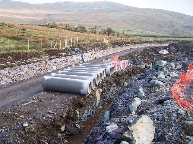
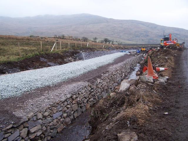
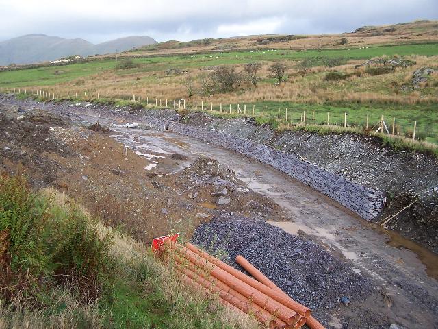
These southerly roadside views (3/9/05, 23/12/05, 8/1/06 and 28/5/06) show the new sawn slate slab retaining wall extending towards the south end of Pitt's Head Cutting. A fresh delivery of sawn slate blocks is visible in the foreground. The second view shows the retaining wall finished and the trackbed sub base rolled level. The excavation of the deep drain on the west side over 1m below the trackbed will hopefully keep the cutting free of water. The southern end has already been put in pipe. The third view shows the concrete pipes delivered ready to pipe the main drain through this cutting. Slate slab coping stones can be seen ready to complete the retaining wall. The fourth view shows track laid and Dolgarrog in use taking the track gang's equipment home. Click on the image to enlarge. These images are copyright B.W.Hughes and were taken on a Kodak DX6490 digital camera. Images post processed using iPhoto Plus4 and displayed at 96dpi.
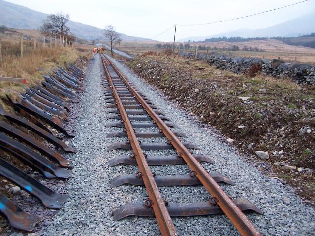
These northerly views (18/12/05 and two from 28/5/06) show the new sawn slate slab retaining wall extending towards the south end of Pitt's Head Cutting. The trackbed has been built up in rolled slate fines sub base. Final drainage arrangements were still to be made. The second view shows the track laid and Dolgarrog being used as the PW gang's motive power. The third view shows the Head of Steel at the end of that weekend. Progress had been slow due to the need to bend rails and reverse some of the previously bent rails. Click on the images to enlarge. The first image is copyright Mike Hart and was taken on a digital camera. Other images are copyright B.W.Hughes and were captured on a Kodak DX6490 digital camera. Images post processed using Iphoto+4 and displayed at 96dpi.
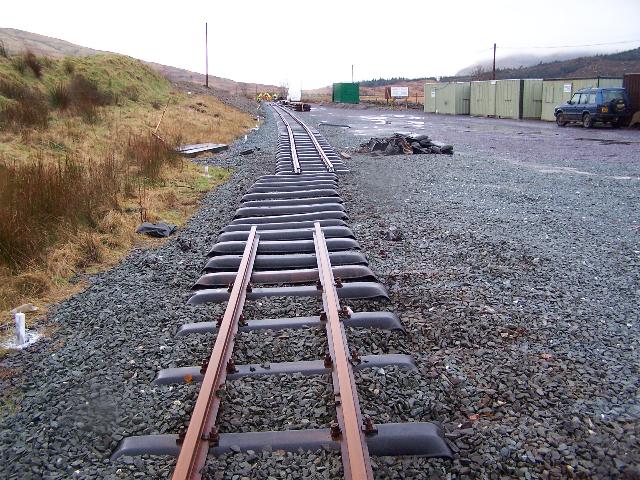
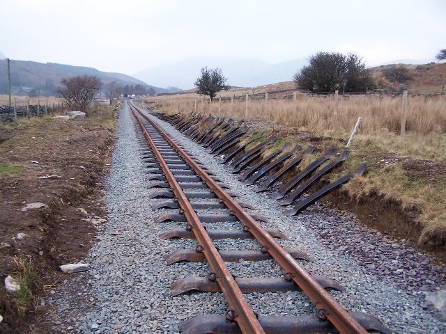
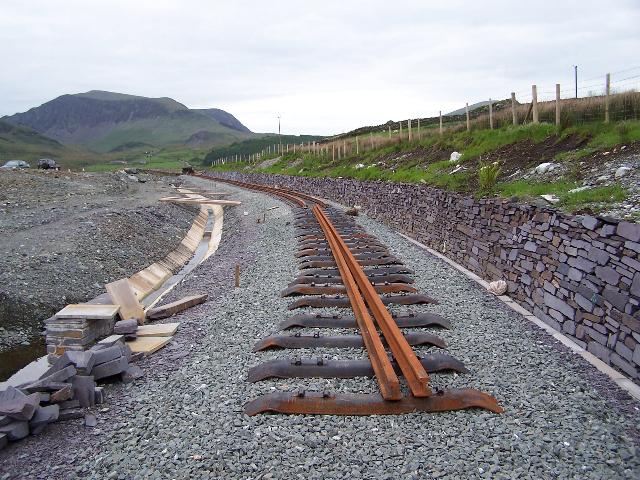
This southerly view (28/5/06) from the same location at Pitt's Head Cutting shows the sleepers laid out towards Pitt's Head road bridge on the ballasted formation. Click on the image to enlarge. This image is copyright B.W.Hughes and was captured on a Kodak DX6490 digital camera. Image post processed using Iphoto+4 and displayed at 96dpi.
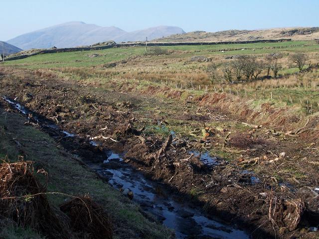
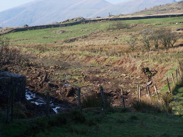
These northerly roadside views (18/2/05, 19/3/05, 17/4/05 and 19/8/05) from Pitt's Head road bridge show the trackbed clearance programme having chopped down all of the trees in the bog and a drainage channel completed on the west side of Pitt's Head Cutting. The third view shows the trackbed cut through the excavated bog. The final view shows the surveyor's posts and a trench dug on the east (uphill) side for a retaining wall. Click on the image to enlarge. These images are copyright B.W.Hughes and were captured on a Kodak DX6490 digital camera. Images post processed using Iphoto+4 and displayed at 96dpi.

These southerly roadside view (13/2/05 and 18/2/2005) at Pitt's Head road bridge show the trackbed clearance programme having chopped down some of the trees where the trackbed curves sharply under the bridge. The drainage ditch is seen completed in the right hand view. The trackbed is against the far side of this wide cutting at this location. Click on the image to enlarge. These images are copyright Mike Hart and B.W.Hughes respectively and were captured on a digital cameras. Images post processed using Iphoto+4 and displayed at 96dpi.
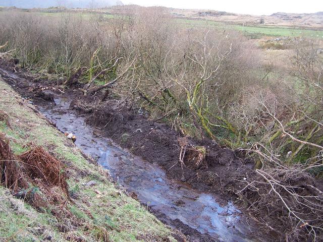
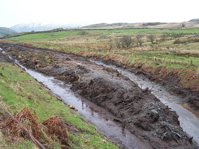
This southerly view (21/2/04) at Pitt's Head Cutting shows a clear drainage channel has been excavated. Achnashean were waiting for the cutting to dry a little before final clearance as they reported it was like trying to clear porridge! The trackbed continues to the right before curving back to the left to join the road. Click on the image to enlarge. This image is copyright Keith Bradbury and was captured on a digital camera. Image post processed using Iphoto+4 and displayed at 96dpi.
These northerly roadside views (19/3/05 and 17/4/05) of Pitt's Head Cutting show the bog now cleared of trees and a month later, the formation excavated down to the original ballast bed. The alignment follows the right hand edge of the cutting. The sharp curve as the route emerges from under the road bridge is clearly visible. The work has exposed a culvert right next to the bridge and a deeper ditch will be necessary running north alongside the railway to clear the remaining wet patch under the road bridge and ensure the whole area remains free of flooding. Click on the images to enlarge. These images are copyright B.W.Hughes and were captured on a Kodak DX6490 digital camera. Images post processed using Iphoto+4 and displayed at 96dpi.

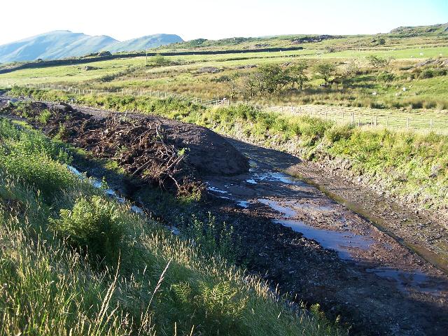
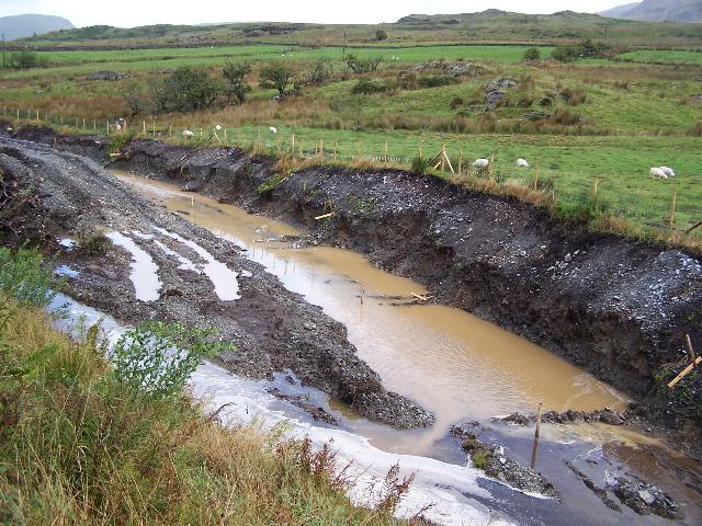
These northerly roadside views (30/4/05, 1/8/05, 10/8/05 and 24/8/05) show the cutting right next to Pitt's Head road bridge. In the first view, fencing of the mountain side of the cutting is now complete and it is clear vehicles regularly drive along the trackbed now it is firm. In the second view, waste material has been sorted into two piles. Tree roots are stored nearer the road and fill has been stored nearer the railway. An area near to the bridge has been left clear, possibly because of its photogenic location. The third view shows the east side of the cutting scraped and surveyor's posts placed on the centreline. The final view shows the flooding of Pitt's Head Cutting after heavy overnight rain. It is clear that the roadside drainage ditch on the left needs to be about 1m deeper in order to deal with typical Snowdonian rainstorms! Click on the images to enlarge. These images are copyright B.W.Hughes and were captured on a Kodak DX6490 digital camera. Images post processed using Iphoto+4 and displayed at 96dpi.
These easterly roadside views (1/10/05, 12/11/05 and 20/11/05) show the cutting right next to the road bridge with the retaining wall nearing completion. In the second view, the trackbed appears well drained and a pile of brown slotted drainpipes appears stored ready to be installed in Summit Cutting. In the third view landscaping was underway with the accumulated debris in the foreground. Surveyor's were present checking the alignment and final extension of the retaining wall next to the bridge. The fourth view shows the completed drainage access in the foreground and the light tracked vehicle used on the Summit Cutting length to prevent damage to the trackbed. The drainage can also be seen being installed alongside the retaining wall. Click on the image to enlarge. This image is copyright B.W.Hughes and was taken on a Kodak DX6490 digital camera. Image post processed using iPhoto Plus4. Image displayed at 96dpi.
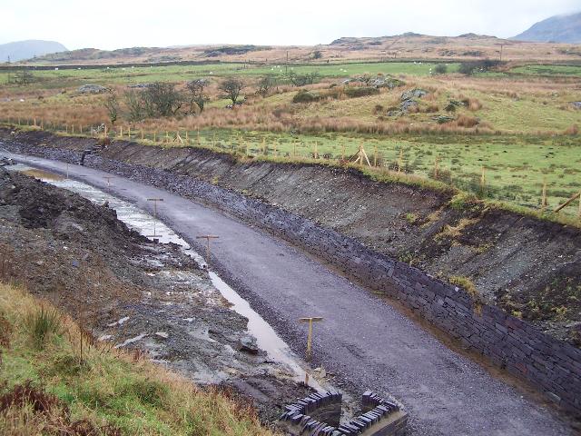

These northerly roadside views (23/12/05, 8/1/06, 20/2/06 and 31/5/06) at Pitt's Head Cutting shows the sub base has been rolled level. The second view shows a ditch has been added on the west side of the trackbed. Concrete slabs are visible being used to line the ditch at the foot of the retaining wall. Slate slab coping stones have been laid out on top of the retaining wall. Ballast is due to be laid here in January and tracklaying with the new pandrol clipped rail will follow through shortly afterwards as track extends south from Rhyd Ddu. The third view shows the ballast bed, which was completed by 5/2/06. The fourth view shows the track laid up to the bridge by the permanent staff that day. Click on the images to enlarge. These images are copyright B.W.Hughes and were captured on a Kodak DX6490 digital camera. Images post processed using Iphoto+4 and displayed at 96dpi.


These easterly roadside views (1/5/05, 12/11/05 and 11/12/05) show the cutting right next to the road bridge. A gulley descends the far bank and feeds into choked and buried culvert. The second view shows how the Summit Cutting drainage is being linked into the Pitt's Head cutting drainage. The third view shows the retaining wall has been extended right up to the bridge portal and the drain from the Summit Cutting is working. The fourth view shows the retaining wall being extended upwards, north of the bridge and the fifth view shows the wall complete. The tie-bars installed by GCC in 2000 to strengthen the bridge portal can also been seen. Click on the image to enlarge. These images are copyright B.W.Hughes and were taken on a Kodak DX6490 digital camera. Images post processed using iPhoto Plus4 and displayed at 96dpi.
This northerly view (18/12/05) shows the new sawn slate slab retaining wall extending towards the south end of Pitt's Head Cutting. The trackbed has been built up in rolled slate fines sub base. The ditch to the right carries the outflow from the peat bog around Summit Cutting. Click on the image to enlarge. This image is copyright Mike Hart and was taken on a digital camera. Image post processed using iPhoto Plus4. Image displayed at 96dpi.
Pitt's Head road bridge OB123
The cutting at Pitt's Head was poorly drained and retained some original WHR rail until the nascent FR recovered it in 1961! Although Cohen's recovered most of the track in 1941 for the war effort, the Pitt's Head to Hafod Ruffydd section was left intact for possible gunnery practice. This section was lifted in 1948/49 excepting the 8 lengths under nearly 1 metre of bog in Pitt's Head cutting.
Some Phase 4 work was completed early courtesy of the Highway Authority GCC repointing the Pitt's Head bridge OB123 (Ch.15940) and waterproofing it during August and September 2000. The idea was to get the work done before it would interfere with the railway works scheduled for early 2005.
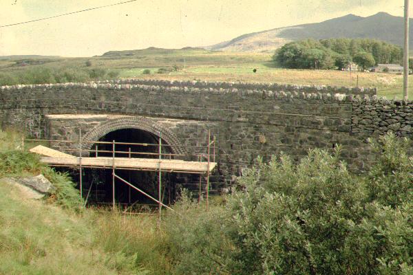
This northerly view shows work in progress by GCC repointing and waterproofing OB123, the A4085 road bridge at Pitt's Head during the Summer of 2000. Snowdon is in the background. Click on the image to enlarge. This image is copyright B.W.Hughes. Slide scan technology utilised is Olympus ES10 & iPhoto Plus4. Slide scanned at 200dpi.
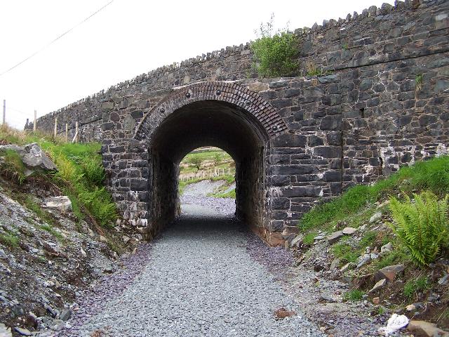
Pitt's Head bridge was built with the PBSSR electric operation in mind as early as 1906 so it is to a different design to NWNGR bridges and the high arch space left for the trolley wire may allow the railway to run through the bridge with little or no necessity to deepen the trackbed or underpin the abutments.
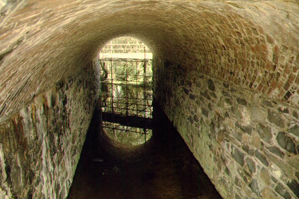
This northerly view through OB123 shows the long skew angle and spiral brickwork pattern. Flooding begins at the southern portal of the bridge and runs back through Pitt's Head cutting which is very overgrown. Click on the image to enlarge. This image is copyright B.W.Hughes. Slide scan technology utilised is Olympus ES10 & iPhoto Plus4. Slide scanned at 200dpi.
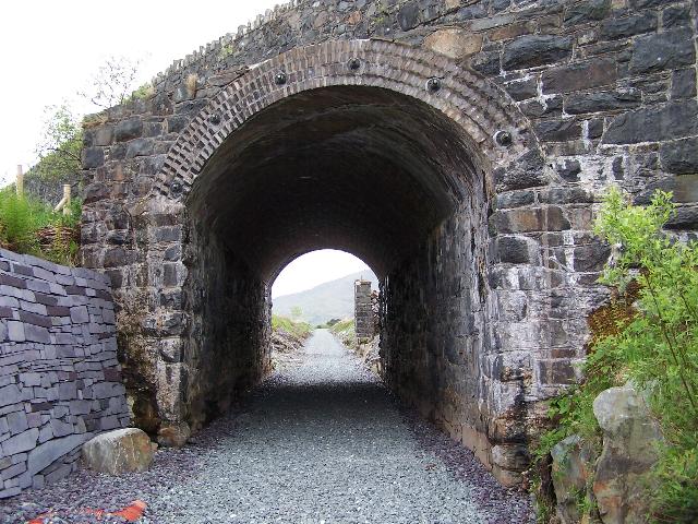
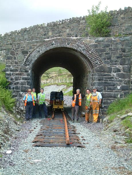
These southerly views (28/5/06 and 25/6/06) show the north face of the road bridge. The first view shows the bridge with the ballasted Summit Cutting beyond. The tie-bars installed by GCC in 2000 to strengthen the bridge portal can also been seen. The second view shows the same view a month later with ballasted track laid through Summit Cutting beyond. Click on the images to enlarge. These images are copyright B.W.Hughes and were taken on a Kodak DX6490 digital camera. Images post processed using iPhoto Plus4 and displayed at 96dpi.

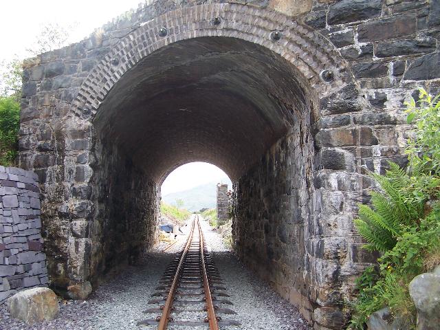
These southerly views (28/5/06 and 25/6/06) show the trackbed at Pitt's Head road bridge. The first view shows the trackbed ballasted. The second view shows the track laid just one month later. Click on the images to enlarge. These images are copyright B.W.Hughes and were captured on a Kodak DX6490 digital camera. Images post processed using Iphoto+4 and displayed at 96dpi.
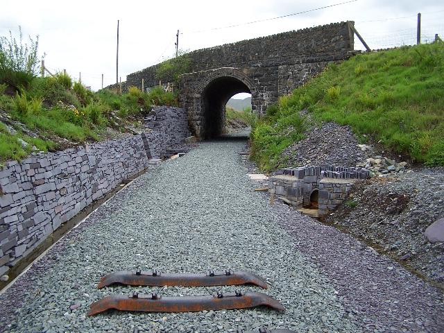
This northerly view (4/6/06) shows the Head of Steel emerging from Pitt's Head road bridge. Work south of here must pause until James Cyf. excavates Phasey's drains and replaces them with open top channels. Click on the image to enlarge. This image is copyright Tim Evans and was taken on a digital camera. Image post processed using iPhoto Plus4 and displayed at 96dpi.
Summit Cutting

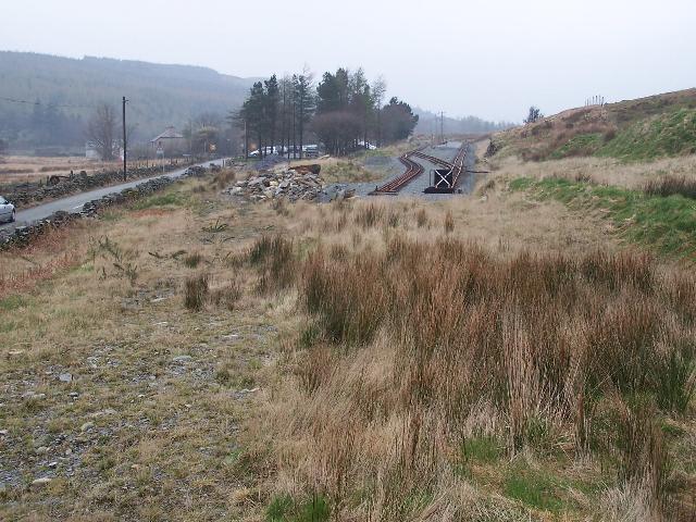
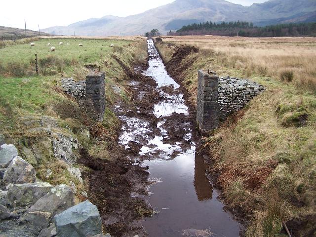
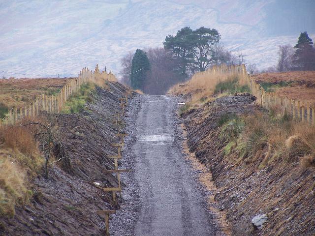
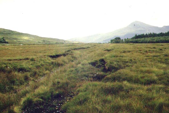
This southerly view (20/12/99) looking towards Beddgelert, shows the railway approaching the summit from Pitt's Head road bridge. The abutments of a former cattle bridge (OB124) are visible and the cutting is overgrown and very wet, passing through a bog. The summit level can be seen in the distance and the Beddgelert Forest at Pont Cae'r-Gors is also visible. Click on the image to enlarge. This image is copyright B.W.Hughes. Slide scan technology utilised is Olympus ES10 & iPhoto Plus4. Slide scanned at 200dpi.

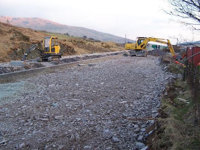
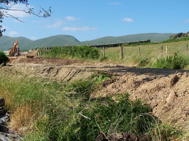
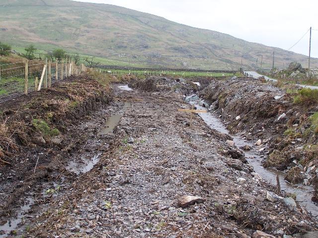
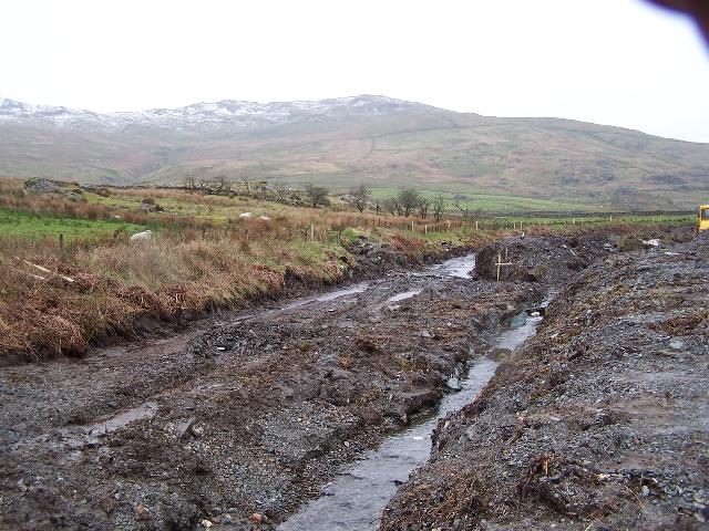
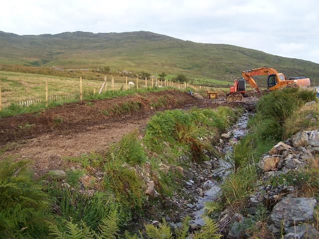
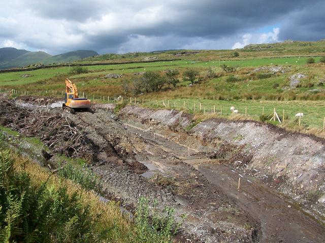
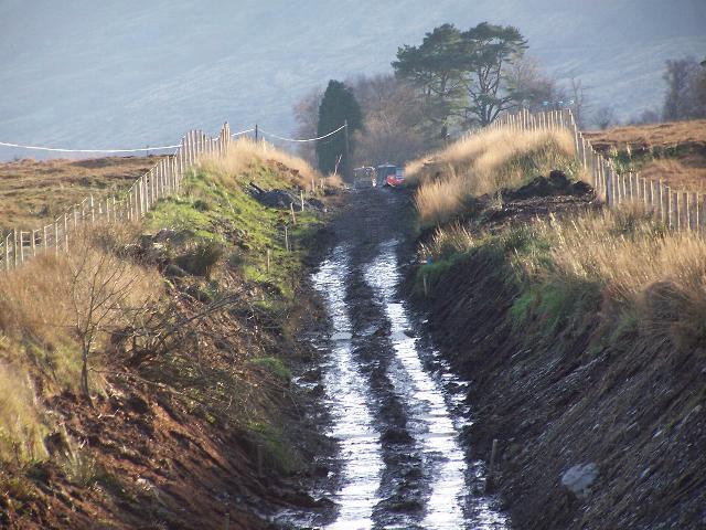
These southerly views (14/2/05 and 17/2/05) at Pitt's Head road bridge show the trackbed clearance programme having scraped the fallen peat out of the Summit Cutting. The lip of the Nant Colwyn pass is clearly visible next to the trees. The railway begins the 1 in 40 descent at that point. A few days later the cutting was clear though still needed draining. Until the drainage regime is properly secured through Pitt's Head Cutting, Summit Cutting will flood at this end. The excavator is up to its axles in mud! Click on the images to enlarge. These images are copyright B.W.Hughes and were captured on a Kodak DX6490 digital camera. Images post processed using Iphoto+4 and displayed at 96dpi.
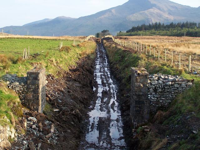
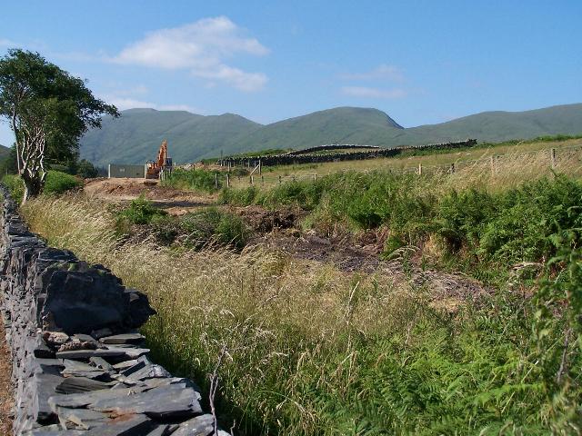
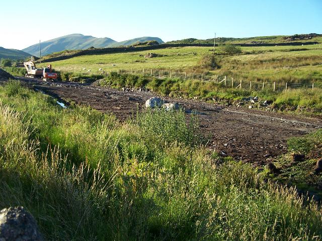
These southerly views (30/4/05, 14/5/05, 28/10/05 and 12/11/05) show Summit Cutting with fencing complete on the west side and later with the fencing contract finished. Some excavation of the peat is visible in the distance to ensure the peat does not slump back into the cutting. It is now apparent that for some reason, the piers of the accommodation bridge were not built in line with the trackbed and so appear asymmetric. The third view shows both cutting sides being pared back by removal of peat both sides of the accommodation bridge. This has revealed that this northerly part of the cutting is partly rock cut. The fourth view shows the paring back of peat underway all the way to Summit Cutting with the excavator in view in the distance. Click on the images to enlarge. These images are copyright B.W.Hughes and were captured on a Kodak DX6490 digital camera. Images post processed using Iphoto+4 and displayed at 96dpi.

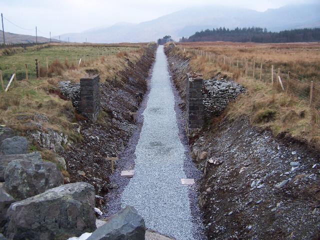
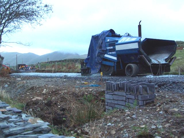
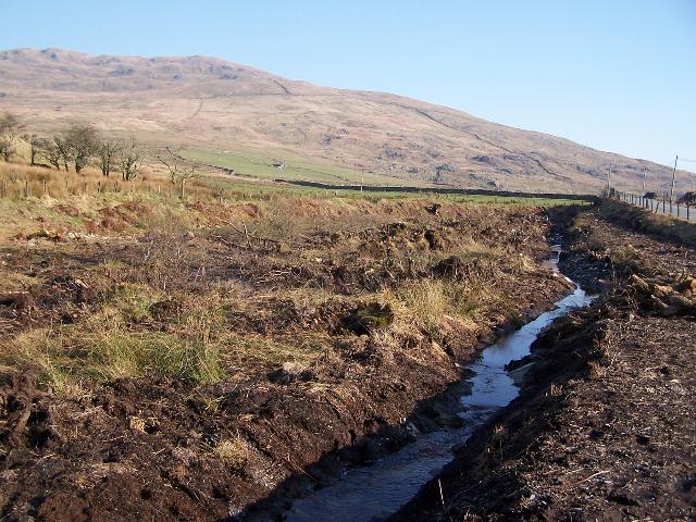
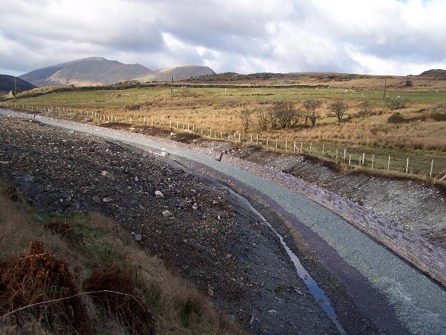
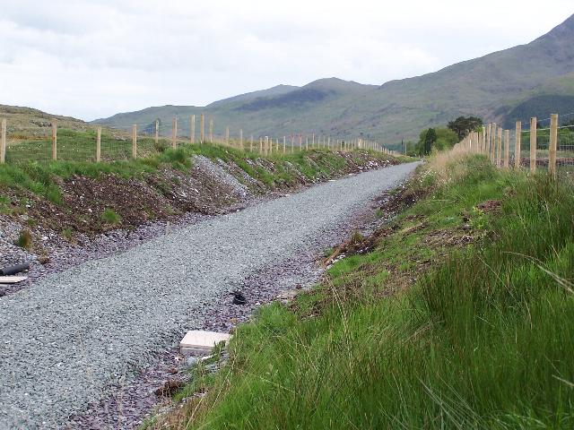
These southerly views (11/12/05, 23/12/05, 5/2/06 and 25/6/06) show Summit Cutting. The first view shows Phasey's staff working on a Sunday to complete the cutting. Geotextile and sub base have being trucked in. It appears that parallel drains either side of the cutting will cope with the run-off from the peat as the cutting was finally looking to be drying out. The second view shows the sub base rolled and the cutting finally drying out! The third view shows the trackbed ballasted and the tracklaying teams will be laying the new rail here soon. The fourth view shows track laid and additional drainage works on the east side requiring a concrete channel cess. Click on the image to enlarge. This image is copyright B.W.Hughes and was taken on a Kodak DX6490 digital camera. Image post processed using iPhoto Plus4 and displayed at 96dpi.
A Summit Board is likely to be fitted in Summit Cutting indicating the height of the location, as at various locations on Network Rail.
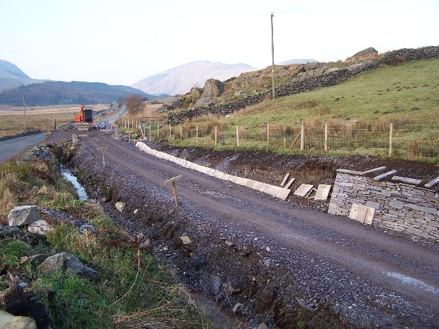
These southerly views (10/8/05, 20/11/05 and 23/12/05) show Summit Cutting from Pitt's Head road bridge and, in the fourth view, the trackbed. The first view shows surveyor's poles on the short level section through Summit Cutting. The trackbed had been scraped clear again the previous week after re-growth since the Spring clearance. It looks like a section of peat on the right hand side, north of Summit Cutting, will need excavating. Drainage works are an early priority in this cutting before the Autumn brings heavy rainfall. The second view shows increased trimming of the cutting sides but more remains to be done. The third view shows the cutting drainage finished and the rolled sub base applied. Surveyor's 10m posts have appeared. No attempt seems to have been made to keep the alignment straight! Click on the image to enlarge. This image is copyright B.W.Hughes and was taken on a Kodak DX6490 digital camera. Image post processed using iPhoto Plus4. Image displayed at 96dpi.
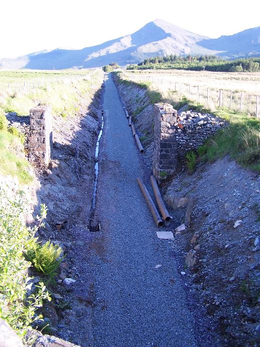
This southerly view (2/6/06) shows work underway to improve Phasey's drainage of Summit Cutting. The slotted rains they installed have been removed. It is essential this work is completed before tracklayers pass through and reduce access to construction vehicles, though they were laying under Pitt's Head bridge on 2/6/06! Click on the image to enlarge. This image is copyright B.W.Hughes and was taken on a Kodak DX6490 digital camera. Image post processed using iPhoto Plus4 and displayed at 96dpi.
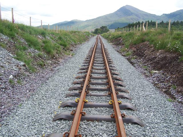
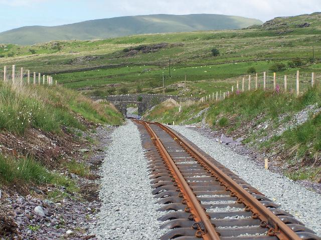
This southerly view (25/6/06) shows the track laid through Summit Cutting. The yellow painted track clips are the 'Golden Spikes' laid by the Imperial College Railway Society the previous weekend. Click on the image to enlarge. This image is copyright B.W.Hughes and was taken on a Kodak DX6490 digital camera. Image post processed using iPhoto Plus4 and displayed at 96dpi.
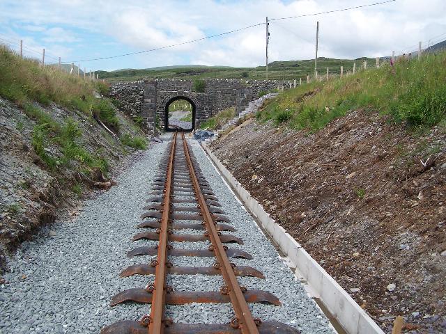
This northerly view (25/6/06) shows the track laid through Summit Cutting with the new drainage to the right and Pitt's Head road bridge in the distance. Click on the image to enlarge. This image is copyright B.W.Hughes and was taken on a Kodak DX6490 digital camera. Image post processed using iPhoto Plus4 and displayed at 96dpi.
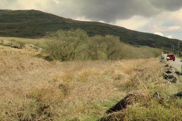
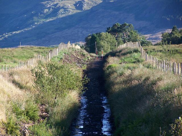
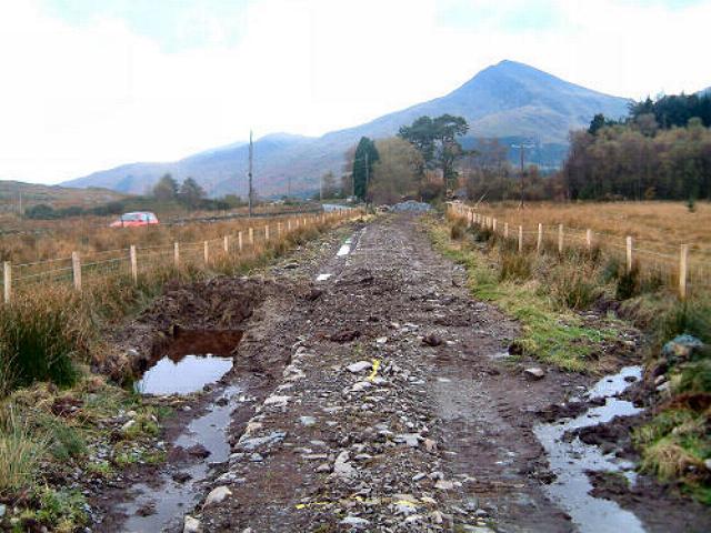
These southerly views (archive and 28/5/06) show the short summit length of the WHR as it approaches the lip of the Nant Colwyn Pass. The railway was excavated through bog on this length and the WHR Baldwin (at the very least) was known to roll here. The peat sides have collapsed into the cutting and work was necessary to stabilise this length. The second view shows the completed trackbed. Click on the image to enlarge. This image is copyright B.W.Hughes. Slide scan technology utilised is Olympus ES10 & iPhoto Plus4. Slide scanned at 200dpi.
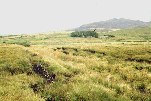
This northerly archive view shows the short summit level excavated through peat with the change of gradient clearly visible to 1 in 46 dropping towards Pitt's Head cutting with trees to the left. Snowdon is in the background and Ffridd Uchaf farm and Guesthouse in the trees at the centre. The second view shows the cutting nearing completion with drainage either side and the installation of rolled sub base. Click on the image to enlarge. This image is copyright B.W.Hughes and was taken on a Kodak DX6490 digital camera. Slide scan technology utilised is Olympus ES10. Slide scanned at 200dpi. Image post processed using iPhoto Plus4 and displayed at 96dpi.
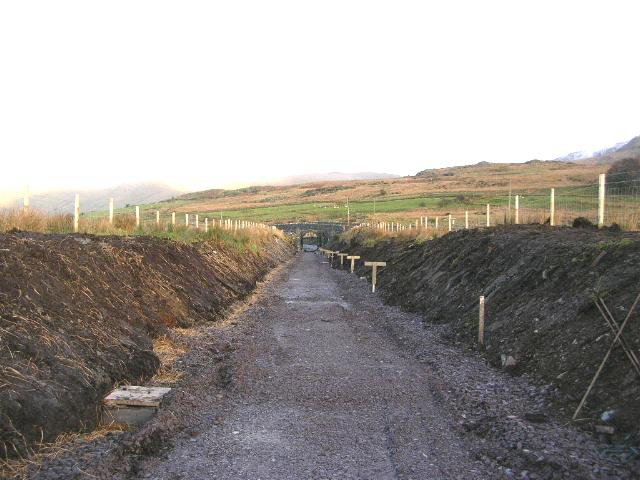

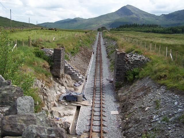
These northerly views (18/12/05, 28/5/06 and two from 25/6/06) show the short summit level excavated through peat with the change of gradient clearly visible to 1 in 46 dropping towards Pitt's Head Cutting and road bridge. The second view shows the ballasted formation and the third view shows tracklaying completed with the sharp change of gradient. The fourth view shows the point at which the Beddgelert water main crosses the alignment marked by the four concrete posts. Click on the images to enlarge. These images are copyright B.W.Hughes and were taken on a Kodak DX6490 digital camera. Images post processed using iPhoto Plus4 and displayed at 96dpi.
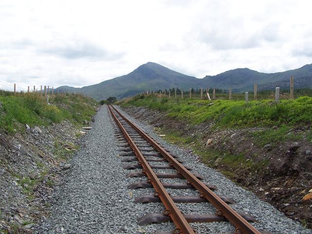
This southerly view (25/6/06) shows the track laid through Summit Cutting. Click on the image to enlarge. This image is copyright B.W.Hughes and was taken on a Kodak DX6490 digital camera. Image post processed using iPhoto Plus4 and displayed at 96dpi.
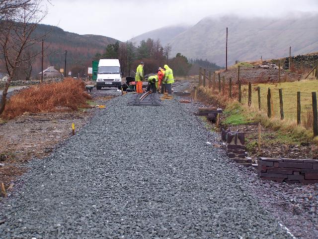
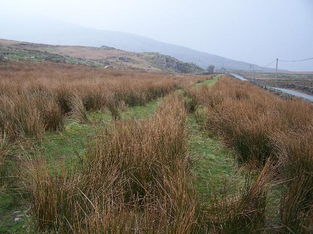
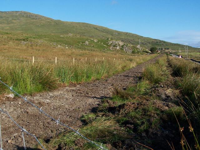
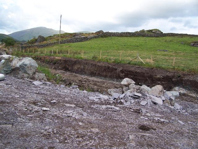
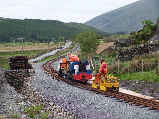
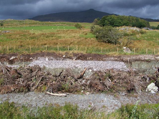
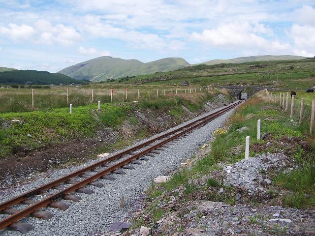
These southerly views (29/10/05 and 25/6/06) show the southern end of Summit Cutting and LC69. The first view shows the original 2m wide stone bed retained by cobbles emerging from the grass cover. This stone bed is a repeating feature on boggy sections through the Beddgelert Forest. Sidelong French drains are being placed. The second view shows the track laid across LC69 with Dolgarrog in the distance. Click on the images to enlarge. The first image is copyright Chris Price and was taken on a Fuji Finepix F601Z digital camera. The second image is copyright B.W.Hughes and was taken on a Kodak DX6490 digital camera. Images post processed using iPhoto Plus4 and displayed at 96dpi.

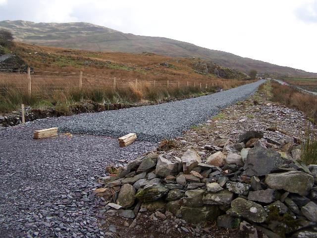
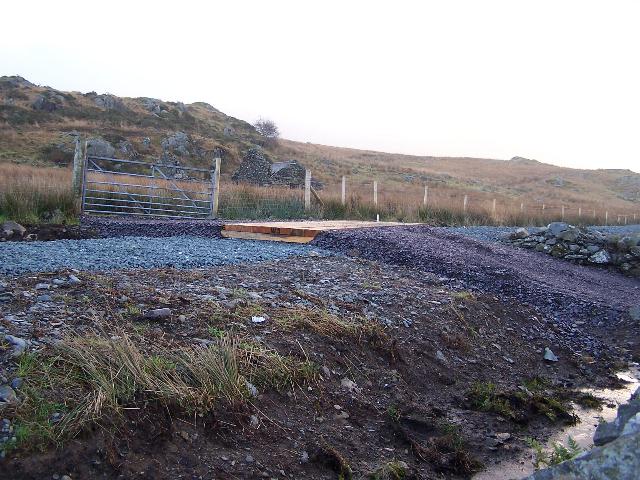
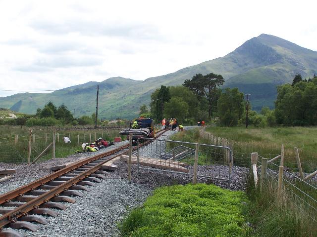
This northerly view (25/6/06) shows the Head of Steel approaching the end of ballast at Pont Cae'r Gors. Click on the image to enlarge. This image is copyright B.W.Hughes and was taken on a Kodak DX6490 digital camera. Image post processed using iPhoto Plus4 and displayed at 96dpi.
Click here to visit Pont Cae'r Gors to Hafod Ruffydd Halt page
Click here to return to the Stop Press Page
Site Development
If you have suggestions for development of this site, please contact me by email at the address on the Stop Press page.
Comments
Please add comments in my Guestbook.
Page Version 4.3 Dated 29/6/06