WHR
Beddgelert Forest Walks
V4.1 updated 2/4/05
Beddgelert Forest
Forest Enterprise ( previously known as the Forestry Commission) runs a well-appointed campsite in Beddgelert Forest. Access is roughly a mile from Beddgelert on the A4085 to Caernarfon. Numerous walks have been made available to the public. Wooden posts with numbers designate way-marked locations. The map is available for 50p from the Beddgelert Forest Campsite Reception.
Although the current forest was planted in 1926 by the Forestry Commission, there was a previous forest in the area. The incomplete works of the PBSSR were used in WWI to extract timber from Cwm Du to Rhyd Ddu and from Ty'n-y-coed (including a short lived incline in the woods) to a point next to the main road near the incomplete PBSSR Beddgelert main road bridge.
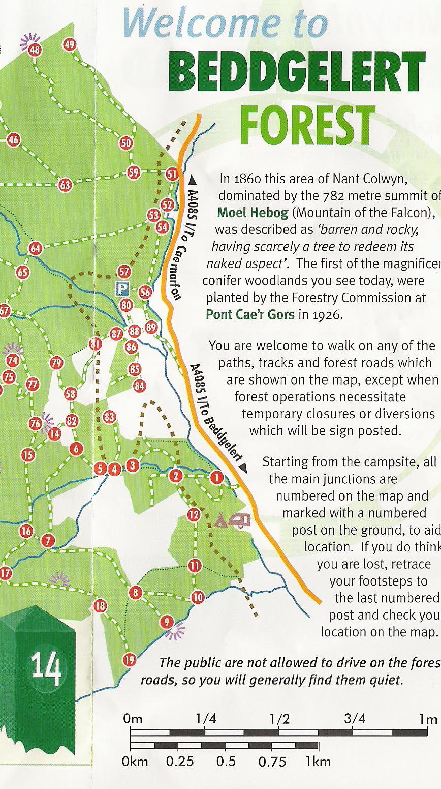
Extract from Walks in the Beddgelert Forest Map
Click on then image to expand. Image is copyright Forest Enterprise.
Way-marked locations associated with the WHR are as follows: -
51...Pont Cae'r Gors (route continues north to Rhyd Ddu)
53 to 57 embankment above Llan-y-trwsgyl
81...Site of Hafod Ruffydd halt
4 to 3 Start of Afon Meillionen S curve on embankment above path
2 Afon Meillionen bridge
2...12 Site of proposed Beddgelert Forest Halt
12...Route continues south towards Beddgelert
Map Key
The WHR is marked as a brown dotted line.
White areas are pastures.
Green areas are forest.
Wider paths are roadways (not accessible to cars).
Dotted lines are footpaths.
P is the public car park at Pont Cae'r Gors.
North is at the top of the map.
Site Development
If you have suggestions for development of this site, please contact me by email.
Comments
Please add comments in my Guestbook on the homepage.
Page Version 4.1 Dated 2/4/05